Diese Seite ist keine offizielle Seite der App oder ihres Entwicklers, sondern eine unabhängige redaktionelle Veröffentlichung, die zu Informations- und Kommentarzwecken erstellt wurde. Sofern nicht ausdrücklich anders angegeben, sind weder die App noch ihr Entwickler mit MWM, Apple, Google Play, dem App-Herausgeber oder dem Entwickler der App verbunden, von ihnen unterstützt, gesponsert, autorisiert oder anderweitig offiziell verbunden, und nichts auf dieser Seite impliziert, dass die App unter Verwendung der Dienste von MWM entwickelt wurde. Alle Marken, Logos, Screenshots und andere Inhalte bleiben Eigentum ihrer jeweiligen Inhaber.

WilCo - Pilot Aviation Weather
Beherrschen Sie den Himmel mit entschlüsselten METARs, 3D-Flughafendarstellungen und professionellen Flugwerkzeugen. Entwickelt von Piloten, um das Situationsbewusstsein für Schüler, Privatpiloten und Flugsimulations-Enthusiasten zu verbessern.
Downloads
31K+Bewertung
Bewertungen gesamt
0Herausgeber
Kategorie
WeatherSprachen
10Neueste Version
2.6.18Größe
48.8 MBErstveröffentlichung
3. Feb. 2021Meistern Sie Ihren Flug mit professioneller Präzision
WilCo optimiert Ihre Vorflugroutine, indem es entschlüsseltes Wetter, 3D-Situationsbewusstsein und kritische Leistungswerkzeuge in einer intuitiven digitalen Flugtasche zusammenfasst.
Entschlüsseltes Wetter und NOTAMs
Keine manuelle Entschlüsselung mehr. Greifen Sie auf METAR-, TAF- und NOTAM-Berichte in einfacher Sprache mit integrierter Windvektoranalyse für Ihre spezifische Landebahn zu.
3D-Flughafen-Situationsbewusstsein
Erkunden Sie Ihr Ziel, bevor Sie fliegen. Nutzen Sie die 3D-Karte, um Anflüge und die Umgebungslandschaft zu Vorschau zu sehen, um Sicherheit und Vertrauen zu erhöhen.
Die folgenden Screenshots und die Beschreibung stammen direkt aus dem offiziellen Store-Eintrag der App und sind Eigentum des Entwicklers.
App Store
Screenshots
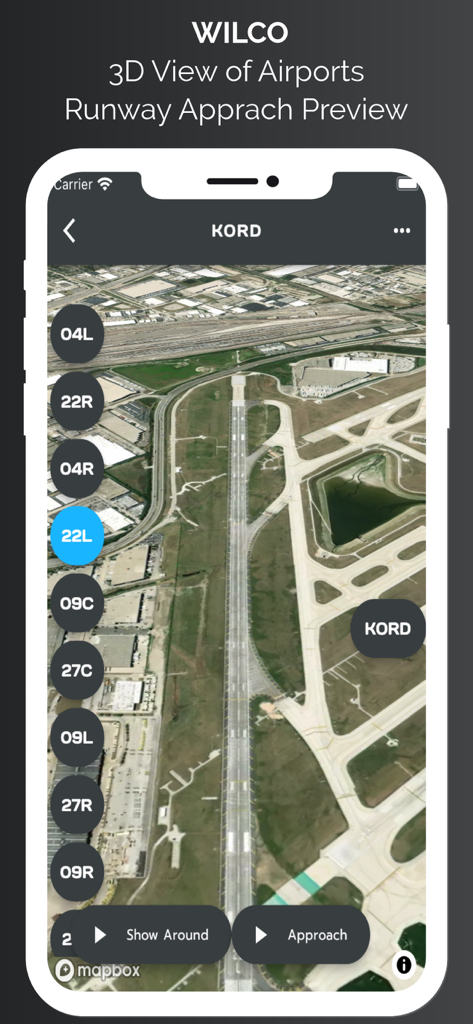
3D-Satellitenansicht der Anflugvorschau auf die Landebahn des Flughafens Chicago O Hare in der WilCo Aviation App.
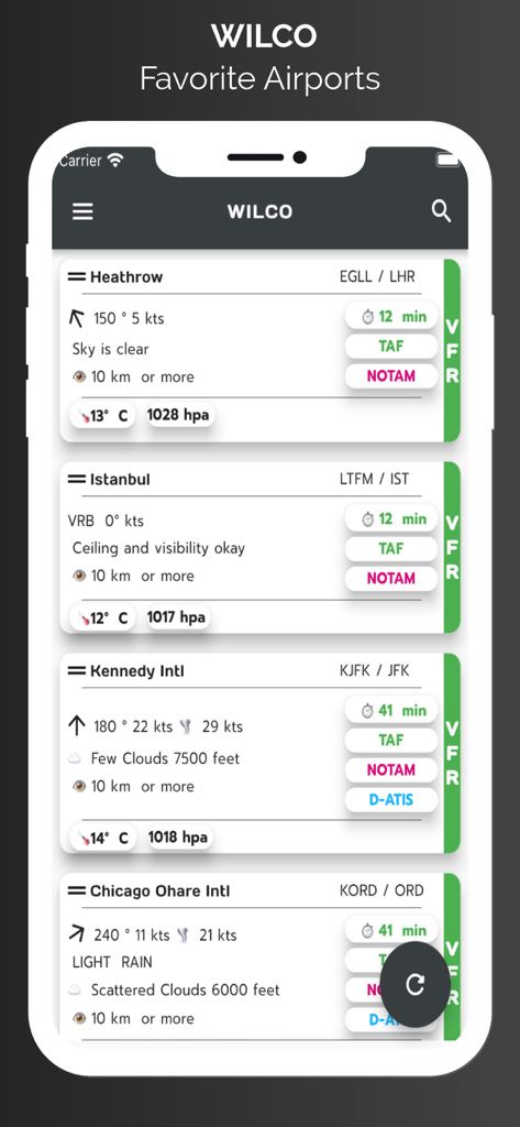
WilCo App-Bildschirm, der eine Liste bevorzugter Flughäfen mit entschlüsselten Wetterdaten anzeigt, einschließlich Windgeschwindigkeit, Sichtweite und Himmelsbedingungen.
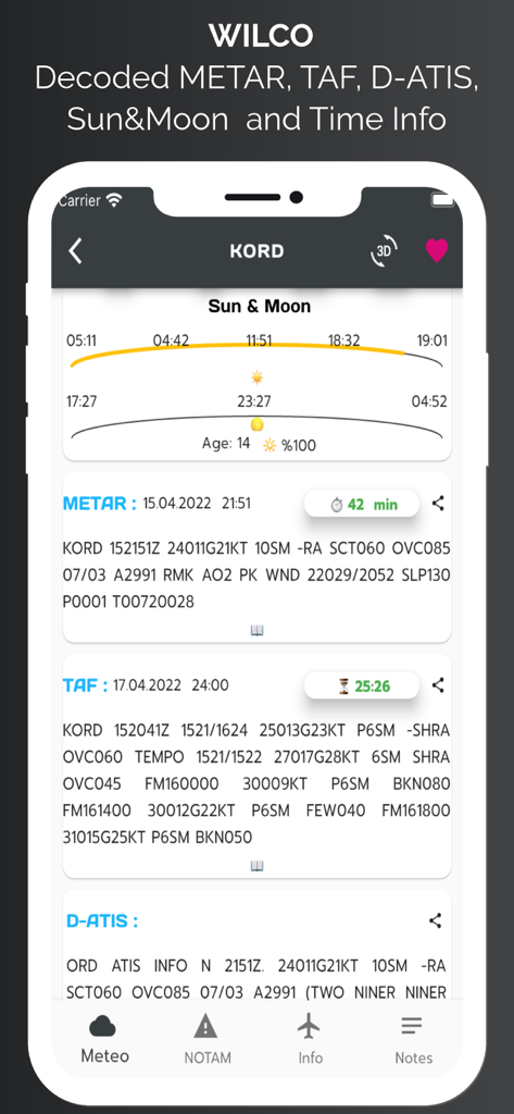
WilCo App-Oberfläche, die Luftfahrtwetterdaten anzeigt, einschließlich METAR, TAF, D-ATIS und Sonnen- und Mondzeiten für den Flughafen Chicago OHare.
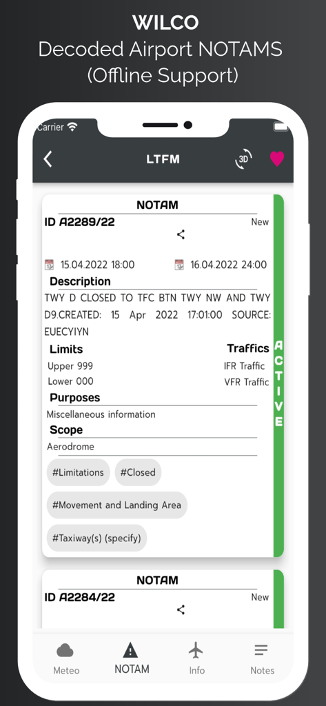
Smartphone-Bildschirm, der entschlüsselte Flughafen-NOTAM-Informationen in der WilCo Aviation App anzeigt.
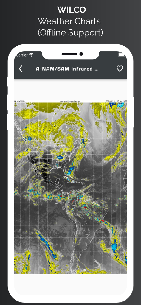
WilCo App zeigt eine infrarote Satellitenwetterkarte von Nord- und Südamerika mit Offline-Unterstützung.
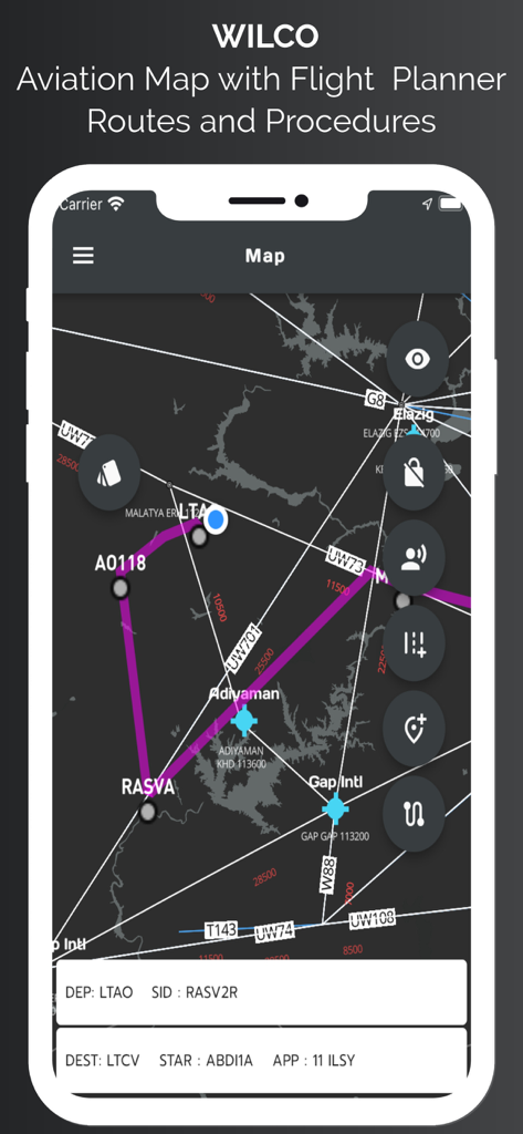
WilCo App Luftfahrtkarten-Oberfläche, die Flugrouten, Wegpunkte und Verfahren anzeigt.
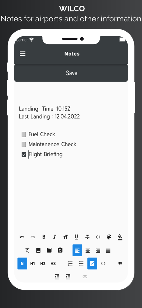
WilCo Aviation App-Bildschirm, der Pilotnotizen für Flughäfen und eine Checkliste für Flugbriefings anzeigt.
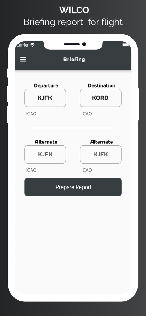
Die Briefing-Berichtsseite in der WilCo App, auf der Piloten die ICAO-Codes von Abflug- und Zielflughäfen eingeben.
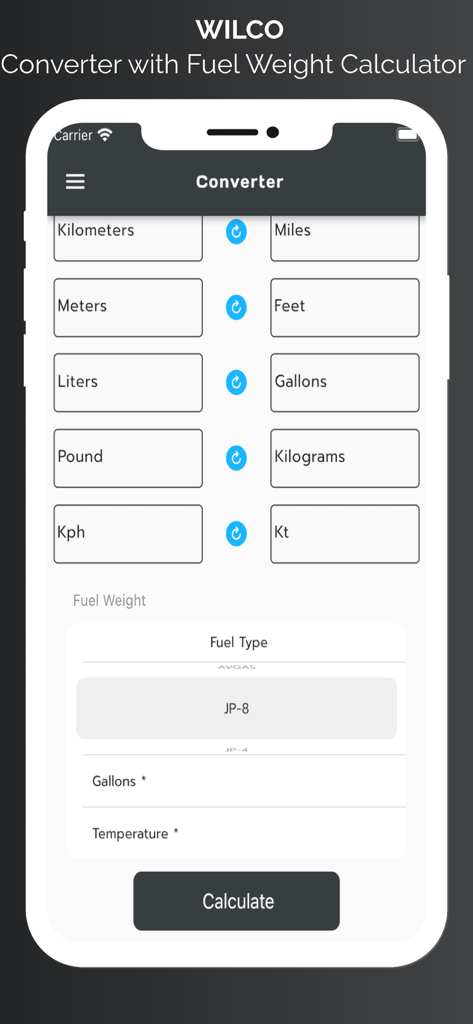
WilCo App-Einheitenumrechner und Treibstoffgewichtsrechner-Oberfläche für Piloten
Beschreibung
Download
Ähnliche Apps
Top-gerankte Apps in derselben Kategorie

墨迹天气-MojiWeather
Beijing MojiFengyun Technology Co.,Ltd.

The Weather Channel - Radar
The Weather Channel

Windy.com
Windyty, SE

天气预报-精准15日天气预报
Chongqing Caochen Technology Co., Ltd.

My Aurora Forecast & Alerts
JRustonApps B.V.

AccuWeather: Weather Forecast
AccuWeather International, Inc.

Weather & Radar - Storm radar
WetterOnline - Meteorologische Dienstleistungen GmbH

天气通
Weibo Internet Technology (China) Co.Ltd.

The Thermometer -Digital-
Vida Apps Incorporated
Diese Seite ist keine offizielle Seite der App oder ihres Entwicklers, sondern eine unabhängige redaktionelle Veröffentlichung, die zu Informations- und Kommentarzwecken erstellt wurde. Sofern nicht ausdrücklich anders angegeben, sind weder die App noch ihr Entwickler mit MWM, Apple, Google Play, dem App-Herausgeber oder dem Entwickler der App verbunden, von ihnen unterstützt, gesponsert, autorisiert oder anderweitig offiziell verbunden, und nichts auf dieser Seite impliziert, dass die App unter Verwendung der Dienste von MWM entwickelt wurde. Alle Marken, Logos, Screenshots und andere Inhalte bleiben Eigentum ihrer jeweiligen Inhaber.