Diese Seite ist keine offizielle Seite der App oder ihres Entwicklers, sondern eine unabhängige redaktionelle Veröffentlichung, die zu Informations- und Kommentarzwecken erstellt wurde. Sofern nicht ausdrücklich anders angegeben, sind weder die App noch ihr Entwickler mit MWM, Apple, Google Play, dem App-Herausgeber oder dem Entwickler der App verbunden, von ihnen unterstützt, gesponsert, autorisiert oder anderweitig offiziell verbunden, und nichts auf dieser Seite impliziert, dass die App unter Verwendung der Dienste von MWM entwickelt wurde. Alle Marken, Logos, Screenshots und andere Inhalte bleiben Eigentum ihrer jeweiligen Inhaber.

World atlas & world map MxGeo
Meistern Sie die Weltgeographie mit interaktiven politischen Karten, detaillierten statistischen Daten und fesselnden Quizfragen. Erkunden Sie über 260 Länder in einer erstklassigen, werbefreien Umgebung, die für lebenslang Lernende und Neugierige gleichermaßen entwickelt wurde.
Downloads
175K+Bewertung
Bewertungen gesamt
100Herausgeber
Kategorie
EducationSprachen
11Neueste Version
9.5.5Größe
123.4 MBErstveröffentlichung
15. Juli 2016Weltgeographie & globale Daten beherrschen
Der umfassende digitale Almanach für Wissbegierige, Studenten und Reisende, die präzise globale Einblicke suchen.
Tiefe statistische Einblicke
Greifen Sie auf umfassende Daten zu, einschließlich HDI, Bevölkerungswachstum und Wirtschaftsstatistiken für über 260 Länder und Gebiete.
Interaktive Trivia-Herausforderungen
Meistern Sie Flaggen, Hauptstädte und Grenzen durch spielerische Quizfragen, die für Schüler und lebenslang Lernende gleichermaßen konzipiert sind.
Die folgenden Screenshots und die Beschreibung stammen direkt aus dem offiziellen Store-Eintrag der App und sind Eigentum des Entwicklers.
App Store
Screenshots
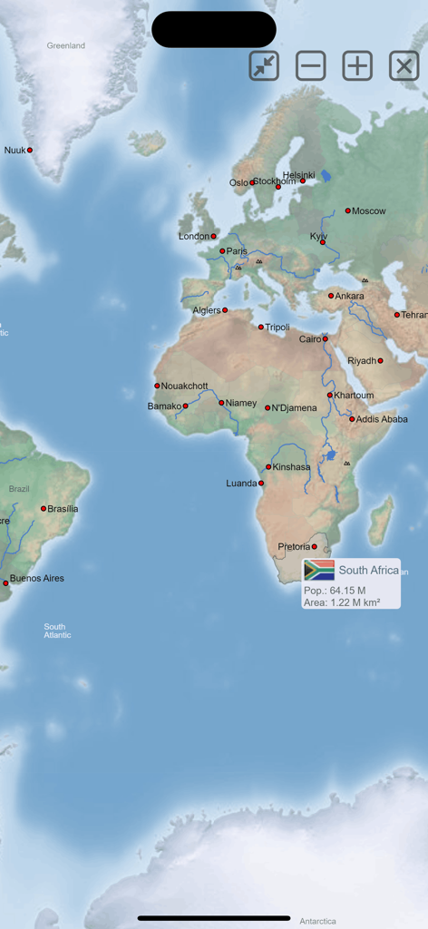
MxGeo Weltatlas-App-Kartenschnittstelle mit Statistiken für Südafrika
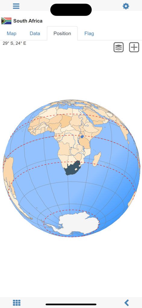
Screenshot der Weltatlas MxGeo-App, der die Position von Südafrika auf einem 3D-Globus zeigt
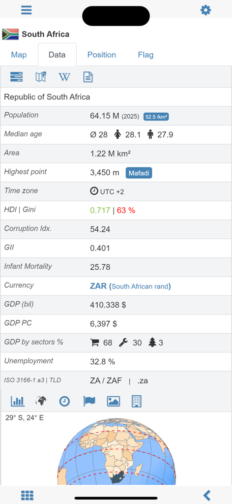
Detaillierte demografische und wirtschaftliche Statistiken für Südafrika in der MxGeo-App
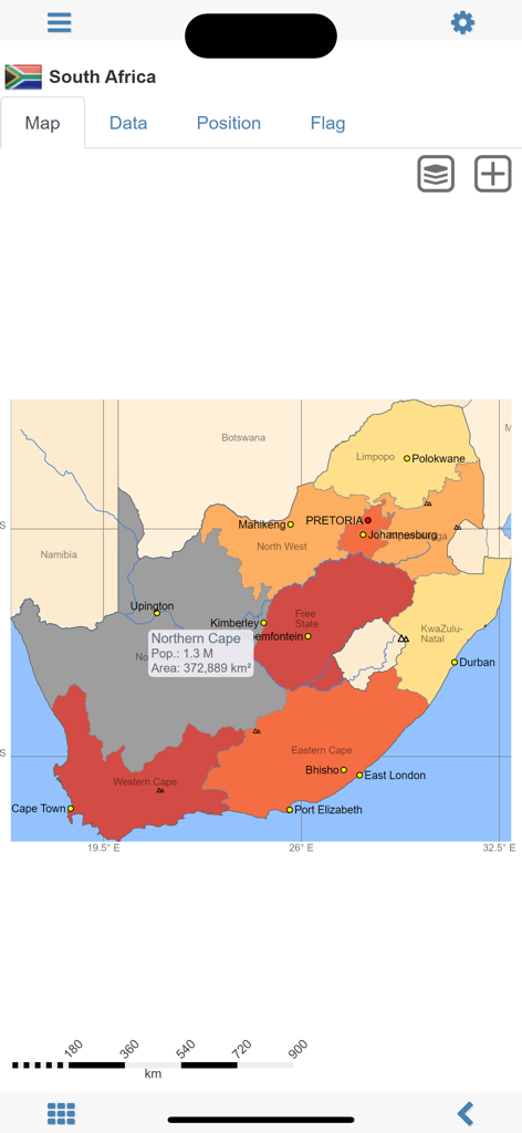
Detaillierte politische Karte von Südafrika mit regionalen Bevölkerungs- und Flächendaten in der Weltatlas MxGeo-App.
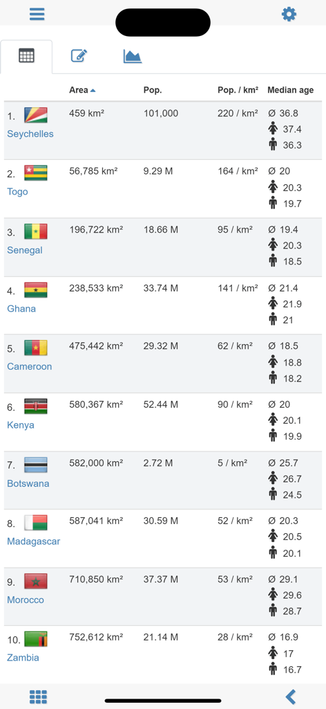
Eine Vergleichstabelle in der Weltatlas MxGeo-App, die statistische Daten wie Fläche, Bevölkerung und Medianalter für afrikanische Länder zeigt.
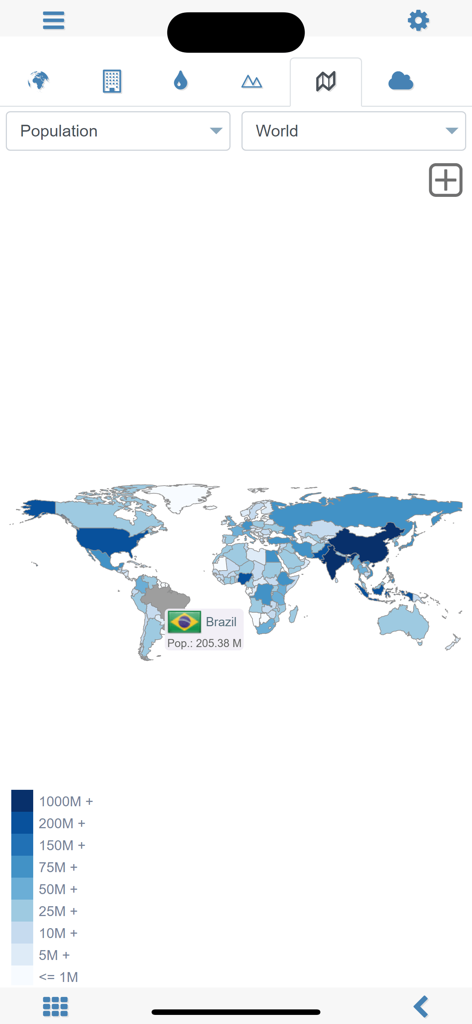
Eine Weltkarte mit Bevölkerungsstatistiken, wobei Brasilien in der MxGeo-App ausgewählt ist
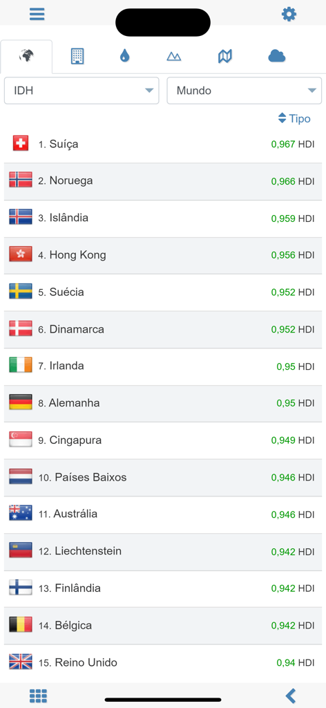
Ranking der Top-Länder nach dem Index der menschlichen Entwicklung in der Weltatlas-App
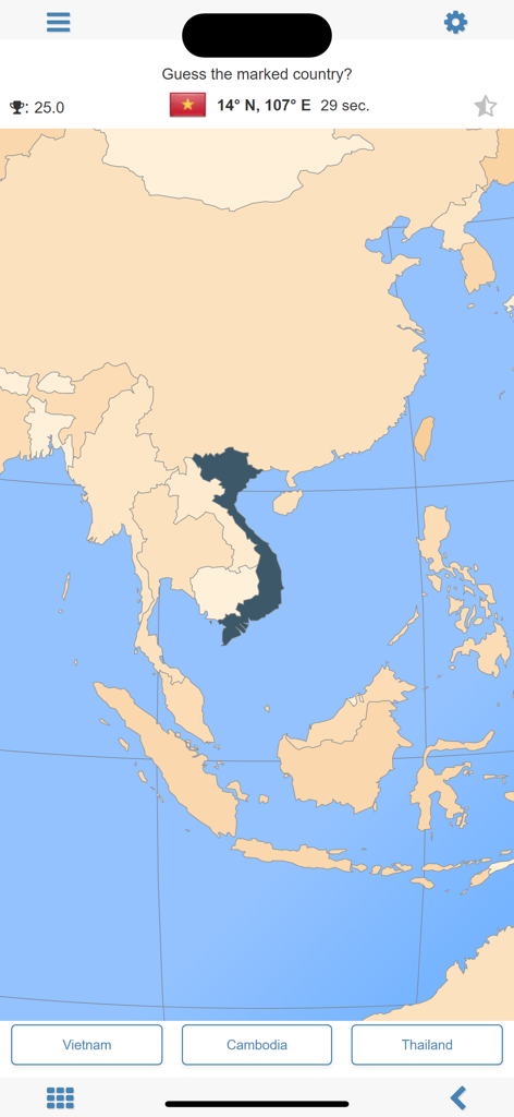
MxGeo Geographie-Quiz-Bildschirm mit einer Karte von Südostasien, auf der Vietnam hervorgehoben ist.
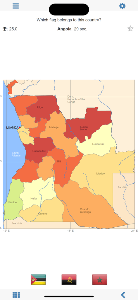
Geographie-Quiz-Bildschirm der MxGeo-App, auf dem die Flagge von Angola identifiziert werden soll, mit einer Karte seiner Provinzen
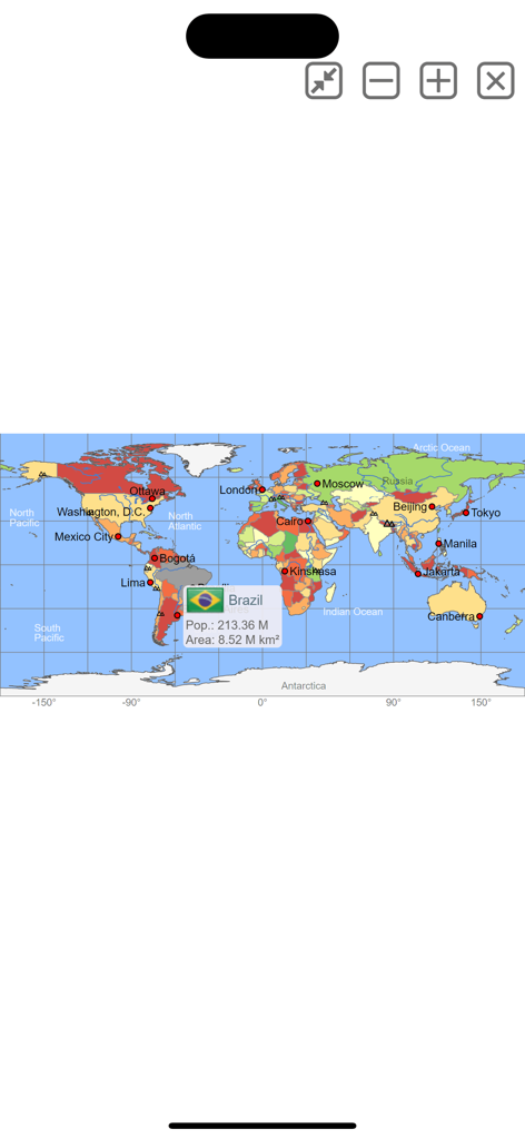
Interaktive Weltkarte mit Bevölkerungs- und Flächendaten für Brasilien
Beschreibung
Download
Ähnliche Apps
Top-gerankte Apps in derselben Kategorie

Duolingo - Language Lessons
Duolingo, Inc

Speak & Learn English: Learna
DEEP FLOW SOFTWARE SERVICES - FZCO

驾考宝典-科一科四驾驶证考试驾考通
Wuhan Jiakaobaodian Information Service Co., Ltd.

Toca Boca World
Toca Boca AB

Google Classroom
Google LLC

作业帮-中小学家长作业检查和辅导工具
Guangzhou Polar Future Culture Technology Co., Ltd

学信网
Student Information Consultation Service Co., Ltd.

Gauth: AI Study Companion
GAUTHTECH PTE. LTD.

ArtWorkout: Learn How to Draw
Aleksandr Ulitin
Diese Seite ist keine offizielle Seite der App oder ihres Entwicklers, sondern eine unabhängige redaktionelle Veröffentlichung, die zu Informations- und Kommentarzwecken erstellt wurde. Sofern nicht ausdrücklich anders angegeben, sind weder die App noch ihr Entwickler mit MWM, Apple, Google Play, dem App-Herausgeber oder dem Entwickler der App verbunden, von ihnen unterstützt, gesponsert, autorisiert oder anderweitig offiziell verbunden, und nichts auf dieser Seite impliziert, dass die App unter Verwendung der Dienste von MWM entwickelt wurde. Alle Marken, Logos, Screenshots und andere Inhalte bleiben Eigentum ihrer jeweiligen Inhaber.