このページはアプリまたはその開発者の公式ページではなく、情報提供および論評を目的として作成された独立した編集出版物です。明示的に別段の記載がない限り、アプリおよびその開発者は、MWM、Apple、Google Play、アプリのパブリッシャー、またはアプリの開発者と提携、承認、後援、認可、またはその他の公式的な関係はなく、このページのいかなる内容も、アプリがMWMのサービスを使用して開発されたことを意味するものではありません。すべての商標、ロゴ、スクリーンショット、その他のコンテンツはそれぞれの所有者の財産です。

Explore Hong Kong
地元のように自信を持ってMTRをナビゲート。CNNやロンリープラネットに信頼されている、使いやすいルートプランナーとストリートマップは100%オフラインで動作します—データやローミングは不要です。
ダウンロード
127K+ユーザー評価
評価数
1K+開発元
カテゴリ
Travel対応言語
5最新バージョン
20.0.0サイズ
29.9 MBリリース日
2010年1月27日自信を持って香港MTRをマスターする
CNNやロンリープラネットに信頼されている当社のアプリは、savvy な国際旅行者向けに特別に設計された、最も直感的でオフライン対応の交通ツールを提供します。
100% オフラインの自由
高額なローミング料金は忘れてください。地下深くでも、インターネット接続なしで、完全なマップにアクセスし、駅を検索し、ルート全体を計画できます。
3タップでのルート計画
目的地へより速く到達できます。わずか3回の簡単なタップで、最も速い経路を計算し、あらゆる旅程の正確な所要時間を得られます。
以下のスクリーンショットと説明は、アプリの公式ストアリスティングから直接取得されたものであり、アプリ開発者の所有物です。
アプリストア
スクリーンショット
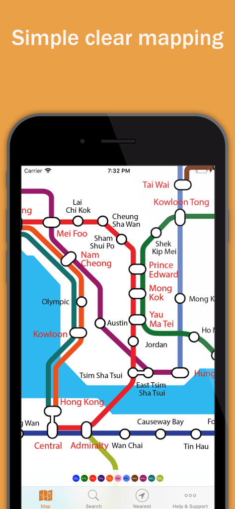
iPhone画面に表示された香港のシンプルでクリアなMTR地下鉄マップ
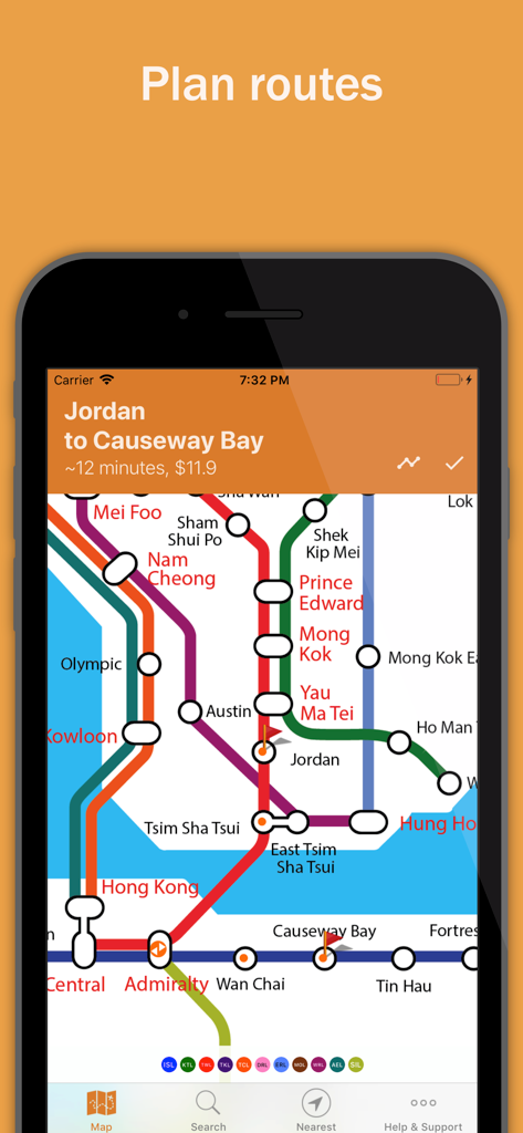
Explore Hong Kongアプリのルートプランナー。ジョーダンからコーズウェイベイまでの地下鉄の旅を表示
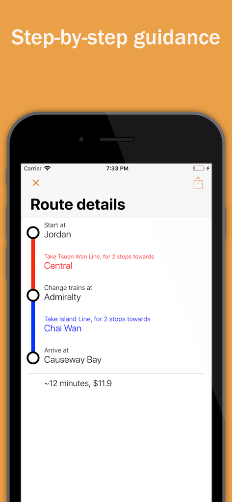
香港のMTRの方向と所要時間を示す段階的なルートガイダンス
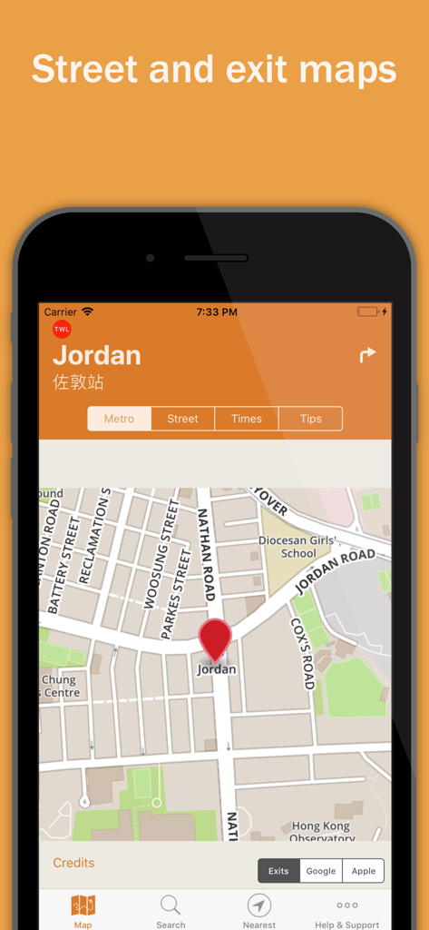
香港のジョーダンMTR駅のバイリンガルストリート&出口マップ
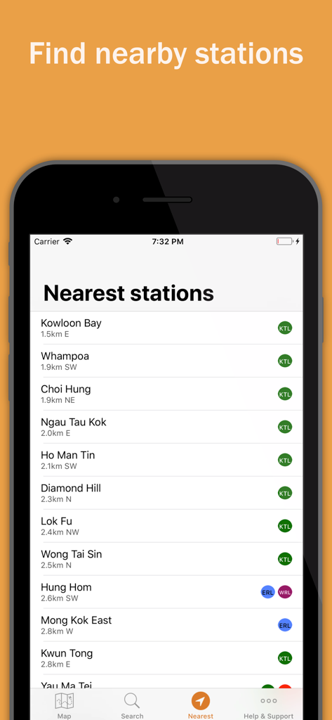
Explore Hong Kongアプリに、距離と路線名とともに表示された香港MTRの最寄り駅リスト。
説明
Download
類似アプリ
同じカテゴリのトップランクアプリ

Uber - Request a ride
Uber Technologies, Inc.

Airbnb
Airbnb, Inc.

铁路12306
ACADEMY OF RAILWAY SCIENCES CO., ltd.

Booking.com: Hotels & Travel
Booking.com B.V.

Grab: Taxi Ride, Food Delivery
GRABTAXI HOLDINGS PTE. LTD.

Trip.com: Book Flights, Hotels
Trip.com Travel Singapore Pte. Ltd.

DiDi China: Ride Hailing
Didi Chuxing (Beijing) Network Platform Technology Co., Ltd

去哪儿旅行-订酒店机票火车票
Beijing Qunar Information Technology Company Limit

Bolt: Request a Ride
BOLT TECHNOLOGY OU
このページはアプリまたはその開発者の公式ページではなく、情報提供および論評を目的として作成された独立した編集出版物です。明示的に別段の記載がない限り、アプリおよびその開発者は、MWM、Apple、Google Play、アプリのパブリッシャー、またはアプリの開発者と提携、承認、後援、認可、またはその他の公式的な関係はなく、このページのいかなる内容も、アプリがMWMのサービスを使用して開発されたことを意味するものではありません。すべての商標、ロゴ、スクリーンショット、その他のコンテンツはそれぞれの所有者の財産です。