Diese Seite ist keine offizielle Seite der App oder ihres Entwicklers, sondern eine unabhängige redaktionelle Veröffentlichung, die zu Informations- und Kommentarzwecken erstellt wurde. Sofern nicht ausdrücklich anders angegeben, sind weder die App noch ihr Entwickler mit MWM, Apple, Google Play, dem App-Herausgeber oder dem Entwickler der App verbunden, von ihnen unterstützt, gesponsert, autorisiert oder anderweitig offiziell verbunden, und nichts auf dieser Seite impliziert, dass die App unter Verwendung der Dienste von MWM entwickelt wurde. Alle Marken, Logos, Screenshots und andere Inhalte bleiben Eigentum ihrer jeweiligen Inhaber.

Cartograph Maps 3
Entwickelt für Overlander, Abenteuerfahrer und GIS-Power-User. Beherrschen Sie das Hinterland mit fortschrittlichen Vektor-Offline-Karten, Schummerung und BRouter-Routing – kein Mobilfunksignal erforderlich.
Downloads
28K+Bewertung
Bewertungen gesamt
0Herausgeber
Kategorie
NavigationSprachen
9Neueste Version
3.8.8Größe
85.9 MBErstveröffentlichung
8. Jan. 2022Entwickelt für den Off-Grid-Entdecker
Übernehmen Sie die Kontrolle über Ihre Reise mit professionellen Offline-Karten, Geländeanalyse und Hardware-Integration, die für die anspruchsvollsten Umgebungen entwickelt wurden.
Echte Offline-Unabhängigkeit
Navigieren Sie im Hinterland mit leistungsstarken Mapsforge-Vektorkarten, Schummerung und Offline-Routenberechnung – kein Mobilfunkempfang erforderlich.
Erweiterte Hardware-Integration
Verbinden Sie sich direkt mit WunderLINQ- oder Carpe-Iter-Motorrad-Hubs und navigieren Sie mit professionellen Koordinatensystemen wie MGRS und UTM.
Die folgenden Screenshots und die Beschreibung stammen direkt aus dem offiziellen Store-Eintrag der App und sind Eigentum des Entwicklers.
App Store
Screenshots
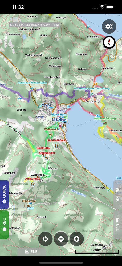
Detaillierte Offline-Geländekarte in Cartograph Maps 3 mit Spuren und Schummerung
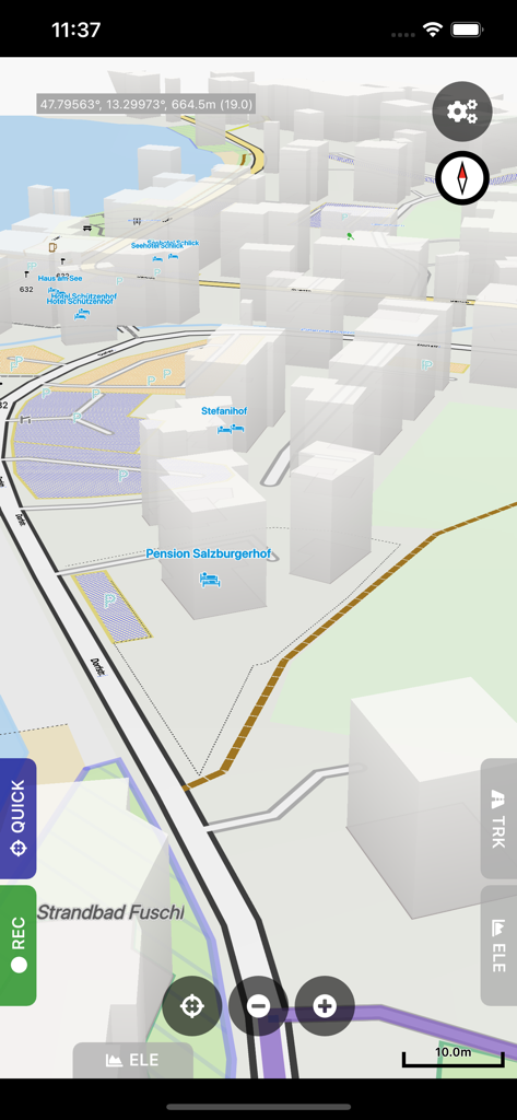
Mobile Oberfläche von Cartograph Maps 3 mit einer 3D-Vektorkarte mit Gebäuden und Koordinaten
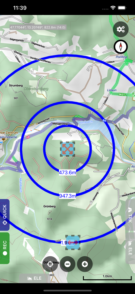
Cartograph Maps 3 App-Oberfläche mit Kreisen zur Messung des Kreisabstands auf einer detaillierten topografischen Offline-Karte.
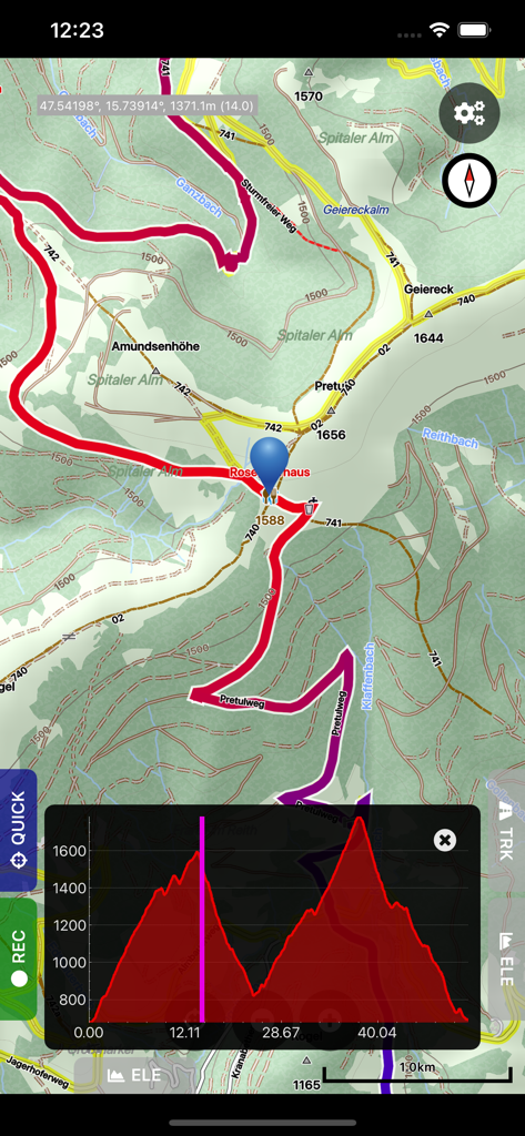
Cartograph Maps 3 Oberfläche mit topografischer Karte und Höhenprofil-Grafik
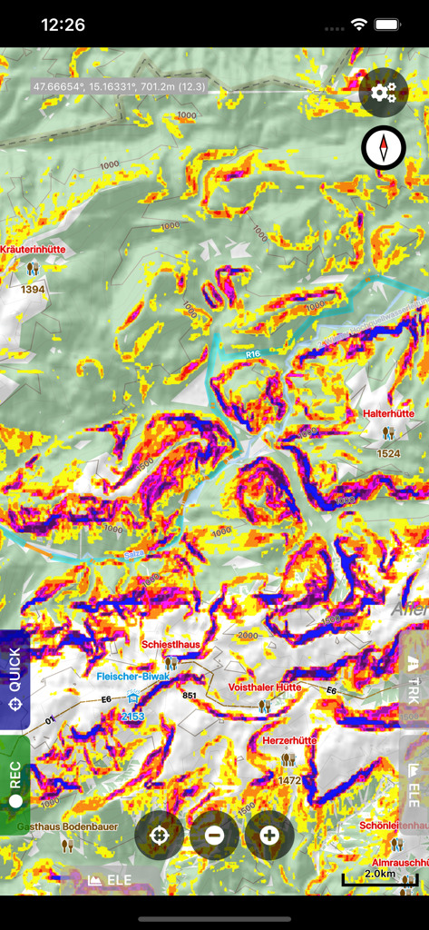
Cartograph Maps 3 Anzeige mit einer topografischen Karte und einer farbigen Hang-Mapping-Überlagerung zur Geländeanalyse.
Beschreibung
Download
Ähnliche Apps
Apps mit ähnlichen Funktionen und Nutzererfahrung

MilGPS
Cascode Labs Pty Ltd

SEAiq Pilot VPP
Sakhalin, LLC

新知卫星地图-路线规划,高清地图导航
Chongqing Xinzhi Space Technology Co., Ltd.

Coordinates – GPS Converter
Mapnitude Company Limited

Mgrs & Utm Map
Vahid Cataltas

DeepStateMap
Heorhii Karpenko

Map Plus
Miocool Inc.

Compass 55. Map & GPS kit.
Kalimex-Consulting s.r.o.

Vetus Maps
Andrey Fetisov
Diese Seite ist keine offizielle Seite der App oder ihres Entwicklers, sondern eine unabhängige redaktionelle Veröffentlichung, die zu Informations- und Kommentarzwecken erstellt wurde. Sofern nicht ausdrücklich anders angegeben, sind weder die App noch ihr Entwickler mit MWM, Apple, Google Play, dem App-Herausgeber oder dem Entwickler der App verbunden, von ihnen unterstützt, gesponsert, autorisiert oder anderweitig offiziell verbunden, und nichts auf dieser Seite impliziert, dass die App unter Verwendung der Dienste von MWM entwickelt wurde. Alle Marken, Logos, Screenshots und andere Inhalte bleiben Eigentum ihrer jeweiligen Inhaber.