Diese Seite ist keine offizielle Seite der App oder ihres Entwicklers, sondern eine unabhängige redaktionelle Veröffentlichung, die zu Informations- und Kommentarzwecken erstellt wurde. Sofern nicht ausdrücklich anders angegeben, sind weder die App noch ihr Entwickler mit MWM, Apple, Google Play, dem App-Herausgeber oder dem Entwickler der App verbunden, von ihnen unterstützt, gesponsert, autorisiert oder anderweitig offiziell verbunden, und nichts auf dieser Seite impliziert, dass die App unter Verwendung der Dienste von MWM entwickelt wurde. Alle Marken, Logos, Screenshots und andere Inhalte bleiben Eigentum ihrer jeweiligen Inhaber.

FlyBy E6B
Meistern Sie Ihre Cockpit-Mathematik mit über 70 Präzisionswerkzeugen, entwickelt von einem professionellen Flugkapitän. Vom Flugschülertraining bis zum kommerziellen Betrieb erhalten Sie die Zuverlässigkeit und Funktionen, die Sie für sichereres und intelligenteres Fliegen benötigen.
Downloads
220K+Bewertung
Bewertungen gesamt
200Herausgeber
Kategorie
NavigationSprachen
1Neueste Version
2025.31Größe
23.7 MBErstveröffentlichung
21. Juni 2010Professionelle Präzision für jede Flugphase
Gebaut von erfahrenen Flugkapitänen, liefert FlyBy E6B über 70 spezialisierte Luftfahrtwerkzeuge, die entwickelt wurden, um manuelle Berechnungen zu eliminieren und die kognitive Belastung zu reduzieren, von Flugschulprüfungen bis hin zu komplexen kommerziellen Einsätzen.
Erweiterte Navigation & VNAV
Gehen Sie über grundlegende Mathematik hinaus mit professionellen Werkzeugen für Critical Point, Point of No Return und präzisen Vertical Navigation (VNAV) Sinkprofilen.
Echtzeit-Wind & Fluggeschwindigkeit
Sofortige Berechnungen für True Airspeed (TAS), Ground Speed und Gegenwind-/Seitenwindkomponenten, um sicherzustellen, dass Sie dem Flugzeug voraus sind.
Die folgenden Screenshots und die Beschreibung stammen direkt aus dem offiziellen Store-Eintrag der App und sind Eigentum des Entwicklers.
App Store
Screenshots
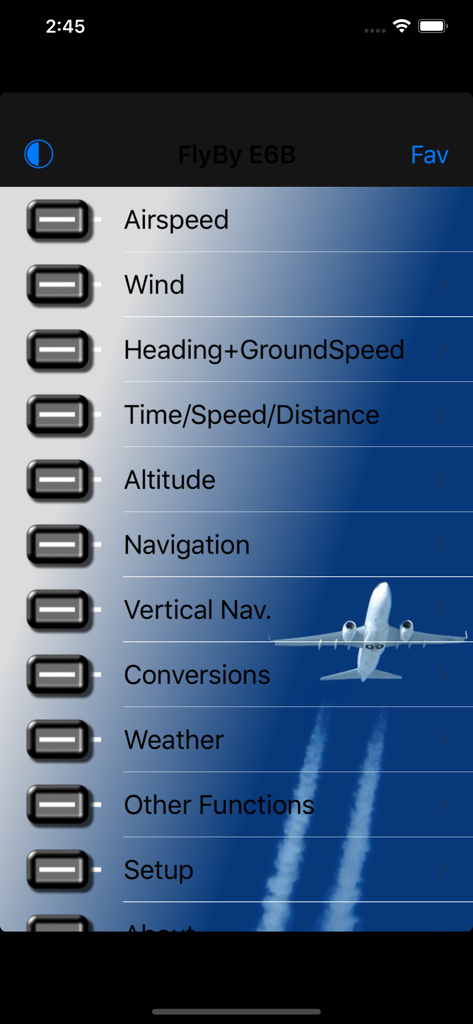
FlyBy E6B Hauptmenü-Oberfläche, die Optionen für Luftfahrtberechnungen anzeigt
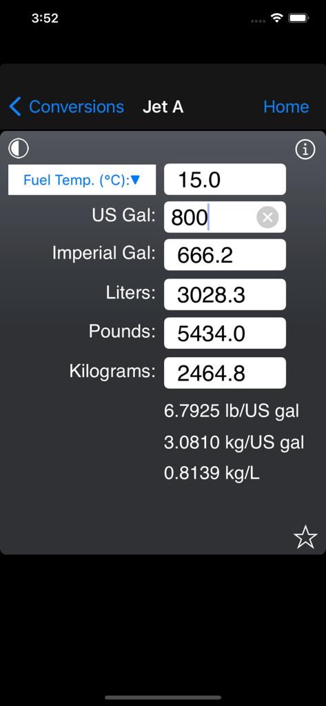
FlyBy E6B App-Oberfläche, die den Bildschirm zur Umrechnung von Jet A-Treibstoffvolumen und -gewicht zeigt

Bildschirm zur Berechnung des Passagiergewichts in der Luftfahrt für die Flugplanung in der FlyBy E6B App.
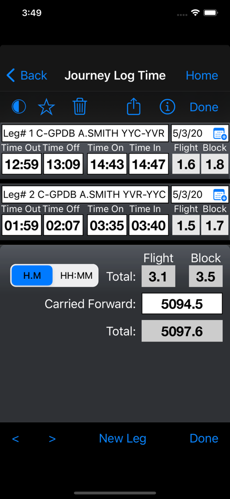
FlyBy E6B App-Oberfläche, die die Journey-Log-Zeitfunktion mit Berechnungen der Flugzeit und Blockzeit für mehrere Abschnitte anzeigt
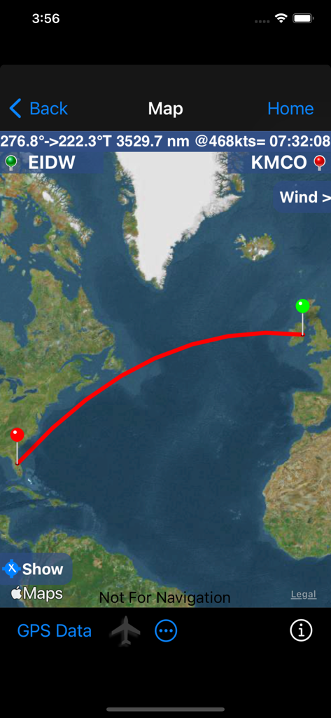
FlyBy E6B App Kartenoberfläche, die eine Flugroute von Dublin nach Orlando mit Entfernungs- und Zeitangaben zeigt
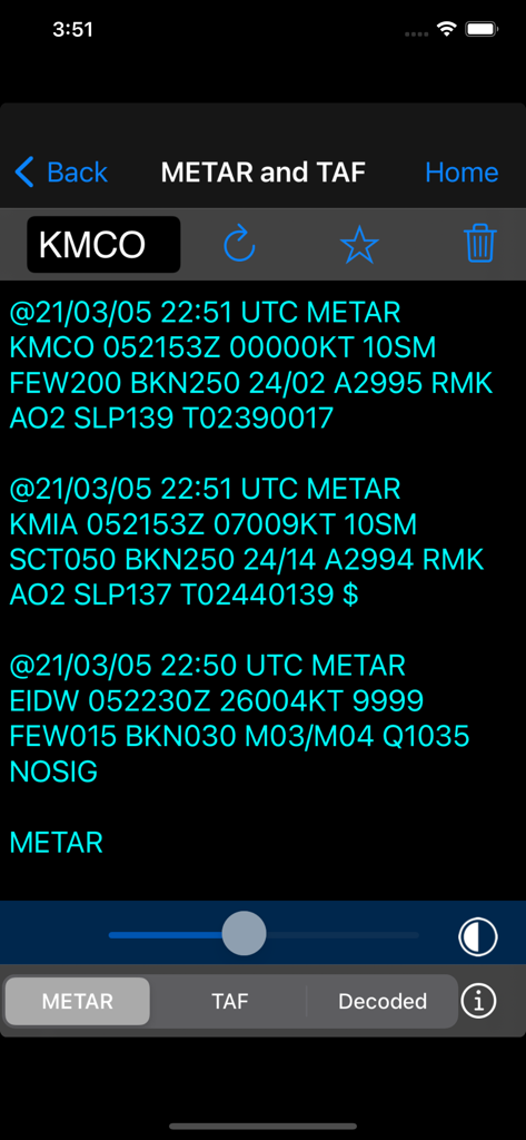
Bildschirm für Luftfahrtwetterberichte, der METAR- und TAF-Daten in der FlyBy E6B App anzeigt
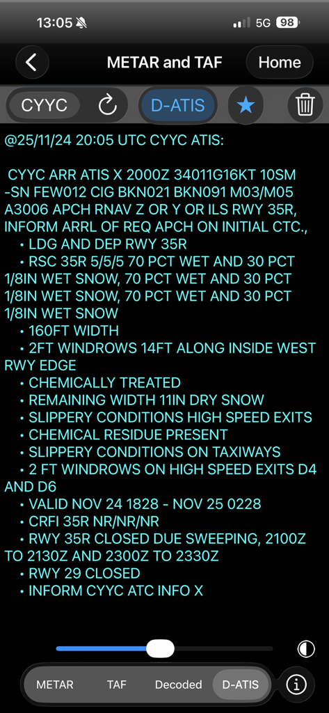
FlyBy E6B App zeigt einen detaillierten D-ATIS-Wetterbericht und Startbahnzustände an
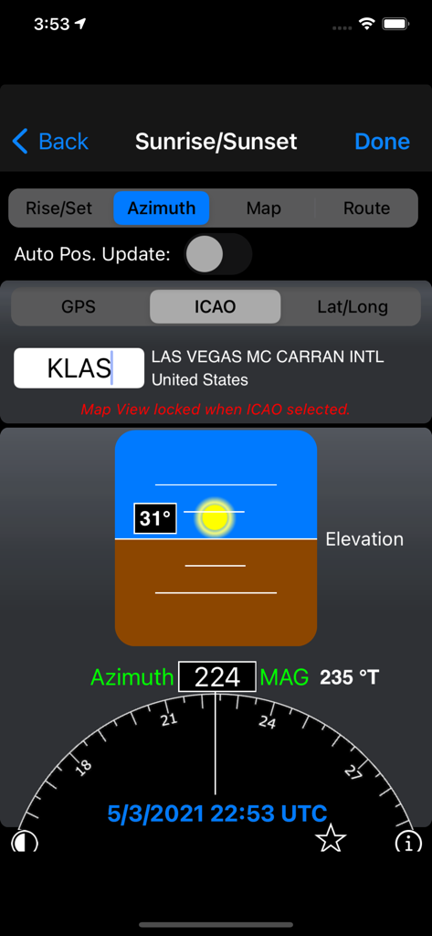
Berechnung des Sonnenaufgangs- und Sonnenuntergangs-Azimuts für den Flughafen Las Vegas in der FlyBy E6B App
Beschreibung
Download
Ähnliche Apps
Apps mit ähnlichen Funktionen und Nutzererfahrung

BA Financial Calculator
Angel Montana

Astrology Master
ibrahim veli

Sporty's E6B Flight Computer
Sporty's Pilot Shop

BA Financial Calculator (PRO)
Angel Montana

Construction Master Pro Calc
Calculated Industries, Inc.

Construction Master 5 Calc
Calculated Industries, Inc.

Pipe Trades Pro Calc
Calculated Industries, Inc.

Qualifier Plus IIIx/fx
Calculated Industries, Inc.

Resolutioner
Sun Apps, LLC
Diese Seite ist keine offizielle Seite der App oder ihres Entwicklers, sondern eine unabhängige redaktionelle Veröffentlichung, die zu Informations- und Kommentarzwecken erstellt wurde. Sofern nicht ausdrücklich anders angegeben, sind weder die App noch ihr Entwickler mit MWM, Apple, Google Play, dem App-Herausgeber oder dem Entwickler der App verbunden, von ihnen unterstützt, gesponsert, autorisiert oder anderweitig offiziell verbunden, und nichts auf dieser Seite impliziert, dass die App unter Verwendung der Dienste von MWM entwickelt wurde. Alle Marken, Logos, Screenshots und andere Inhalte bleiben Eigentum ihrer jeweiligen Inhaber.