Diese Seite ist keine offizielle Seite der App oder ihres Entwicklers, sondern eine unabhängige redaktionelle Veröffentlichung, die zu Informations- und Kommentarzwecken erstellt wurde. Sofern nicht ausdrücklich anders angegeben, sind weder die App noch ihr Entwickler mit MWM, Apple, Google Play, dem App-Herausgeber oder dem Entwickler der App verbunden, von ihnen unterstützt, gesponsert, autorisiert oder anderweitig offiziell verbunden, und nichts auf dieser Seite impliziert, dass die App unter Verwendung der Dienste von MWM entwickelt wurde. Alle Marken, Logos, Screenshots und andere Inhalte bleiben Eigentum ihrer jeweiligen Inhaber.

KOMPASS Outdoor & Hiking Maps
Entwickelt für ernsthafte Abenteurer. Erleben Sie topografische Details mit hoher Dichte, Offline-Sicherheit und Tausende von zertifizierten Touren für Ihre nächste europäische Bergexpedition.
Downloads
387K+Bewertung
Bewertungen gesamt
6K+Herausgeber
Kategorie
NavigationSprachen
2Neueste Version
6.3.2Größe
114.5 MBErstveröffentlichung
27. Sept. 2013Meistern Sie Ihre europäischen Abenteuer
Navigieren Sie die Alpen und darüber hinaus mit der weltweit vertrauenswürdigsten professionellen Kartografie, redaktionell geprüften Touren und erweiterten Offline-Sicherheitsfunktionen.
Zertifizierte Profikarten
Lassen Sie unzuverlässige Crowdsourcing-Daten hinter sich. Greifen Sie auf hochpräzise Karten mit zertifizierten Wegenetzen und lokalen Sehenswürdigkeiten zu, denen Experten seit 1953 vertrauen.
Offline-Zuverlässigkeit & Sicherheit
Speichern Sie Karten und Routen direkt auf Ihrem Gerät. Navigieren Sie sicher in abgelegenen Bergregionen, ohne Datenverbindung oder Roaminggebühren.
Die folgenden Screenshots und die Beschreibung stammen direkt aus dem offiziellen Store-Eintrag der App und sind Eigentum des Entwicklers.
App Store
Screenshots
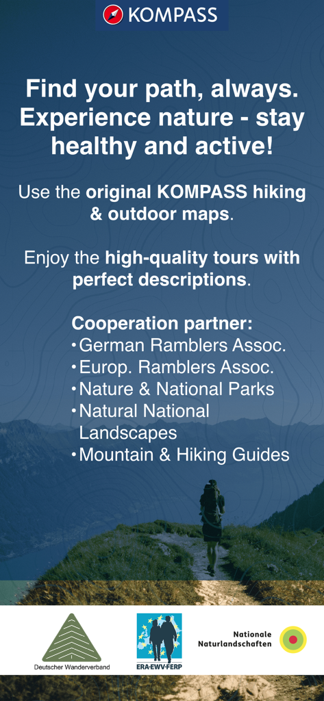
Werbebildschirm für die KOMPASS Wander-App mit einem Wanderer auf einem Bergpfad und einer Liste zertifizierter Partner
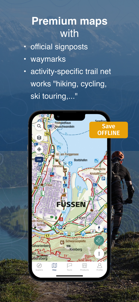
iPhone-Bildschirm mit der KOMPASS-App und einer detaillierten topografischen Karte von Füssen und Premium-Outdoor-Funktionen
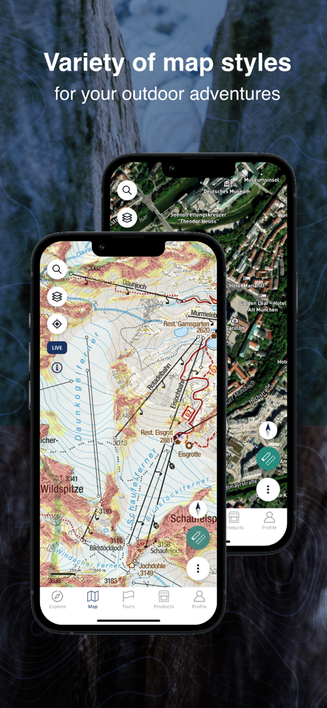
Verschiedene Kartenstile für Outdoor-Abenteuer in der KOMPASS Wander-App
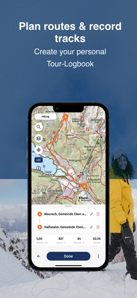
Die KOMPASS-App-Oberfläche zeigt eine detaillierte topografische Karte mit einer geplanten Wanderroute und Tourenstatistiken.

Smartphone-Bildschirm mit digitalen Wander- und Radführern von Kompass.
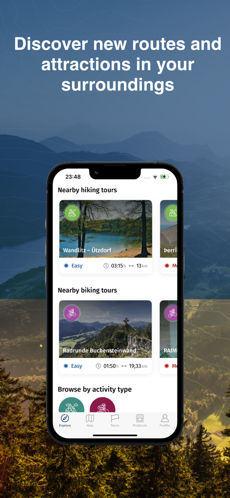
KOMPASS App Entdecken-Bildschirm mit kuratierten Wander- und Radtouren
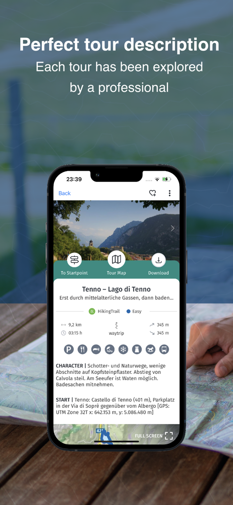
Smartphone mit einer zertifizierten Wanderung in der KOMPASS Outdoor-App für Tenno
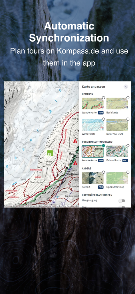
KOMPASS-App zeigt automatische Synchronisierung zwischen Website-Planung und mobilen Karten
Beschreibung
Download
Ähnliche Apps
Apps mit ähnlichen Funktionen und Nutzererfahrung

AllTrails: Hike, Bike & Run
AllTrails, Inc.

Pedometer++
Cross Forward Consulting, LLC

Organic Maps: Offline Map
Organic Maps OU

Gaia GPS: Mobile Trail Maps
Trailbehind, INC.

Offline hiking maps: Mapy.com
Seznam.cz a.s.

Hiking Map Poland
Mapa Turystyczna sp. z o.o.

MapOut
Valnova GmbH

FarOut: Offline GPS Trail Maps
Atlas Guides DE, Inc.

Norgeskart
Norgeskart AS
Diese Seite ist keine offizielle Seite der App oder ihres Entwicklers, sondern eine unabhängige redaktionelle Veröffentlichung, die zu Informations- und Kommentarzwecken erstellt wurde. Sofern nicht ausdrücklich anders angegeben, sind weder die App noch ihr Entwickler mit MWM, Apple, Google Play, dem App-Herausgeber oder dem Entwickler der App verbunden, von ihnen unterstützt, gesponsert, autorisiert oder anderweitig offiziell verbunden, und nichts auf dieser Seite impliziert, dass die App unter Verwendung der Dienste von MWM entwickelt wurde. Alle Marken, Logos, Screenshots und andere Inhalte bleiben Eigentum ihrer jeweiligen Inhaber.