Diese Seite ist keine offizielle Seite der App oder ihres Entwicklers, sondern eine unabhängige redaktionelle Veröffentlichung, die zu Informations- und Kommentarzwecken erstellt wurde. Sofern nicht ausdrücklich anders angegeben, sind weder die App noch ihr Entwickler mit MWM, Apple, Google Play, dem App-Herausgeber oder dem Entwickler der App verbunden, von ihnen unterstützt, gesponsert, autorisiert oder anderweitig offiziell verbunden, und nichts auf dieser Seite impliziert, dass die App unter Verwendung der Dienste von MWM entwickelt wurde. Alle Marken, Logos, Screenshots und andere Inhalte bleiben Eigentum ihrer jeweiligen Inhaber.

Maps 3D PRO - Hike & Bike
Schließen Sie sich über 1,7 Millionen Abenteurern an, die Offline-Geländekarten in NASA-Qualität und professionelles GPS-Tracking nutzen, um jeden Gipfel und jeden Trail zu erobern.
Downloads
378K+Bewertung
Bewertungen gesamt
100Herausgeber
Kategorie
NavigationSprachen
6Neueste Version
6.8Größe
25.2 MBErstveröffentlichung
25. März 2011Meistern Sie jedes Gelände in beeindruckendem 3D
Hören Sie auf, mit flachen Karten zu navigieren. Erhalten Sie eine Vogelperspektive Ihres nächsten Abenteuers mit professioneller 3D-Höhenvisualisierung und Offline-GPS-Tracking, entwickelt für den ernsthaften Entdecker.
Präzise 3D-Visualisierung
Visualisieren Sie Täler, Hügel und Gipfel mithilfe von NASA-Geländescans. Kennen Sie die genaue Höhe und Schwierigkeit Ihrer Route, bevor Sie überhaupt beginnen.
Vollständige Offline-Zuverlässigkeit
Laden Sie weltweite Kartendaten herunter, bevor Sie aufbrechen. Navigieren Sie sicher im tiefsten Hinterland mit voller GPS-Funktionalität und ohne Mobilfunksignal.
Die folgenden Screenshots und die Beschreibung stammen direkt aus dem offiziellen Store-Eintrag der App und sind Eigentum des Entwicklers.
App Store
Screenshots
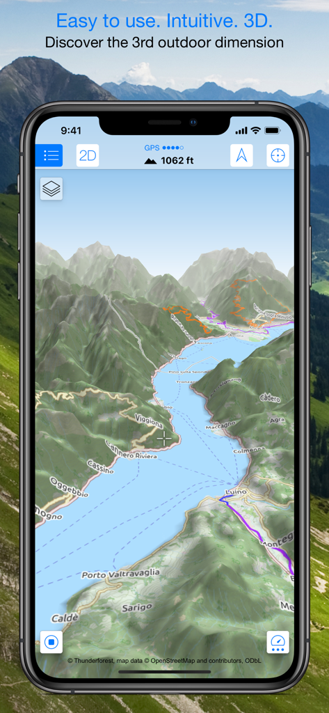
Smartphone zeigt eine 3D-topografische Karte mit Bergen und Wanderwegen.
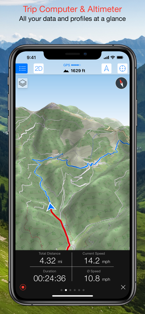
Maps 3D PRO-Oberfläche zeigt eine 3D-topografische Karte mit Trip-Computer-Daten, einschließlich Geschwindigkeit, Entfernung und Höhe.
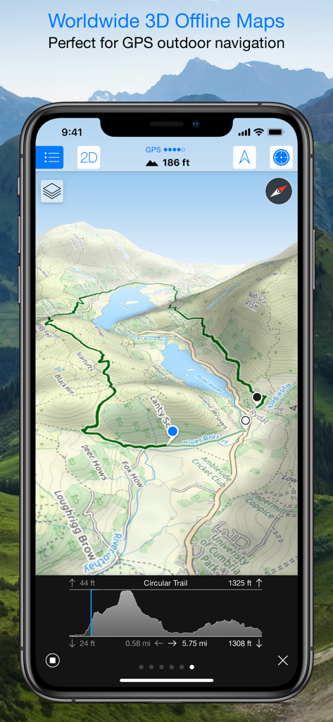
Maps 3D PRO-App-Oberfläche zeigt eine 3D-topografische Karte mit einem Wanderweg und einem Höhenprofil.
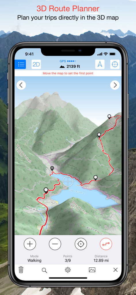
Maps 3D PRO-App-Screenshot zeigt eine geplante Wanderroute auf einer 3D-Geländekarte.
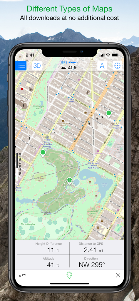
Maps 3D PRO-App-Oberfläche zeigt eine detaillierte Parkkarte mit Echtzeit-Höhen- und Entfernungsdaten.
Beschreibung
Download
Ähnliche Apps
Apps mit ähnlichen Funktionen und Nutzererfahrung

AllTrails: Hike, Bike & Run
AllTrails, Inc.

Pedometer++
Cross Forward Consulting, LLC

Organic Maps: Offline Map
Organic Maps OU

Gaia GPS: Mobile Trail Maps
Trailbehind, INC.

Offline hiking maps: Mapy.com
Seznam.cz a.s.

Hiking Map Poland
Mapa Turystyczna sp. z o.o.

MapOut
Valnova GmbH

FarOut: Offline GPS Trail Maps
Atlas Guides DE, Inc.

Norgeskart
Norgeskart AS
Diese Seite ist keine offizielle Seite der App oder ihres Entwicklers, sondern eine unabhängige redaktionelle Veröffentlichung, die zu Informations- und Kommentarzwecken erstellt wurde. Sofern nicht ausdrücklich anders angegeben, sind weder die App noch ihr Entwickler mit MWM, Apple, Google Play, dem App-Herausgeber oder dem Entwickler der App verbunden, von ihnen unterstützt, gesponsert, autorisiert oder anderweitig offiziell verbunden, und nichts auf dieser Seite impliziert, dass die App unter Verwendung der Dienste von MWM entwickelt wurde. Alle Marken, Logos, Screenshots und andere Inhalte bleiben Eigentum ihrer jeweiligen Inhaber.