Diese Seite ist keine offizielle Seite der App oder ihres Entwicklers, sondern eine unabhängige redaktionelle Veröffentlichung, die zu Informations- und Kommentarzwecken erstellt wurde. Sofern nicht ausdrücklich anders angegeben, sind weder die App noch ihr Entwickler mit MWM, Apple, Google Play, dem App-Herausgeber oder dem Entwickler der App verbunden, von ihnen unterstützt, gesponsert, autorisiert oder anderweitig offiziell verbunden, und nichts auf dieser Seite impliziert, dass die App unter Verwendung der Dienste von MWM entwickelt wurde. Alle Marken, Logos, Screenshots und andere Inhalte bleiben Eigentum ihrer jeweiligen Inhaber.

SityTrail
Erkunden Sie mit Zuversicht mit offiziellen USGS-Topografiekarten, Sicherheitswarnungen bei Routenabweichungen und nahtloser Apple Watch-Integration. Von der sorgfältigen Planung auf Ihrem Desktop bis zur freihändigen Navigation auf dem Trail ist SityTrail das ultimative Werkzeug für ernsthafte Entdecker.
Downloads
167K+Bewertung
Bewertungen gesamt
2K+Herausgeber
Kategorie
TravelSprachen
6Neueste Version
12.16.2Größe
55.6 MBErstveröffentlichung
21. März 2011Beherrschen Sie die Trails mit professioneller Präzision
SityTrail kombiniert High-End-Topografiekarten mit erweiterten Sicherheitsfunktionen, um Ihr iPhone und Ihre Apple Watch in das ultimative Outdoor-Navigationssystem zu verwandeln.
Offizielle USGS-Topo-Karten
Greifen Sie offline auf hochauflösende topografische Daten zu. Navigieren Sie auch ohne Mobilfunkempfang durch die entlegensten Wildnisgebiete mit professioneller Genauigkeit.
Aktiver Schutz vor Routenabweichung
Erkunden Sie mit Zuversicht mit Echtzeit-Vibrationsalarmen und Sprachansagen, die Sie im Moment einer Abweichung von Ihrer geplanten Route benachrichtigen.
Die folgenden Screenshots und die Beschreibung stammen direkt aus dem offiziellen Store-Eintrag der App und sind Eigentum des Entwicklers.
App Store
Screenshots
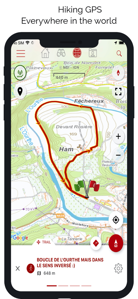
SityTrail App-Oberfläche, die eine detaillierte topografische Karte mit einer roten Wanderwegschleife anzeigt.
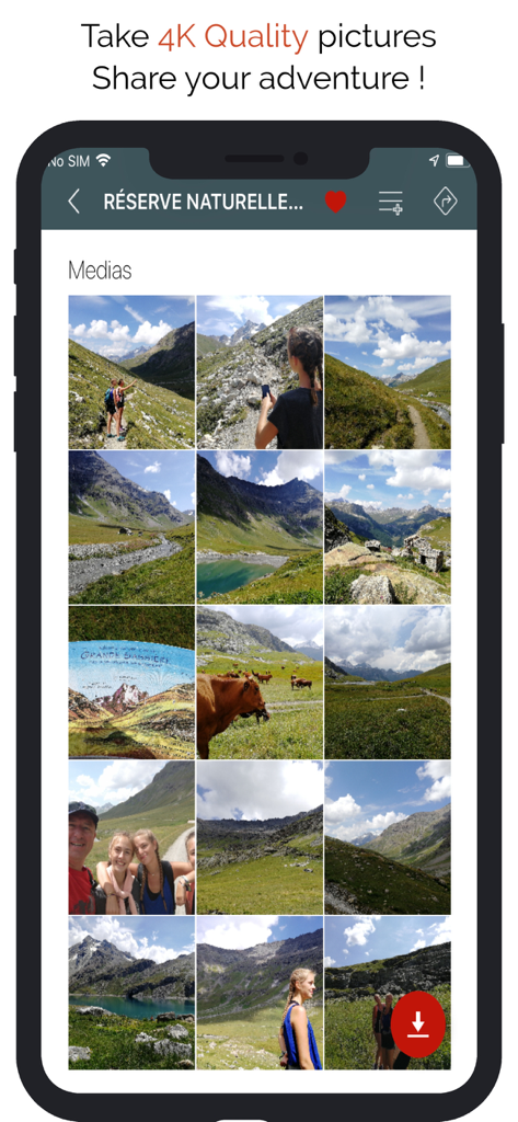
SityTrail App-Bildschirm, der eine Sammlung von Wander- und Berglandschaftsfotos zeigt
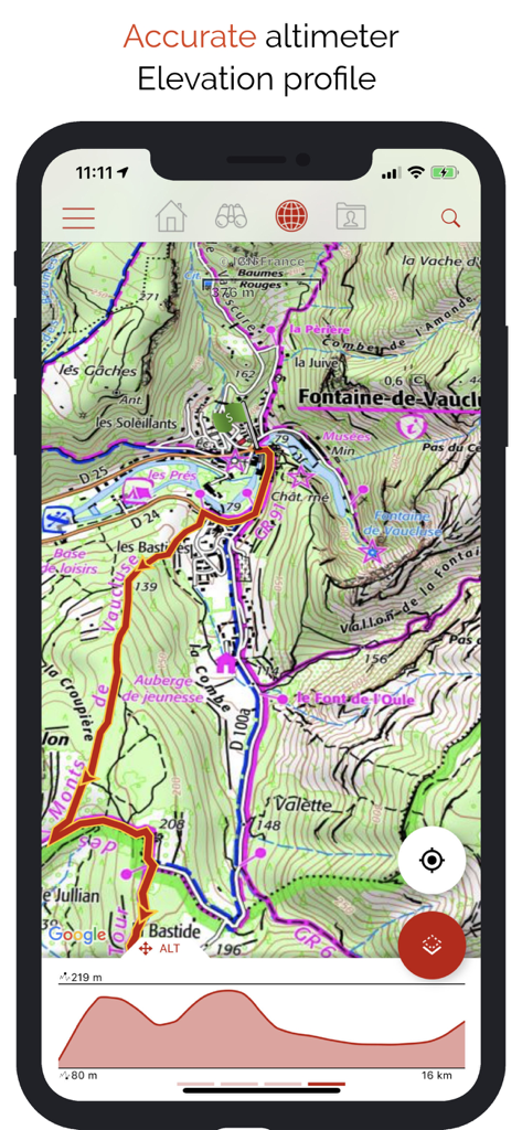
SityTrail App-Oberfläche, die eine detaillierte topografische Karte und ein Höhenprofil-Diagramm für Wanderungen zeigt

SityTrail App-Oberfläche, die das Benutzerprofil und organisierte Listen von Wanderwegen und Sehenswürdigkeiten anzeigt

SityTrail App-Oberfläche, die den Premium-Trailkatalog und von der Community kuratierte Outdoor-Routen anzeigt.
Beschreibung
Download
Ähnliche Apps
Apps mit ähnlichen Funktionen und Nutzererfahrung

AllTrails: Hike, Bike & Run
AllTrails, Inc.

Pedometer++
Cross Forward Consulting, LLC

Organic Maps: Offline Map
Organic Maps OU

Gaia GPS: Mobile Trail Maps
Trailbehind, INC.

Offline hiking maps: Mapy.com
Seznam.cz a.s.

Hiking Map Poland
Mapa Turystyczna sp. z o.o.

MapOut
Valnova GmbH

FarOut: Offline GPS Trail Maps
Atlas Guides DE, Inc.

Norgeskart
Norgeskart AS
Diese Seite ist keine offizielle Seite der App oder ihres Entwicklers, sondern eine unabhängige redaktionelle Veröffentlichung, die zu Informations- und Kommentarzwecken erstellt wurde. Sofern nicht ausdrücklich anders angegeben, sind weder die App noch ihr Entwickler mit MWM, Apple, Google Play, dem App-Herausgeber oder dem Entwickler der App verbunden, von ihnen unterstützt, gesponsert, autorisiert oder anderweitig offiziell verbunden, und nichts auf dieser Seite impliziert, dass die App unter Verwendung der Dienste von MWM entwickelt wurde. Alle Marken, Logos, Screenshots und andere Inhalte bleiben Eigentum ihrer jeweiligen Inhaber.