このページはアプリまたはその開発者の公式ページではなく、情報提供および論評を目的として作成された独立した編集出版物です。明示的に別段の記載がない限り、アプリおよびその開発者は、MWM、Apple、Google Play、アプリのパブリッシャー、またはアプリの開発者と提携、承認、後援、認可、またはその他の公式的な関係はなく、このページのいかなる内容も、アプリがMWMのサービスを使用して開発されたことを意味するものではありません。すべての商標、ロゴ、スクリーンショット、その他のコンテンツはそれぞれの所有者の財産です。

Airports Plus
世界中の数千の空港に関する詳細な滑走路レイアウト、無線周波数、およびリアルタイムMETAR/TAFデータにアクセスできます。iPadに最適化されており、インターネット接続なしでも完全に機能します。
ダウンロード
211K+ユーザー評価
評価数
100開発元
カテゴリ
Travel対応言語
26最新バージョン
5.2サイズ
148.8 MBリリース日
2012年1月24日すべてのフライトのための必須インテリジェンス
パイロットと航空愛好家向けに設計された、世界の空港技術仕様、無線周波数、およびリアルタイム気象データの包括的なオフラインデータベースにアクセスできます。
高速オフラインデータベース
コックピットの冗長性を最大限に高めるため、セルラー接続がない状態でも、10,000フィート上空で数千の詳細な空港プロファイルに即座にアクセスできます。
重要な無線&滑走路データ
ATIS、タワー、グラウンド周波数への即時アクセスに加え、詳細な滑走路の寸法、方位、表面、照明仕様を取得できます。
以下のスクリーンショットと説明は、アプリの公式ストアリスティングから直接取得されたものであり、アプリ開発者の所有物です。
アプリストア
スクリーンショット
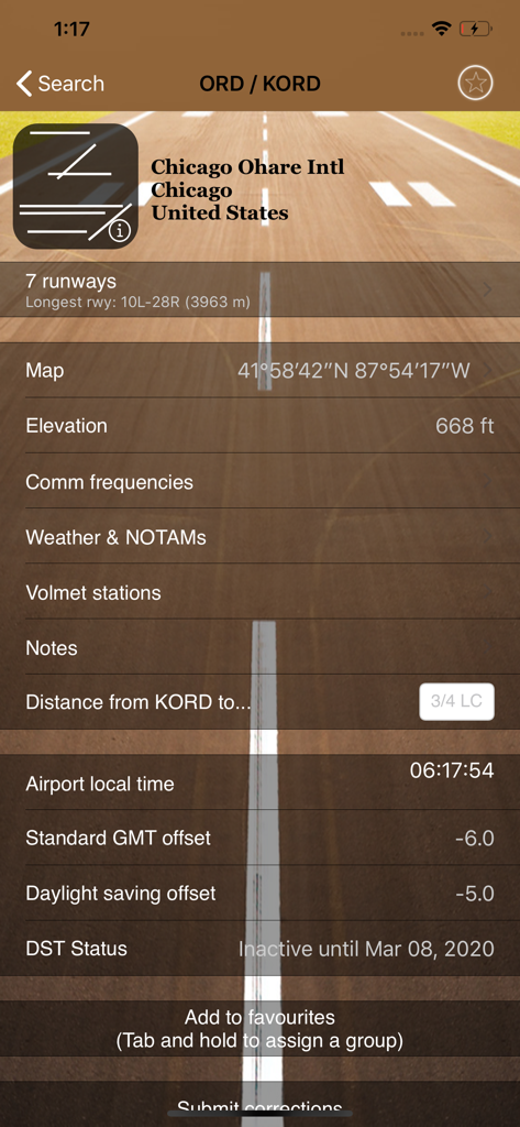
シカゴ・オヘア国際空港の詳細な航空データ。滑走路、標高、現地時間を含む。
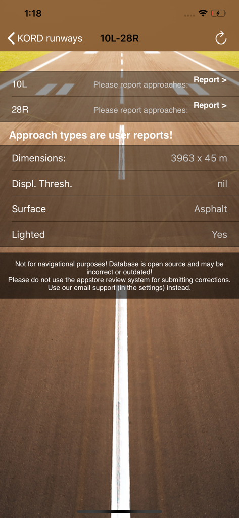
Airports Plusアプリのシカゴ・オヘア国際空港の技術的な滑走路仕様。
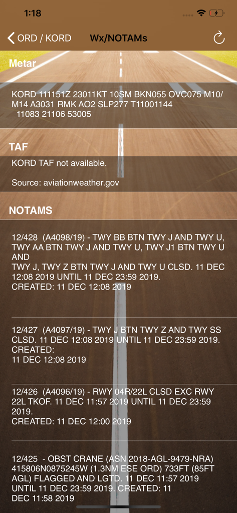
Airports Plusアプリに表示されるKORD空港の航空気象METARとNOTAM安全通知。
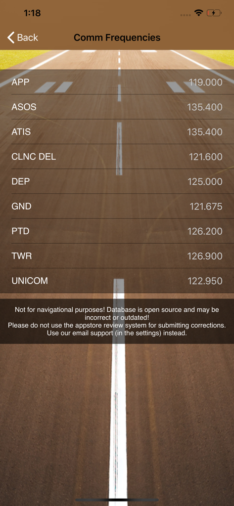
Airports Plusアプリ画面に表示されるタワーやグラウンドなどの空港通信周波数。
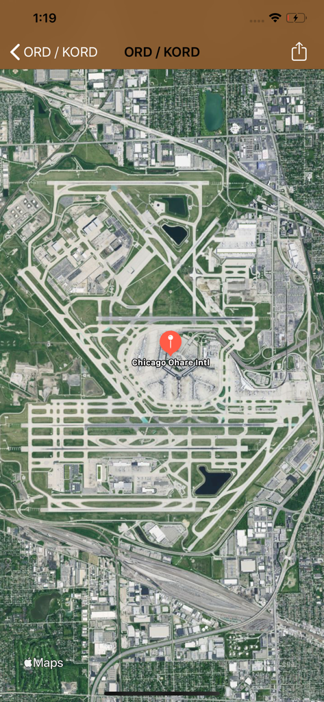
Airports Plusアプリのシカゴ・オヘア国際空港の衛星マップビュー。
説明
Download
類似アプリ
同じカテゴリのトップランクアプリ

Uber - Request a ride
Uber Technologies, Inc.

Airbnb
Airbnb, Inc.

铁路12306
ACADEMY OF RAILWAY SCIENCES CO., ltd.

Booking.com: Hotels & Travel
Booking.com B.V.

Grab: Taxi Ride, Food Delivery
GRABTAXI HOLDINGS PTE. LTD.

Trip.com: Book Flights, Hotels
Trip.com Travel Singapore Pte. Ltd.

DiDi China: Ride Hailing
Didi Chuxing (Beijing) Network Platform Technology Co., Ltd

去哪儿旅行-订酒店机票火车票
Beijing Qunar Information Technology Company Limit

Bolt: Request a Ride
BOLT TECHNOLOGY OU
このページはアプリまたはその開発者の公式ページではなく、情報提供および論評を目的として作成された独立した編集出版物です。明示的に別段の記載がない限り、アプリおよびその開発者は、MWM、Apple、Google Play、アプリのパブリッシャー、またはアプリの開発者と提携、承認、後援、認可、またはその他の公式的な関係はなく、このページのいかなる内容も、アプリがMWMのサービスを使用して開発されたことを意味するものではありません。すべての商標、ロゴ、スクリーンショット、その他のコンテンツはそれぞれの所有者の財産です。