このページはアプリまたはその開発者の公式ページではなく、情報提供および論評を目的として作成された独立した編集出版物です。明示的に別段の記載がない限り、アプリおよびその開発者は、MWM、Apple、Google Play、アプリのパブリッシャー、またはアプリの開発者と提携、承認、後援、認可、またはその他の公式的な関係はなく、このページのいかなる内容も、アプリがMWMのサービスを使用して開発されたことを意味するものではありません。すべての商標、ロゴ、スクリーンショット、その他のコンテンツはそれぞれの所有者の財産です。

AirTrack Classic
モバイルデバイスでプログレードのMFD、PFD、FMCを使用して、シミュレーターに命を吹き込みましょう。長距離フライトをリモートで監視し、オートパイロットを制御し、MSFS、X-Plane、Navigraphとシームレスに統合します。
ダウンロード
262K+ユーザー評価
評価数
400開発元
カテゴリ
Navigation対応言語
1最新バージョン
3.21サイズ
188.6 MBリリース日
2010年8月3日プロフェッショナルフライトデッキ統合
モバイルデバイスを高忠実度アビオニクススイートに変えましょう。実際のコックピットのような精度で、バーチャルフライトの制御、監視、ナビゲーションを行います。
アンテザードフライト監視
コントロールを失うことなくデスクから離れましょう。リアルタイムWiFi同期を介して、家の中のどこからでも高度、対気速度、ETAを監視できます。
リモートオートパイロット&FMC
専用FMCインターフェースを介してMCPを調整し、ラジオをチューニングし、フライトプランを管理し、iPadを機能的なタッチスクリーンコックピットパネルに変えます。
以下のスクリーンショットと説明は、アプリの公式ストアリスティングから直接取得されたものであり、アプリ開発者の所有物です。
アプリストア
スクリーンショット
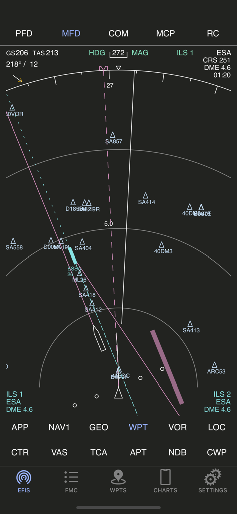
AirTrack Classicアプリの多機能ディスプレイ。フライトナビゲーションとウェイポイントを表示。
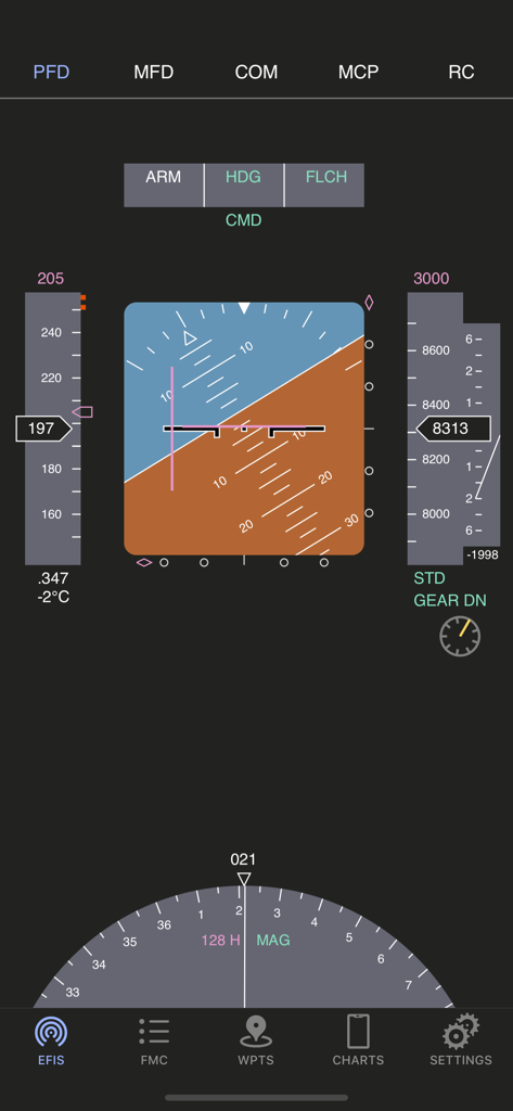
AirTrack Classicプライマリフライトディスプレイインターフェース。フライト計器を表示。
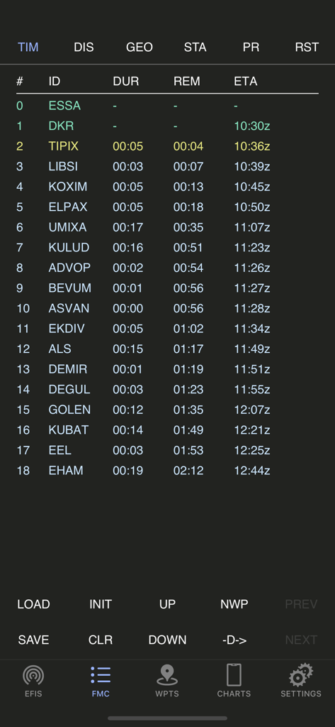
AirTrack Classicアプリ。フライトマネジメントコンピュータのルートプランナースクリーンを表示。
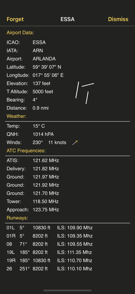
AirTrack Classicのスクリーンショット。ESSAアルランダ空港の詳細な空港データ(天気、ATC周波数、滑走路情報を含む)を表示。
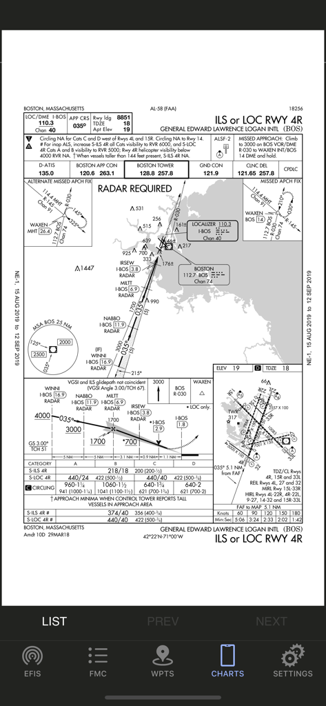
AirTrack Classicアプリに表示されているボストン・ローガン国際空港の航空計器進入方式図。
説明
Download
類似アプリ
似た機能とユーザー体験を持つアプリ

NBA 2K25 MyTEAM
2K Sports

Planner for AC: NH
Carolin Svensson

fnbr.co — Tracker for Fortnite
Kairu Media Ltd

Warframe Companion
Digital Extremes

VALPAW
Thorben Hamann

战盟-官方社交平台
Chengdu Liwei Network Technology Co., Ltd.

SIM-Dashboard
Christian Hausmann

Career Mode Tracker
Ivo Teixeira

NBA 2K24 MyTEAM
2K Sports
このページはアプリまたはその開発者の公式ページではなく、情報提供および論評を目的として作成された独立した編集出版物です。明示的に別段の記載がない限り、アプリおよびその開発者は、MWM、Apple、Google Play、アプリのパブリッシャー、またはアプリの開発者と提携、承認、後援、認可、またはその他の公式的な関係はなく、このページのいかなる内容も、アプリがMWMのサービスを使用して開発されたことを意味するものではありません。すべての商標、ロゴ、スクリーンショット、その他のコンテンツはそれぞれの所有者の財産です。