このページはアプリまたはその開発者の公式ページではなく、情報提供および論評を目的として作成された独立した編集出版物です。明示的に別段の記載がない限り、アプリおよびその開発者は、MWM、Apple、Google Play、アプリのパブリッシャー、またはアプリの開発者と提携、承認、後援、認可、またはその他の公式的な関係はなく、このページのいかなる内容も、アプリがMWMのサービスを使用して開発されたことを意味するものではありません。すべての商標、ロゴ、スクリーンショット、その他のコンテンツはそれぞれの所有者の財産です。

Alaska State Roads
最後のフロンティアを自信を持ってナビゲートしましょう。390のライブ高速道路カメラと即時の事故アラートにアクセスして、あらゆる旅で安全かつ情報通になりましょう。
ダウンロード
3K+ユーザー評価
評価数
0開発元
カテゴリ
Travel対応言語
1最新バージョン
1.2サイズ
4.5 MBリリース日
2020年9月14日最後のアラスカ州道路をマスターしよう
運輸省から直接提供されるリアルタイムの視覚的証拠と権威あるデータで、アラスカ特有の運転の課題をナビゲートしましょう。
390以上のライブカメラフィード
推測はやめましょう。エンジンをかける前に、州全体の雪の積雪量、氷、視界のレベルをライブで確認できます。
公式事故アラート
事故や危険に関する色分けされた深刻度レポートにアクセスし、生存と安全のための最も信頼できるデータを入手できます。
以下のスクリーンショットと説明は、アプリの公式ストアリスティングから直接取得されたものであり、アプリ開発者の所有物です。
アプリストア
スクリーンショット
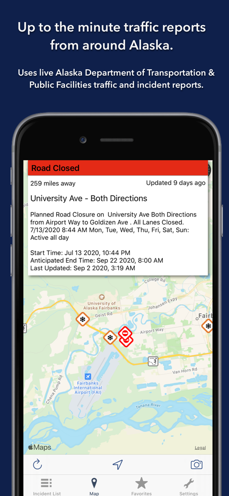
フェアバンクスを地図上に表示し、道路閉鎖通知とライブ交通事故アイコンを表示しているアラスカ州道路アプリのスクリーンショット。
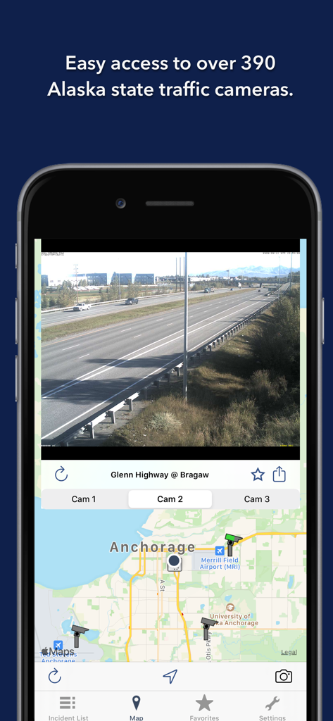
アンカレッジの地図の上にグレンハイウェイのライブ交通カメラフィードを表示しているアラスカ州道路アプリ。
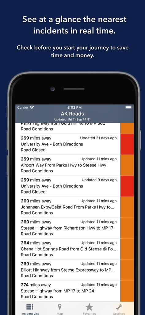
色分けされた深刻度インジケーター付きで、アラスカ州道路アプリのリアルタイム道路事故と閉鎖のリスト。
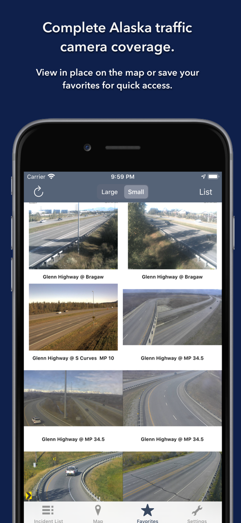
グレンハイウェイのライブ交通カメラフィードを表示しているアラスカ州道路アプリ。
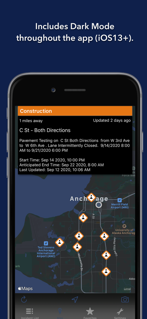
アンカレッジの地図上に建設アラートを表示しているダークモードのアラスカ州道路アプリインターフェース。
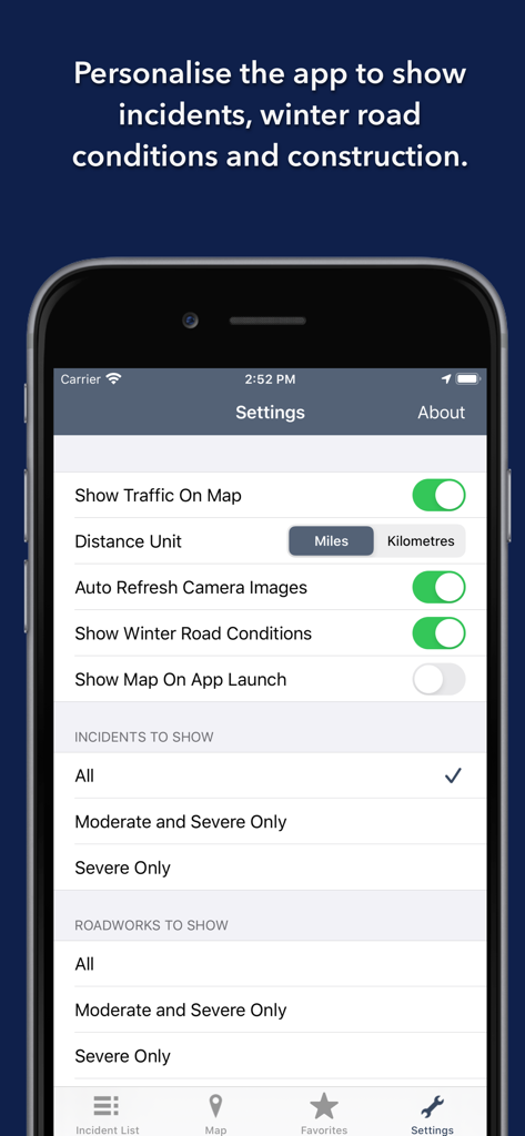
交通事故と冬の道路状況に関するアラスカ州道路アプリのパーソナライズ設定
説明
Download
類似アプリ
同じカテゴリのトップランクアプリ

Uber - Request a ride
Uber Technologies, Inc.

Airbnb
Airbnb, Inc.

铁路12306
ACADEMY OF RAILWAY SCIENCES CO., ltd.

Booking.com: Hotels & Travel
Booking.com B.V.

Grab: Taxi Ride, Food Delivery
GRABTAXI HOLDINGS PTE. LTD.

Trip.com: Book Flights, Hotels
Trip.com Travel Singapore Pte. Ltd.

DiDi China: Ride Hailing
Didi Chuxing (Beijing) Network Platform Technology Co., Ltd

去哪儿旅行-订酒店机票火车票
Beijing Qunar Information Technology Company Limit

Bolt: Request a Ride
BOLT TECHNOLOGY OU
このページはアプリまたはその開発者の公式ページではなく、情報提供および論評を目的として作成された独立した編集出版物です。明示的に別段の記載がない限り、アプリおよびその開発者は、MWM、Apple、Google Play、アプリのパブリッシャー、またはアプリの開発者と提携、承認、後援、認可、またはその他の公式的な関係はなく、このページのいかなる内容も、アプリがMWMのサービスを使用して開発されたことを意味するものではありません。すべての商標、ロゴ、スクリーンショット、その他のコンテンツはそれぞれの所有者の財産です。