このページはアプリまたはその開発者の公式ページではなく、情報提供および論評を目的として作成された独立した編集出版物です。明示的に別段の記載がない限り、アプリおよびその開発者は、MWM、Apple、Google Play、アプリのパブリッシャー、またはアプリの開発者と提携、承認、後援、認可、またはその他の公式的な関係はなく、このページのいかなる内容も、アプリがMWMのサービスを使用して開発されたことを意味するものではありません。すべての商標、ロゴ、スクリーンショット、その他のコンテンツはそれぞれの所有者の財産です。

Altimeter Pro: Compass, GPS
ハイカー、クライマー、アウトドア愛好家のためのプロフェッショナルツールキット。標高を追跡し、気圧を監視し、ポケットやApple Watchから直接、データ豊富な写真で頂上制覇の成功を共有します。
ダウンロード
118K+ユーザー評価
評価数
500開発元
カテゴリ
Navigation対応言語
8最新バージョン
2.1サイズ
89.7 MBリリース日
2017年5月29日あらゆる地形を正確にマスター
登山、ハイキング、探検のための究極のオールインワンコンパニオン。リアルタイムの標高と位置データを手首と手のひらに直接届けます。
リアルタイムの高度と気圧
標高上昇と気圧を即座に監視し、天候の変化を予測し、高高度アドベンチャー中に安全を確保します。
検証済み成果共有
高度、GPS座標、コンパスの方向を自動オーバーレイで頂上での瞬間をキャプチャし、成果の証拠を共有します。
よくある質問
について知っておくべきこと Altimeter Pro: Compass, GPS
What is Altimeter Pro: Compass, GPS?
Altimeter Pro: Compass, GPSは、移動中やハイキング中に、場所、高度、方向、地理座標、住所、気圧を瞬時に確認できるアプリケーションです。
What information does Altimeter Pro provide in Normal Mode?
ノーマルモードでは、Altimeter Proは現在の高度、気圧、緯度経度座標、住所、移動速度、詳細なコンパスによる方向を提供します。
Can Altimeter Pro track my location and altitude while I am moving?
はい、Altimeter Proには「マップ上のトラックモード」があり、移動中の場所と高度、気圧、座標、住所、速度、方向の変化を瞬時に追跡します。
How does Altimeter Pro measure altitude and location coordinates?
Altimeter Proは、デバイスのGPS信号を使用して高度と位置座標を計算します。これらの測定値の精度は、GPS信号の品質によって異なる場合があります。
Can Altimeter Pro save altitudes of specific locations?
はい、Altimeter Proのマーカーモードを使用すると、ユーザーは選択した場所の高度と座標情報をマップ上で直接探索、マーク、保存できます。
Does Altimeter Pro allow sharing of photos with location data?
はい、Altimeter Proの共有モードを使用すると、ユーザーは高度、気圧、座標、住所情報が埋め込まれた写真を共有できます。撮影角度によってはコンパスの方向も含まれます。
Is Altimeter Pro compatible with Apple Watch?
はい、Altimeter Proを使用してApple Watchから直接高度と位置情報にアクセスできます。
Can I customize the measurement units in Altimeter Pro?
はい、Altimeter Proでは、高度単位をメートルまたはフィート、座標形式、速度をkm/hまたはmph、気圧計単位をpsiまたはkPAに変更できます。
Does Altimeter Pro display atmospheric pressure?
はい、Altimeter Proは、ノーマルモード、トラックモード、およびメインインターフェイスで、気圧計の読み取り値として外気(大気)圧を表示します。
Can Altimeter Pro show my current speed?
はい、Altimeter Proは移動中の速度を表示します。これは、ノーマルモードとマップ上のトラックモードの両方で利用可能です。
Does Altimeter Pro offer a dark mode interface?
はい、Altimeter Proは、アプリケーションのスクリーンショットに示されているように、インターフェイス用のダークモードオプションを提供しています。
Can I view my location on a satellite map in Altimeter Pro?
はい、Altimeter Proは、標準のマップインターフェイスに代わるものとして、衛星マップビューで現在地を表示することをサポートしています。
以下のスクリーンショットと説明は、アプリの公式ストアリスティングから直接取得されたものであり、アプリ開発者の所有物です。
アプリストア
スクリーンショット
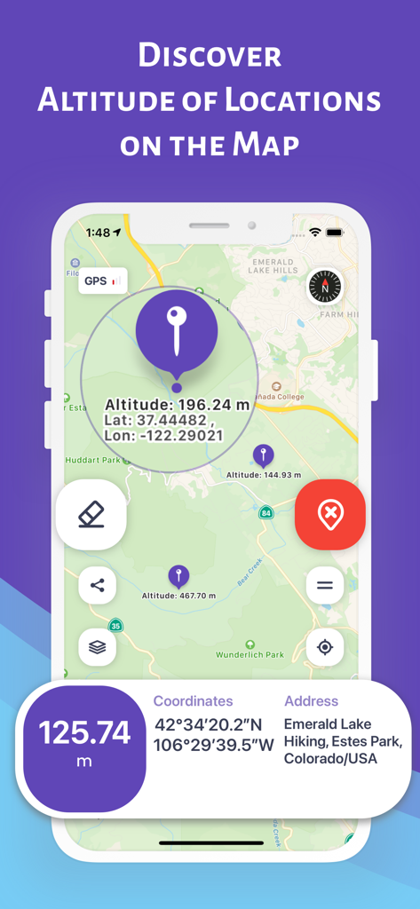
コロラドのハイキング場所の高度とGPS座標を示す地図を表示するAltimeter Proアプリインターフェイス
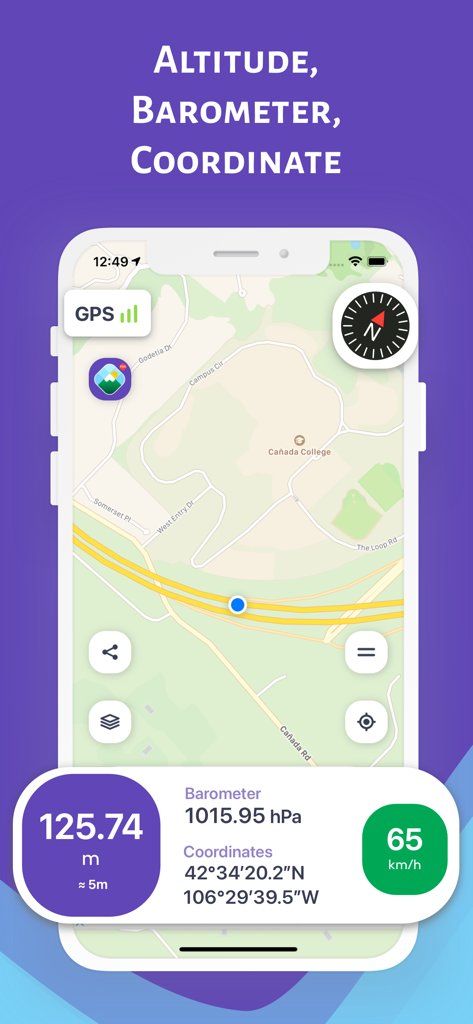
詳細な地図に高度計、気圧計、GPS座標を表示するAltimeter Proアプリインターフェイス
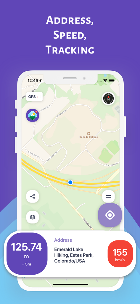
高度、速度、位置住所を含む地図追跡を表示するAltimeter Proアプリインターフェイス
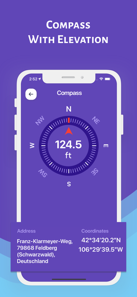
現在の高度とGPS座標を持つデジタルコンパスを表示するAltimeter Proアプリインターフェイス
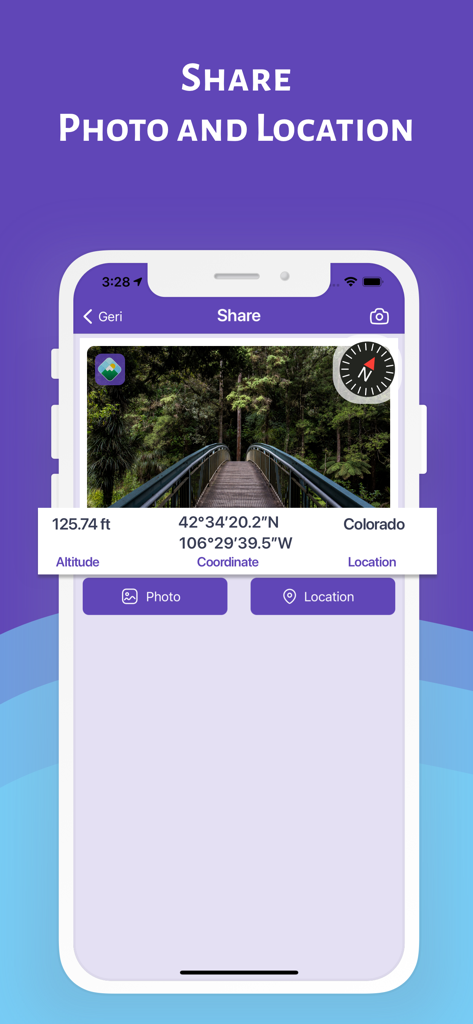
ソーシャル共有のために高度、GPS座標、コンパスデータが表示されているAltimeter Proアプリ内の森林の橋の写真。
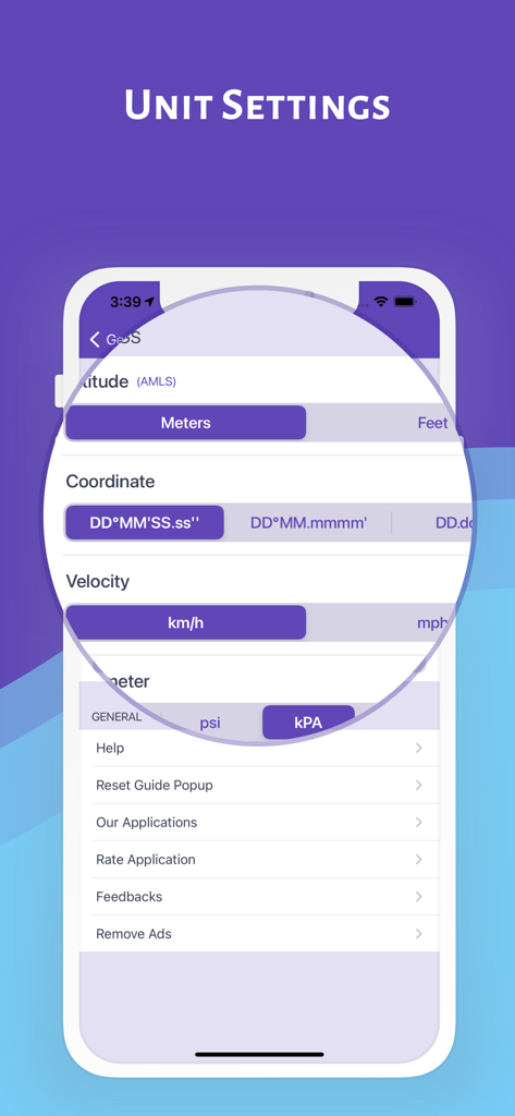
Altimeter Proアプリの単位設定画面。高度、座標、速度、気圧のカスタマイズオプションが表示されます。
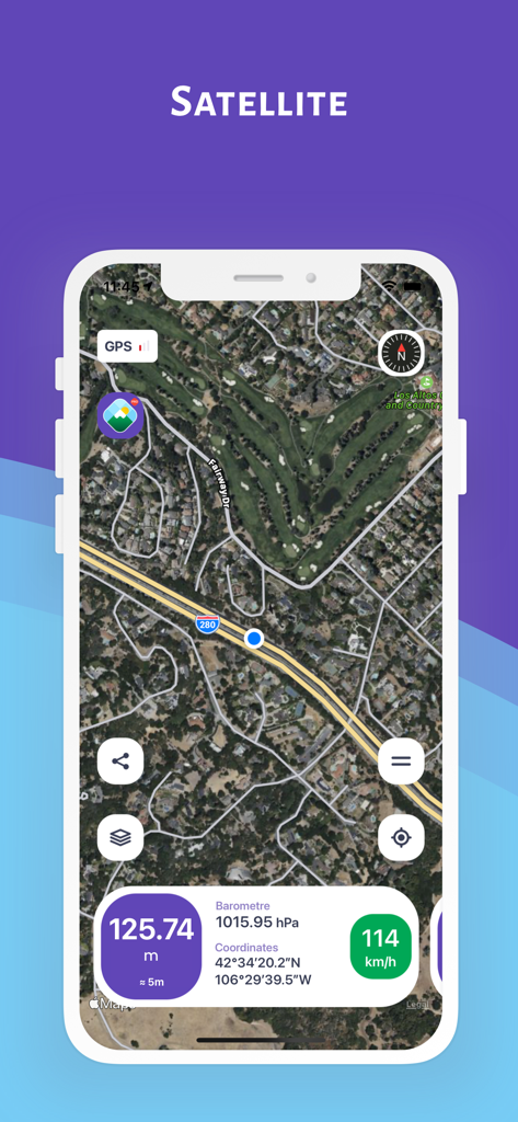
リアルタイムの高度と座標を示す衛星地図を表示するAltimeter Proアプリのスクリーンショット
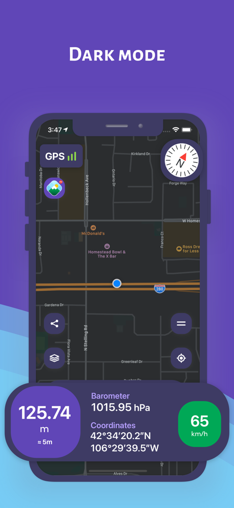
ナビゲーションマップとリアルタイムの高度データを示す、ダークモードのAltimeter Proアプリのスクリーンショット
説明
Download
類似アプリ
同じカテゴリのトップランクアプリ

Google Maps
Google LLC

Waze Navigation & Live Traffic
waze

AMap Global
AutoNavi Information Technology Co. Ltd.

百度地图-路线规划,出行必备
Beijing Baidu Netcom Science & Technology Co.,Ltd

Moovit: Bus & Transit Tracker
Moovit App Global LTD

Transit • Subway & Bus Times
9280-0366 Quebec inc.

ParkMobile: Park. Pay. Go.
Parkmobile USA, Inc

腾讯地图-路线规划,导航地铁打车出行
Shenzhen Tencent Computer Systems Company Limited

Île-de-France Mobilités
Ile de France Mobilites
このページはアプリまたはその開発者の公式ページではなく、情報提供および論評を目的として作成された独立した編集出版物です。明示的に別段の記載がない限り、アプリおよびその開発者は、MWM、Apple、Google Play、アプリのパブリッシャー、またはアプリの開発者と提携、承認、後援、認可、またはその他の公式的な関係はなく、このページのいかなる内容も、アプリがMWMのサービスを使用して開発されたことを意味するものではありません。すべての商標、ロゴ、スクリーンショット、その他のコンテンツはそれぞれの所有者の財産です。