このページはアプリまたはその開発者の公式ページではなく、情報提供および論評を目的として作成された独立した編集出版物です。明示的に別段の記載がない限り、アプリおよびその開発者は、MWM、Apple、Google Play、アプリのパブリッシャー、またはアプリの開発者と提携、承認、後援、認可、またはその他の公式的な関係はなく、このページのいかなる内容も、アプリがMWMのサービスを使用して開発されたことを意味するものではありません。すべての商標、ロゴ、スクリーンショット、その他のコンテンツはそれぞれの所有者の財産です。

Altimeter Ultra: GPS & Compass
リアルタイムの高度、気圧、精密GPSで地形をマスターしましょう。ルートを記録し、パフォーマンスを分析し、探検家のコミュニティと発見を共有しましょう。
ダウンロード
9K+ユーザー評価
評価数
100開発元
カテゴリ
Navigation対応言語
1最新バージョン
1.4サイズ
56.9 MBリリース日
2024年5月28日精度で全てのピークを征服
荒野でのリアルタイムデータと信頼性の高いナビゲーションを要求するハイカー、クライマー、冒険家のために設計された究極のオールインワンツールキット。
リアルタイム高度&天気
正確な高度と気圧の測定値にアクセスして、上昇を追跡し、刻々と変化する気象パターンを即座に予測します。
旅を記録&分析
速度と距離の統計を含む詳細なルート履歴を記録し、山の成果をアウトドアコミュニティと共有しましょう。
信頼性の高いオフグリッドナビゲーション
高精度のデジタルコンパスと統合された高出力懐中電灯により、遠隔地でも安全を確保し、暗闇でも安心感を与えます。
信頼性の高いオフグリッドナビゲーション
高精度のデジタルコンパスと統合された高出力懐中電灯により、遠隔地でも安全を確保し、暗闇でも安心感を与えます。
以下のスクリーンショットと説明は、アプリの公式ストアリスティングから直接取得されたものであり、アプリ開発者の所有物です。
アプリストア
スクリーンショット
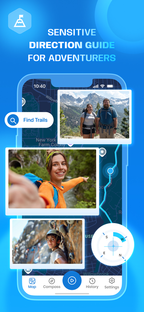
Altimeter Ultraアプリのインターフェースのスクリーンショット。トレイルマップ、ナビゲーションコンパス、ハイキングやロッククライミングなどのアウトドアアドベンチャー写真が表示されています。
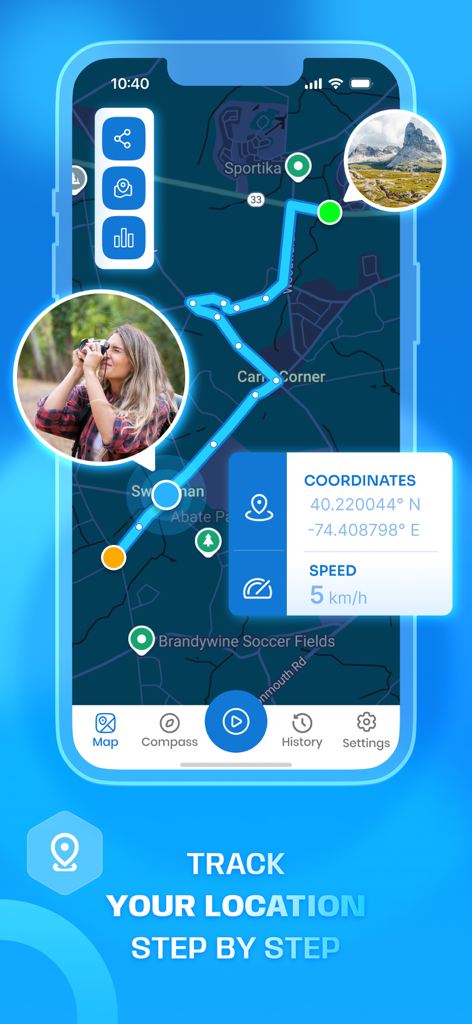
座標と速度統計を含むGPSルート追跡を示すモバイルアプリインターフェース。
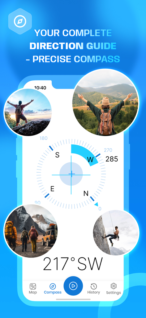
ハイカーや登山者の画像に囲まれたAltimeter Ultraアプリのデジタルコンパスインターフェース。
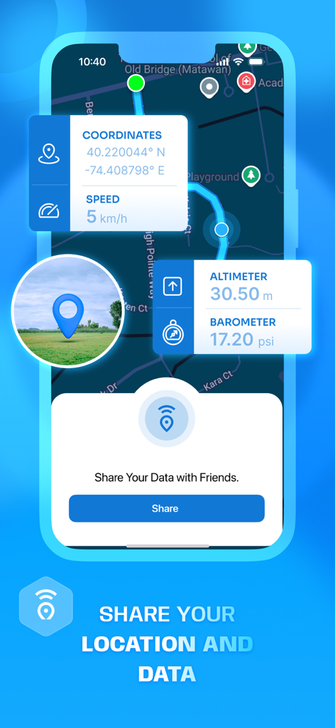
Altimeter Ultraアプリのインターフェース。リアルタイムGPS座標、高度、気圧、位置情報共有機能が表示されています。
説明
Download
類似アプリ
同じカテゴリのトップランクアプリ

Google Maps
Google LLC

Waze Navigation & Live Traffic
waze

AMap Global
AutoNavi Information Technology Co. Ltd.

百度地图-路线规划,出行必备
Beijing Baidu Netcom Science & Technology Co.,Ltd

Moovit: Bus & Transit Tracker
Moovit App Global LTD

Transit • Subway & Bus Times
9280-0366 Quebec inc.

ParkMobile: Park. Pay. Go.
Parkmobile USA, Inc

腾讯地图-路线规划,导航地铁打车出行
Shenzhen Tencent Computer Systems Company Limited

Île-de-France Mobilités
Ile de France Mobilites
このページはアプリまたはその開発者の公式ページではなく、情報提供および論評を目的として作成された独立した編集出版物です。明示的に別段の記載がない限り、アプリおよびその開発者は、MWM、Apple、Google Play、アプリのパブリッシャー、またはアプリの開発者と提携、承認、後援、認可、またはその他の公式的な関係はなく、このページのいかなる内容も、アプリがMWMのサービスを使用して開発されたことを意味するものではありません。すべての商標、ロゴ、スクリーンショット、その他のコンテンツはそれぞれの所有者の財産です。