このページはアプリまたはその開発者の公式ページではなく、情報提供および論評を目的として作成された独立した編集出版物です。明示的に別段の記載がない限り、アプリおよびその開発者は、MWM、Apple、Google Play、アプリのパブリッシャー、またはアプリの開発者と提携、承認、後援、認可、またはその他の公式的な関係はなく、このページのいかなる内容も、アプリがMWMのサービスを使用して開発されたことを意味するものではありません。すべての商標、ロゴ、スクリーンショット、その他のコンテンツはそれぞれの所有者の財産です。

ダウンロード
1M+ユーザー評価
評価数
400開発元
カテゴリ
Navigation対応言語
2最新バージョン
1.5.2サイズ
64.7 MBリリース日
2020年10月29日プロフェッショナルな探求のための高精度ツール
HD衛星測位、面積測定、高度なルート追跡により、スマートフォンを高性能測量機器に変えましょう。
プロフェッショナルな面積マッピング
HD衛星マップ上で土地の範囲を即座に計算し、KML/KMZ経由で空間データをエクスポートして、プロフェッショナルなGISレポートを作成できます。
高度なルートトレース
高度データと位置情報付き写真でオフグリッドのトレイルを記録。オーバーランディングやサイトスカウティングに最適です。
以下のスクリーンショットと説明は、アプリの公式ストアリスティングから直接取得されたものであり、アプリ開発者の所有物です。
アプリストア
スクリーンショット
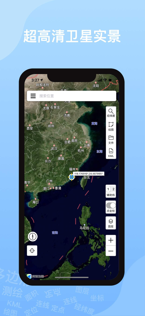
Ovital Mapモバイルアプリが、高精細衛星画像とプロフェッショナルなナビゲーションツールを表示
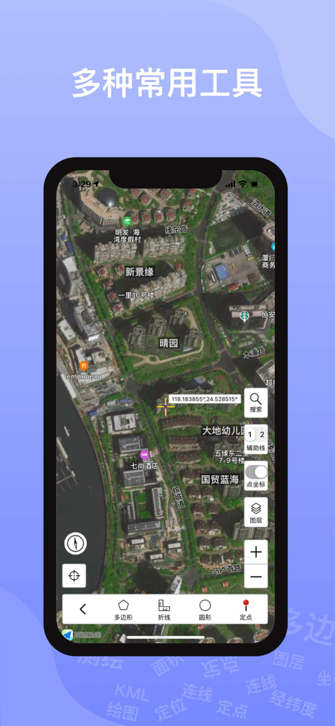
Ovital Map衛星ビューインターフェースが、地理座標と測定ツールを表示
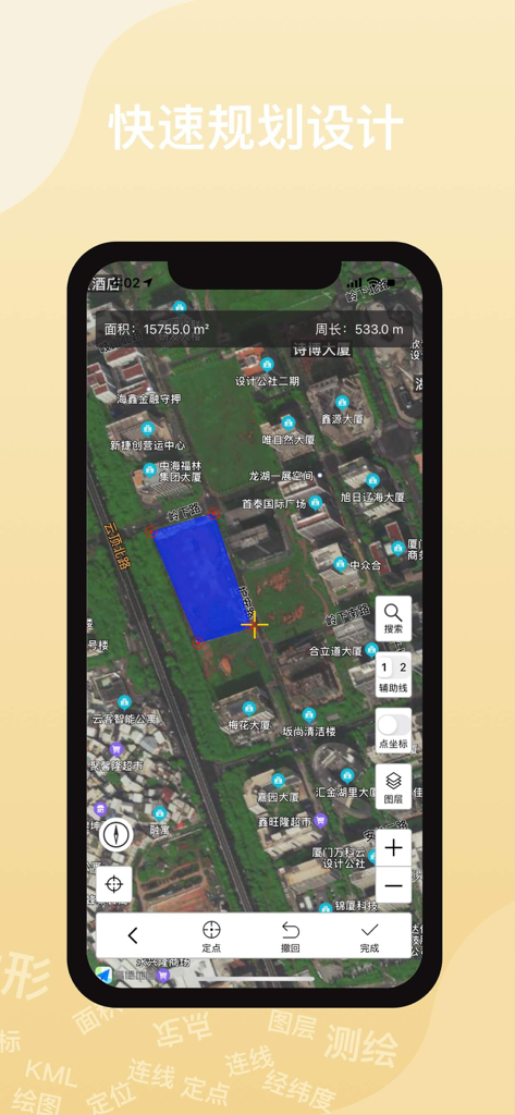
Ovital Mapアプリインターフェースが、衛星マップ上で土地面積を測定
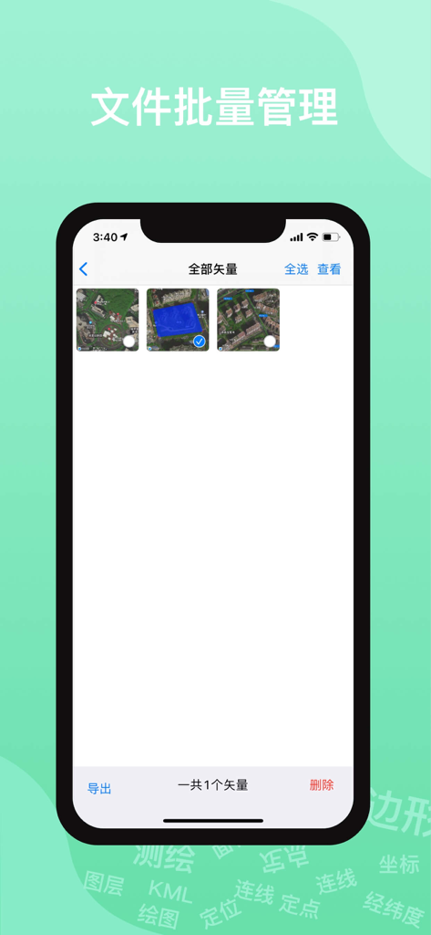
ベクトルマップデータの書き出し用、Ovital Mapのバッチファイル管理インターフェース
説明
Download
類似アプリ
同じカテゴリのトップランクアプリ

Google Maps
Google LLC

Waze Navigation & Live Traffic
waze

AMap Global
AutoNavi Information Technology Co. Ltd.

百度地图-路线规划,出行必备
Beijing Baidu Netcom Science & Technology Co.,Ltd

Moovit: Bus & Transit Tracker
Moovit App Global LTD

Transit • Subway & Bus Times
9280-0366 Quebec inc.

ParkMobile: Park. Pay. Go.
Parkmobile USA, Inc

腾讯地图-路线规划,导航地铁打车出行
Shenzhen Tencent Computer Systems Company Limited

Île-de-France Mobilités
Ile de France Mobilites
このページはアプリまたはその開発者の公式ページではなく、情報提供および論評を目的として作成された独立した編集出版物です。明示的に別段の記載がない限り、アプリおよびその開発者は、MWM、Apple、Google Play、アプリのパブリッシャー、またはアプリの開発者と提携、承認、後援、認可、またはその他の公式的な関係はなく、このページのいかなる内容も、アプリがMWMのサービスを使用して開発されたことを意味するものではありません。すべての商標、ロゴ、スクリーンショット、その他のコンテンツはそれぞれの所有者の財産です。