このページはアプリまたはその開発者の公式ページではなく、情報提供および論評を目的として作成された独立した編集出版物です。明示的に別段の記載がない限り、アプリおよびその開発者は、MWM、Apple、Google Play、アプリのパブリッシャー、またはアプリの開発者と提携、承認、後援、認可、またはその他の公式的な関係はなく、このページのいかなる内容も、アプリがMWMのサービスを使用して開発されたことを意味するものではありません。すべての商標、ロゴ、スクリーンショット、その他のコンテンツはそれぞれの所有者の財産です。

aSmart HUD 3D +SpeedCams
フロントガラスを未来的な3Dダッシュボードに変えましょう。リアルタイムの速度カメラアラート、高度なトリップロギング、統合された音楽コントロールをすべて、現代のドライバーのために設計されたプロフェッショナルHUDで実現します。
ダウンロード
155K+ユーザー評価
評価数
600開発元
カテゴリ
Navigation対応言語
1最新バージョン
8.1サイズ
8.4 MBリリース日
2009年9月24日プロフェッショナル3Dダッシュボードでドライブを変革
現代のドライバーのために設計された、リアルタイムHUDプロジェクション、高度な速度カメラアラート、包括的なトリップデータを備えたプレミアムコックピットインターフェースを体験してください。
未来的なHUDプロジェクション
ダッシュボードをフロントガラスに直接投影し、安全な夜間運転と、視線を道路から離すことなくハイテクコックピット体験を実現します。
スマート速度カメラ防御
編集可能なグローバルな速度違反カメラと赤信号カメラのデータベースと、プロアクティブなマルチレベル速度制限警告を組み合わせて、高額なチケットを回避しましょう。
以下のスクリーンショットと説明は、アプリの公式ストアリスティングから直接取得されたものであり、アプリ開発者の所有物です。
アプリストア
スクリーンショット
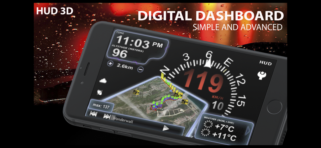
aSmart HUD 3Dデジタルダッシュボードアプリのインターフェース、速度とナビゲーションを表示
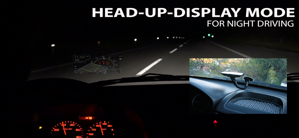
aSmart HUD 3Dアプリのインターフェース、夜間運転中のヘッドアップディスプレイモードで車のフロントガラスに反射
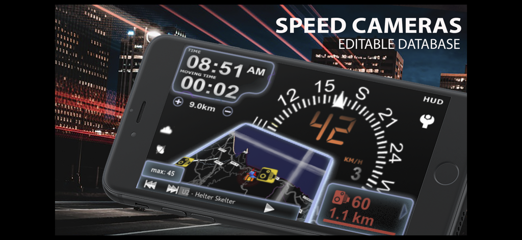
aSmart HUD 3Dアプリ、速度カメラアラートとナビゲーションインターフェースを備えたデジタル車のダッシュボードを表示
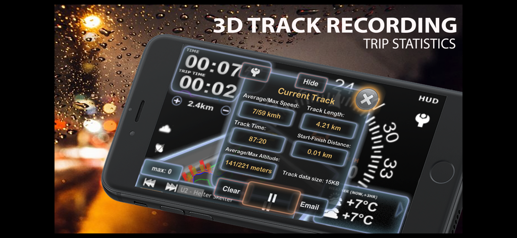
aSmart HUD 3Dアプリで3Dトラック記録と詳細なトリップ統計を表示するインターフェース
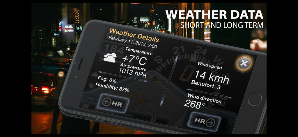
aSmart HUD 3Dアプリで温度、気圧、風速を含む気象詳細を表示するスマートフォン
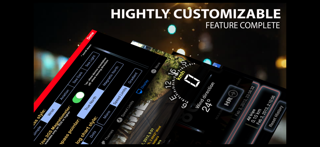
aSmart HUD 3Dアプリの画面のモンタージュ、カスタマイズ可能なダッシュボード設定とリアルタイム運転データを示しています
説明
Download
類似アプリ
同じカテゴリのトップランクアプリ

Google Maps
Google LLC

Waze Navigation & Live Traffic
waze

AMap Global
AutoNavi Information Technology Co. Ltd.

百度地图-路线规划,出行必备
Beijing Baidu Netcom Science & Technology Co.,Ltd

Moovit: Bus & Transit Tracker
Moovit App Global LTD

Transit • Subway & Bus Times
9280-0366 Quebec inc.

ParkMobile: Park. Pay. Go.
Parkmobile USA, Inc

腾讯地图-路线规划,导航地铁打车出行
Shenzhen Tencent Computer Systems Company Limited

Île-de-France Mobilités
Ile de France Mobilites
このページはアプリまたはその開発者の公式ページではなく、情報提供および論評を目的として作成された独立した編集出版物です。明示的に別段の記載がない限り、アプリおよびその開発者は、MWM、Apple、Google Play、アプリのパブリッシャー、またはアプリの開発者と提携、承認、後援、認可、またはその他の公式的な関係はなく、このページのいかなる内容も、アプリがMWMのサービスを使用して開発されたことを意味するものではありません。すべての商標、ロゴ、スクリーンショット、その他のコンテンツはそれぞれの所有者の財産です。