このページはアプリまたはその開発者の公式ページではなく、情報提供および論評を目的として作成された独立した編集出版物です。明示的に別段の記載がない限り、アプリおよびその開発者は、MWM、Apple、Google Play、アプリのパブリッシャー、またはアプリの開発者と提携、承認、後援、認可、またはその他の公式的な関係はなく、このページのいかなる内容も、アプリがMWMのサービスを使用して開発されたことを意味するものではありません。すべての商標、ロゴ、スクリーンショット、その他のコンテンツはそれぞれの所有者の財産です。

BusBahnBim
ウィーンの街からアルプスの山頂まで、電車、トラム、バス、自転車などのリアルタイム多目的ルーティングで旅をマスターしましょう。
ダウンロード
239K+ユーザー評価
評価数
1K+開発元
カテゴリ
Travel対応言語
11最新バージョン
11.2.4サイズ
81.4 MBリリース日
2012年4月18日オーストリアを移動するために必要なすべて
推測はやめて、オーストリアで最も正確な多目的交通プランナーで探索を始めましょう。地元のようにA地点からB地点へ移動できるように設計されています。
シームレスな多目的ルーティング
電車、トラム、バス、自転車を1つの旅程に組み合わせて、どの街やアルプスの村でも最も速い移動手段を見つけましょう。
信頼できるリアルタイム精度
公式のオーストリア交通データに基づく遅延や工事のリアルタイム更新で、移動のストレスを回避しましょう。
以下のスクリーンショットと説明は、アプリの公式ストアリスティングから直接取得されたものであり、アプリ開発者の所有物です。
アプリストア
スクリーンショット
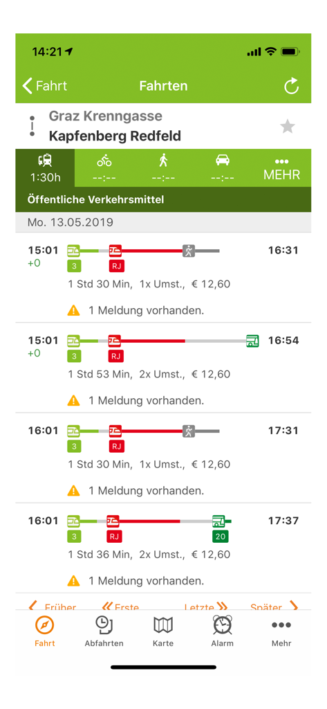
BusBahnBimアプリのスクリーンショット。オーストリアの旅行ルートと公共交通機関の時刻表を表示しています
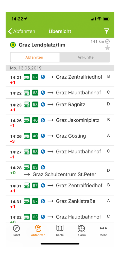
BusBahnBimアプリのグラーツ・レンドプラッツのリアルタイムバス出発リスト
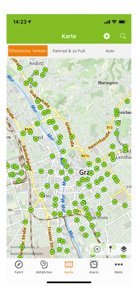
BusBahnBimアプリのマップビュー。オーストリア・グラーツの公共交通機関の停留所を表示しています
説明
Download
類似アプリ
同じカテゴリのトップランクアプリ

Uber - Request a ride
Uber Technologies, Inc.

Airbnb
Airbnb, Inc.

铁路12306
ACADEMY OF RAILWAY SCIENCES CO., ltd.

Booking.com: Hotels & Travel
Booking.com B.V.

Grab: Taxi Ride, Food Delivery
GRABTAXI HOLDINGS PTE. LTD.

Trip.com: Book Flights, Hotels
Trip.com Travel Singapore Pte. Ltd.

DiDi China: Ride Hailing
Didi Chuxing (Beijing) Network Platform Technology Co., Ltd

去哪儿旅行-订酒店机票火车票
Beijing Qunar Information Technology Company Limit

Bolt: Request a Ride
BOLT TECHNOLOGY OU
このページはアプリまたはその開発者の公式ページではなく、情報提供および論評を目的として作成された独立した編集出版物です。明示的に別段の記載がない限り、アプリおよびその開発者は、MWM、Apple、Google Play、アプリのパブリッシャー、またはアプリの開発者と提携、承認、後援、認可、またはその他の公式的な関係はなく、このページのいかなる内容も、アプリがMWMのサービスを使用して開発されたことを意味するものではありません。すべての商標、ロゴ、スクリーンショット、その他のコンテンツはそれぞれの所有者の財産です。