このページはアプリまたはその開発者の公式ページではなく、情報提供および論評を目的として作成された独立した編集出版物です。明示的に別段の記載がない限り、アプリおよびその開発者は、MWM、Apple、Google Play、アプリのパブリッシャー、またはアプリの開発者と提携、承認、後援、認可、またはその他の公式的な関係はなく、このページのいかなる内容も、アプリがMWMのサービスを使用して開発されたことを意味するものではありません。すべての商標、ロゴ、スクリーンショット、その他のコンテンツはそれぞれの所有者の財産です。

Coastal Explorer
洗練されたクルーズ計画、シームレスなハードウェア統合、NOAAチャートの精度で、すべての航海をマスターしましょう。陸上でも海上でも信頼性の高い、真剣な船乗りから信頼されています。
ダウンロード
2K+ユーザー評価
評価数
0開発元
カテゴリ
Navigation対応言語
1最新バージョン
1.3サイズ
54.3 MBリリース日
2021年1月26日真剣な船乗りのための高精度ツール
ソファでの計画から外洋ナビゲーションまで、Coastal Explorerは、安全でシームレスな航海に必要なプロフェッショナルグレードのデータとハードウェア統合を提供します。
高度なクルーズ計画
iPadで詳細なルートとウェイポイントを作成し、クラウド経由で seu すべてのデバイスに即座に同期します。
シームレスなマリン統合
AIS、深度計、オートパイロット、NMEAセンサーと連携して、タブレットをプライマリチャートプロッターに変えましょう。
以下のスクリーンショットと説明は、アプリの公式ストアリスティングから直接取得されたものであり、アプリ開発者の所有物です。
アプリストア
スクリーンショット
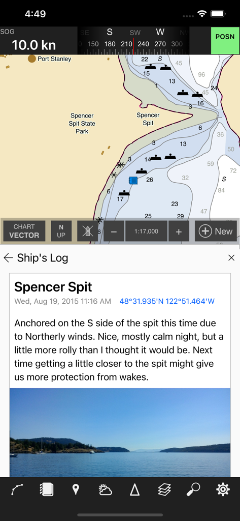
Coastal Explorerアプリに海図と船のログエントリが表示されています
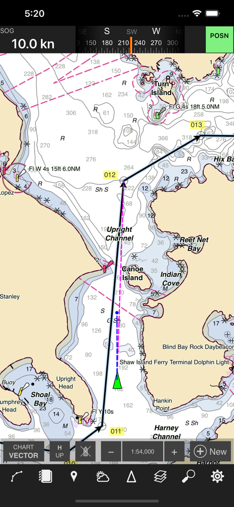
Coastal Explorerアプリのインターフェイスに、計画されたルートとナビゲーションマーカーを備えた詳細な海図が表示されています
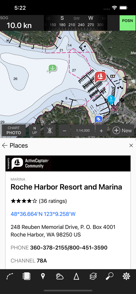
Coastal Explorerアプリに海図とロッシュハーバーの詳細なマリーナ情報が表示されています
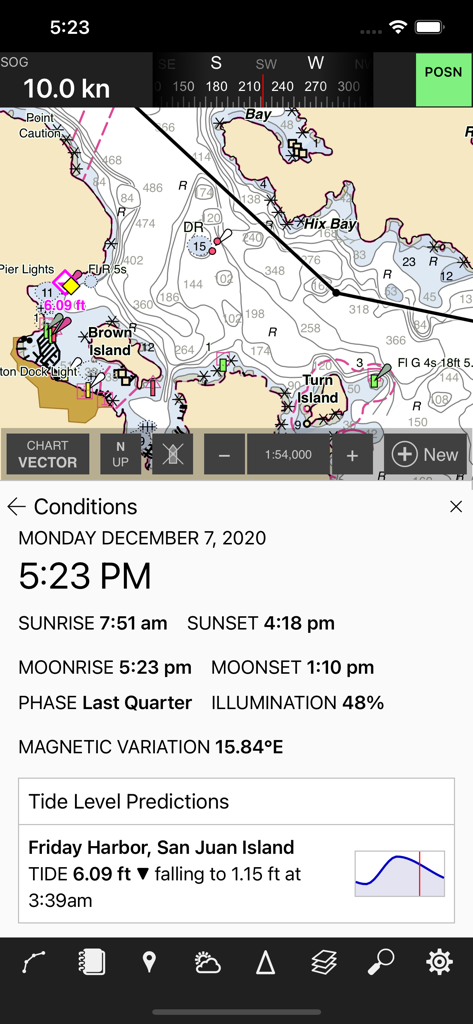
海図ナビゲーションアプリに、リアルタイムの潮汐と月齢データが表示されたサンフアン島の詳細なチャートが表示されています。
説明
Download
類似アプリ
同じカテゴリのトップランクアプリ

Google Maps
Google LLC

Waze Navigation & Live Traffic
waze

AMap Global
AutoNavi Information Technology Co. Ltd.

百度地图-路线规划,出行必备
Beijing Baidu Netcom Science & Technology Co.,Ltd

Moovit: Bus & Transit Tracker
Moovit App Global LTD

Transit • Subway & Bus Times
9280-0366 Quebec inc.

ParkMobile: Park. Pay. Go.
Parkmobile USA, Inc

腾讯地图-路线规划,导航地铁打车出行
Shenzhen Tencent Computer Systems Company Limited

Île-de-France Mobilités
Ile de France Mobilites
このページはアプリまたはその開発者の公式ページではなく、情報提供および論評を目的として作成された独立した編集出版物です。明示的に別段の記載がない限り、アプリおよびその開発者は、MWM、Apple、Google Play、アプリのパブリッシャー、またはアプリの開発者と提携、承認、後援、認可、またはその他の公式的な関係はなく、このページのいかなる内容も、アプリがMWMのサービスを使用して開発されたことを意味するものではありません。すべての商標、ロゴ、スクリーンショット、その他のコンテンツはそれぞれの所有者の財産です。