このページはアプリまたはその開発者の公式ページではなく、情報提供および論評を目的として作成された独立した編集出版物です。明示的に別段の記載がない限り、アプリおよびその開発者は、MWM、Apple、Google Play、アプリのパブリッシャー、またはアプリの開発者と提携、承認、後援、認可、またはその他の公式的な関係はなく、このページのいかなる内容も、アプリがMWMのサービスを使用して開発されたことを意味するものではありません。すべての商標、ロゴ、スクリーンショット、その他のコンテンツはそれぞれの所有者の財産です。

Compass 55. Map & GPS kit.
高精度のMGRS座標、オフラインマップ、テクニカルな追跡ツールで、あらゆる地形を制覇。完全なコントロールとデータ共有ゼロを求める冒険家やプロフェッショナルのために構築された、堅牢でプライバシー優先のナビゲーションスイート。
ダウンロード
987K+ユーザー評価
評価数
5K+開発元
カテゴリ
Navigation対応言語
7最新バージョン
5.2.3サイズ
70.2 MBリリース日
2016年9月23日テクニカルな冒険者のために構築
バックカントリーからコックピットまで、Compass 55はプライバシーを損なうことなく、プロフェッショナル級のGPSツールと完全なオフラインの信頼性を提供します。
プロフェッショナル級の精度
MGRS、UTM、緯度/経度座標で現在地を把握。ミリタリーレベルの精度でウェイポイントを変換、編集、共有できます。
グリッドを超えて
オフラインマップをダウンロードし、カスタムタイルサーバーをインポート。携帯電話の信号が不要で、人里離れた荒野や大海原をナビゲートできます。
以下のスクリーンショットと説明は、アプリの公式ストアリスティングから直接取得されたものであり、アプリ開発者の所有物です。
アプリストア
スクリーンショット
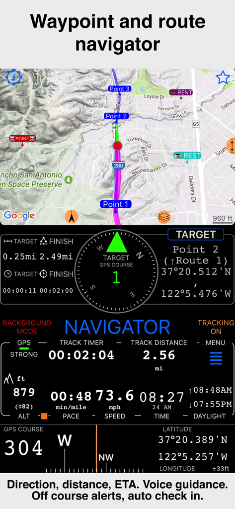
速度と高度のデータを備えたウェイポイントとルートナビゲーションを表示するCompass 55のインターフェース
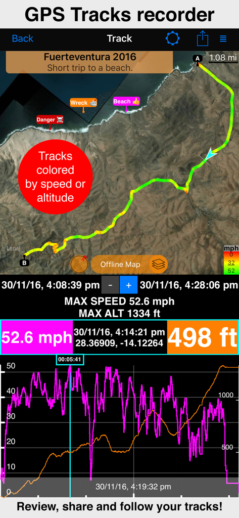
マップ、速度、高度の統計を表示するGPSトラック記録画面
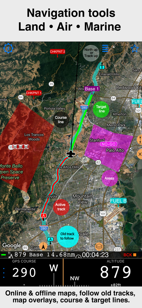
トラックオーバーレイと高度データを備えた衛星マップを表示するCompass 55プロフェッショナルナビゲーションインターフェース
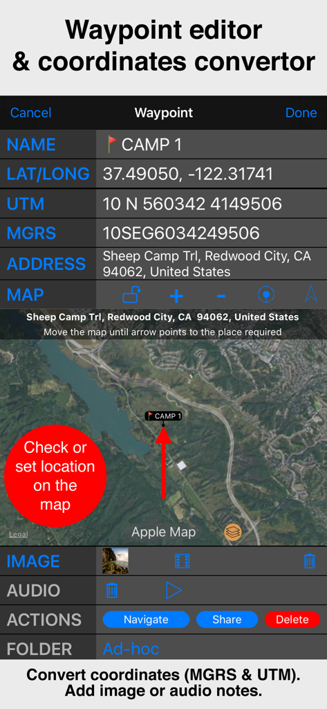
衛星マップビューとともにMGRSおよびUTM座標を表示するCompass 55ウェイポイントエディタのインターフェース。
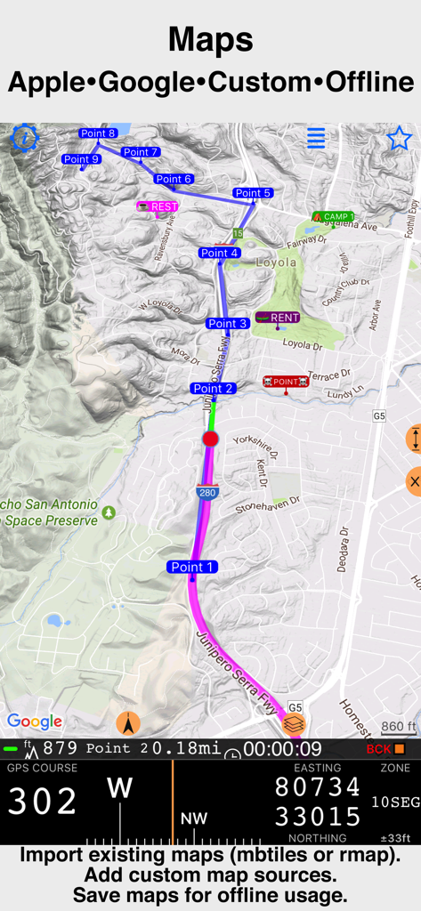
テクニカルなGPS座標を備えたCompass 55プロフェッショナルナビゲーションマップ
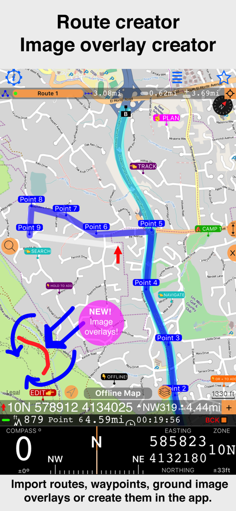
地形図上でのウェイポイントと新しい画像オーバーレイ機能によるルート作成を表示するCompass 55アプリのインターフェース。
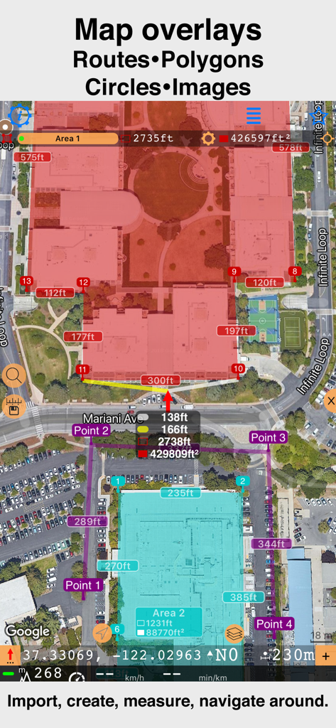
Compass 55でカスタムポリゴンと距離測定を表示する衛星マップインターフェース
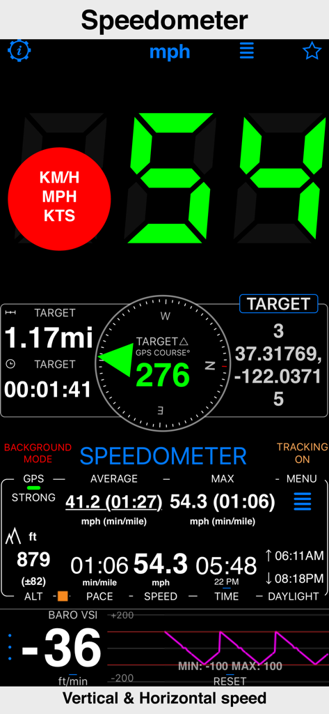
GPSデータによる水平および垂直速度を表示するCompass 55アプリのスピードメーターインターフェース
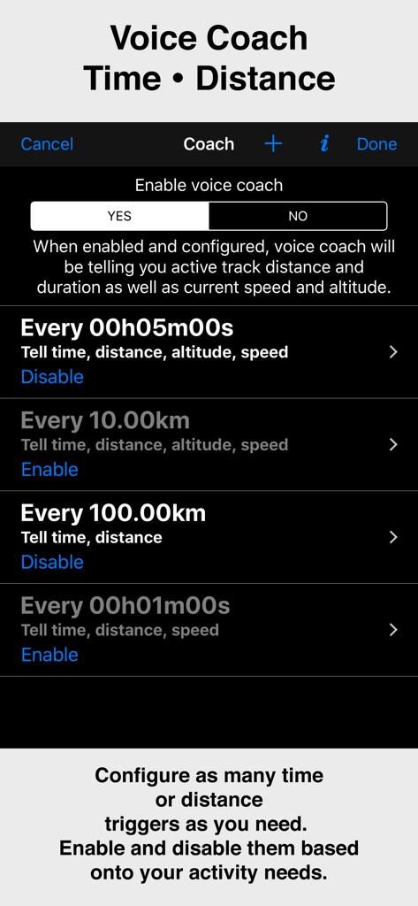
時間と距離のトリガーを表示するCompass 55アプリのボイスコーチ機能の設定画面
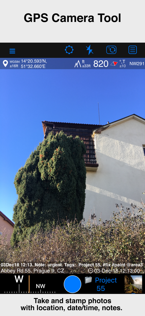
位置座標、高度、日付、メモのオーバーレイが含まれた写真を表示するCompass 55アプリのGPSカメラツール
説明
Download
類似アプリ
似た機能とユーザー体験を持つアプリ

MilGPS
Cascode Labs Pty Ltd

SEAiq Pilot VPP
Sakhalin, LLC

Cartograph Maps 3
Harald Meyer

新知卫星地图-路线规划,高清地图导航
Chongqing Xinzhi Space Technology Co., Ltd.

Coordinates – GPS Converter
Mapnitude Company Limited

Mgrs & Utm Map
Vahid Cataltas

DeepStateMap
Heorhii Karpenko

Map Plus
Miocool Inc.

Vetus Maps
Andrey Fetisov
このページはアプリまたはその開発者の公式ページではなく、情報提供および論評を目的として作成された独立した編集出版物です。明示的に別段の記載がない限り、アプリおよびその開発者は、MWM、Apple、Google Play、アプリのパブリッシャー、またはアプリの開発者と提携、承認、後援、認可、またはその他の公式的な関係はなく、このページのいかなる内容も、アプリがMWMのサービスを使用して開発されたことを意味するものではありません。すべての商標、ロゴ、スクリーンショット、その他のコンテンツはそれぞれの所有者の財産です。