このページはアプリまたはその開発者の公式ページではなく、情報提供および論評を目的として作成された独立した編集出版物です。明示的に別段の記載がない限り、アプリおよびその開発者は、MWM、Apple、Google Play、アプリのパブリッシャー、またはアプリの開発者と提携、承認、後援、認可、またはその他の公式的な関係はなく、このページのいかなる内容も、アプリがMWMのサービスを使用して開発されたことを意味するものではありません。すべての商標、ロゴ、スクリーンショット、その他のコンテンツはそれぞれの所有者の財産です。

Compass: GPS & Altimeter
ハイカー、探検家、プロフェッショナル向けのオールインワンアウトドアツール。信号不要で、高度を追跡し、3D地形を監視し、プロ仕様の地理データで旅を記録しましょう。
ダウンロード
12K+ユーザー評価
評価数
100開発元
カテゴリ
Travel対応言語
33最新バージョン
2.1.4サイズ
31.4 MBリリース日
2025年5月14日すべてのトレイルと地形をマスターする
山の頂上から遠隔地の砂漠まで、完全にオフグリッドでも、プロ仕様のナビゲーションとリアルタイムの環境データを取得しましょう。
高精度プロナビゲーション
3D地形ビューと磁場監視でコースを維持し、深い自然での迷いを防ぎます。
リアルタイム高度&天気
気圧、風速、高度の傾向を追跡し、急な山の天候の変化に先んじましょう。
以下のスクリーンショットと説明は、アプリの公式ストアリスティングから直接取得されたものであり、アプリ開発者の所有物です。
アプリストア
スクリーンショット
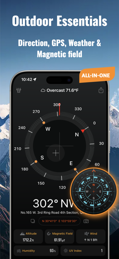
コンパスGPSおよび高度計アプリのインターフェース。アウトドア探索のための方向、天気、高度情報が表示されます。
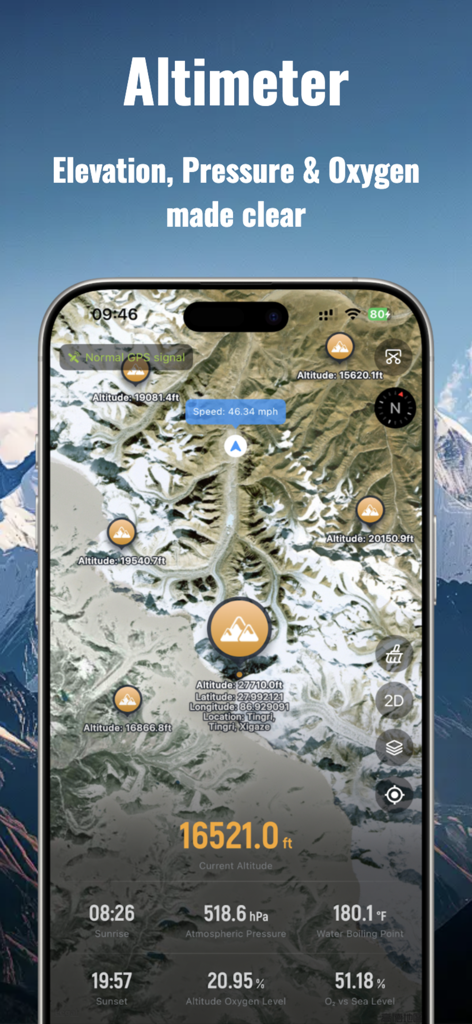
高度計画面。衛星マップ上に標高、気圧、酸素レベルが表示されます。
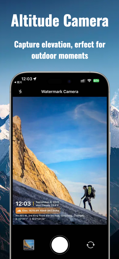
高度カメラインターフェース。山のハイキング写真にGPS位置と標高データが表示されます。
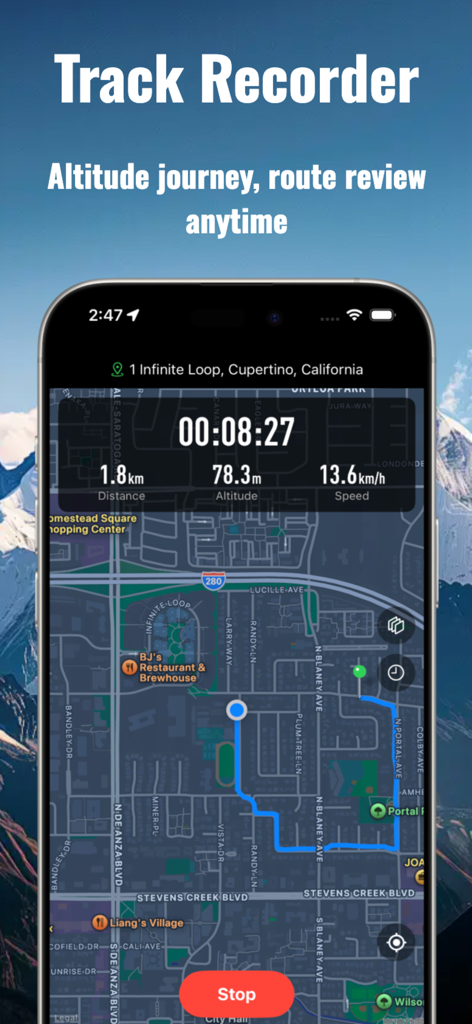
スマートフォン画面。マッピングされたルートとリアルタイムの距離、高度、速度データが表示されるトラックレコーダー機能を示しています。

モバイルアプリインターフェースのさまざまなコンパスおよび高度計デザインテーマのグリッド。
説明
Download
類似アプリ
似た機能とユーザー体験を持つアプリ

Realtime Altimeter
Zhenlai Xia

Travel Camera & Compass
Ha Nguyen

compass-latitude and longitude
美霞 熊

Compass ×
DOUBLE U s.r.o.

GPS Altitude-海拔表
祥琦 孔

Compass - GPS positioning
嘉 罗

Compass360X-GPS Speedometer
卫豪 吴

指南针-GPS经纬度海拔定位
Chongqing Xinzhi Space Technology Co., Ltd.

Travel Altimeter & Elevation
BranchenKing Ltd.
このページはアプリまたはその開発者の公式ページではなく、情報提供および論評を目的として作成された独立した編集出版物です。明示的に別段の記載がない限り、アプリおよびその開発者は、MWM、Apple、Google Play、アプリのパブリッシャー、またはアプリの開発者と提携、承認、後援、認可、またはその他の公式的な関係はなく、このページのいかなる内容も、アプリがMWMのサービスを使用して開発されたことを意味するものではありません。すべての商標、ロゴ、スクリーンショット、その他のコンテンツはそれぞれの所有者の財産です。