このページはアプリまたはその開発者の公式ページではなく、情報提供および論評を目的として作成された独立した編集出版物です。明示的に別段の記載がない限り、アプリおよびその開発者は、MWM、Apple、Google Play、アプリのパブリッシャー、またはアプリの開発者と提携、承認、後援、認可、またはその他の公式的な関係はなく、このページのいかなる内容も、アプリがMWMのサービスを使用して開発されたことを意味するものではありません。すべての商標、ロゴ、スクリーンショット、その他のコンテンツはそれぞれの所有者の財産です。

Coverage?
主要キャリアの5G、LTE、ローミングマップを重ねて比較できる、テクノマド必須のツール。独自のオフラインカバレッジデータにアクセスし、アメリカとカナダ全土で自信を持って旅行を計画しましょう。
ダウンロード
210K+ユーザー評価
評価数
1K+開発元
カテゴリ
Navigation対応言語
1最新バージョン
2025.4サイズ
34.9 MBリリース日
2010年12月22日接続をマスターする
信号がある場所を推測するのはやめましょう。カバレッジ?は、包括的なキャリア横断マップをポケットに入れ、ストレスフリーな旅行と信頼性の高いリモートワークを実現します。
オフラインでの安心
高解像度マップはデバイスに直接保存されます。電波がゼロのデッドゾーンにいる場合でも、信号を見つけることができます。
キャリア横断オーバーレイ
AT&T、Verizon、T-Mobile、Dishを直接比較します。次のキャンプ場やリモートデスティネーションでどのキャリアが優れているかを即座に確認できます。
以下のスクリーンショットと説明は、アプリの公式ストアリスティングから直接取得されたものであり、アプリ開発者の所有物です。
アプリストア
スクリーンショット
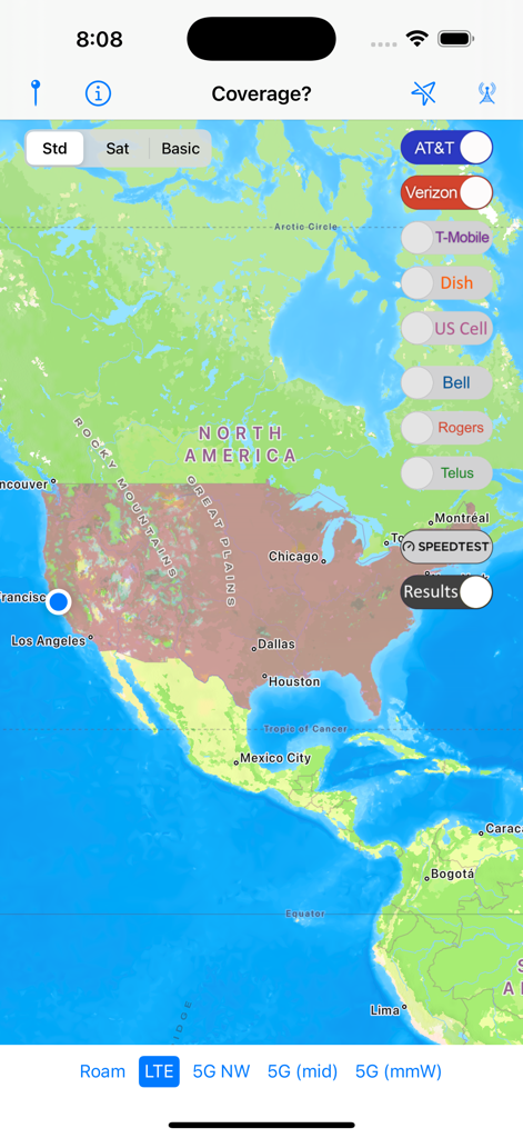
カバレッジアプリのインターフェース。北米全域のセルラー信号マップにキャリアのトグルが表示されている。
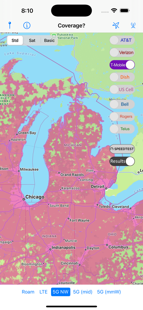
カバレッジアプリのインターフェース。ミシガン州とその周辺地域のT-Mobile 5Gネットワークカバレッジが表示されている。
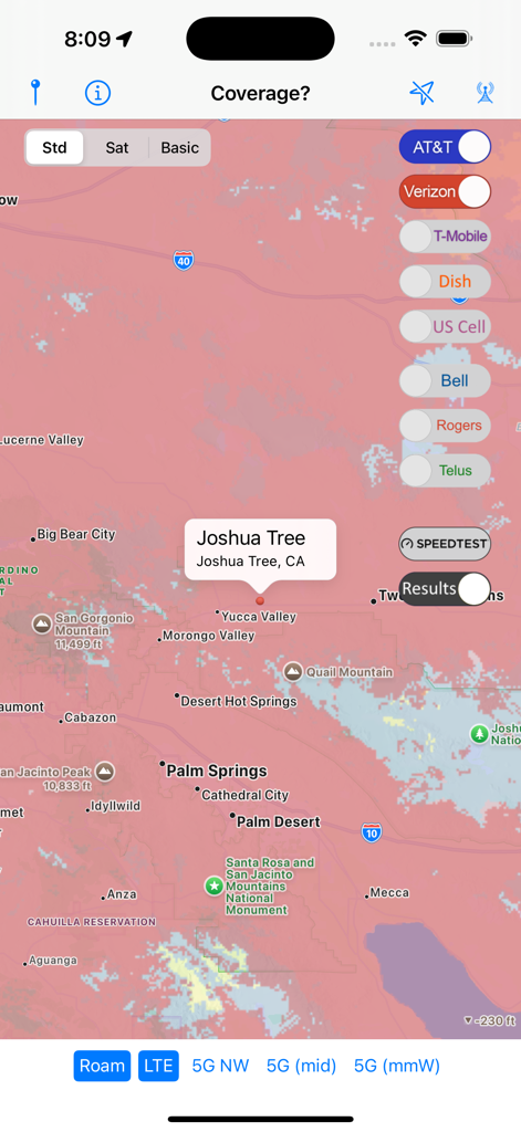
カリフォルニア州ジョシュアツリー地域のセルラー信号比較マップを表示するカバレッジアプリ。
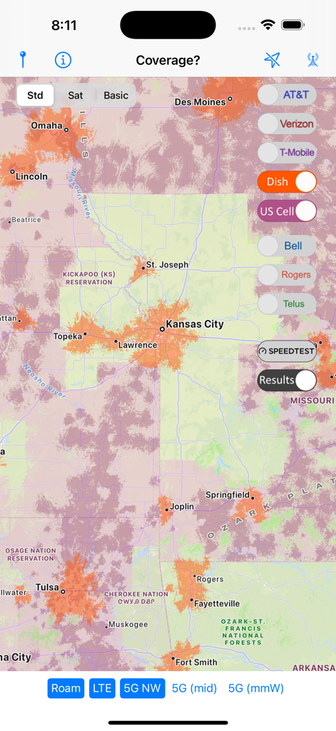
カンザスシティ地域におけるDishネットワークの信号強度を示すセルラーカバレッジマップ。
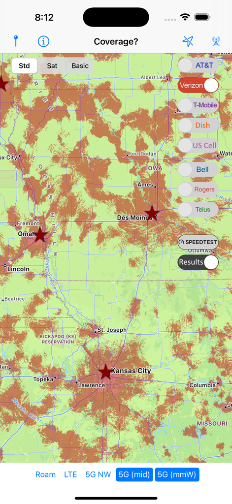
カバレッジアプリのマップビュー。米国中西部におけるVerizon 5Gセルラーカバレッジが表示されている。
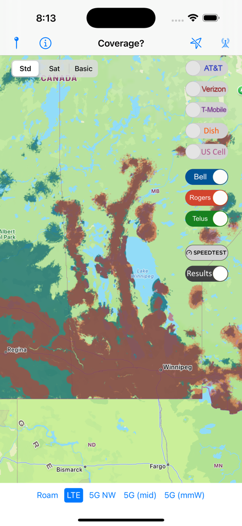
カナダのキャリアBell、Rogers、Telusのセルラーカバレッジマップオーバーレイ。
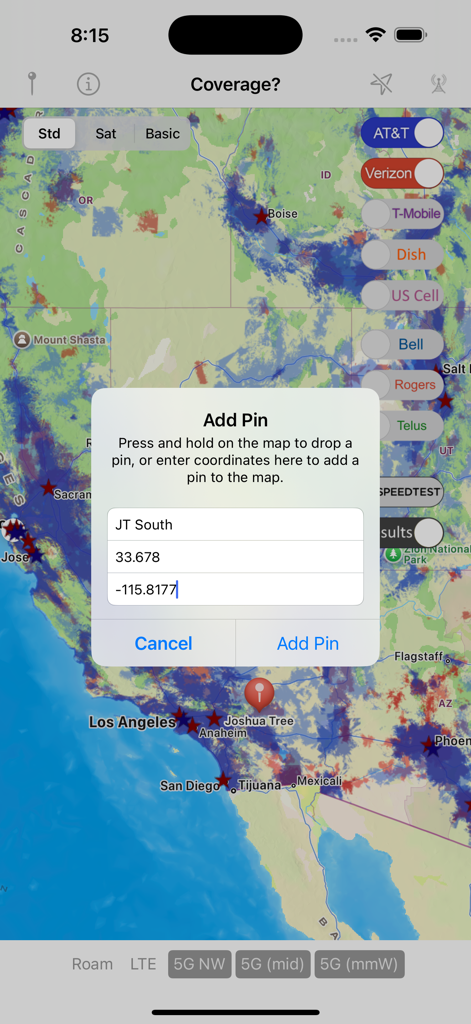
セルラーネットワークマップ上に緯度経度情報を持つピン追加ダイアログを表示するカバレッジアプリのインターフェース。
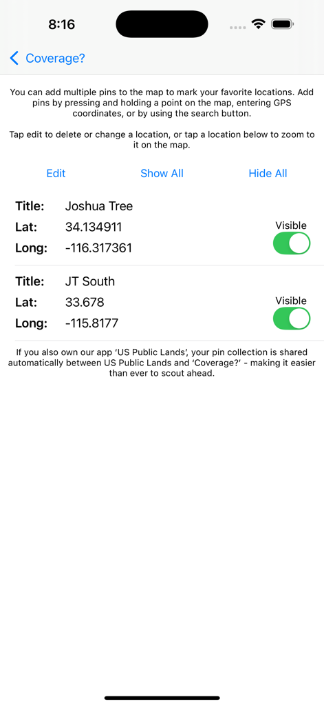
カバレッジアプリで、ジョシュアツリーの緯度経度情報を持つ管理された場所ピンが表示される画面。
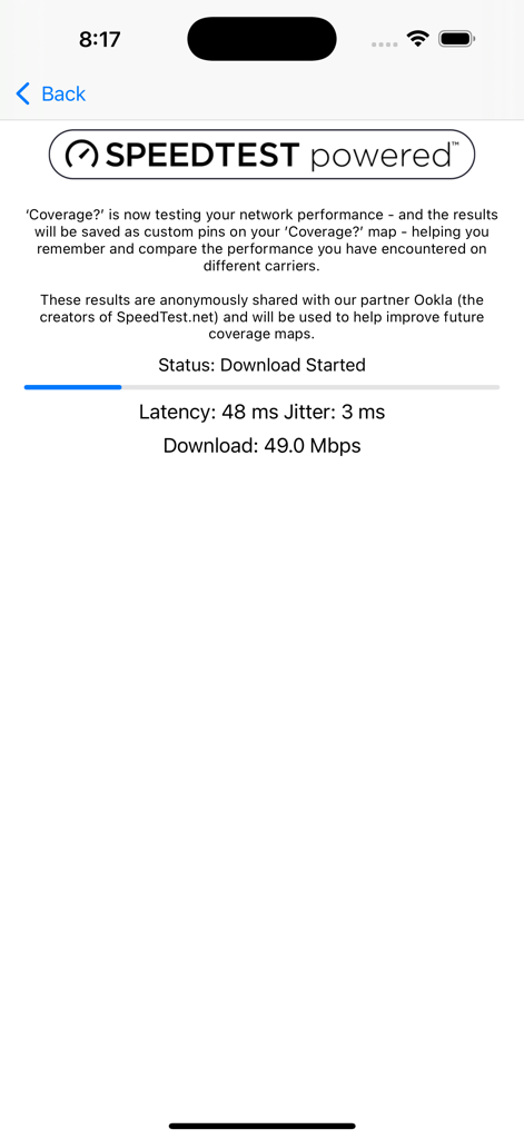
Ooklaによって提供されるダウンロード速度や遅延を含むリアルタイムのネットワークパフォーマンス結果を表示するカバレッジアプリの画面。
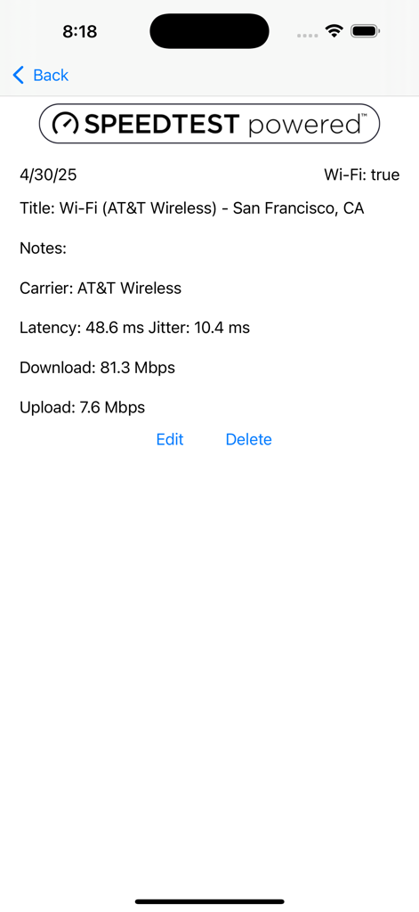
サンフランシスコにおけるAT&T Wirelessのダウンロードおよびアップロード速度を示すネットワーク速度テスト結果画面。
説明
Download
類似アプリ
同じカテゴリのトップランクアプリ

Google Maps
Google LLC

Waze Navigation & Live Traffic
waze

AMap Global
AutoNavi Information Technology Co. Ltd.

百度地图-路线规划,出行必备
Beijing Baidu Netcom Science & Technology Co.,Ltd

Moovit: Bus & Transit Tracker
Moovit App Global LTD

Transit • Subway & Bus Times
9280-0366 Quebec inc.

ParkMobile: Park. Pay. Go.
Parkmobile USA, Inc

腾讯地图-路线规划,导航地铁打车出行
Shenzhen Tencent Computer Systems Company Limited

Île-de-France Mobilités
Ile de France Mobilites
このページはアプリまたはその開発者の公式ページではなく、情報提供および論評を目的として作成された独立した編集出版物です。明示的に別段の記載がない限り、アプリおよびその開発者は、MWM、Apple、Google Play、アプリのパブリッシャー、またはアプリの開発者と提携、承認、後援、認可、またはその他の公式的な関係はなく、このページのいかなる内容も、アプリがMWMのサービスを使用して開発されたことを意味するものではありません。すべての商標、ロゴ、スクリーンショット、その他のコンテンツはそれぞれの所有者の財産です。