このページはアプリまたはその開発者の公式ページではなく、情報提供および論評を目的として作成された独立した編集出版物です。明示的に別段の記載がない限り、アプリおよびその開発者は、MWM、Apple、Google Play、アプリのパブリッシャー、またはアプリの開発者と提携、承認、後援、認可、またはその他の公式的な関係はなく、このページのいかなる内容も、アプリがMWMのサービスを使用して開発されたことを意味するものではありません。すべての商標、ロゴ、スクリーンショット、その他のコンテンツはそれぞれの所有者の財産です。

Drone Assist - Flight Planning
リアルタイムの状況認識、飛行禁止区域のアラート、プロ仕様の飛行報告を提供する業界で最も信頼されるソースを使用している、16万人以上のパイロットに加わりましょう。
ダウンロード
163K+ユーザー評価
評価数
1K+開発元
カテゴリ
Navigation対応言語
4最新バージョン
2.4.182332サイズ
28.7 MBリリース日
2017年7月26日よりスマートに、より安全に、そして完全なコンプライアンスで飛行
リアルタイムの空域状況認識と飛行計画のための最も信頼できるソースを利用している16万人以上のパイロットに加わりましょう。
即時の空域インテリジェンス
飛行禁止区域(NFZ)、NOTAM、地上レベルのリスクにリアルタイムでアクセスし、高額なFAAの罰金や物理的な危険を回避します。
プロフェッショナルなミッション計画
飛行計画を作成、管理、提出して他の空域利用者に警告し、すべての商用またはホビーミッションのプロフェッショナルな記録を構築します。
以下のスクリーンショットと説明は、アプリの公式ストアリスティングから直接取得されたものであり、アプリ開発者の所有物です。
アプリストア
スクリーンショット
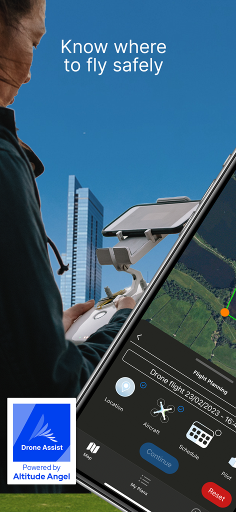
コントローラーに取り付けられたスマートフォンで、Drone Assistアプリを使用して飛行計画と空域安全情報を確認しているドローンパイロット。
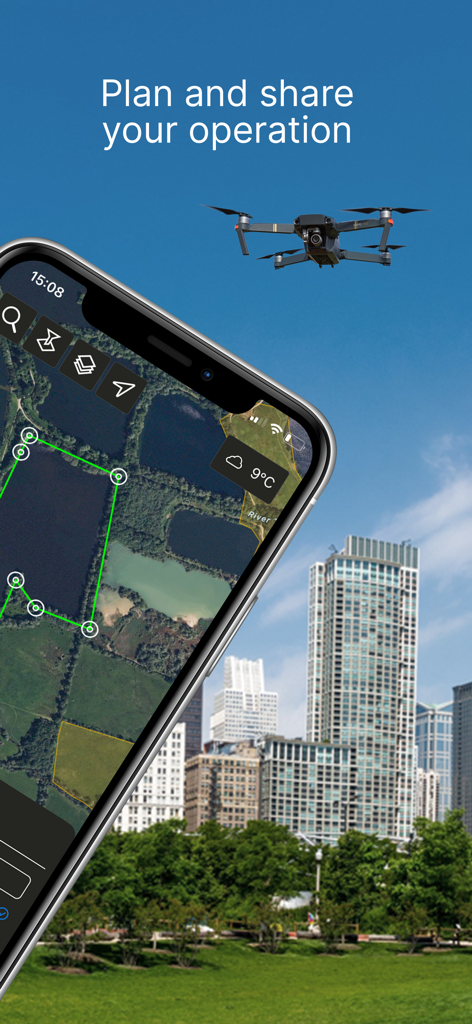
都市部でのドローン飛行計画のための Drone Assist アプリのインターフェースを表示しているスマートフォン。
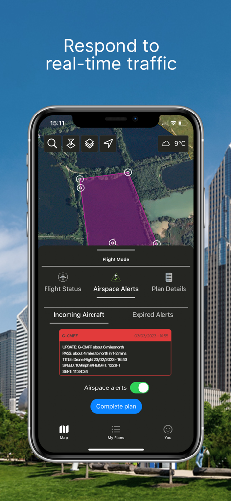
リアルタイムの航空機交通アラートと飛行エリアマップを表示しているDrone Assistアプリのインターフェース。
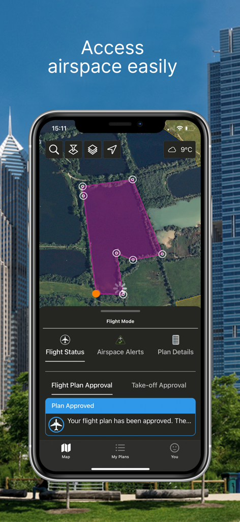
マップ上に紫色の影で示された飛行エリアと、飛行計画が承認されたという通知を表示しているDrone Assistアプリのインターフェースを備えたスマートフォン。
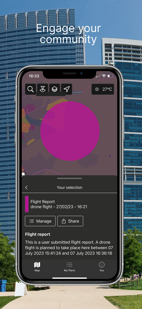
飛行報告とマップ共有機能を表示しているDrone Assistモバイルアプリ。
説明
Download
類似アプリ
同じカテゴリのトップランクアプリ

Google Maps
Google LLC

Waze Navigation & Live Traffic
waze

AMap Global
AutoNavi Information Technology Co. Ltd.

百度地图-路线规划,出行必备
Beijing Baidu Netcom Science & Technology Co.,Ltd

Moovit: Bus & Transit Tracker
Moovit App Global LTD

Transit • Subway & Bus Times
9280-0366 Quebec inc.

ParkMobile: Park. Pay. Go.
Parkmobile USA, Inc

腾讯地图-路线规划,导航地铁打车出行
Shenzhen Tencent Computer Systems Company Limited

Île-de-France Mobilités
Ile de France Mobilites
このページはアプリまたはその開発者の公式ページではなく、情報提供および論評を目的として作成された独立した編集出版物です。明示的に別段の記載がない限り、アプリおよびその開発者は、MWM、Apple、Google Play、アプリのパブリッシャー、またはアプリの開発者と提携、承認、後援、認可、またはその他の公式的な関係はなく、このページのいかなる内容も、アプリがMWMのサービスを使用して開発されたことを意味するものではありません。すべての商標、ロゴ、スクリーンショット、その他のコンテンツはそれぞれの所有者の財産です。