このページはアプリまたはその開発者の公式ページではなく、情報提供および論評を目的として作成された独立した編集出版物です。明示的に別段の記載がない限り、アプリおよびその開発者は、MWM、Apple、Google Play、アプリのパブリッシャー、またはアプリの開発者と提携、承認、後援、認可、またはその他の公式的な関係はなく、このページのいかなる内容も、アプリがMWMのサービスを使用して開発されたことを意味するものではありません。すべての商標、ロゴ、スクリーンショット、その他のコンテンツはそれぞれの所有者の財産です。

Drone Forecast DJI Fly Air Map
飛行の推測作業をやめましょう。高度別風速、リアルタイムの飛行禁止区域、カスタマイズされた安全アラートにアクセスして、UAVを保護し、常に完璧なショットを捉えましょう。
ダウンロード
22K+ユーザー評価
評価数
100開発元
カテゴリ
Weather対応言語
32最新バージョン
1.2.5サイズ
30.6 MBリリース日
2024年12月16日絶対的な自信を持って飛行
プロのUAVパイロットおよびハイエンドドローン愛好家向けにカスタマイズされた包括的な気象インテリジェンスと空域データ。
高度別風速データ
突風を推測しないでください。正確な飛行高度での超ローカル風速を取得して、完全な安定性とハードウェアの安全性を確保します。
統合空域マップ
リアルタイムの飛行禁止区域オーバーレイとFAA準拠の地域飛行制限により、合法的に飛行し、高額な罰金を回避できます。
以下のスクリーンショットと説明は、アプリの公式ストアリスティングから直接取得されたものであり、アプリ開発者の所有物です。
アプリストア
スクリーンショット
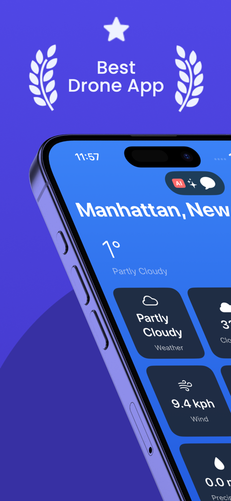
ドローン予報アプリのインターフェースに、安全な飛行計画のための風速と気象が表示されています。
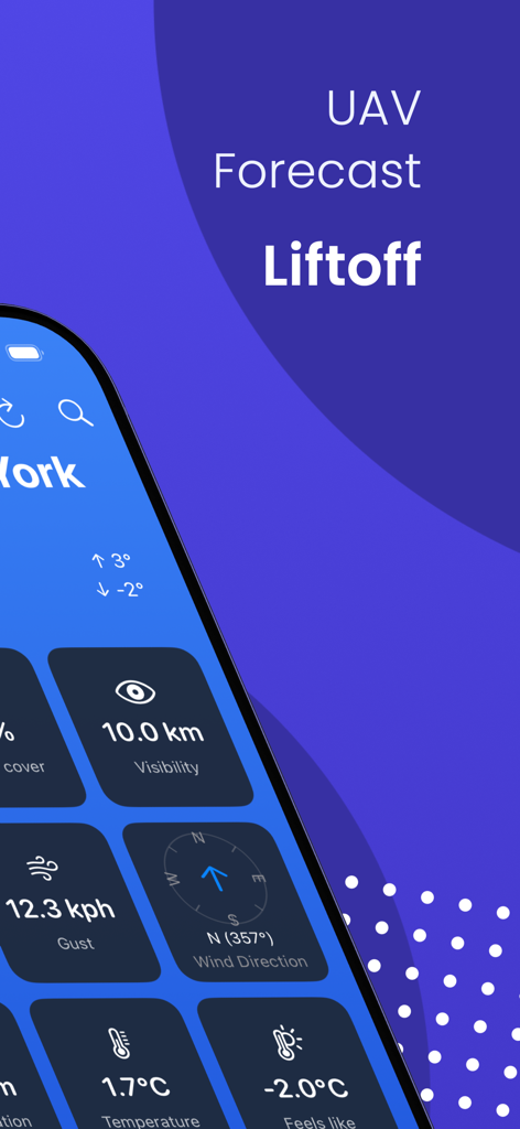
ドローン予報アプリに、UAVパイロット向けのリアルタイムの風速、視界、気温が表示されています
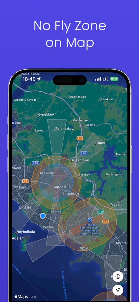
ドローン予報アプリのインターフェースに、パイロット向けの規制空域と飛行禁止区域がインタラクティブマップ上に表示されています。
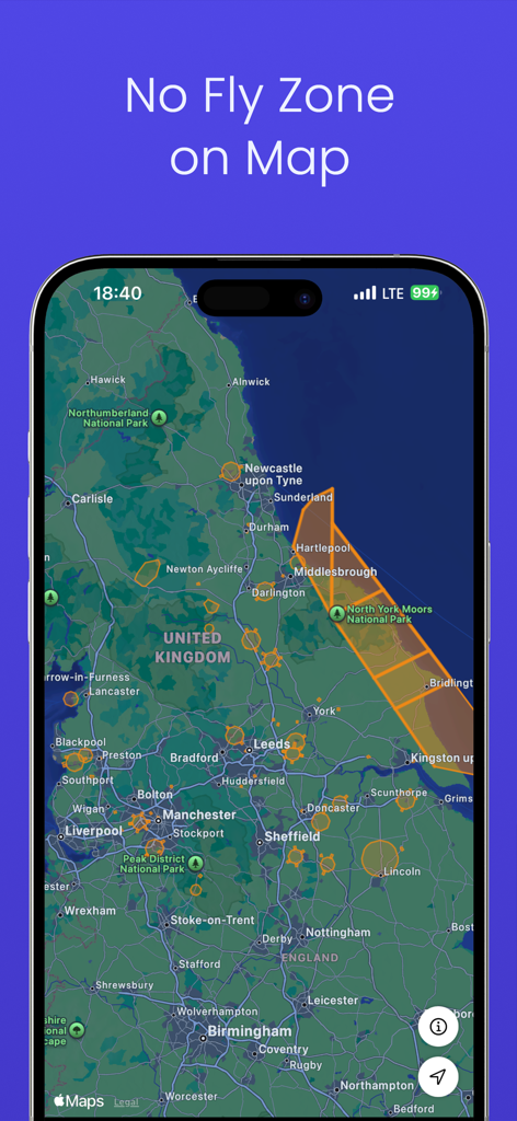
規制されたドローン飛行エリアと飛行禁止区域を示すインタラクティブマップ。
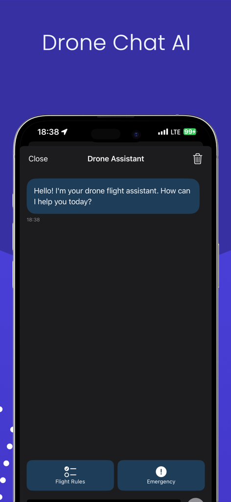
飛行規則や緊急事態へのクイックリンクを備えた、AIドローン飛行アシスタントチャットインターフェース。
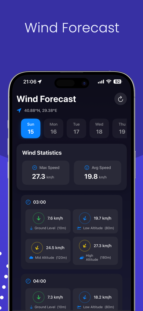
安全なUAV運用のため、さまざまな飛行高度にわたる風速統計を表示するドローン風予報ダッシュボード。
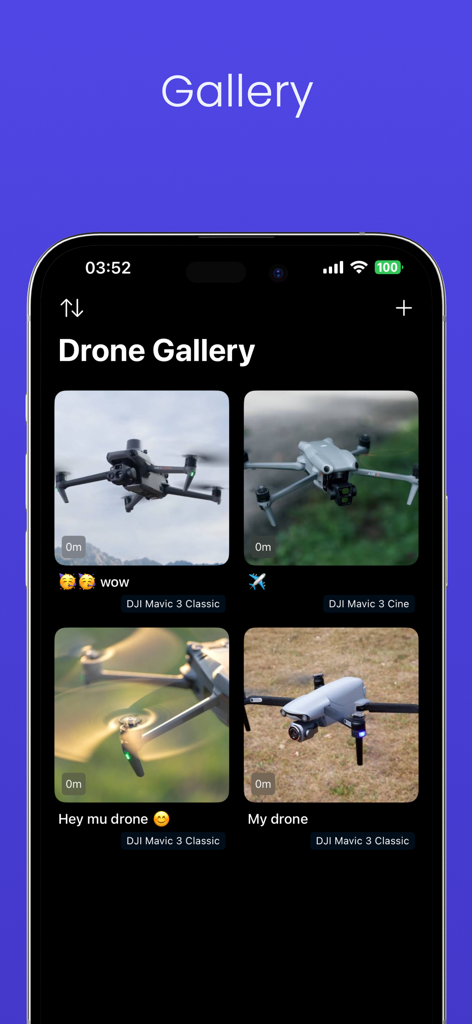
さまざまなDJI Mavicドローン写真が表示されたドローンギャラリー機能のモバイルインターフェース
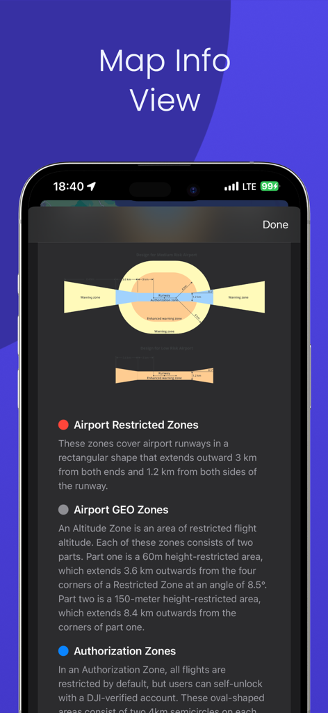
飛行制限区域や空港GEOゾーンの図を示すマップ情報ビュー
説明
Download
類似アプリ
同じカテゴリのトップランクアプリ

墨迹天气-MojiWeather
Beijing MojiFengyun Technology Co.,Ltd.

The Weather Channel - Radar
The Weather Channel

Windy.com
Windyty, SE

天气预报-精准15日天气预报
Chongqing Caochen Technology Co., Ltd.

My Aurora Forecast & Alerts
JRustonApps B.V.

AccuWeather: Weather Forecast
AccuWeather International, Inc.

Weather & Radar - Storm radar
WetterOnline - Meteorologische Dienstleistungen GmbH

天气通
Weibo Internet Technology (China) Co.Ltd.

The Thermometer -Digital-
Vida Apps Incorporated
このページはアプリまたはその開発者の公式ページではなく、情報提供および論評を目的として作成された独立した編集出版物です。明示的に別段の記載がない限り、アプリおよびその開発者は、MWM、Apple、Google Play、アプリのパブリッシャー、またはアプリの開発者と提携、承認、後援、認可、またはその他の公式的な関係はなく、このページのいかなる内容も、アプリがMWMのサービスを使用して開発されたことを意味するものではありません。すべての商標、ロゴ、スクリーンショット、その他のコンテンツはそれぞれの所有者の財産です。