このページはアプリまたはその開発者の公式ページではなく、情報提供および論評を目的として作成された独立した編集出版物です。明示的に別段の記載がない限り、アプリおよびその開発者は、MWM、Apple、Google Play、アプリのパブリッシャー、またはアプリの開発者と提携、承認、後援、認可、またはその他の公式的な関係はなく、このページのいかなる内容も、アプリがMWMのサービスを使用して開発されたことを意味するものではありません。すべての商標、ロゴ、スクリーンショット、その他のコンテンツはそれぞれの所有者の財産です。

ダウンロード
141K+ユーザー評価
評価数
2K+開発元
カテゴリ
Travel対応言語
5最新バージョン
20.0.0サイズ
43.4 MBリリース日
2010年1月19日地元のように街をマスターする
ビジネス旅行者や都市探検家のために設計されたこのアプリは、広州の地下鉄システムへのスムーズで高性能なガイドを提供し、会議やランドマークを見逃すことがないようにします。
100% オフラインでの信頼性
ローミングデータやVPNの心配なしでナビゲート。マップ、検索、ルートプランニングは完全にオフラインで動作し、どの地域でも重要なセーフティネットを提供します。
シームレスなバイリンガルサポート
すべての駅名と案内表示を英語と中国語の両方で表示し、言語の壁をなくします。プラットフォームでのナビゲートや、タクシー運転手に目的地を示すのに最適です。
以下のスクリーンショットと説明は、アプリの公式ストアリスティングから直接取得されたものであり、アプリ開発者の所有物です。
アプリストア
スクリーンショット
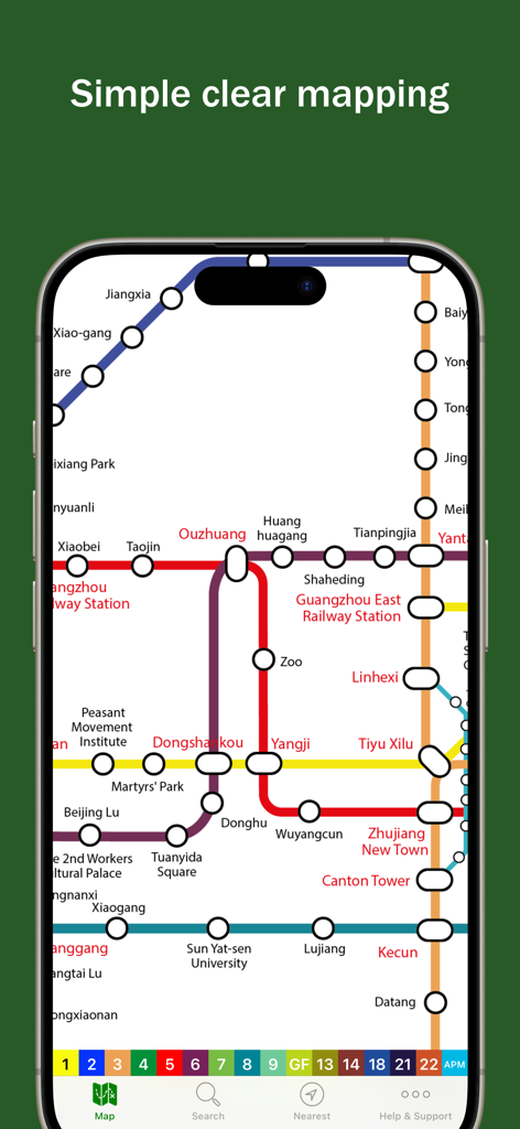
携帯電話の画面に表示された、シンプルで分かりやすいカラーコードの広州地下鉄マップ。
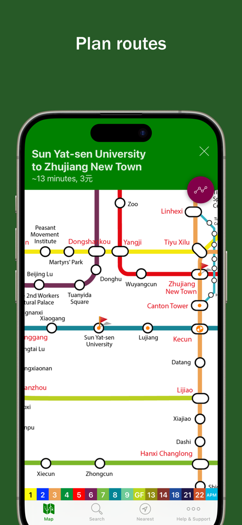
カラフルな地下鉄マップ上に計画された駅間ルートを示すExplore Guangzhouアプリのスクリーンショット
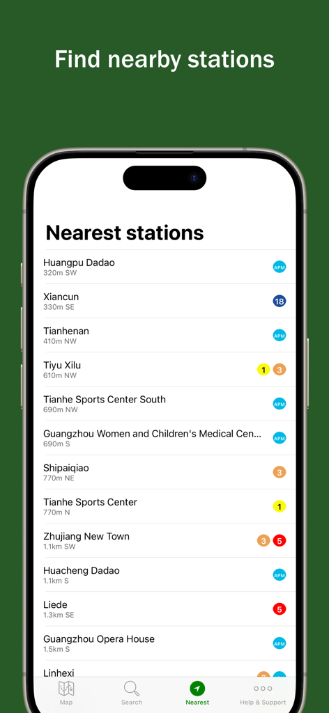
距離と路線アイコンとともに、広州の最寄りの地下鉄駅のリストを表示するスマートフォンの画面。
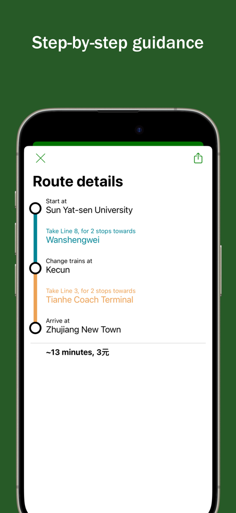
iPhone上で段階的なルート案内と移動時間を示す広州地下鉄アプリ
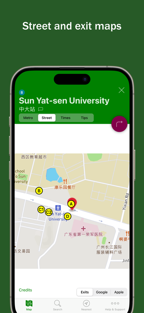
広州の中山大学駅のバイリンガルストリートマップ。複数の出口と周辺の通りを示しています。
説明
Download
類似アプリ
同じカテゴリのトップランクアプリ

Uber - Request a ride
Uber Technologies, Inc.

Airbnb
Airbnb, Inc.

铁路12306
ACADEMY OF RAILWAY SCIENCES CO., ltd.

Booking.com: Hotels & Travel
Booking.com B.V.

Grab: Taxi Ride, Food Delivery
GRABTAXI HOLDINGS PTE. LTD.

Trip.com: Book Flights, Hotels
Trip.com Travel Singapore Pte. Ltd.

DiDi China: Ride Hailing
Didi Chuxing (Beijing) Network Platform Technology Co., Ltd

去哪儿旅行-订酒店机票火车票
Beijing Qunar Information Technology Company Limit

Bolt: Request a Ride
BOLT TECHNOLOGY OU
このページはアプリまたはその開発者の公式ページではなく、情報提供および論評を目的として作成された独立した編集出版物です。明示的に別段の記載がない限り、アプリおよびその開発者は、MWM、Apple、Google Play、アプリのパブリッシャー、またはアプリの開発者と提携、承認、後援、認可、またはその他の公式的な関係はなく、このページのいかなる内容も、アプリがMWMのサービスを使用して開発されたことを意味するものではありません。すべての商標、ロゴ、スクリーンショット、その他のコンテンツはそれぞれの所有者の財産です。