このページはアプリまたはその開発者の公式ページではなく、情報提供および論評を目的として作成された独立した編集出版物です。明示的に別段の記載がない限り、アプリおよびその開発者は、MWM、Apple、Google Play、アプリのパブリッシャー、またはアプリの開発者と提携、承認、後援、認可、またはその他の公式的な関係はなく、このページのいかなる内容も、アプリがMWMのサービスを使用して開発されたことを意味するものではありません。すべての商標、ロゴ、スクリーンショット、その他のコンテンツはそれぞれの所有者の財産です。

Fires: Wildfire News and Atlas
数百万人に信頼されているプロ仕様のツールで、家と家族を守りましょう。ライブ3D航空機追跡、公式避難警報、高解像度オフラインマップで、発生中の火災を監視します。
ダウンロード
349K+ユーザー評価
評価数
100開発元
カテゴリ
News対応言語
1最新バージョン
4.7.0サイズ
54.6 MBリリース日
2016年9月8日安全のためのプロフェッショナル級インテリジェンス
世界で最も信頼されている山火事トラッカーを使用して、緊急隊員と同じリアルタイムデータにアクセスし、家や家族、アウトドアでの冒険を守りましょう。
ライブ3D航空機追跡
消防用タンカーやヘリコプターを3D飛行経路でリアルタイムに監視し、消火活動がどこに集中しているかを正確に把握できます。
プロフェッショナル・オフライン地図
電波の届かない場所でも、80以上の高解像度な国立森林公園やBLM(土地管理局)の地図にアクセスして安全にナビゲートできます。
以下のスクリーンショットと説明は、アプリの公式ストアリスティングから直接取得されたものであり、アプリ開発者の所有物です。
アプリストア
スクリーンショット
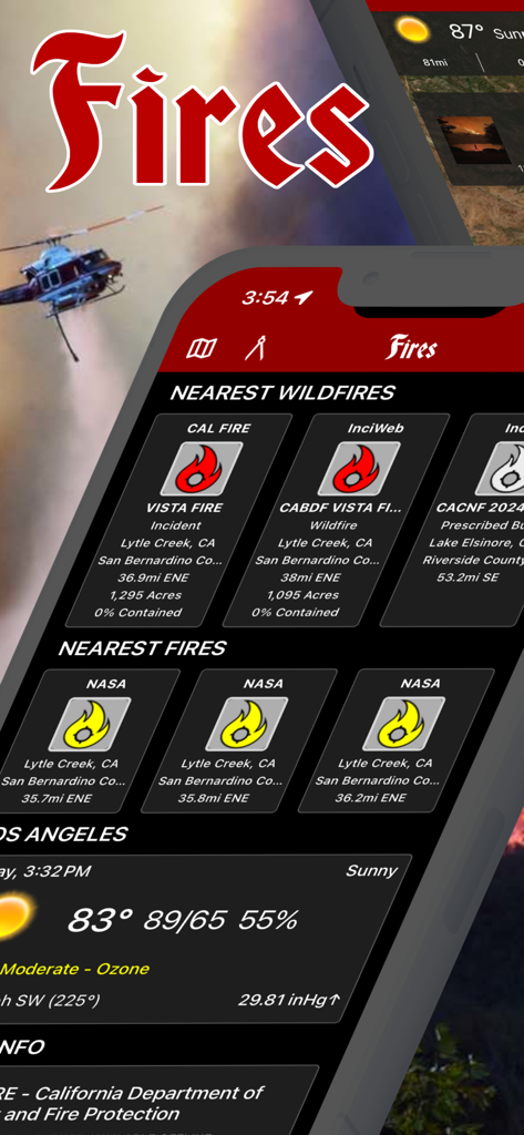
リアルタイムの山火事追跡と地域の気象データを表示するFiresアプリのインターフェース
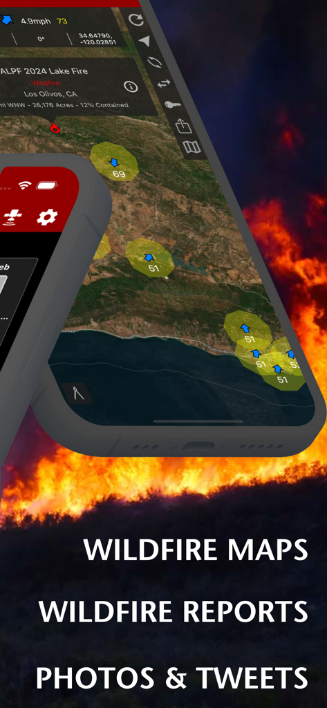
炎の背景に山火事マップとインシデントレポートを表示するFiresアプリのインターフェース
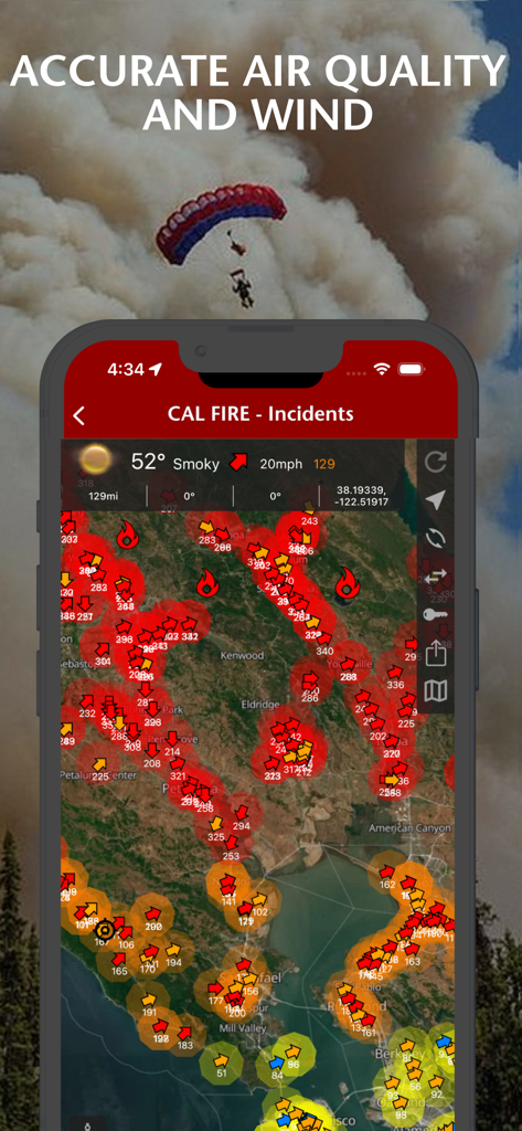
インタラクティブなインシデントマップ上に空気質と風の状態を表示する山火事ニュースアプリ
スマートフォンの画面にFiresアプリのマップを表示し、山火事の延焼範囲と気象状況を確認している様子

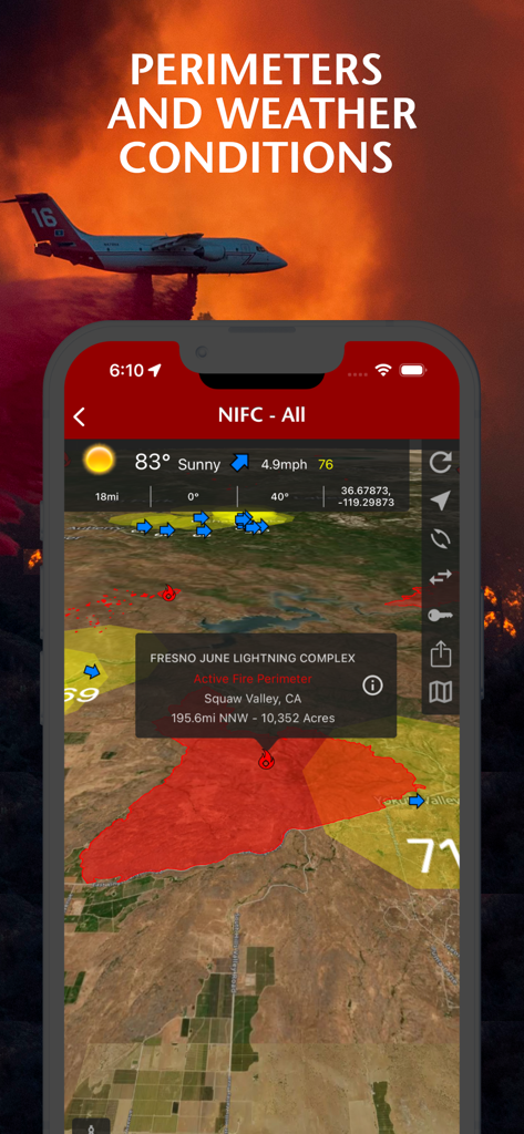
マップの延焼範囲や2024年レイク火災の写真など、山火事の詳細情報を表示するモバイルアプリのインターフェース
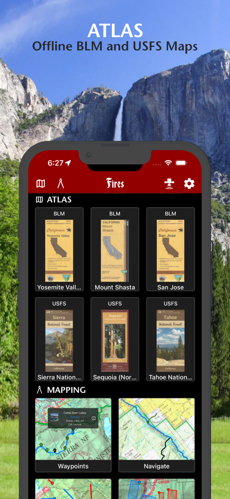
国立森林公園や公園向けのオフラインBLMおよびUSFS(森林局)マップを表示するFiresアプリのインターフェース
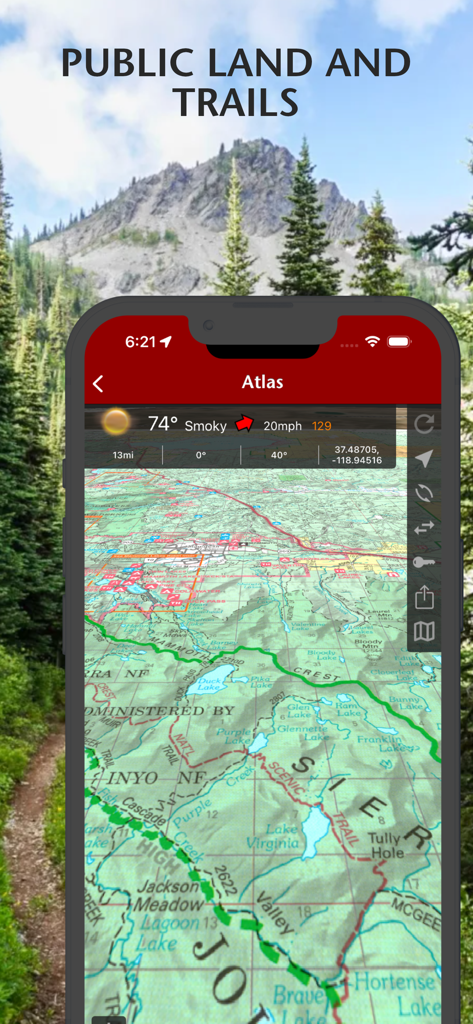
Firesアプリで公有地やハイキングコース、気象データを表示する地形図ビュー
説明
Download
類似アプリ
同じカテゴリのトップランクアプリ

X
X Corp.

REDDIT, INC.

Substack
Substack Inc.

NYTimes: US and Global News
The New York Times Company

Nextdoor: Neighborhood Network
Nextdoor.com, Inc.

CrimeRadar Dispatch Audio
Scoopz Inc.

NewsBreak: Local News & Alerts
Particle Media Inc.

Ground News
Snapwise Inc.

Google News
Google LLC
このページはアプリまたはその開発者の公式ページではなく、情報提供および論評を目的として作成された独立した編集出版物です。明示的に別段の記載がない限り、アプリおよびその開発者は、MWM、Apple、Google Play、アプリのパブリッシャー、またはアプリの開発者と提携、承認、後援、認可、またはその他の公式的な関係はなく、このページのいかなる内容も、アプリがMWMのサービスを使用して開発されたことを意味するものではありません。すべての商標、ロゴ、スクリーンショット、その他のコンテンツはそれぞれの所有者の財産です。