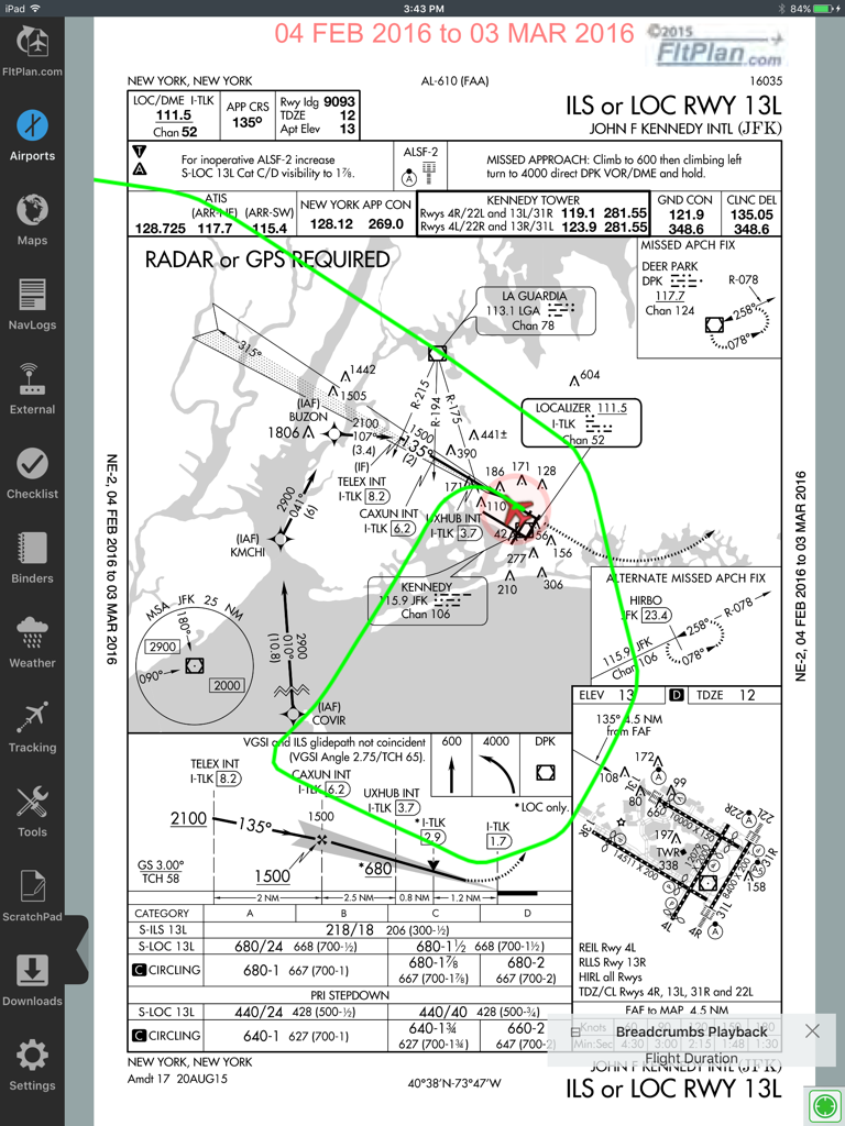
FltPlan Go iPadアプリ。JFK空港のILSアプローチプレートに、緑色のパンくずリスト状のフライトパスオーバーレイが表示されています。
Aviation moving map in FltPlan Go with weather radar and approach plate overlay
説明
FltPlan Go is the essential companion to FltPlan.com. Because FltPlan Go is integrated with FltPlan.com, flight plans and NavLogs are automatically synced to your device along with Weight & Balance profiles, eLogbook profiles, and Checklists for offline and in-flight use.
• Create and file your flight plan on FltPlan.com, and it will sync to FltPlan Go to allow you to responsively edit the flight plan on the map
• NavLogs are automatically synced and downloaded for offline use
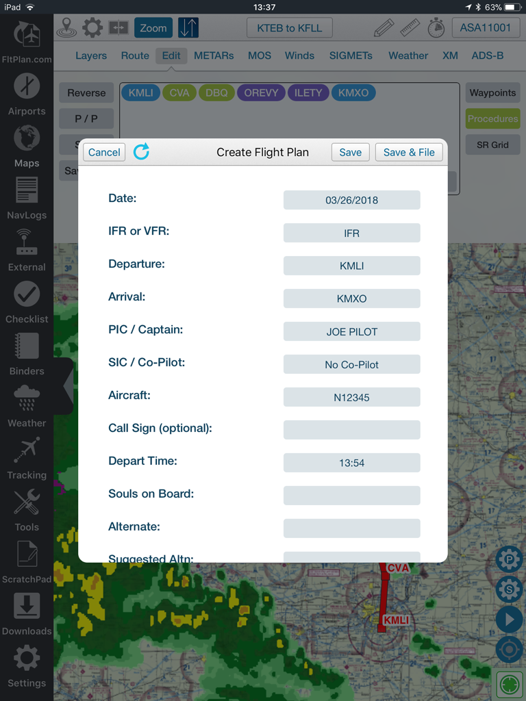
• Create and file your flight plan on FltPlan Go to sync to FltPlan.com
FltPlan Go delivers powerful routing, weather, mapping features, and comprehensive aviation information including:
AIRPORTS:
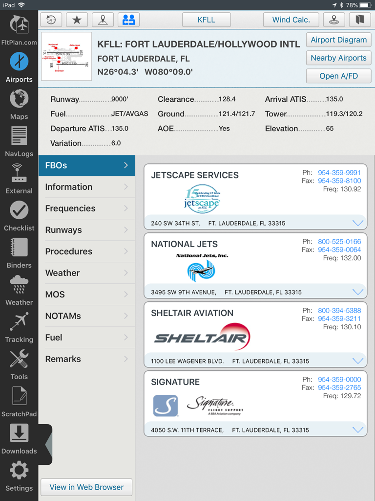
• Airport & FBO Information including current fuel prices
• Geo-Referenced approach plates & airport diagrams (U.S & Canada)
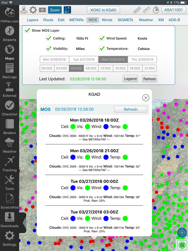
• Weather, including METARs, TAFs, PIREPs, & MOS
• NOTAMs & Remarks
MAPS:
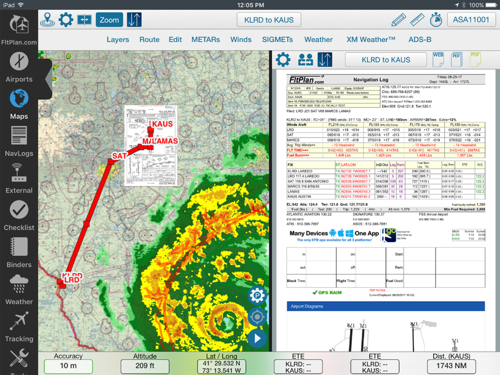
• Sync FltPlan.com flight plans and interactively edit on the map
• File a flight plan from within FltPlan Go
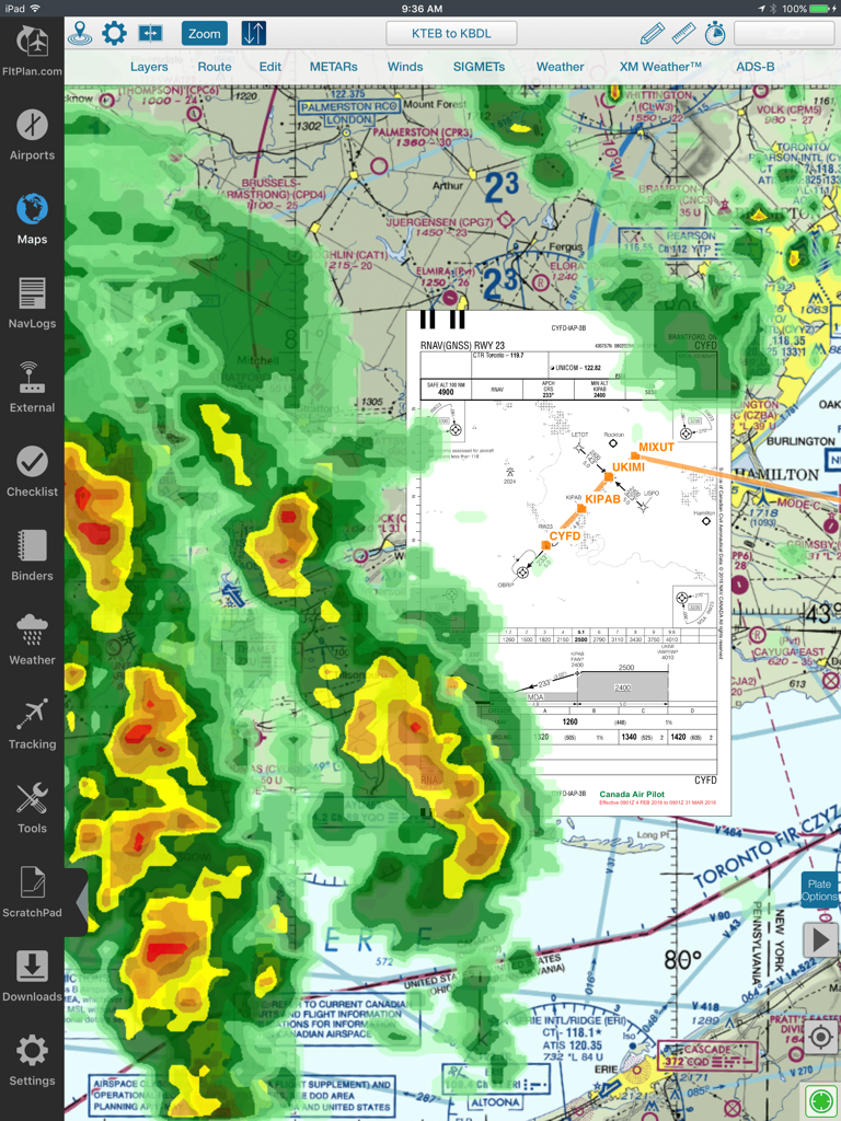
• Moving maps with sectionals, enroute charts, & more
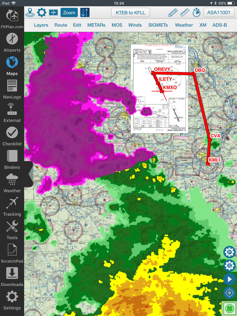
• Overlay approach plates & procedures on the map
• Layers including SUAs, TFRs, State Outline, Airports, Fuel Prices, CAP Grid, Stadiums, and Customs
• Display METARs, Winds, SIGMETs, and animated Weather on the map
• Display MOS weather forecasts (up to 4 days out) on the map
• Breadcrumbs with enhanced playback & option to open in Google Earth
• Split Screen to view information simultaneously, including airports, Flight Instruments (AHRS),
procedures, NavLogs, Howgozit, Checklists, & More
• Display Search & Rescue patterns
• Course Deviation Indicator (CDI)
• View Howgozit to track real time progress of your flight
• Create or import Custom Waypoints in KML or CSV format
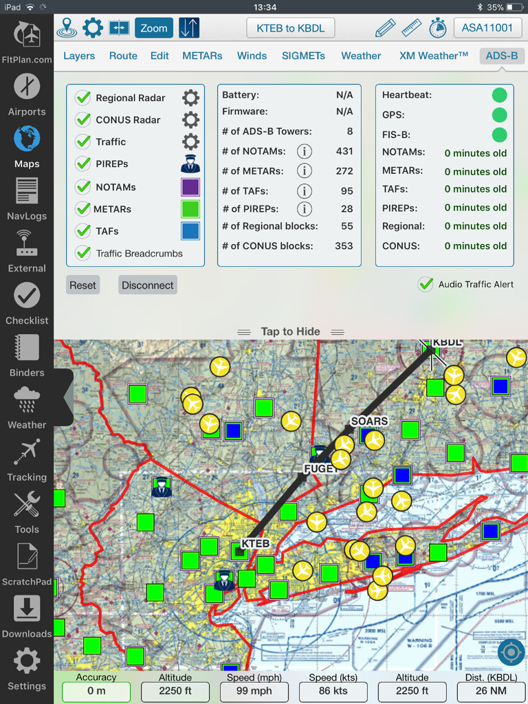
• Overlay in-flight ADS-B traffic & weather or XM Weather*
NAVLOGS:
• NavLogs automatically sync and download for offline use
• Email or print NavLogs from within FltPlan Go
ADDITIONAL FEATURES:
• Weight & Balance - create computations with the option to email
• eLogbook - create logbook entries to sync to our eLogbook program
• Checklists - synced from FltPlan.com for your specific aircraft
• Binders - create flight specific binders with documents or procedures, airports, NavLogs, weather briefs, & more
• Weather - search airport or route weather
• Tracking - view live tracking
• PDCs
• Cloud Tops
• Aviation Calculators
• Access to FltPlan.com
EXTERNAL:
AVIONICS
• Garmin
• Dynon SkyView
• Advanced Flight Systems
• Avidyne IFD Series
• DAC International GDC64
ADS-B
• Garmin
• Stratus 3
• Dual XGPS 170/190
• Dynon D2
• FreeFlight
• Pathfinder
• iLevil SW
• L-3 Lynx
• SkyGuard
• Stratux
• FlightBox
• pingBuddy
• Clarity
• Custom Unit
GPS
• Garmin GDL 51 & GLO
• Dual XGPS 150
• Bad Elf
APP-TO-APP
• Garmin Pilot
• Satcom Direct
• Jeppesen Mobile FD 2.7
SIMULATORS
• X-Plane Simulator
• FSX & Prepar3D
*Subscription/Unit Required
*Continued use of GPS running in the background can dramatically decrease battery life.
FltPlan has grown into the largest flight planning company in North America. FltPlan covers the U.S., Canada, Mexico, Central America, the Caribbean, Panama, and parts of Venezuela and Columbia. FltPlan’s 165,000-plus active, registered users file more than 55% of all N#-registered flight plans. FltPlan Go is a part of FltPlan's comprehensive system that includes free, web-based flight planning and filing and a full range of premium services. FltPlan has more than 18 years of general aviation experience, giving pilots access to the best support team in the business.
24/7 FltPlan Go support is available at Tech@FltPlan.com