このページはアプリまたはその開発者の公式ページではなく、情報提供および論評を目的として作成された独立した編集出版物です。明示的に別段の記載がない限り、アプリおよびその開発者は、MWM、Apple、Google Play、アプリのパブリッシャー、またはアプリの開発者と提携、承認、後援、認可、またはその他の公式的な関係はなく、このページのいかなる内容も、アプリがMWMのサービスを使用して開発されたことを意味するものではありません。すべての商標、ロゴ、スクリーンショット、その他のコンテンツはそれぞれの所有者の財産です。

ダウンロード
220K+ユーザー評価
評価数
200開発元
カテゴリ
Navigation対応言語
1最新バージョン
2025.31サイズ
23.7 MBリリース日
2010年6月21日フライトのあらゆる段階に対応するプロフェッショナルの精度
ベテランの航空会社パイロットが開発したFlyBy E6Bは、70以上の専門的な航空ツールを提供し、フライトスクールの試験から複雑な商用運航まで、手計算を排除し、認知負荷を軽減するように設計されています。
高度な航法・VNAV
クリティカルポイント、リターン不能点、正確な垂直航法(VNAV)降下プロファイルのためのプロフェッショナルグレードのツールで、基本的な計算を超えましょう。
リアルタイムの風・対気速度
対地速度、真対気速度、向かい風/横風成分の即時計算により、航空機の状況を常に把握できます。
以下のスクリーンショットと説明は、アプリの公式ストアリスティングから直接取得されたものであり、アプリ開発者の所有物です。
アプリストア
スクリーンショット
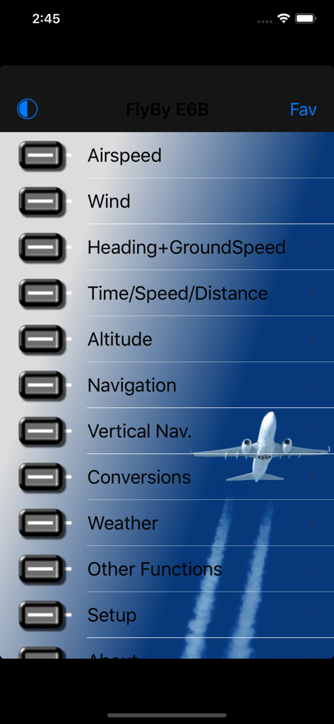
FlyBy E6Bのメインメニューインターフェース。航空計算オプションが表示されています。
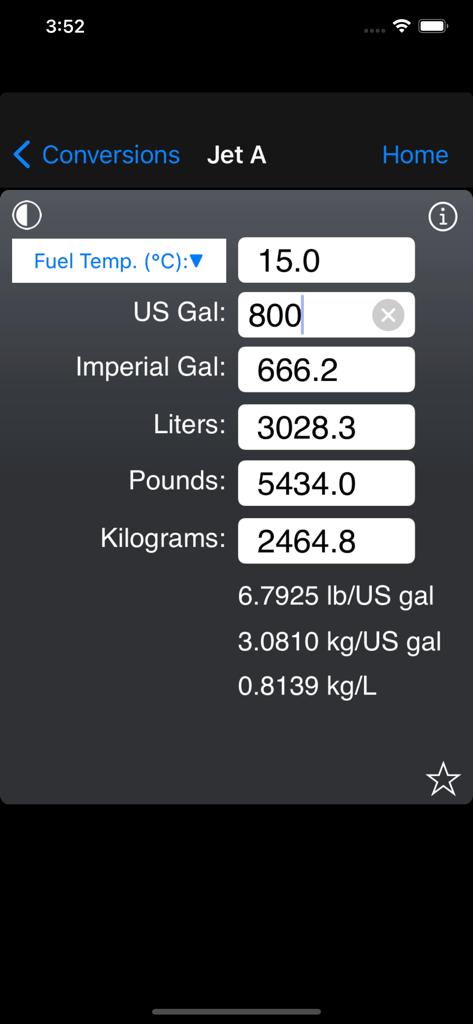
FlyBy E6Bアプリのインターフェース。ジェットA燃料の体積と重量の換算画面が表示されています。

FlyBy E6Bアプリでのフライトプランニングのための航空乗客重量計算画面。
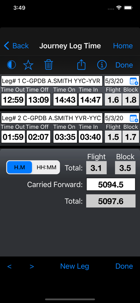
FlyBy E6Bアプリのジャーニーログ時間機能。複数区間の飛行時間とブロック時間の計算が表示されています。
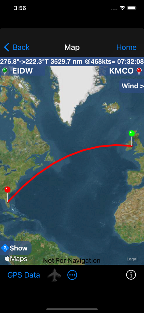
FlyBy E6Bアプリの地図インターフェース。ダブリンからオーランドまでの飛行ルートと、距離および時間の詳細が表示されています。
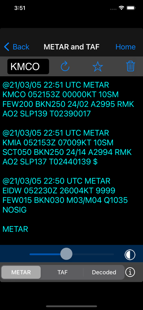
FlyBy E6BアプリでMETARとTAFデータを示す航空気象レポート画面。
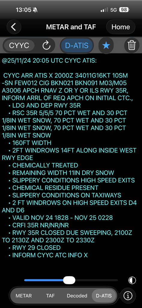
FlyBy E6Bアプリに詳細なD-ATIS気象レポートと滑走路状況が表示されています。
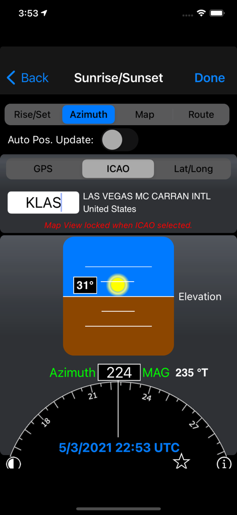
FlyBy E6Bアプリのラスベガス空港における日の出と日の入りの方位角計算。
説明
Download
類似アプリ
似た機能とユーザー体験を持つアプリ

BA Financial Calculator
Angel Montana

Astrology Master
ibrahim veli

Sporty's E6B Flight Computer
Sporty's Pilot Shop

BA Financial Calculator (PRO)
Angel Montana

Construction Master Pro Calc
Calculated Industries, Inc.

Construction Master 5 Calc
Calculated Industries, Inc.

Pipe Trades Pro Calc
Calculated Industries, Inc.

Qualifier Plus IIIx/fx
Calculated Industries, Inc.

Resolutioner
Sun Apps, LLC
このページはアプリまたはその開発者の公式ページではなく、情報提供および論評を目的として作成された独立した編集出版物です。明示的に別段の記載がない限り、アプリおよびその開発者は、MWM、Apple、Google Play、アプリのパブリッシャー、またはアプリの開発者と提携、承認、後援、認可、またはその他の公式的な関係はなく、このページのいかなる内容も、アプリがMWMのサービスを使用して開発されたことを意味するものではありません。すべての商標、ロゴ、スクリーンショット、その他のコンテンツはそれぞれの所有者の財産です。