このページはアプリまたはその開発者の公式ページではなく、情報提供および論評を目的として作成された独立した編集出版物です。明示的に別段の記載がない限り、アプリおよびその開発者は、MWM、Apple、Google Play、アプリのパブリッシャー、またはアプリの開発者と提携、承認、後援、認可、またはその他の公式的な関係はなく、このページのいかなる内容も、アプリがMWMのサービスを使用して開発されたことを意味するものではありません。すべての商標、ロゴ、スクリーンショット、その他のコンテンツはそれぞれの所有者の財産です。

Forest Watcher
自然保護の専門家が、携帯電話サービスがない場所でも、森林破壊アラートへのナビゲート、現場証拠の文書化、土地保護活動の管理を行うための不可欠なオフライン優先ツール。
ダウンロード
31K+ユーザー評価
評価数
0開発元
カテゴリ
Navigation対応言語
5最新バージョン
3.3.1サイズ
56.7 MBリリース日
2017年9月18日リアルタイムデータで現場での保全活動を強化
Forest Watcherは、衛星監視と現地調査の間のギャップを埋めます。インターネット接続がない場所でも、アラートへナビゲートし、変化を記録し、保護区を管理できます。
動的な変化アラート
ほぼリアルタイムの森林破壊と火災データにアクセスし、パトロールを優先し、発生している環境脅威に対応します。
信頼性の高いオフラインナビゲーション
監視地域を事前に読み込み、携帯電話サービスが利用できない遠隔地の「圏外」で正確なGPS座標へナビゲートできます。
以下のスクリーンショットと説明は、アプリの公式ストアリスティングから直接取得されたものであり、アプリ開発者の所有物です。
アプリストア
スクリーンショット
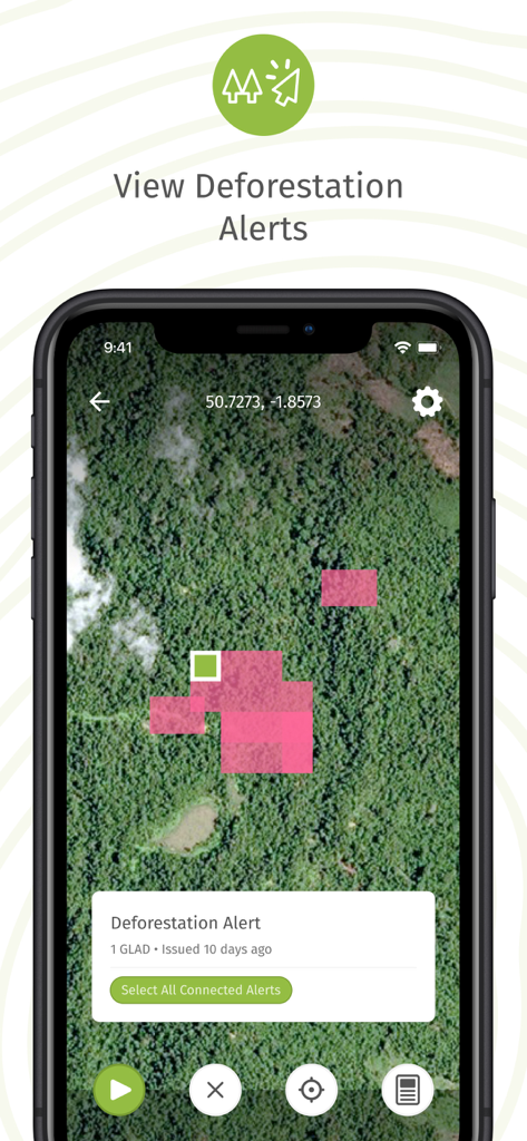
森林破壊アラートを示すピンク色の領域が衛星地図に表示されたForest Watcherアプリの画面

アクティブな保全チームのリストが表示された、オフラインモードでのチーム管理インターフェースを示すForest Watcherアプリのスマートフォンスクリーン。
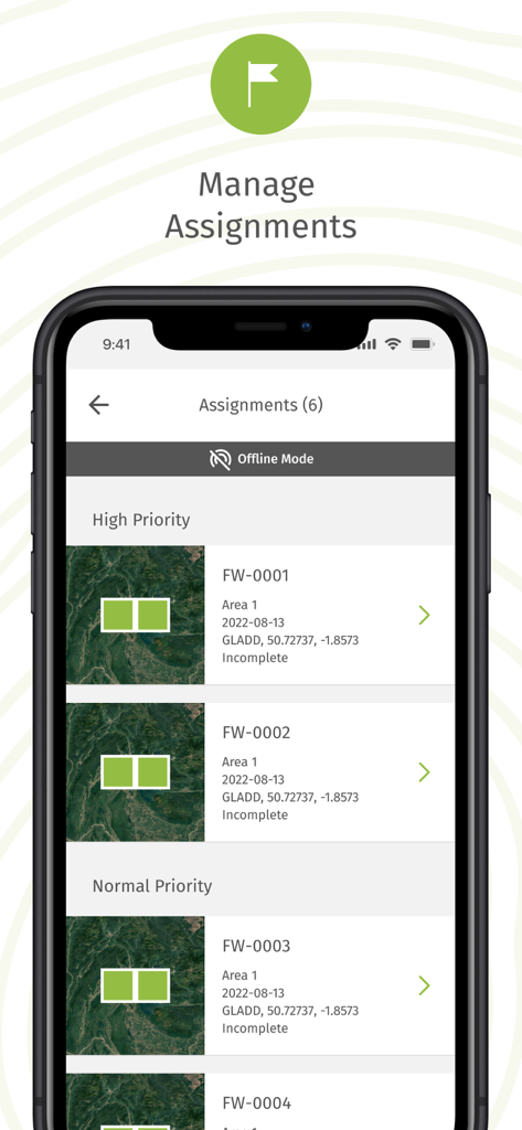
オフラインモードで優先順位付けされた森林監視タスクのリストが表示されたForest Watcherアプリのモバイル画面
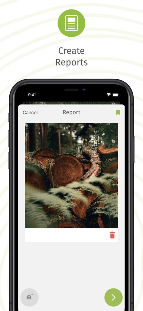
伐採された木の丸太の写真を含む現場レポート作成用のForest Watcherアプリインターフェースを示すスマートフォンスクリーン
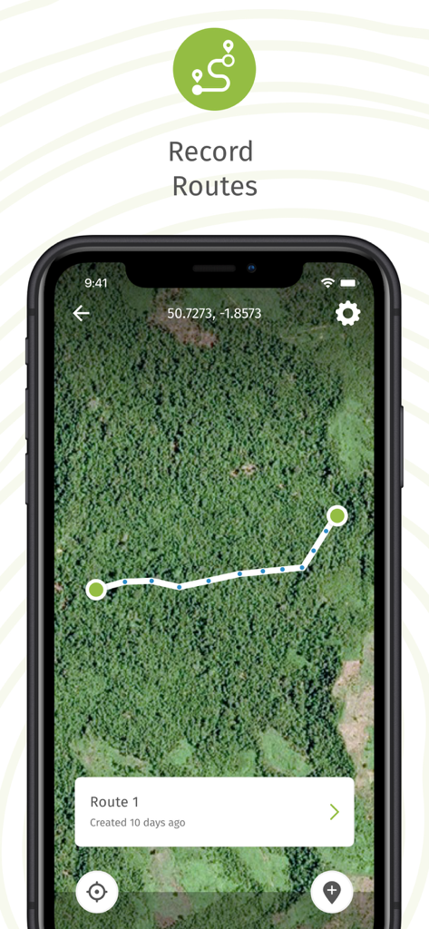
衛星地図に記録されたフィールドルートが表示されたForest Watcherモバイルアプリのインターフェース
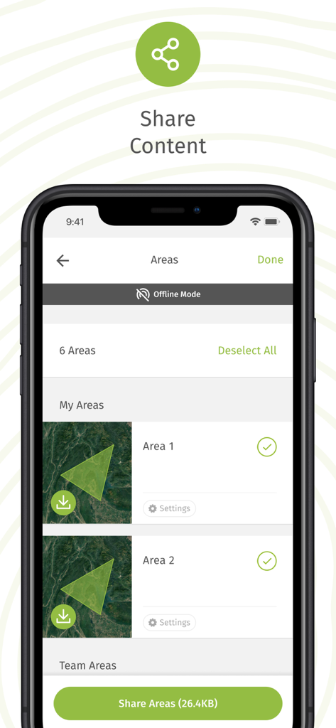
オフラインモードで選択した森林地域を共有するためのForest Watcherアプリのインターフェース
説明
Download
類似アプリ
同じカテゴリのトップランクアプリ

Google Maps
Google LLC

Waze Navigation & Live Traffic
waze

AMap Global
AutoNavi Information Technology Co. Ltd.

百度地图-路线规划,出行必备
Beijing Baidu Netcom Science & Technology Co.,Ltd

Moovit: Bus & Transit Tracker
Moovit App Global LTD

Transit • Subway & Bus Times
9280-0366 Quebec inc.

ParkMobile: Park. Pay. Go.
Parkmobile USA, Inc

腾讯地图-路线规划,导航地铁打车出行
Shenzhen Tencent Computer Systems Company Limited

Île-de-France Mobilités
Ile de France Mobilites
このページはアプリまたはその開発者の公式ページではなく、情報提供および論評を目的として作成された独立した編集出版物です。明示的に別段の記載がない限り、アプリおよびその開発者は、MWM、Apple、Google Play、アプリのパブリッシャー、またはアプリの開発者と提携、承認、後援、認可、またはその他の公式的な関係はなく、このページのいかなる内容も、アプリがMWMのサービスを使用して開発されたことを意味するものではありません。すべての商標、ロゴ、スクリーンショット、その他のコンテンツはそれぞれの所有者の財産です。