このページはアプリまたはその開発者の公式ページではなく、情報提供および論評を目的として作成された独立した編集出版物です。明示的に別段の記載がない限り、アプリおよびその開発者は、MWM、Apple、Google Play、アプリのパブリッシャー、またはアプリの開発者と提携、承認、後援、認可、またはその他の公式的な関係はなく、このページのいかなる内容も、アプリがMWMのサービスを使用して開発されたことを意味するものではありません。すべての商標、ロゴ、スクリーンショット、その他のコンテンツはそれぞれの所有者の財産です。

GPS Altitude&Height tracker
ハイカーや登山家向けのオフライン必須ツールキット。どこにいても高度、気圧、正確な位置を追跡し、スタンプ付きカメラで頂上での栄光を共有できます。
ダウンロード
80K+ユーザー評価
評価数
1K+開発元
カテゴリ
Travel対応言語
2最新バージョン
2.0.1サイズ
16.8 MBリリース日
2024年12月10日全ての山を制覇する
ハイカーや探検家が高度を追跡し、安全を確保し、頂上での成果を共有するための必須精密ツール。
オフライン高度追跡
携帯サービスがない遠隔地でも、どこでもリアルタイムの標高とGPSデータを取得できます。
頂上透かしカメラ
自動的な高度と位置スタンプで頂上での瞬間を撮影し、即座にソーシャルプルーフに。
以下のスクリーンショットと説明は、アプリの公式ストアリスティングから直接取得されたものであり、アプリ開発者の所有物です。
アプリストア
スクリーンショット
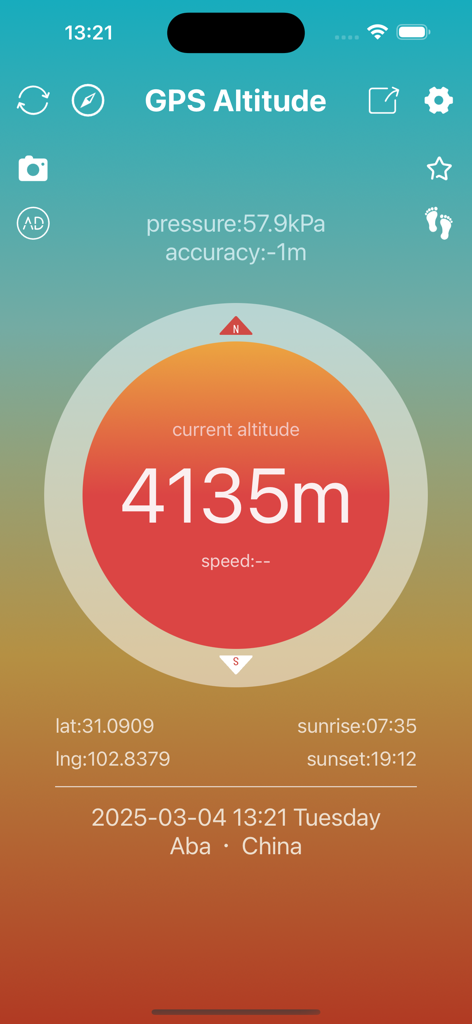
GPS高度トラッカーアプリのインターフェース。高度4135メートル、気圧、位置データが表示されています。
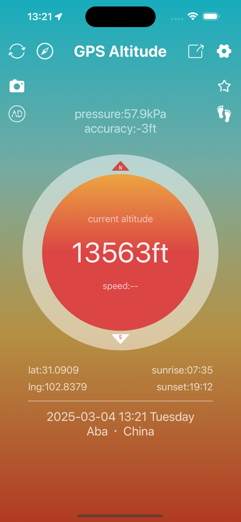
GPS高度アプリのインターフェース。標高13563フィート、気圧、座標が表示されています。

GPS高度トラッカーアプリのモバイルインターフェース。標高4135メートル、地図上の位置が表示されています。
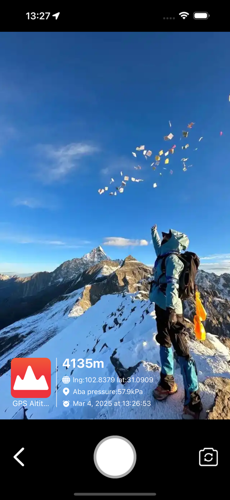
雪山の頂上にいるハイカー。高度4135メートルと座標を示すGPS透かしが表示されています。
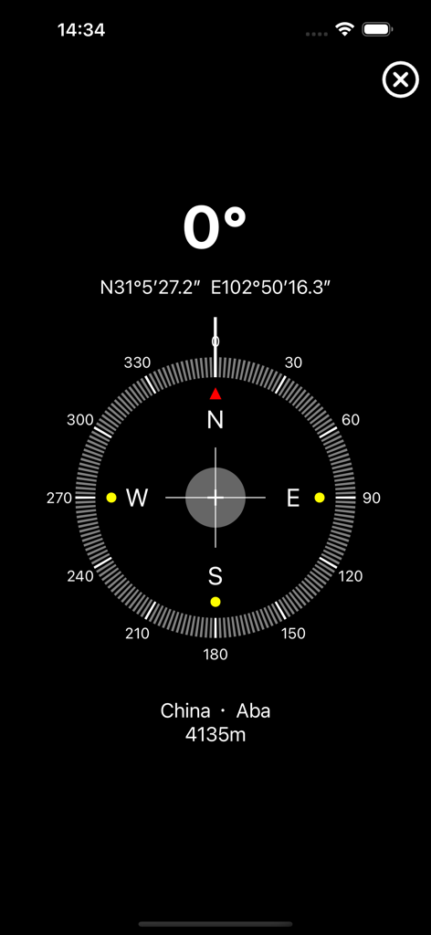
デジタルコンパスインターフェース。北を0度とし、GPS座標と高度4135メートルが表示されています。
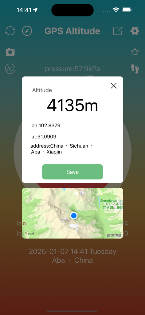
GPS高度アプリのインターフェース。高度4135メートル、緯度経度座標、地図上の位置が表示されています。
説明
Download
類似アプリ
同じカテゴリのトップランクアプリ

Uber - Request a ride
Uber Technologies, Inc.

Airbnb
Airbnb, Inc.

铁路12306
ACADEMY OF RAILWAY SCIENCES CO., ltd.

Booking.com: Hotels & Travel
Booking.com B.V.

Grab: Taxi Ride, Food Delivery
GRABTAXI HOLDINGS PTE. LTD.

Trip.com: Book Flights, Hotels
Trip.com Travel Singapore Pte. Ltd.

DiDi China: Ride Hailing
Didi Chuxing (Beijing) Network Platform Technology Co., Ltd

去哪儿旅行-订酒店机票火车票
Beijing Qunar Information Technology Company Limit

Bolt: Request a Ride
BOLT TECHNOLOGY OU
このページはアプリまたはその開発者の公式ページではなく、情報提供および論評を目的として作成された独立した編集出版物です。明示的に別段の記載がない限り、アプリおよびその開発者は、MWM、Apple、Google Play、アプリのパブリッシャー、またはアプリの開発者と提携、承認、後援、認可、またはその他の公式的な関係はなく、このページのいかなる内容も、アプリがMWMのサービスを使用して開発されたことを意味するものではありません。すべての商標、ロゴ、スクリーンショット、その他のコンテンツはそれぞれの所有者の財産です。