このページはアプリまたはその開発者の公式ページではなく、情報提供および論評を目的として作成された独立した編集出版物です。明示的に別段の記載がない限り、アプリおよびその開発者は、MWM、Apple、Google Play、アプリのパブリッシャー、またはアプリの開発者と提携、承認、後援、認可、またはその他の公式的な関係はなく、このページのいかなる内容も、アプリがMWMのサービスを使用して開発されたことを意味するものではありません。すべての商標、ロゴ、スクリーンショット、その他のコンテンツはそれぞれの所有者の財産です。

Gps Area Calculator: Land Calc
歩く、運転する、またはポイントをマークすることによって、プロフェッショナルな精度で面積、距離、周囲長を測定します。農家や請負業者が土地を管理し、マップを即座に共有するための必須ツールです。
ダウンロード
86K+ユーザー評価
評価数
300開発元
カテゴリ
Navigation対応言語
18最新バージョン
1.7サイズ
67.4 MBリリース日
2019年5月15日すべてのエーカーにプロフェッショナルな精度を
業界で最も正確なモバイル土地測定ツールで、時間とコストのかかるエラーを排除する数千人の農家や請負業者に加わりましょう。
ドライブ・トゥ・メジャー GPSトラッキング
歩いたり運転したりして周囲長を計算し、広大な畑の面積を楽に測定します。ポッド、牧草地、作物ゾーンの測定に最適で、数分で完了します。
スマートマーカー精度
境界線を定義し、フェンス、ユーティリティライン、障害物などの特定のPOI(地点情報)を、高解像度の衛星画像でピンポイントの信頼性でマークします。
以下のスクリーンショットと説明は、アプリの公式ストアリスティングから直接取得されたものであり、アプリ開発者の所有物です。
アプリストア
スクリーンショット
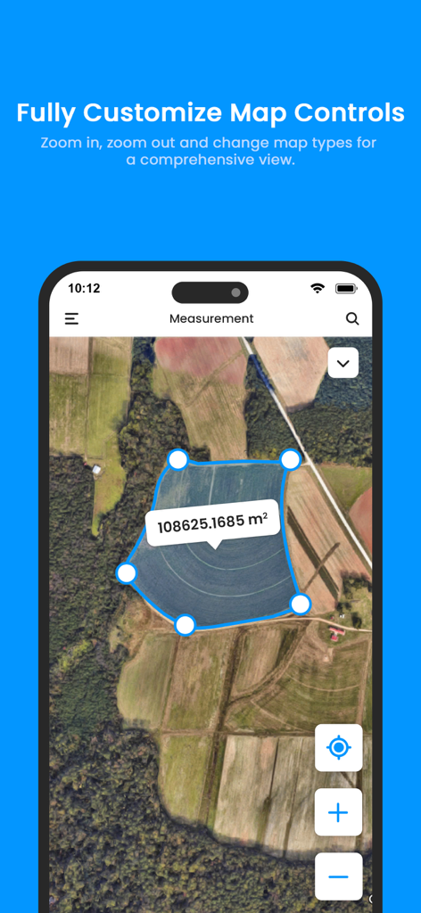
GPSエリア計算機アプリが、測定された青いポリゴンエリアとカスタマイズコントロールを備えた農地の衛星マップを表示しています。
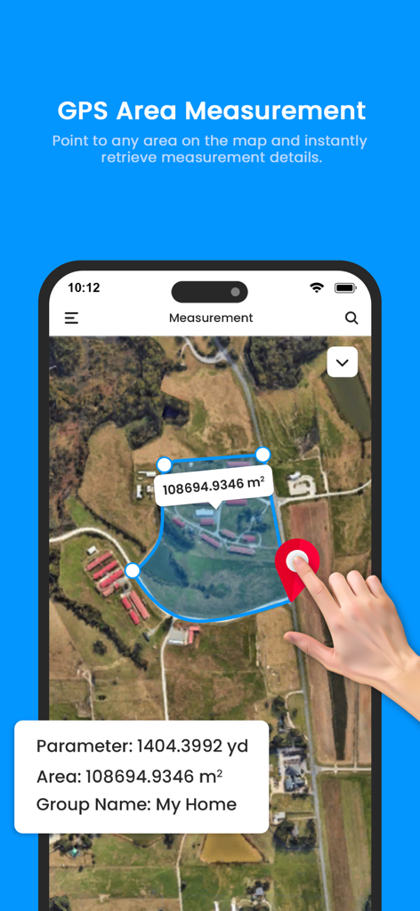
GPSエリア計算機アプリのインターフェースが、面積と周囲長のデータを持つ測定された土地区画を衛星マップ上に表示しています。
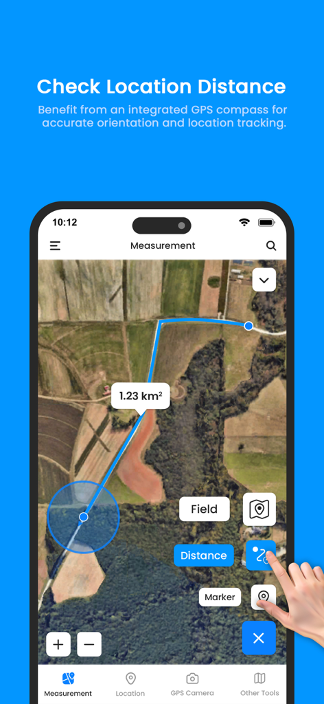
GPSエリア計算機アプリが、1.23平方キロメートルの土地面積測定を示す衛星マップインターフェースを表示しています。
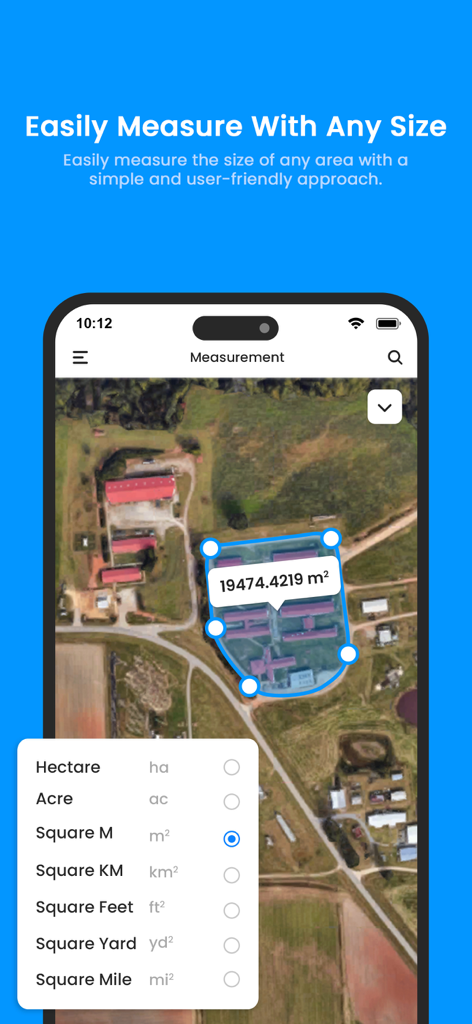
GPSエリア計算機アプリの衛星マップインターフェースに、エーカーやヘクタールを含む単位選択メニューと測定面積が表示されています。
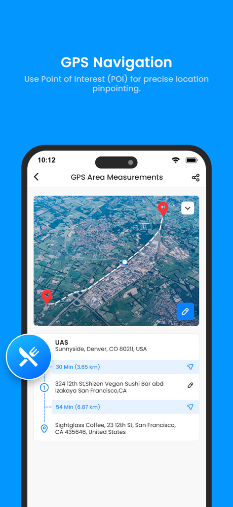
衛星マップ上にPOI(地点情報)をマークするためのGPSナビゲーションインターフェース。
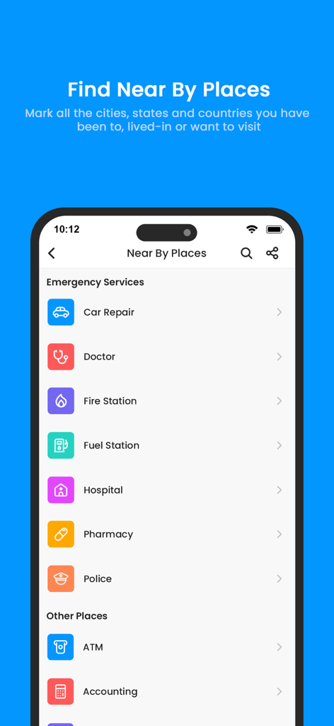
土地測定アプリで、緊急サービスやその他のPOI(地点情報)のカテゴリが表示された近くの場所画面。
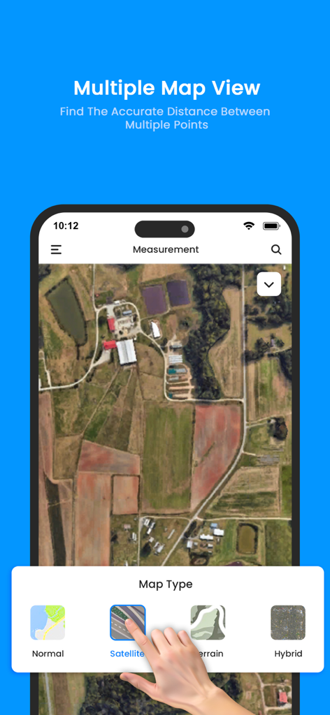
土地測定のために、衛星や地形を含むさまざまなマップビューオプションを示すスマートフォンの画面。
説明
Download
類似アプリ
同じカテゴリのトップランクアプリ

Google Maps
Google LLC

Waze Navigation & Live Traffic
waze

AMap Global
AutoNavi Information Technology Co. Ltd.

百度地图-路线规划,出行必备
Beijing Baidu Netcom Science & Technology Co.,Ltd

Moovit: Bus & Transit Tracker
Moovit App Global LTD

Transit • Subway & Bus Times
9280-0366 Quebec inc.

ParkMobile: Park. Pay. Go.
Parkmobile USA, Inc

腾讯地图-路线规划,导航地铁打车出行
Shenzhen Tencent Computer Systems Company Limited

Île-de-France Mobilités
Ile de France Mobilites
このページはアプリまたはその開発者の公式ページではなく、情報提供および論評を目的として作成された独立した編集出版物です。明示的に別段の記載がない限り、アプリおよびその開発者は、MWM、Apple、Google Play、アプリのパブリッシャー、またはアプリの開発者と提携、承認、後援、認可、またはその他の公式的な関係はなく、このページのいかなる内容も、アプリがMWMのサービスを使用して開発されたことを意味するものではありません。すべての商標、ロゴ、スクリーンショット、その他のコンテンツはそれぞれの所有者の財産です。