このページはアプリまたはその開発者の公式ページではなく、情報提供および論評を目的として作成された独立した編集出版物です。明示的に別段の記載がない限り、アプリおよびその開発者は、MWM、Apple、Google Play、アプリのパブリッシャー、またはアプリの開発者と提携、承認、後援、認可、またはその他の公式的な関係はなく、このページのいかなる内容も、アプリがMWMのサービスを使用して開発されたことを意味するものではありません。すべての商標、ロゴ、スクリーンショット、その他のコンテンツはそれぞれの所有者の財産です。

GPS Fields Area Measure App
土地所有者、請負業者、アウトドア愛好家のために設計されたプロ仕様のツールで、面積を正確に測定し、複数地点を巡るルートを計画し、安全にナビゲーションしましょう。
ダウンロード
14K+ユーザー評価
評価数
0開発元
カテゴリ
Navigation対応言語
16最新バージョン
1.0サイズ
149.8 MBリリース日
2024年12月10日土地と道路のための究極のデジタルツールキット
造園プロジェクトの面積計算から、ハイテクHUDを使った田舎道のナビゲーションまで、必要なすべてのプロフェッショナルツールを1つの強力なアプリで提供します。
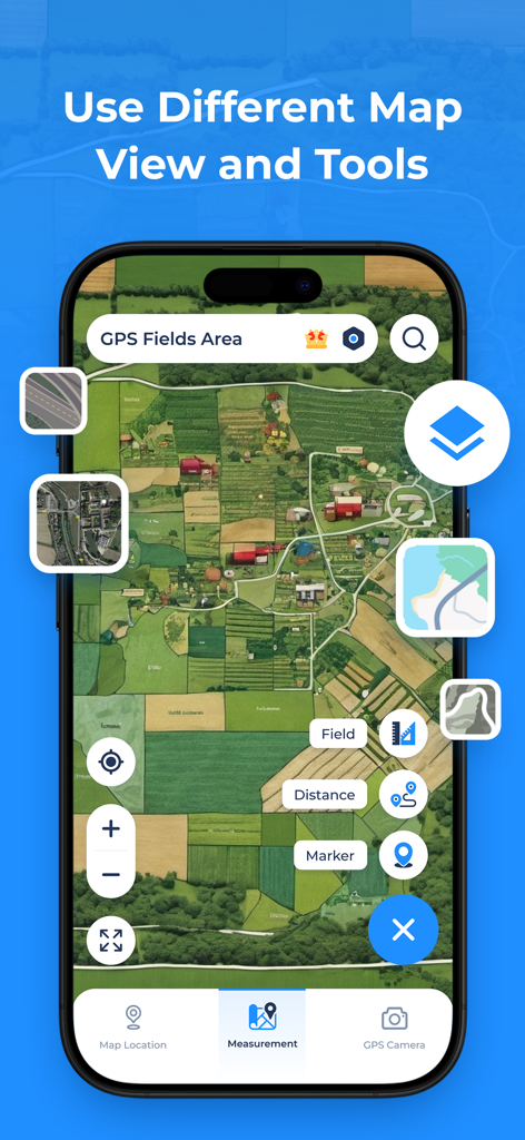
精密な土地と面積の計算
地図上の地点をマークするだけで、エーカー、平方フィート、または周囲長を簡単に測定できます。フェンス、農業、不動産管理に最適です。
ジオタグ付きGPSカメラ
緯度、経度、タイムスタンプが自動的に含まれる写真で作業を記録し、プロフェッショナルな記録管理を行います。
以下のスクリーンショットと説明は、アプリの公式ストアリスティングから直接取得されたものであり、アプリ開発者の所有物です。
アプリストア
スクリーンショット
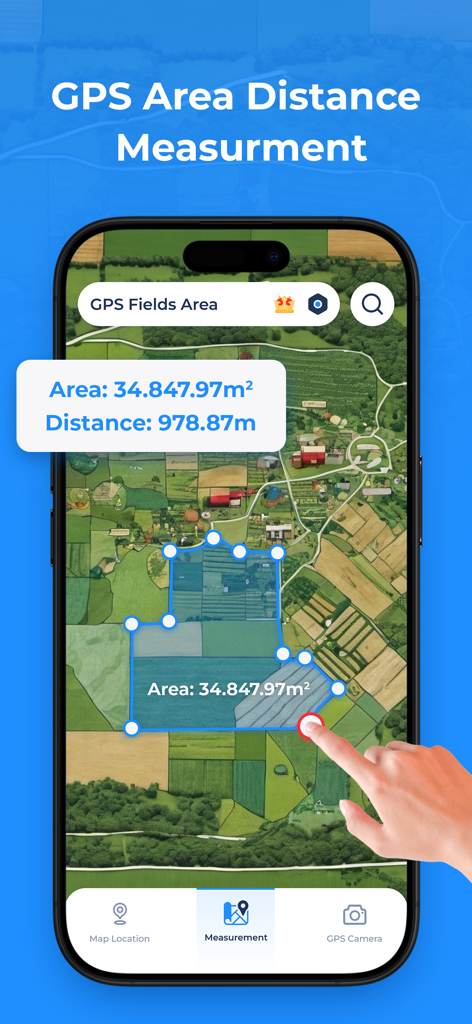
測定されたフィールドエリアと距離計算が表示されたスマートフォンアプリの衛星地図。
GPS Fields Area Measureアプリの衛星地図ビューと土地測定ツール。
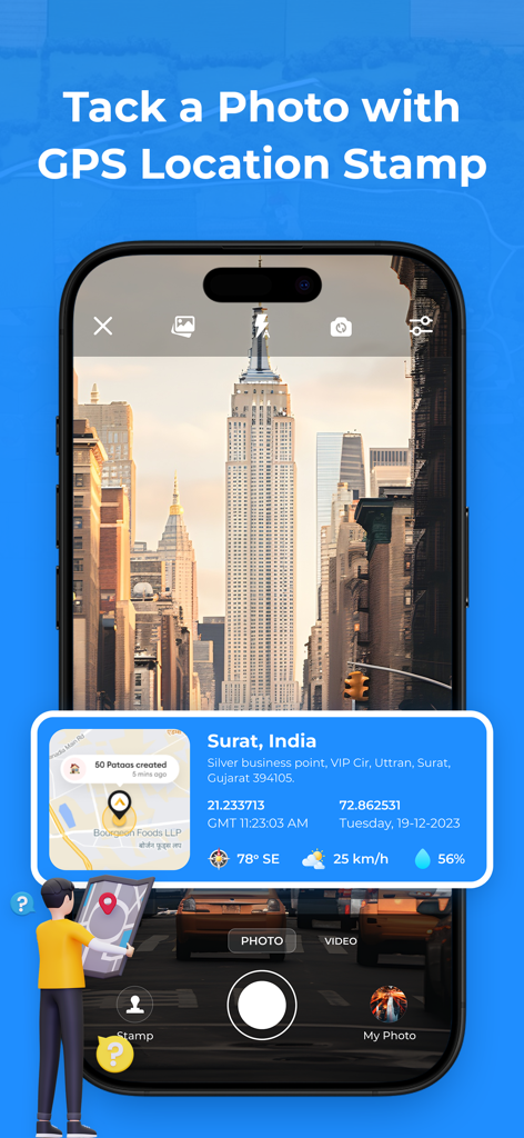
写真に位置座標と地図のオーバーレイが表示されたGPSカメラ機能を示すスマートフォンの画面。
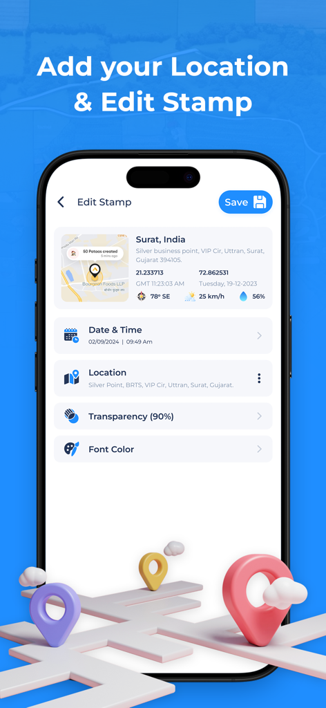
日付、時刻、座標を含むGPS位置スタンプを編集するオプションが表示されるモバイル画面。
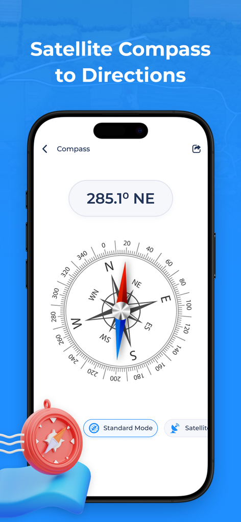
GPS Fields Area Measureアプリのデジタルコンパスと方向角度、衛星モード。
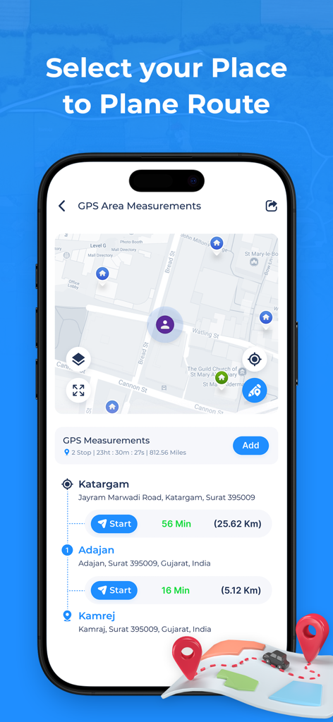
GPS Fields Area Measureアプリの複数地点ルートプランナー、地図ナビゲーション、所要時間。

GPSナビゲーションアプリの万里の長城やペトラなどの世界の有名なランドマークのリスト。
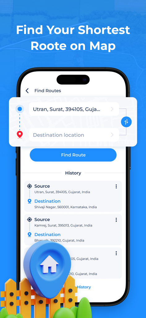
GPS Fields Area Measureアプリのインターフェース、ソースと宛先の入力、検索履歴が表示されたルートファインダー機能。
説明
Download
類似アプリ
同じカテゴリのトップランクアプリ

Google Maps
Google LLC

Waze Navigation & Live Traffic
waze

AMap Global
AutoNavi Information Technology Co. Ltd.

百度地图-路线规划,出行必备
Beijing Baidu Netcom Science & Technology Co.,Ltd

Moovit: Bus & Transit Tracker
Moovit App Global LTD

Transit • Subway & Bus Times
9280-0366 Quebec inc.

ParkMobile: Park. Pay. Go.
Parkmobile USA, Inc

腾讯地图-路线规划,导航地铁打车出行
Shenzhen Tencent Computer Systems Company Limited

Île-de-France Mobilités
Ile de France Mobilites
このページはアプリまたはその開発者の公式ページではなく、情報提供および論評を目的として作成された独立した編集出版物です。明示的に別段の記載がない限り、アプリおよびその開発者は、MWM、Apple、Google Play、アプリのパブリッシャー、またはアプリの開発者と提携、承認、後援、認可、またはその他の公式的な関係はなく、このページのいかなる内容も、アプリがMWMのサービスを使用して開発されたことを意味するものではありません。すべての商標、ロゴ、スクリーンショット、その他のコンテンツはそれぞれの所有者の財産です。