このページはアプリまたはその開発者の公式ページではなく、情報提供および論評を目的として作成された独立した編集出版物です。明示的に別段の記載がない限り、アプリおよびその開発者は、MWM、Apple、Google Play、アプリのパブリッシャー、またはアプリの開発者と提携、承認、後援、認可、またはその他の公式的な関係はなく、このページのいかなる内容も、アプリがMWMのサービスを使用して開発されたことを意味するものではありません。すべての商標、ロゴ、スクリーンショット、その他のコンテンツはそれぞれの所有者の財産です。

GPX Viewer-Converter-Tracking
アウトドアデータを完全にコントロール。正確なマッピング、ウェイポイント管理、そして最も遠い冒険のための完全なオフラインサポートにより、GPSトラックのインポート、変換、記録をシームレスに行えます。
ダウンロード
57K+ユーザー評価
評価数
0開発元
カテゴリ
Navigation対応言語
1最新バージョン
1.7.8サイズ
13.5 MBリリース日
2016年9月15日あらゆる冒険のためのプログレードGPSツール
アウトドア愛好家のための究極の実用的ユーティリティ。データの完全なコントロールを求めるハイカー、サイクリスト、オフローダーのために設計された強力なツールで、GPXファイルの表示、追跡、変換を行えます。
高精度ライブトラッキング
速度、時間、距離のリアルタイム指標ですべての動きを記録します。オフライン時でも完璧に機能する高精度の青い線で、あなたの通った道を追跡します。
シームレスなファイル管理
メール、ウェブリンク、またはiTunes経由で.gpxファイルをインポートおよびエクスポート。独自のソーシャルエコシステムやサブスクリプションプラットフォームに縛られることなく、完全なデータの主権を維持します。
以下のスクリーンショットと説明は、アプリの公式ストアリスティングから直接取得されたものであり、アプリ開発者の所有物です。
アプリストア
スクリーンショット
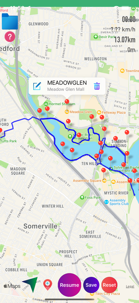
青いトラッキング線と赤いウェイポイントマーカーを表示したGPXビューワーアプリのマップビュー
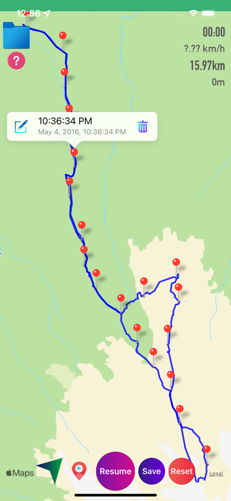
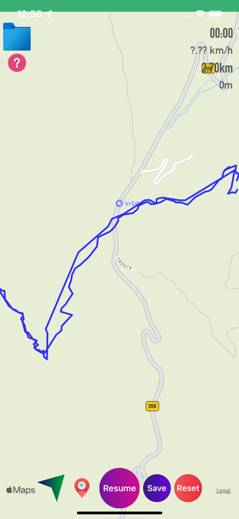
青いパス、赤いウェイポイント、トリップ統計を表示するGPS追跡マップ
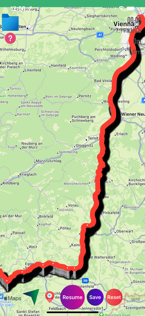
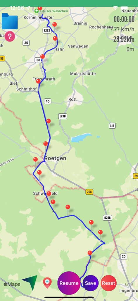
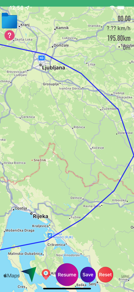
コントロールボタンと共にマップ上に赤い追跡ルートを表示するGPXビューワーアプリのインターフェース
マーカーと統計を表示した、追跡されたルートを表示するGPXビューワーアプリのマップ
距離と速度の統計と共に、マップ上に青いルートトラックを表示するGPXビューワーアプリのインターフェース
再開と保存のトラッキングコントロールを備えた、青いGPSトラック線を表示するマップインターフェース
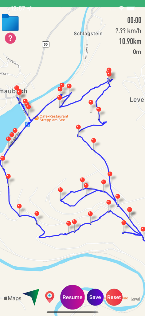
複数の赤いピンマーカーとルート統計と共に、青いGPSトラックを表示するGPXビューワーアプリのマップ画面
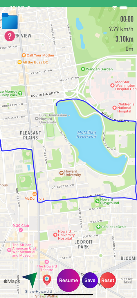
リアルタイムの統計とナビゲーションボタンと共に、マクミラン貯水池周辺の追跡ルートを表示するGPXビューワーアプリのマップ画面
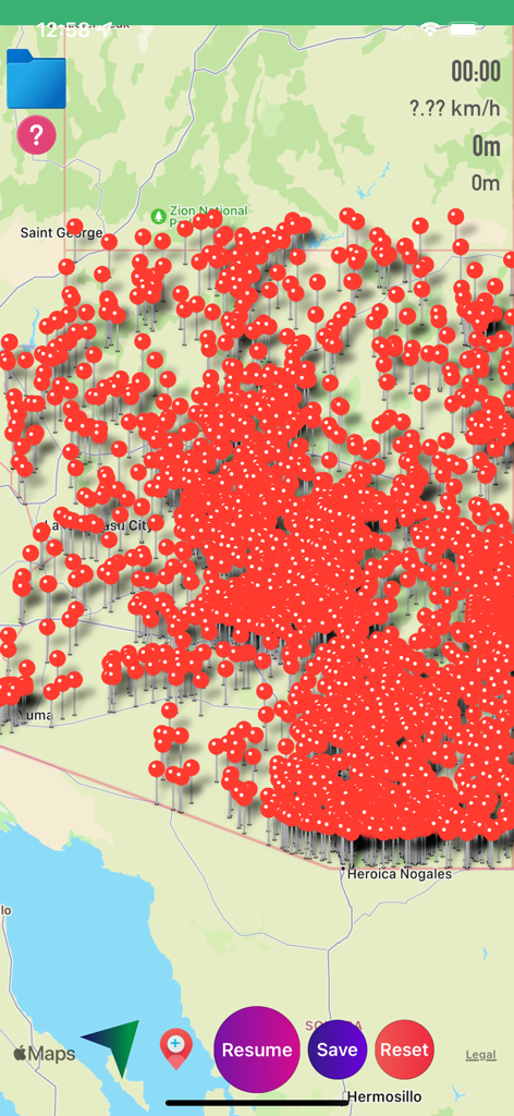
ナビゲーションとルート追跡のために、赤いピンのウェイポイントで密集したGPXビューワーアプリのマップインターフェース
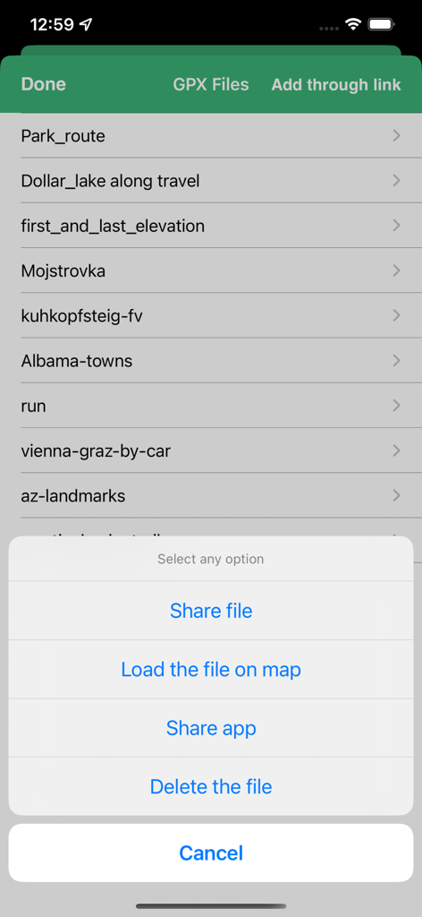
トラックの共有、読み込み、削除のためのメニューを備えたGPXファイル管理画面
説明
Download
類似アプリ
同じカテゴリのトップランクアプリ

Google Maps
Google LLC

Waze Navigation & Live Traffic
waze

AMap Global
AutoNavi Information Technology Co. Ltd.

百度地图-路线规划,出行必备
Beijing Baidu Netcom Science & Technology Co.,Ltd

Moovit: Bus & Transit Tracker
Moovit App Global LTD

Transit • Subway & Bus Times
9280-0366 Quebec inc.

ParkMobile: Park. Pay. Go.
Parkmobile USA, Inc

腾讯地图-路线规划,导航地铁打车出行
Shenzhen Tencent Computer Systems Company Limited

Île-de-France Mobilités
Ile de France Mobilites
このページはアプリまたはその開発者の公式ページではなく、情報提供および論評を目的として作成された独立した編集出版物です。明示的に別段の記載がない限り、アプリおよびその開発者は、MWM、Apple、Google Play、アプリのパブリッシャー、またはアプリの開発者と提携、承認、後援、認可、またはその他の公式的な関係はなく、このページのいかなる内容も、アプリがMWMのサービスを使用して開発されたことを意味するものではありません。すべての商標、ロゴ、スクリーンショット、その他のコンテンツはそれぞれの所有者の財産です。