このページはアプリまたはその開発者の公式ページではなく、情報提供および論評を目的として作成された独立した編集出版物です。明示的に別段の記載がない限り、アプリおよびその開発者は、MWM、Apple、Google Play、アプリのパブリッシャー、またはアプリの開発者と提携、承認、後援、認可、またはその他の公式的な関係はなく、このページのいかなる内容も、アプリがMWMのサービスを使用して開発されたことを意味するものではありません。すべての商標、ロゴ、スクリーンショット、その他のコンテンツはそれぞれの所有者の財産です。

Hill Lists
熱心なハイカーのために作られたアプリで、Munros、Wainwrights、そして20,000以上の山々での進捗状況を追跡しましょう。次回の海外旅行を計画し、すべての登頂を記録し、一生のハイキングを達成のレガシーに変えましょう。
ダウンロード
68K+ユーザー評価
評価数
600開発元
カテゴリ
Navigation対応言語
1最新バージョン
7.8サイズ
43.5 MBリリース日
2009年5月25日精度をもってすべてのピークを制覇
熱心なピークバガーのための究極のコンパニオン。スコットランド高地から湖水地方まで、ハイキングの目標を記録された成果の一生に変えましょう。
20,000の山々、90以上の公式リスト
英国とアイルランドの山の決定版データベースにアクセスします。英国とアイルランドの山の公式データベースから同期されたデータで、Munros、Wainwrightsなどを追跡します。
戦略的な遠征計画
海外旅行者に最適です。海外から次の旅行を計画し、現地のMWIS天気予報をチェックし、ブーツを詰める前に専門家によるルートガイドにアクセスします。
以下のスクリーンショットと説明は、アプリの公式ストアリスティングから直接取得されたものであり、アプリ開発者の所有物です。
アプリストア
スクリーンショット
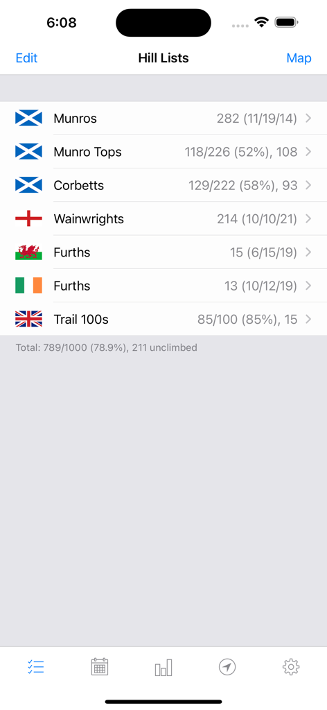
Hill Listsアプリのダッシュボードに、Munros、Corbetts、Wainwrights、その他の英国の山のカテゴリの完了統計が表示されています
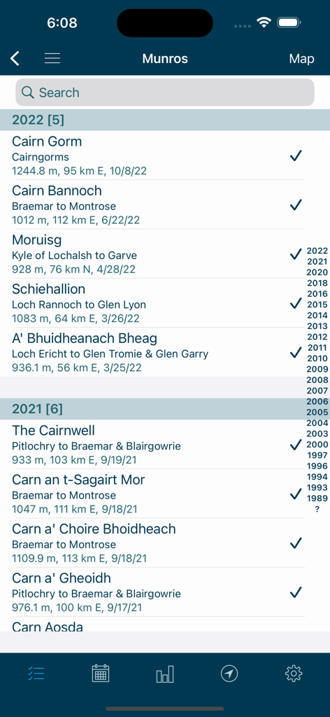
Hill Listsアプリに、日付とチェックマークが付いた完了したMunroの山のリストが表示されています
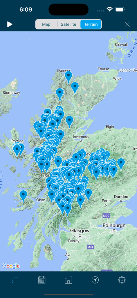
Hill Listsアプリ内のスコットランドの地形図に、山や山の場所を示す多数の青いピンが表示されています
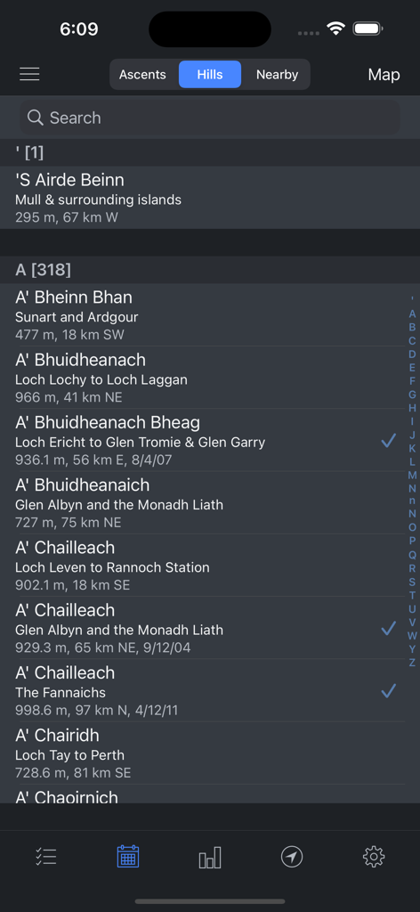
完了チェックマークと標高が付いたスコットランドの山の検索可能なデータベースを表示するモバイルアプリのインターフェース
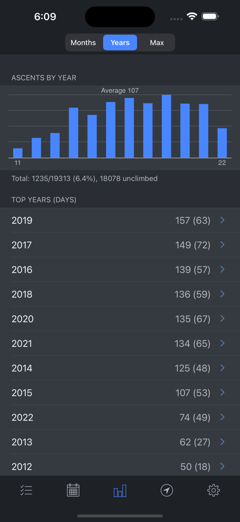
Hill Listsアプリの統計画面に、年ごとのハイキング登頂数を示す棒グラフとリストが表示されています
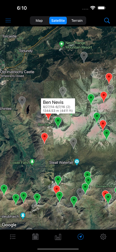
Hill Listsアプリの衛星地図ビューに、ベンネビスのさまざまな山のピンと詳細が表示されています
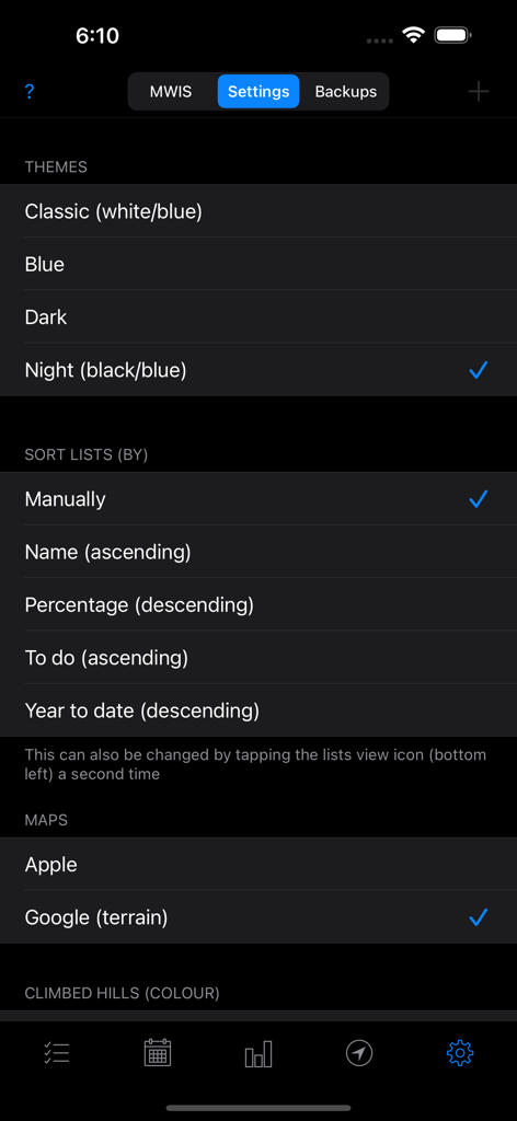
テーマ、リストの並べ替え、地図プロバイダーの選択オプションが表示されているHill Listsアプリの設定画面。
説明
Download
類似アプリ
同じカテゴリのトップランクアプリ

Google Maps
Google LLC

Waze Navigation & Live Traffic
waze

AMap Global
AutoNavi Information Technology Co. Ltd.

百度地图-路线规划,出行必备
Beijing Baidu Netcom Science & Technology Co.,Ltd

Moovit: Bus & Transit Tracker
Moovit App Global LTD

Transit • Subway & Bus Times
9280-0366 Quebec inc.

ParkMobile: Park. Pay. Go.
Parkmobile USA, Inc

腾讯地图-路线规划,导航地铁打车出行
Shenzhen Tencent Computer Systems Company Limited

Île-de-France Mobilités
Ile de France Mobilites
このページはアプリまたはその開発者の公式ページではなく、情報提供および論評を目的として作成された独立した編集出版物です。明示的に別段の記載がない限り、アプリおよびその開発者は、MWM、Apple、Google Play、アプリのパブリッシャー、またはアプリの開発者と提携、承認、後援、認可、またはその他の公式的な関係はなく、このページのいかなる内容も、アプリがMWMのサービスを使用して開発されたことを意味するものではありません。すべての商標、ロゴ、スクリーンショット、その他のコンテンツはそれぞれの所有者の財産です。