このページはアプリまたはその開発者の公式ページではなく、情報提供および論評を目的として作成された独立した編集出版物です。明示的に別段の記載がない限り、アプリおよびその開発者は、MWM、Apple、Google Play、アプリのパブリッシャー、またはアプリの開発者と提携、承認、後援、認可、またはその他の公式的な関係はなく、このページのいかなる内容も、アプリがMWMのサービスを使用して開発されたことを意味するものではありません。すべての商標、ロゴ、スクリーンショット、その他のコンテンツはそれぞれの所有者の財産です。

Hunterra: map&book your hunts
リアルタイムの参加者と犬の追跡、オフラインGPSマップ、安全性と成功のために設計された完全な土地管理システムで、あなたの狩猟場をマスターしましょう。
ダウンロード
12K+ユーザー評価
評価数
100開発元
カテゴリ
Sports対応言語
16最新バージョン
2.5.17サイズ
149.2 MBリリース日
2020年8月31日縄張りを正確にマスターしよう
詳細な土地管理からプロフェッショナルグレードのグループ調整まで、Hunterraは現代のハンターが必要とする戦術的優位性を提供します。
リアルタイムグループ調整
GarminとDogtraceの完全なサポートにより、共同狩猟中にすべての参加者と犬のライブ移動を追跡することで、最大限の安全を確保します。
スマートリース管理
スタンドのデジタル予約システムと、ハントクラブおよびプライベートランドマネージャー向けに設計されたビジターログブックで、推測をなくしましょう。
以下のスクリーンショットと説明は、アプリの公式ストアリスティングから直接取得されたものであり、アプリ開発者の所有物です。
アプリストア
スクリーンショット
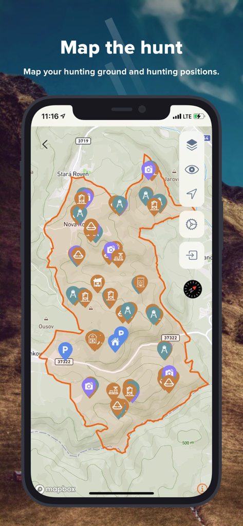
Hunterraアプリのインターフェースを表示するスマートフォン。狩猟場の境界線と、スタンドやトレイルカメラの位置を示すマーカーが表示された地形図が表示されています。
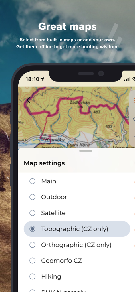
Hunterraアプリのインターフェース。狩猟用の様々な地形図および衛星地図の設定が表示されています。
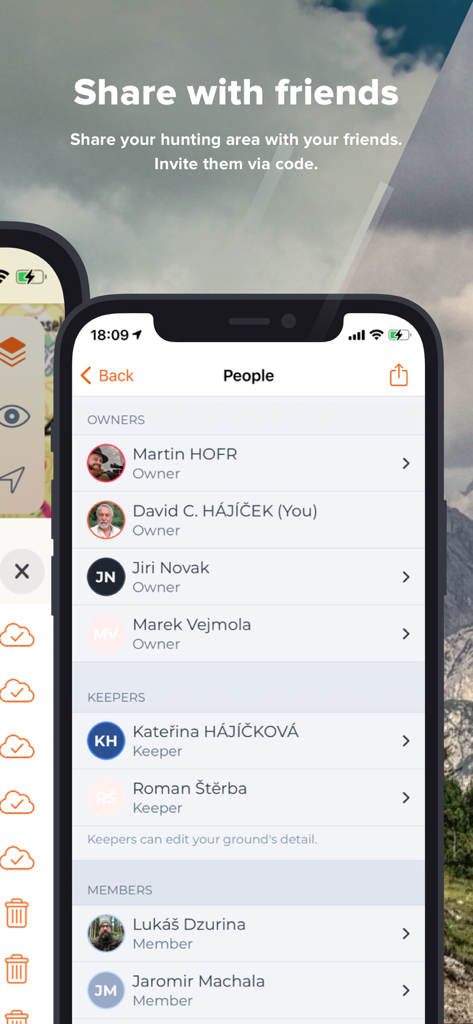
Hunterraのモバイルアプリ画面。所有者、キーパー、メンバーに分類された狩猟エリアのメンバーリストが表示されています。
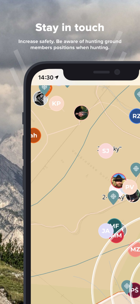
Hunterraアプリ画面。地図上で狩猟チームメンバーのリアルタイム位置追跡が表示されています。
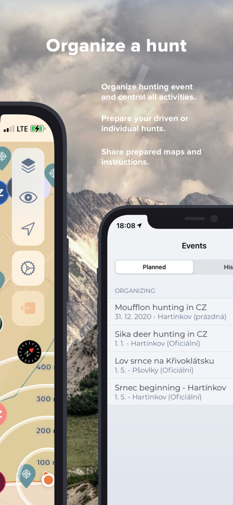
2台のスマートフォンにHunterraアプリのインターフェースが表示されており、狩猟イベントの整理や地図の計画が、山の背景に対して行われています。
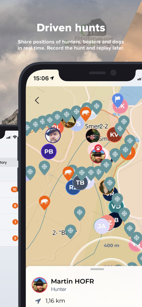
Hunterraアプリのリアルタイムマップ。共同狩猟中にハンターと犬のライブ位置が表示されています。
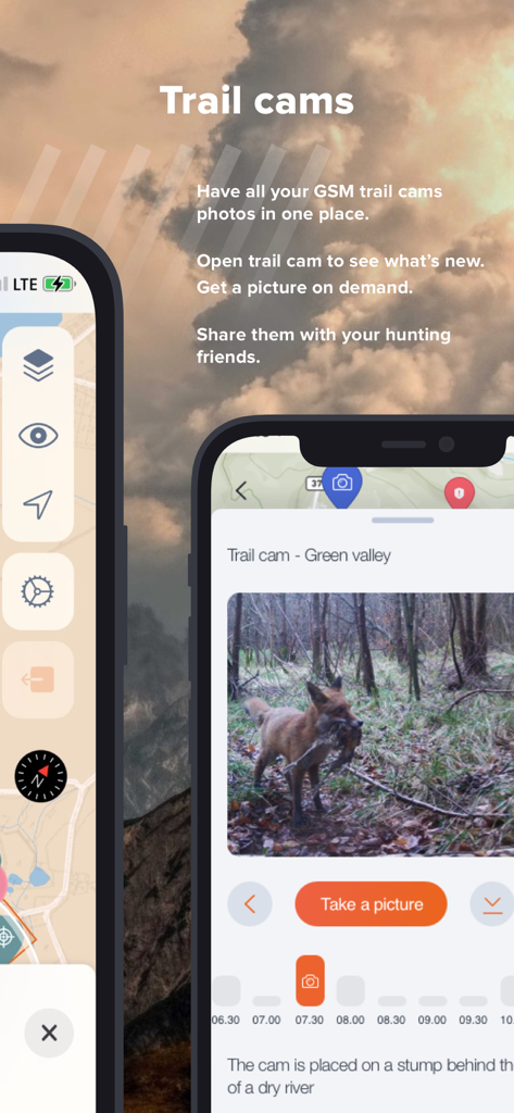
Hunterraアプリ画面。統合されたトレイルカメラの写真と、狩猟用のリモート管理ツールが表示されています。
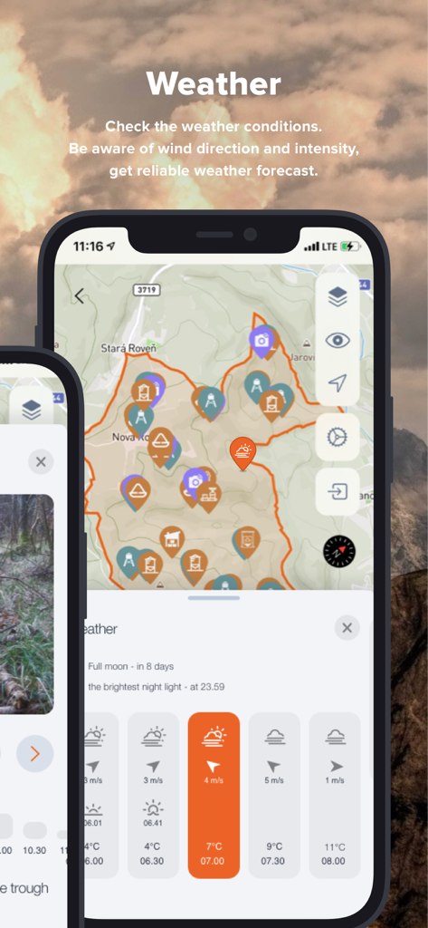
Hunterraアプリのインターフェース。地形図上に狩猟の気象条件と風向きが表示されています。
説明
Download
類似アプリ
同じカテゴリのトップランクアプリ

得物 - 得到美好事物
Shanghai Dewu Information Group Co., Ltd.

懂球帝 - 足球篮球体坛数据
Hainan Football-Loving Girl Network Technology Co., Ltd.

Underdog Sports
Underdog Sports, Inc.

虎扑-评分篮球足球游戏影视
Shanghai Kuanghui Network Technology Co., LTD

ESPN: Live Sports & Scores
Disney Electronic Content, Inc.

Flashscore: Live Scores & News
Livesport s.r.o.

Polymarket
Blockratize Inc

DAZN: Stream Live Sports
DAZN Limited

DraftKings Sportsbook & Casino
DRAFTKINGS LLC.
このページはアプリまたはその開発者の公式ページではなく、情報提供および論評を目的として作成された独立した編集出版物です。明示的に別段の記載がない限り、アプリおよびその開発者は、MWM、Apple、Google Play、アプリのパブリッシャー、またはアプリの開発者と提携、承認、後援、認可、またはその他の公式的な関係はなく、このページのいかなる内容も、アプリがMWMのサービスを使用して開発されたことを意味するものではありません。すべての商標、ロゴ、スクリーンショット、その他のコンテンツはそれぞれの所有者の財産です。