このページはアプリまたはその開発者の公式ページではなく、情報提供および論評を目的として作成された独立した編集出版物です。明示的に別段の記載がない限り、アプリおよびその開発者は、MWM、Apple、Google Play、アプリのパブリッシャー、またはアプリの開発者と提携、承認、後援、認可、またはその他の公式的な関係はなく、このページのいかなる内容も、アプリがMWMのサービスを使用して開発されたことを意味するものではありません。すべての商標、ロゴ、スクリーンショット、その他のコンテンツはそれぞれの所有者の財産です。

Hurricane Track- Storm Tracker
メディアの誇張は抜きにして、リアルタイムのNEXRADレーダー、GOES-19衛星画像、正確な5日間の暴風経路にアクセスしましょう。最も重要な時に、十分な情報に基づいた安全な決定を下すために必要な高度な気象ツールを、すべて無料で入手しましょう。
ダウンロード
530K+ユーザー評価
評価数
100開発元
カテゴリ
Weather対応言語
1最新バージョン
3.5.0サイズ
25.6 MBリリース日
2011年5月22日ご自宅のためのプロ仕様の暴風情報
プロの気象学者が使用するのと同じ高解像度データにアクセスし、脅威を監視し、リスクを評価し、自信を持って資産を保護しましょう。
NEXRAD地域レーダー
お住まいの郵便番号に合わせた精密技術で、超地域的な危険と竜巻警報を監視しましょう。
5日間の予測経路
GOES-19衛星画像を使用して将来の熱帯低気圧の軌道を追跡し、影響の数日前に備えましょう。
よくある質問
について知っておくべきこと Hurricane Track- Storm Tracker
Hurricane Track- Storm Tracker は無料で利用できますか?
はい、Hurricane Track- Storm Tracker は無料のアプリケーションです。アプリの説明には「Hurricane Track is Free!」と明記されています。
Hurricane Track 3.0 ではどのようなレーダー技術が利用可能ですか?
Hurricane Track 3.0 は、GOES-19衛星を含む18のワールドレーダーと、NEXRAD技術を特徴とするカスタマイズ可能なローカルレーダーを利用しています。革新的な雷強度レーダーも提供しています。
Hurricane Track- Storm Tracker は特定の地域のローカルレーダーを提供していますか?
はい、Hurricane Track- Storm Tracker は、NEXRAD技術を使用したカスタマイズ可能な高度なローカルレーダーを提供しており、特に米国地域で利用可能です。
Hurricane Track- Storm Tracker は熱帯低気圧の進路予測を表示できますか?
はい、Hurricane Track- Storm Tracker は将来の熱帯低気圧の進路予測を表示します。今後5日間の予測を提供します。
Hurricane Track- Storm Tracker はどのような危険警報を提供していますか?
Hurricane Track- Storm Tracker は、トルネードウォッチ、洪水警報、高潮など、さまざまなイベントの詳細な予報と危険警報を提供します。この機能は米国のみで、毎時更新されます。
Hurricane Track 3.0 には 3D 地球表示機能が含まれていますか?
はい、Hurricane Track 3.0 はインタラクティブな 3D 地球表示機能を備えています。この表示機能は、ライブの雲、熱帯低気圧、地震を表示します。
Hurricane Track- Storm Tracker は海面水温データを提供していますか?
はい、Hurricane Track- Storm Tracker は海面水温を提供しています。このデータは過去2ヶ月分利用可能です。
以下のスクリーンショットと説明は、アプリの公式ストアリスティングから直接取得されたものであり、アプリ開発者の所有物です。
アプリストア
スクリーンショット
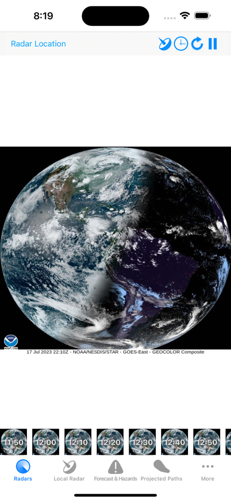
ハリケーン・トラックのモバイルアプリでリアルタイムの雲被覆を示す地球の衛星表示
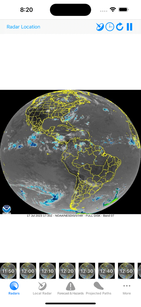
ハリケーン・トラックアプリでのアメリカ大陸のグローバル衛星レーダー表示
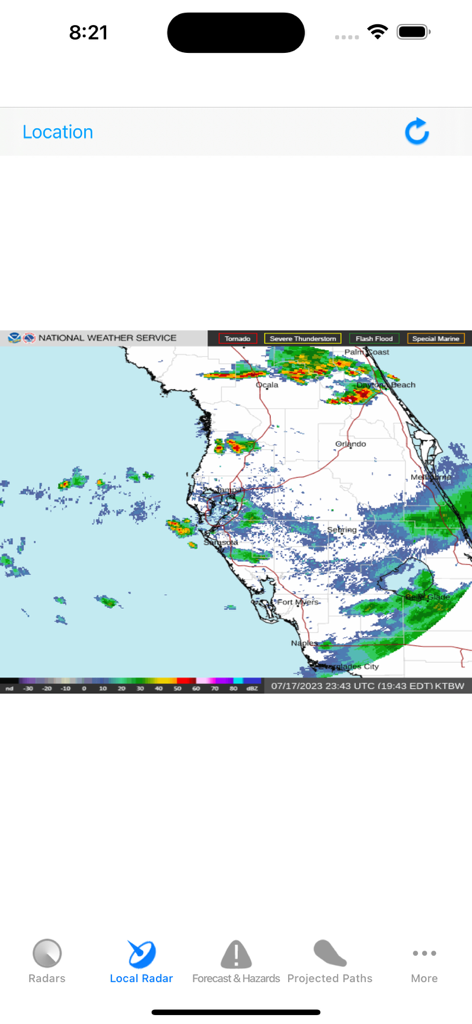
ハリケーン・トラックアプリで天気強度を示すフロリダのローカルNEXRADレーダーマップ
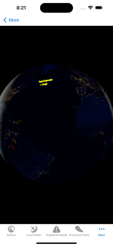
ハリケーン・トラックアプリで熱帯低気圧を示すインタラクティブな3D地球表示
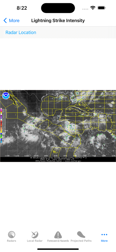
ハリケーン・トラックアプリの雷強度マップ
説明
Download
類似アプリ
似た機能とユーザー体験を持つアプリ

Watch Duty: Wildfire Maps
Sherwood Forestry Service, Inc.

My Hurricane Tracker & Alerts
JRustonApps B.V.

Air Quality & Pollen - AirCare
AirCare Data, Inc.

My Hurricane Tracker Pro
JRustonApps B.V.

เช็คน้ำ
Geo-Informatics and Space Technology Development Agency

SharkSmart
NSW Trade & Investment, Regional Infrastructure & Services

Dorsal Shark Reports
Bluebottle Digital Pty. Ltd.

global storms
Kelly Technology Inc.

My AQI Air Quality & Pollution
Jean Baptiste Stevenard
このページはアプリまたはその開発者の公式ページではなく、情報提供および論評を目的として作成された独立した編集出版物です。明示的に別段の記載がない限り、アプリおよびその開発者は、MWM、Apple、Google Play、アプリのパブリッシャー、またはアプリの開発者と提携、承認、後援、認可、またはその他の公式的な関係はなく、このページのいかなる内容も、アプリがMWMのサービスを使用して開発されたことを意味するものではありません。すべての商標、ロゴ、スクリーンショット、その他のコンテンツはそれぞれの所有者の財産です。