このページはアプリまたはその開発者の公式ページではなく、情報提供および論評を目的として作成された独立した編集出版物です。明示的に別段の記載がない限り、アプリおよびその開発者は、MWM、Apple、Google Play、アプリのパブリッシャー、またはアプリの開発者と提携、承認、後援、認可、またはその他の公式的な関係はなく、このページのいかなる内容も、アプリがMWMのサービスを使用して開発されたことを意味するものではありません。すべての商標、ロゴ、スクリーンショット、その他のコンテンツはそれぞれの所有者の財産です。

Illinois State Roads
シカゴとイリノイ州を自信を持って移動しましょう。一度購入するだけで、2,100以上のライブカメラフィードと即時インシデントレポートにアクセスできます。サブスクリプションは一切不要です。
ダウンロード
6K+ユーザー評価
評価数
0開発元
カテゴリ
Travel対応言語
1最新バージョン
2.0サイズ
2.8 MBリリース日
2019年11月23日イリノイ州の通勤をマスターする
IDOTからのリアルタイム情報とライブカメラフィードを直接提供。視覚的な確実性と月額料金なしを重視する、効率重視のドライバーのために設計されています。
2,100以上のライブ交通カメラ
地図アルゴリズムを信頼するだけではありません。実際の道路状況、天気、事故現場をリアルタイムで確認し、最良のルートを決定しましょう。
サブスクリプションは一切不要
サブスクリプション疲れにさよなら。一度購入するだけで、プレミアムIDOTデータにアクセスでき、クリーンで広告なしのインターフェースを利用できます。
以下のスクリーンショットと説明は、アプリの公式ストアリスティングから直接取得されたものであり、アプリ開発者の所有物です。
アプリストア
スクリーンショット
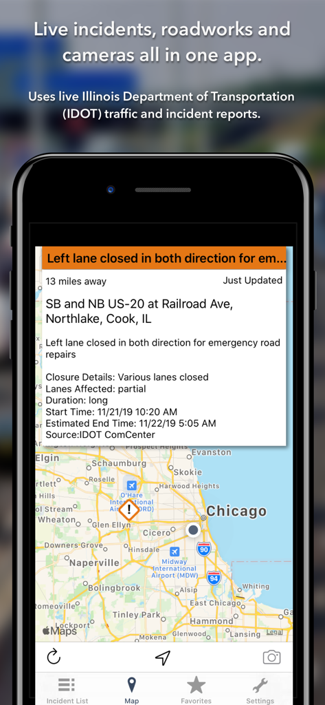
イリノイ州の道路アプリがシカゴの地図上にライブ道路閉鎖インシデントを表示
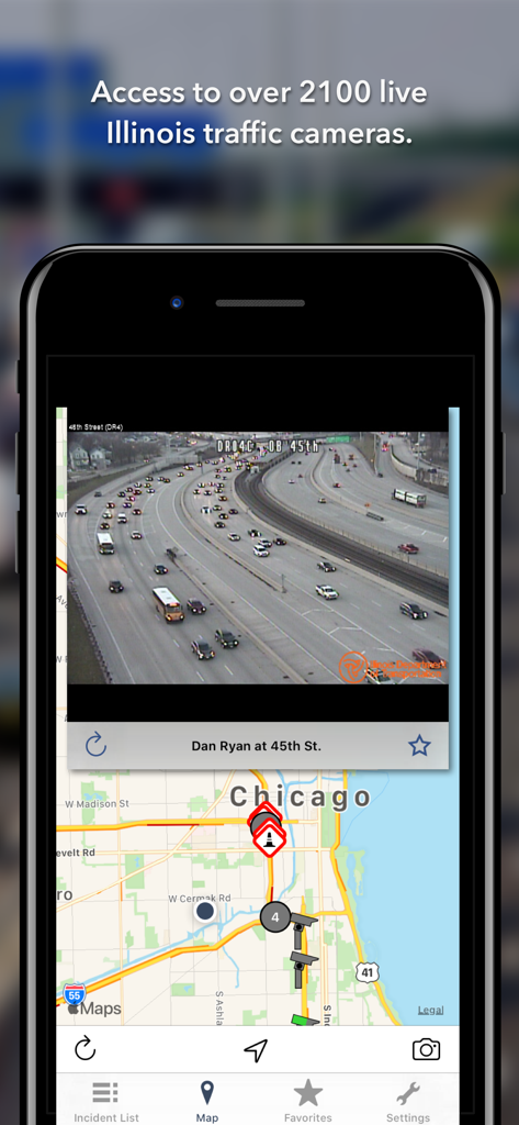
イリノイ州の道路アプリがシカゴのダン・ライアン・エクスプレスウェイのライブ交通カメラフィードを表示
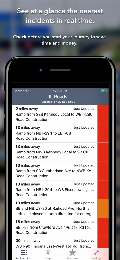
イリノイ州の道路アプリ上のリアルタイム交通インシデントと道路工事のリスト。
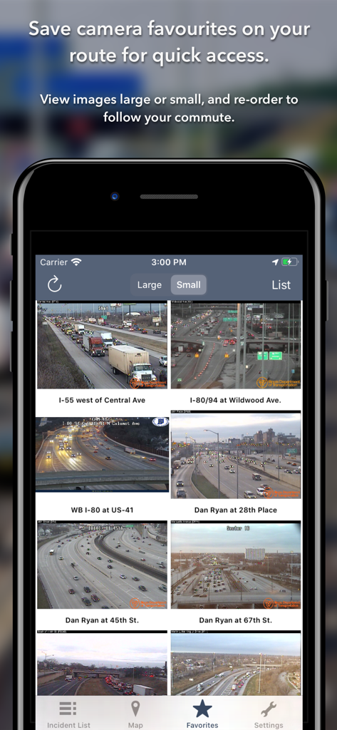
イリノイ州交通局からのライブ交通カメラフィードのグリッドを表示するモバイル画面。
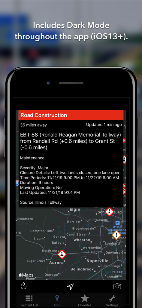
イリノイ州の道路アプリのダークモードのスクリーンショット。地図上に道路工事の詳細とインシデントアイコンを表示。
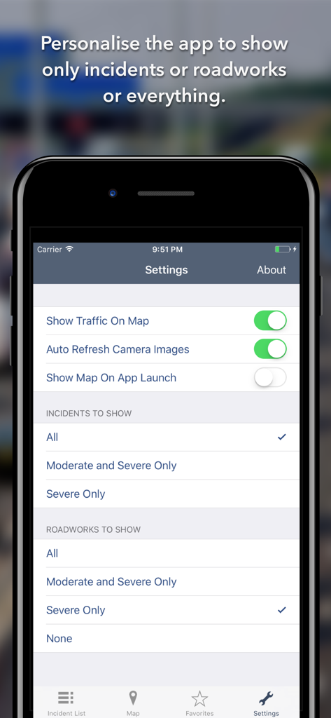
イリノイ州の道路アプリで交通インシデントと道路工事をフィルタリングするための設定メニュー。
説明
Download
類似アプリ
同じカテゴリのトップランクアプリ

Uber - Request a ride
Uber Technologies, Inc.

Airbnb
Airbnb, Inc.

铁路12306
ACADEMY OF RAILWAY SCIENCES CO., ltd.

Booking.com: Hotels & Travel
Booking.com B.V.

Grab: Taxi Ride, Food Delivery
GRABTAXI HOLDINGS PTE. LTD.

Trip.com: Book Flights, Hotels
Trip.com Travel Singapore Pte. Ltd.

DiDi China: Ride Hailing
Didi Chuxing (Beijing) Network Platform Technology Co., Ltd

去哪儿旅行-订酒店机票火车票
Beijing Qunar Information Technology Company Limit

Bolt: Request a Ride
BOLT TECHNOLOGY OU
このページはアプリまたはその開発者の公式ページではなく、情報提供および論評を目的として作成された独立した編集出版物です。明示的に別段の記載がない限り、アプリおよびその開発者は、MWM、Apple、Google Play、アプリのパブリッシャー、またはアプリの開発者と提携、承認、後援、認可、またはその他の公式的な関係はなく、このページのいかなる内容も、アプリがMWMのサービスを使用して開発されたことを意味するものではありません。すべての商標、ロゴ、スクリーンショット、その他のコンテンツはそれぞれの所有者の財産です。