このページはアプリまたはその開発者の公式ページではなく、情報提供および論評を目的として作成された独立した編集出版物です。明示的に別段の記載がない限り、アプリおよびその開発者は、MWM、Apple、Google Play、アプリのパブリッシャー、またはアプリの開発者と提携、承認、後援、認可、またはその他の公式的な関係はなく、このページのいかなる内容も、アプリがMWMのサービスを使用して開発されたことを意味するものではありません。すべての商標、ロゴ、スクリーンショット、その他のコンテンツはそれぞれの所有者の財産です。

iSailGPS : NOAA USA RNC Charts
サブスクリプションなし、広告なし、完全なプライバシーで、米国の沿岸海域に対応した信頼性の高いオフライン対応海図。沿岸クルージングとレースにおいて、Practical Sailor 「ベストチョイス」受賞。
ダウンロード
206K+ユーザー評価
評価数
100開発元
カテゴリ
Navigation対応言語
1最新バージョン
9.6.6サイズ
10.4 MBリリース日
2011年4月29日サブスクリプションなしのプロフェッショナル海洋ナビゲーション
公式 NOAA ラスタ海図を使用して、お使いのデバイスを高性能 GPS 受信機に変えましょう。信頼性が高く、プライバシー重視で、自立した船乗り向けに設計されています。
本物のラスタ海図
従来の紙の海図と同等の比類なき詳細情報を提供します。ベクターマップとは異なり、当社の高解像度 RNC チャートは、ベテランの船乗りが信頼するプロフェッショナルな地図作成の深みと注釈を提供します。
100% オフラインでの信頼性
携帯電話の電波がなくても安全に航海できます。最大 2,200 枚の海図をデバイスに直接ダウンロードして保存できるため、あらゆる気象条件下での外洋航海や緊急事態に備えられます。
以下のスクリーンショットと説明は、アプリの公式ストアリスティングから直接取得されたものであり、アプリ開発者の所有物です。
アプリストア
スクリーンショット
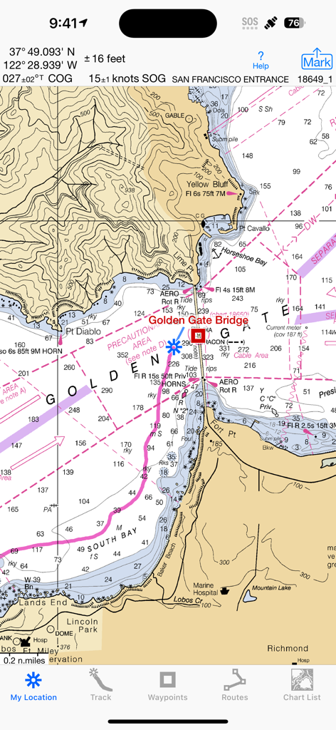
iSailGPS ナビゲーションアプリにサンフランシスコ入口の NOAA ラスタ海図が表示されている様子。
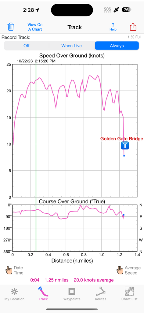
iSailGPS アプリのスクリーンショット。ゴールデンゲートブリッジ付近の船速と対地コースのグラフが表示されたセーリング トラック データ。
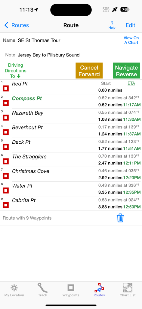
iSailGPS アプリのインターフェースに、距離と ETA データを含むセーリング ルートのナビゲーションウェイポイントのリストが表示されている様子。
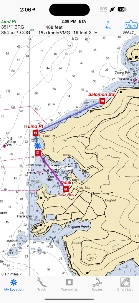
iSailGPS アプリに、ナビゲーション メトリックとルートウェイポイントを備えた詳細な NOAA ラスタ海図が表示されている様子。
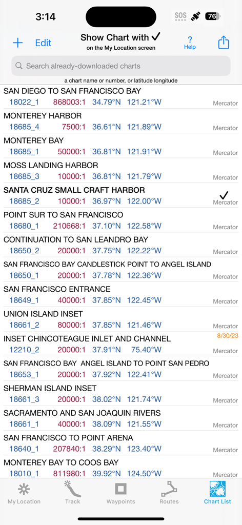
iSailGPS アプリに、カリフォルニア州のダウンロード済み NOAA 海図のリストが表示されている様子。
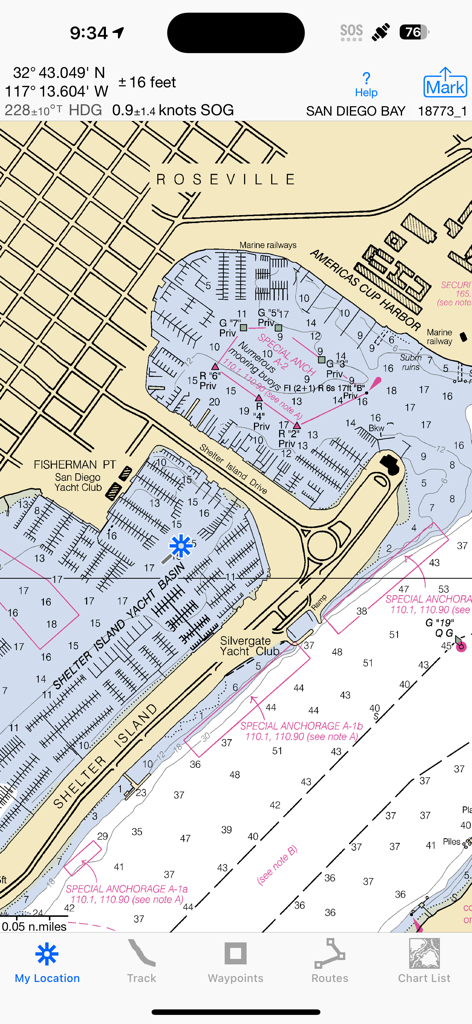
iSailGPS アプリにサンディエゴ湾の詳細な NOAA ラスタ海図が表示されている様子。

iSailGPS アプリに、共有とウェイポイント追加のメニューが開かれた NOAA ラスタ海図が表示されている様子。
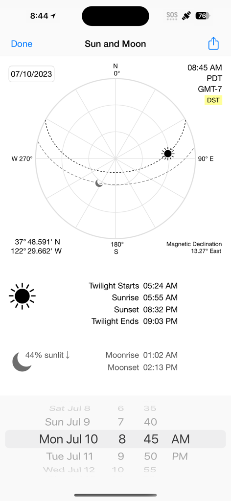
iSailGPS アプリ画面に、天体航法のための日の出、日の入り、月の満ち欠けデータと共に太陽と月の位置が表示されている様子。
説明
Download
類似アプリ
同じカテゴリのトップランクアプリ

Google Maps
Google LLC

Waze Navigation & Live Traffic
waze

AMap Global
AutoNavi Information Technology Co. Ltd.

百度地图-路线规划,出行必备
Beijing Baidu Netcom Science & Technology Co.,Ltd

Moovit: Bus & Transit Tracker
Moovit App Global LTD

Transit • Subway & Bus Times
9280-0366 Quebec inc.

ParkMobile: Park. Pay. Go.
Parkmobile USA, Inc

腾讯地图-路线规划,导航地铁打车出行
Shenzhen Tencent Computer Systems Company Limited

Île-de-France Mobilités
Ile de France Mobilites
このページはアプリまたはその開発者の公式ページではなく、情報提供および論評を目的として作成された独立した編集出版物です。明示的に別段の記載がない限り、アプリおよびその開発者は、MWM、Apple、Google Play、アプリのパブリッシャー、またはアプリの開発者と提携、承認、後援、認可、またはその他の公式的な関係はなく、このページのいかなる内容も、アプリがMWMのサービスを使用して開発されたことを意味するものではありません。すべての商標、ロゴ、スクリーンショット、その他のコンテンツはそれぞれの所有者の財産です。