このページはアプリまたはその開発者の公式ページではなく、情報提供および論評を目的として作成された独立した編集出版物です。明示的に別段の記載がない限り、アプリおよびその開発者は、MWM、Apple、Google Play、アプリのパブリッシャー、またはアプリの開発者と提携、承認、後援、認可、またはその他の公式的な関係はなく、このページのいかなる内容も、アプリがMWMのサービスを使用して開発されたことを意味するものではありません。すべての商標、ロゴ、スクリーンショット、その他のコンテンツはそれぞれの所有者の財産です。

ダウンロード
10K+ユーザー評価
評価数
200開発元
カテゴリ
Navigation対応言語
1最新バージョン
1.7.0サイズ
80.3 MBリリース日
2024年7月20日あなたの世界を正確にナビゲート&測定
DIY愛好家や不動産業界のプロフェッショナルが、あらゆる場所を視覚化し、簡単に距離を計算できるように設計されたオールインワンツールキット。
プロフェッショナルな面積測定
DIY愛好家や不動産業界のプロフェッショナル向けに設計された高精度GPSツールを使用して、土地の面積、フィールドの寸法、または境界線を即座に計算します。
ライブ衛星&ストリート探索
高解像度の地球ビューで視覚的な確実性を得られます。ルートを事前に確認したり、手のひらから世界的に有名な目的地をツアーしたりできます。
以下のスクリーンショットと説明は、アプリの公式ストアリスティングから直接取得されたものであり、アプリ開発者の所有物です。
アプリストア
スクリーンショット
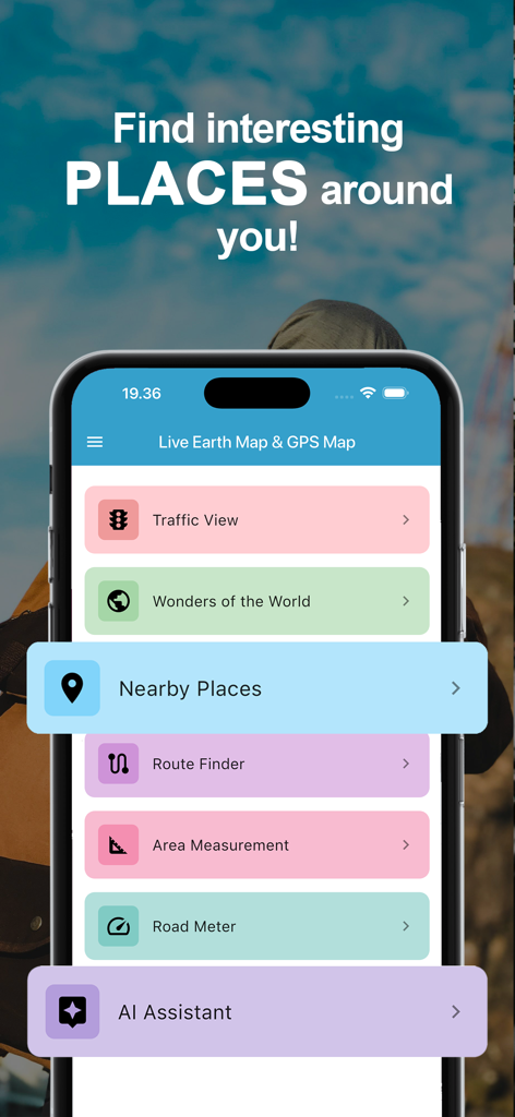
ナビゲーションと面積測定機能を示すライブ地球マップとGPSマップアプリのメインメニュー

旅行アプリで映画館のおすすめを提供するAIアシスタントを示すスマートフォンの画面
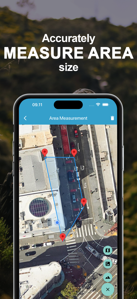
ピンマーカーで土地面積測定を示す衛星マップインターフェース
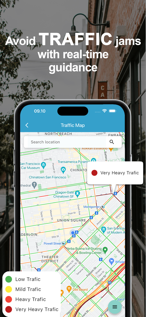
色分けされた交通密度と検索バーを示すリアルタイム交通マップを表示するモバイルアプリインターフェース
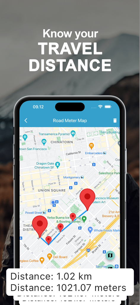
都市マップ上の複数のピンで総距離をキロメートルで計算する距離測定ツールを示すスマートフォン
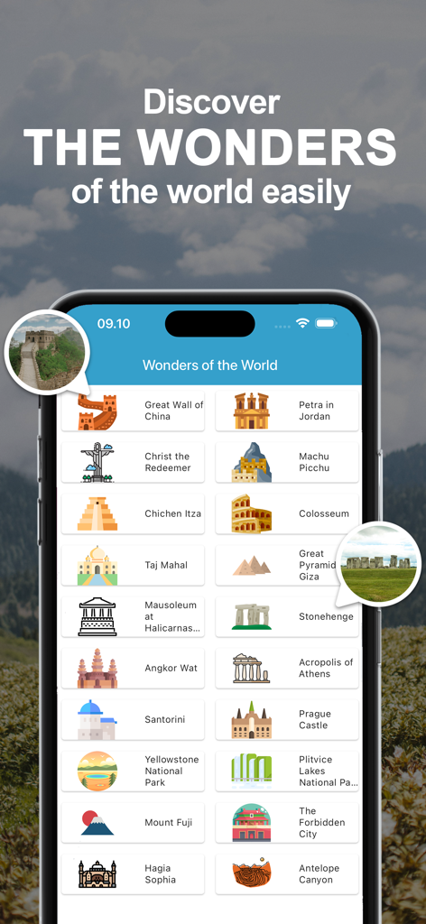
万里の長城やマチュピチュのような有名な世界のランドマークや観光地のリストを表示するモバイルアプリインターフェース
説明
Download
類似アプリ
同じカテゴリのトップランクアプリ

Google Maps
Google LLC

Waze Navigation & Live Traffic
waze

AMap Global
AutoNavi Information Technology Co. Ltd.

百度地图-路线规划,出行必备
Beijing Baidu Netcom Science & Technology Co.,Ltd

Moovit: Bus & Transit Tracker
Moovit App Global LTD

Transit • Subway & Bus Times
9280-0366 Quebec inc.

ParkMobile: Park. Pay. Go.
Parkmobile USA, Inc

腾讯地图-路线规划,导航地铁打车出行
Shenzhen Tencent Computer Systems Company Limited

Île-de-France Mobilités
Ile de France Mobilites
このページはアプリまたはその開発者の公式ページではなく、情報提供および論評を目的として作成された独立した編集出版物です。明示的に別段の記載がない限り、アプリおよびその開発者は、MWM、Apple、Google Play、アプリのパブリッシャー、またはアプリの開発者と提携、承認、後援、認可、またはその他の公式的な関係はなく、このページのいかなる内容も、アプリがMWMのサービスを使用して開発されたことを意味するものではありません。すべての商標、ロゴ、スクリーンショット、その他のコンテンツはそれぞれの所有者の財産です。