このページはアプリまたはその開発者の公式ページではなく、情報提供および論評を目的として作成された独立した編集出版物です。明示的に別段の記載がない限り、アプリおよびその開発者は、MWM、Apple、Google Play、アプリのパブリッシャー、またはアプリの開発者と提携、承認、後援、認可、またはその他の公式的な関係はなく、このページのいかなる内容も、アプリがMWMのサービスを使用して開発されたことを意味するものではありません。すべての商標、ロゴ、スクリーンショット、その他のコンテンツはそれぞれの所有者の財産です。

Malerweg - Germany
116kmの画家への道を自信を持ってマスターしましょう。象徴的なバステイ橋から隠された砂岩の渓谷まで、オフラインマップとリアルタイムのトレイルアラートで8日間の冒険をナビゲートします。
ダウンロード
2K+ユーザー評価
評価数
0開発元
カテゴリ
Travel対応言語
4最新バージョン
1.2.2サイズ
127.3 MBリリース日
2024年5月16日ドイツで最も景色の良いトレイルへの究極のデジタルガイド
116kmの画家への道を自信を持ってナビゲートしましょう。私たちのアプリは、国際的な探検家がナビゲーションやロジスティクスのストレスなしにサクソン・スイスを体験するために必要なすべてを提供します。
スマートトレイルアシスタント
トレイルアラームでナビゲーションの不安を克服しましょう。リアルタイムであなたの進捗状況を監視し、指定されたルートから外れた場合に即座に警告します。
完全なオフライン信頼性
国際ローミング料金や接続の中断を回避しましょう。最も深い砂岩の渓谷でも、シームレスなナビゲーションのために詳細な地形図をデバイスにダウンロードしてください。
以下のスクリーンショットと説明は、アプリの公式ストアリスティングから直接取得されたものであり、アプリ開発者の所有物です。
アプリストア
スクリーンショット
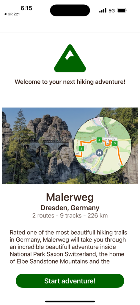
ドイツのマーラーヴェークハイキングアプリのウェルカムスクリーン。景色の良いトレイル写真とデジタルマップのオーバーレイが特徴です。
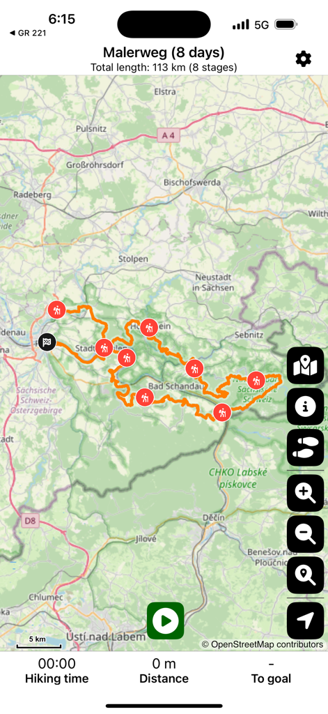
ドイツのマーラーヴェーク8日間のハイキングルートのマップビュー。トレイルマーカー付き。
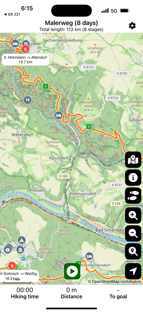
ドイツのマーラーヴェークハイキングトレイルのマップビュー。ステージと地元の施設を表示。
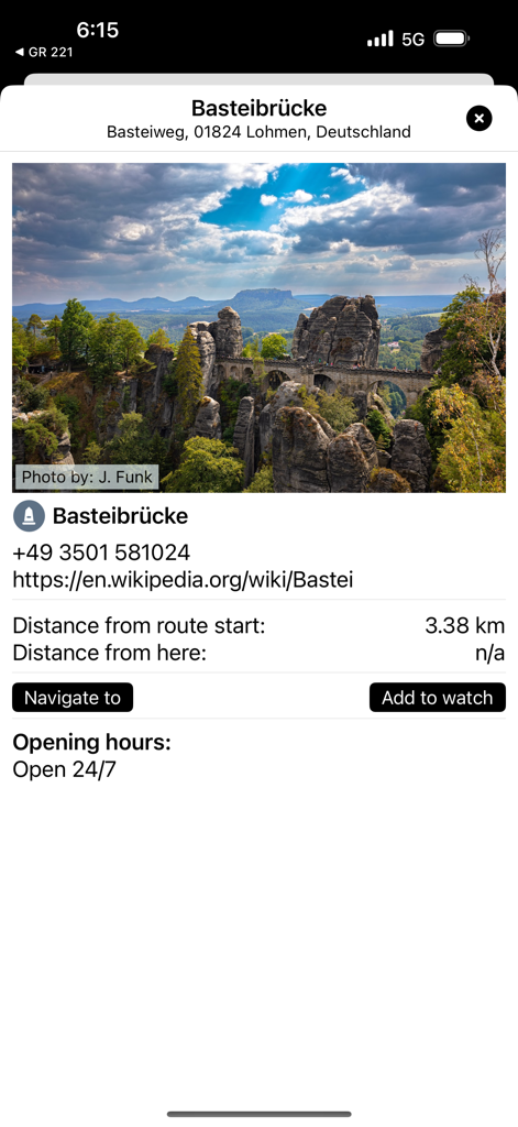
マーラーヴェークハイキングアプリのバステイブリュッケ橋の詳細画面。景色の写真と訪問者情報付き。
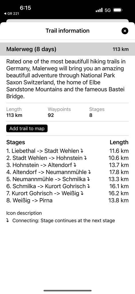
マーラーヴェークアプリが8日間のハイキングトレイル情報とステージリストを表示。
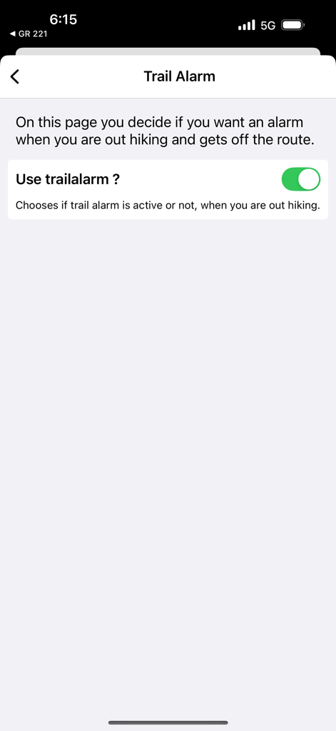
マーラーヴェークハイキングアプリのトレイルアラーム設定画面。トグルスイッチ付き。
説明
Download
類似アプリ
同じカテゴリのトップランクアプリ

Uber - Request a ride
Uber Technologies, Inc.

Airbnb
Airbnb, Inc.

铁路12306
ACADEMY OF RAILWAY SCIENCES CO., ltd.

Booking.com: Hotels & Travel
Booking.com B.V.

Grab: Taxi Ride, Food Delivery
GRABTAXI HOLDINGS PTE. LTD.

Trip.com: Book Flights, Hotels
Trip.com Travel Singapore Pte. Ltd.

DiDi China: Ride Hailing
Didi Chuxing (Beijing) Network Platform Technology Co., Ltd

去哪儿旅行-订酒店机票火车票
Beijing Qunar Information Technology Company Limit

Bolt: Request a Ride
BOLT TECHNOLOGY OU
このページはアプリまたはその開発者の公式ページではなく、情報提供および論評を目的として作成された独立した編集出版物です。明示的に別段の記載がない限り、アプリおよびその開発者は、MWM、Apple、Google Play、アプリのパブリッシャー、またはアプリの開発者と提携、承認、後援、認可、またはその他の公式的な関係はなく、このページのいかなる内容も、アプリがMWMのサービスを使用して開発されたことを意味するものではありません。すべての商標、ロゴ、スクリーンショット、その他のコンテンツはそれぞれの所有者の財産です。