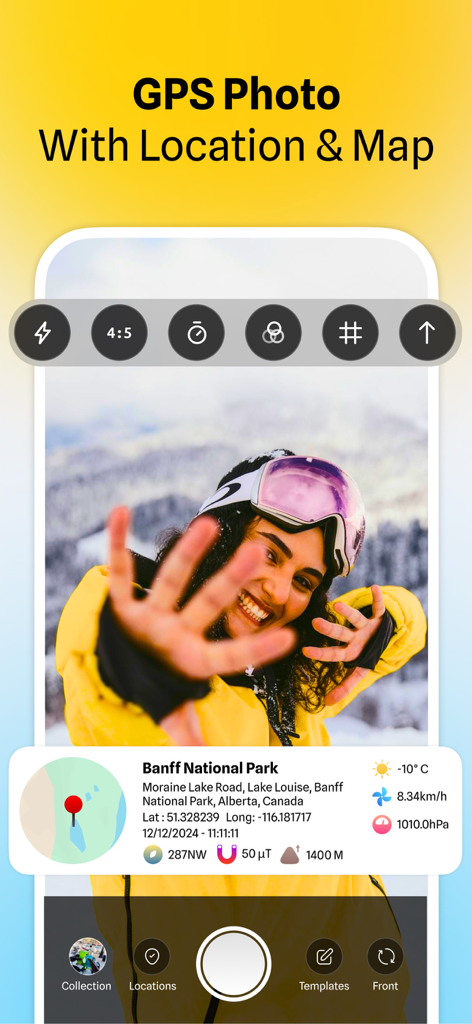
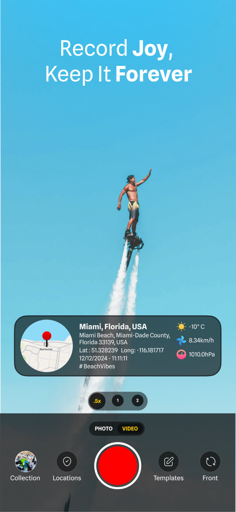
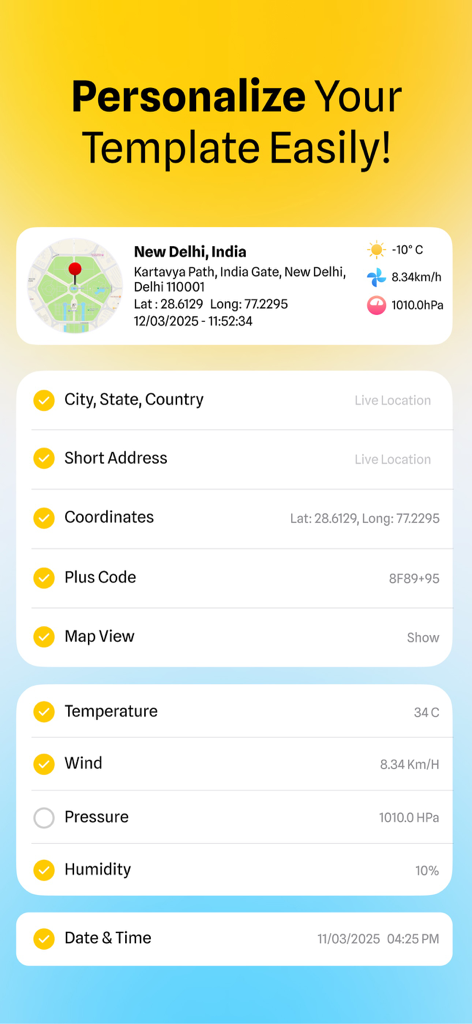
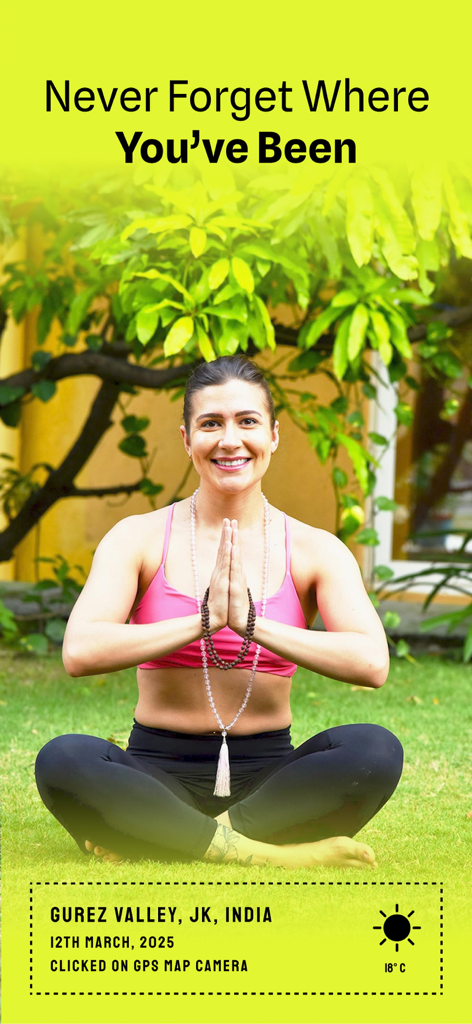
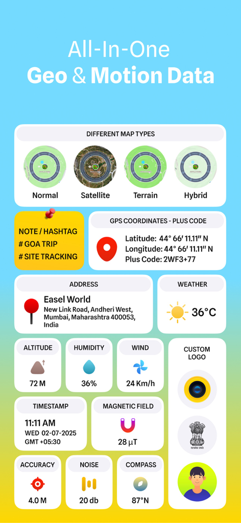
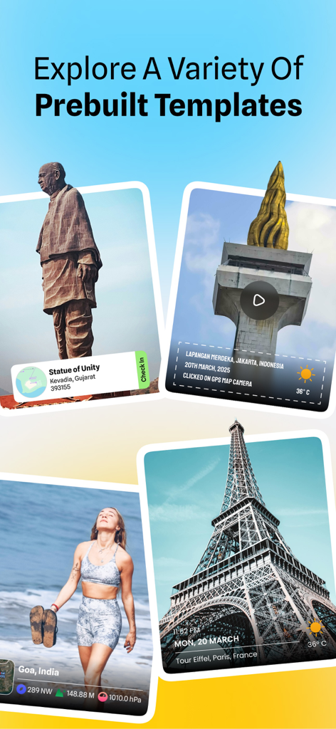
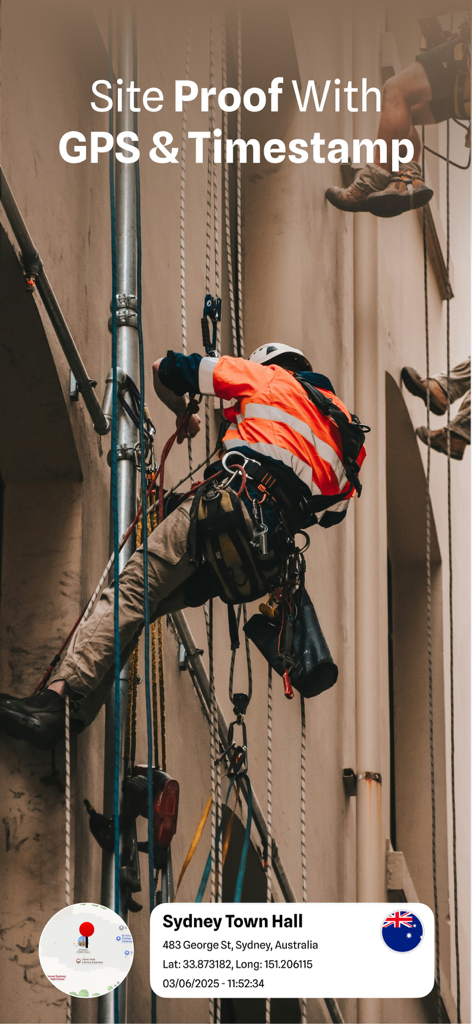
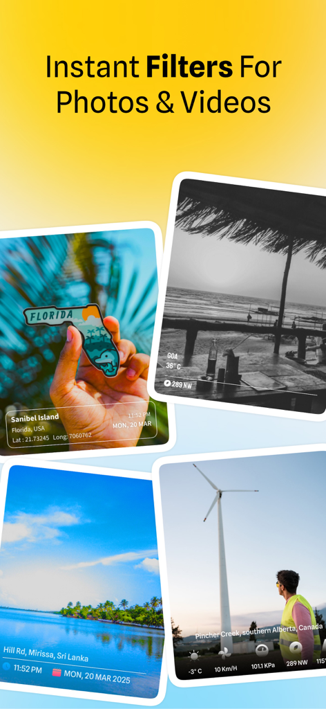
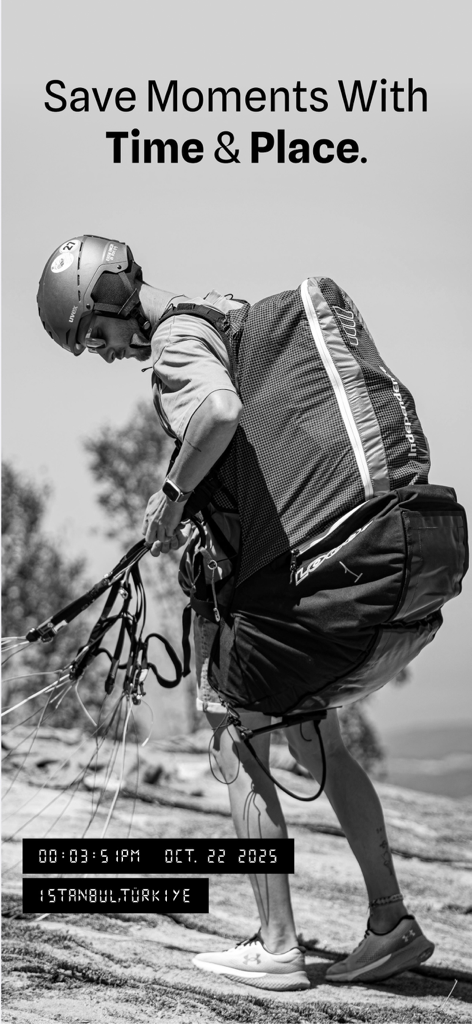
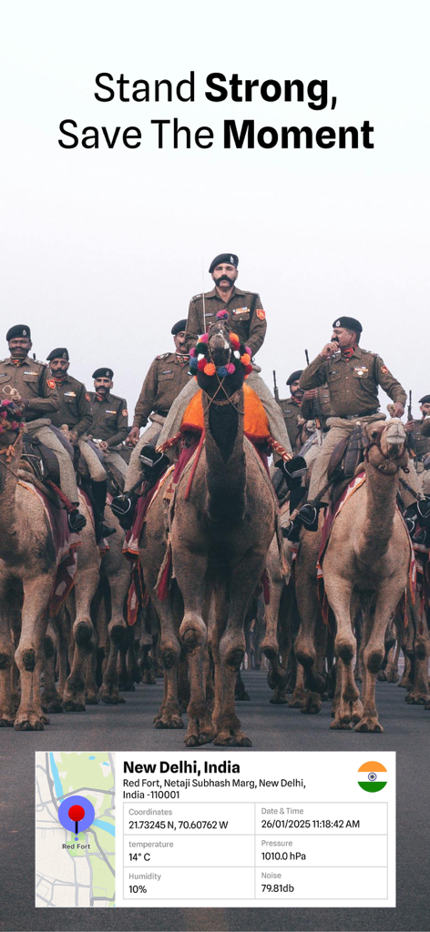
Capture, Tag, and Organize Your Photos with GPS & Timestamps! MapCam - GPS Map Camera is a powerful geotagging photo editor app designed for travelers, professionals, and field workers who need accurate location markers on their images and videos. Whether you're documenting a project, capturing travel memories, or providing proof of area for business, this app allows you to add geolocation coordinates, timestamps, and map details to your pictures with ease. With just one tap, capture shots with latitude, longitude, date, time, and compass direction—plus extra details like altitude, weather, temperature, humidity, and wind speed—to ensure every portrait is accurately marked. Ideal for surveying, real estate, journalism, street documentation, outdoor adventures, and more! Why Use a MapCam? Add GPS Coordinates to Photos: Geotag images and videos with accurate latitude and longitude using your live location or by manually selecting a spot on the built-in map. Add Timestamps and Custom Text: Overlay date, time, and place names on images, or add personalized notes with multiple layout and font options. Map Location Picker: Use an interactive map to pin any area or search by address to assign coordinates to a video or image. GPS Camera with Live Tags: Capture portraits directly within our app with real-time live location marks, dates, and custom tags applied automatically. High-Resolution Output: Maintain original image quality while adding geo mapper tags and timestamps. This app supports high-resolution exports. No Data Collection—100% Privacy: Our app does not collect, upload, or share your data—your photographs stay secure on your device. Advanced Features: - Customizable Stamps—Choose from multiple layouts, fonts, and colors. - Front & Back Camera Support—Capture photographs or videos using either camera with real-time location stamping. - Overlay Metadata Without Changing the Image—Keep your original photo intact while adding place markers and time stamp overlays. - Built-in Gallery & File Browser—Access, edit, and share geotagged photos quickly. How does it work? - Open MapCam and grant location access. - Capture a photo—geolocation coordinates, date, and time will be added automatically. - Customize your stamp layout, font, and marker format. - Save or share your geotagged marked videos & images with just one tap! Who Can Benefit from MapCam? - Tourists & Travelers—Keep a record of trips with location-stamped photos. - Surveyors & Engineers—Document projects with geotagged images. - Real Estate Agents—Capture property listings with verified site details. - Outdoor Enthusiasts—Track hikes, nature photography, and expeditions. - Investigators & Journalists—Save timestamped area-based evidence. - Businesses & Service Providers—Improve locale-based project documentation. - Field Workers & Engineers—Capture on-site progress, inspections, and project conditions with timestamped, geotagged images. - Social Media Creators—Create content enriched with place stamps and custom text, ready for posting. MapCam makes photo documentation simple, accurate, and professional. Whether on an adventure, working in the field, or capturing business records, this app ensures your images are always tagged with the correct GPS location details. Download today and start capturing GPS-stamped photos and videos with precision! Privacy Policy: https://gpsmapcamera.wallzy.app/privacy-policy Terms of use: https://gpsmapcamera.wallzy.app/terms-condition