このページはアプリまたはその開発者の公式ページではなく、情報提供および論評を目的として作成された独立した編集出版物です。明示的に別段の記載がない限り、アプリおよびその開発者は、MWM、Apple、Google Play、アプリのパブリッシャー、またはアプリの開発者と提携、承認、後援、認可、またはその他の公式的な関係はなく、このページのいかなる内容も、アプリがMWMのサービスを使用して開発されたことを意味するものではありません。すべての商標、ロゴ、スクリーンショット、その他のコンテンツはそれぞれの所有者の財産です。

Maryland Roads Traffic
視覚的な確実性と公式のリアルタイムデータで通勤をマスターしましょう。メリーランド州全域のライブ交通カメラと深刻度別レポートに、1回限りの購入でアクセス可能—サブスクリプションは不要です。
ダウンロード
7K+ユーザー評価
評価数
100開発元
カテゴリ
Travel対応言語
1最新バージョン
4.0サイズ
2.9 MBリリース日
2018年1月20日メリーランド州の通勤をマスターする
交通量の予測に頼るのはやめましょう。ライブMDOTカメラとリアルタイムの事故追跡で道路状況を視覚的に確認—すべて1回限りの購入で、サブスクリプションは不要です。
ライブ映像確認
'赤い線'が何を意味するのか推測するのはやめましょう。メリーランド州運輸局のライブカメラにアクセスして、車を出す前に実際の道路密度と気象状況を確認できます。
一目でわかる情報
Todayウィジェットを使用して、スマートフォンのロックを解除せずに近くの事故を即座に確認できます。距離順のアラートで、I-95、I-270、および環状線の遅延に先手を打ちましょう。
以下のスクリーンショットと説明は、アプリの公式ストアリスティングから直接取得されたものであり、アプリ開発者の所有物です。
アプリストア
スクリーンショット
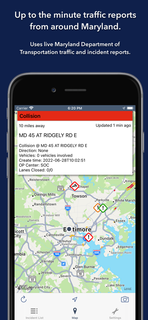
地図上にライブ事故レポートと交通カメラのアイコンを表示するメリーランド道路交通アプリ。
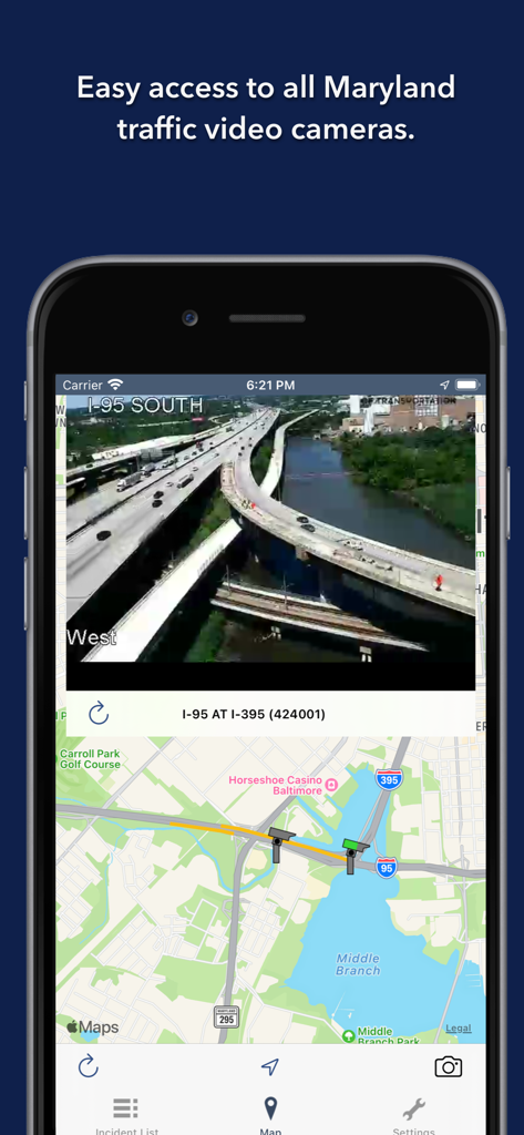
ボルチモアのI-95のライブ交通カメラフィードを表示するメリーランド道路交通アプリのスクリーンショット。
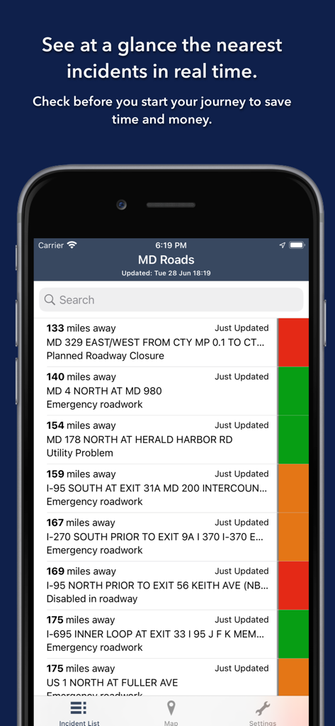
色分けされた深刻度レベルのリアルタイム交通事故リストを表示するメリーランド道路アプリ。
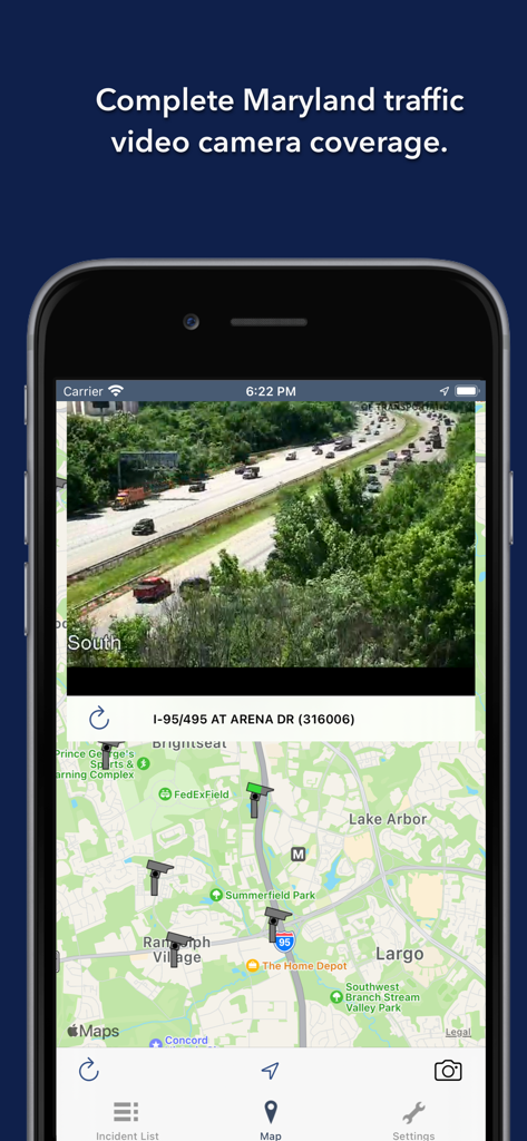
ライブメリーランド交通カメラフィードとマップ表示
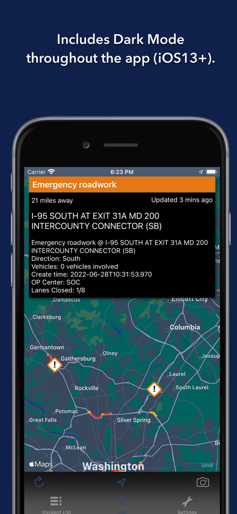
ダークモードでマップと事故の詳細を表示するメリーランド道路交通アプリ。
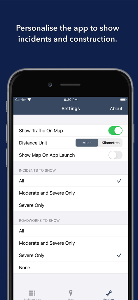
メリーランド州での交通事故と道路工事アラートをパーソナライズするための設定画面。
説明
Download
類似アプリ
同じカテゴリのトップランクアプリ

Uber - Request a ride
Uber Technologies, Inc.

Airbnb
Airbnb, Inc.

铁路12306
ACADEMY OF RAILWAY SCIENCES CO., ltd.

Booking.com: Hotels & Travel
Booking.com B.V.

Grab: Taxi Ride, Food Delivery
GRABTAXI HOLDINGS PTE. LTD.

Trip.com: Book Flights, Hotels
Trip.com Travel Singapore Pte. Ltd.

DiDi China: Ride Hailing
Didi Chuxing (Beijing) Network Platform Technology Co., Ltd

去哪儿旅行-订酒店机票火车票
Beijing Qunar Information Technology Company Limit

Bolt: Request a Ride
BOLT TECHNOLOGY OU
このページはアプリまたはその開発者の公式ページではなく、情報提供および論評を目的として作成された独立した編集出版物です。明示的に別段の記載がない限り、アプリおよびその開発者は、MWM、Apple、Google Play、アプリのパブリッシャー、またはアプリの開発者と提携、承認、後援、認可、またはその他の公式的な関係はなく、このページのいかなる内容も、アプリがMWMのサービスを使用して開発されたことを意味するものではありません。すべての商標、ロゴ、スクリーンショット、その他のコンテンツはそれぞれの所有者の財産です。