このページはアプリまたはその開発者の公式ページではなく、情報提供および論評を目的として作成された独立した編集出版物です。明示的に別段の記載がない限り、アプリおよびその開発者は、MWM、Apple、Google Play、アプリのパブリッシャー、またはアプリの開発者と提携、承認、後援、認可、またはその他の公式的な関係はなく、このページのいかなる内容も、アプリがMWMのサービスを使用して開発されたことを意味するものではありません。すべての商標、ロゴ、スクリーンショット、その他のコンテンツはそれぞれの所有者の財産です。

Moon Phase Photo Maps
理想化された図を、30の月相の実際の高解像度写真に置き換えましょう。鏡像反転マップで望遠鏡の向きと一致させ、ターミネーター沿いの詳細なクレーター、地形、谷を発見しましょう。
ダウンロード
69K+ユーザー評価
評価数
0開発元
カテゴリ
Reference対応言語
1最新バージョン
1.5サイズ
62.5 MBリリース日
2011年1月13日熱心な観測者のための高精度マッピング
望遠鏡および双眼鏡ユーザー専用に設計された技術ツールと高解像度写真で月を体験してください。
実際の月面写真
30枚の実際の月相写真を使用して地形を特定し、様式化された図とは異なる、現実に忠実な参照を提供します。
望遠鏡対応方位設定
画面に表示されるものが接眼レンズと正確に一致するように、望遠鏡の光学系に合わせて視界を即座に反転または鏡像化します。
以下のスクリーンショットと説明は、アプリの公式ストアリスティングから直接取得されたものであり、アプリ開発者の所有物です。
アプリストア
スクリーンショット
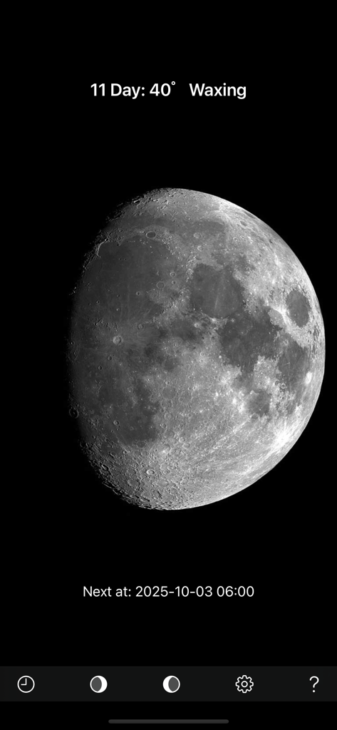
月相フォトマップアプリのスクリーンショット。11日目の月相の実際の写真を表示しています
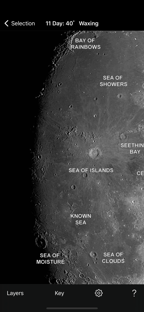
月相フォトマップアプリで、ラベル付きの月の海とクレーターがある月面の詳細な写真
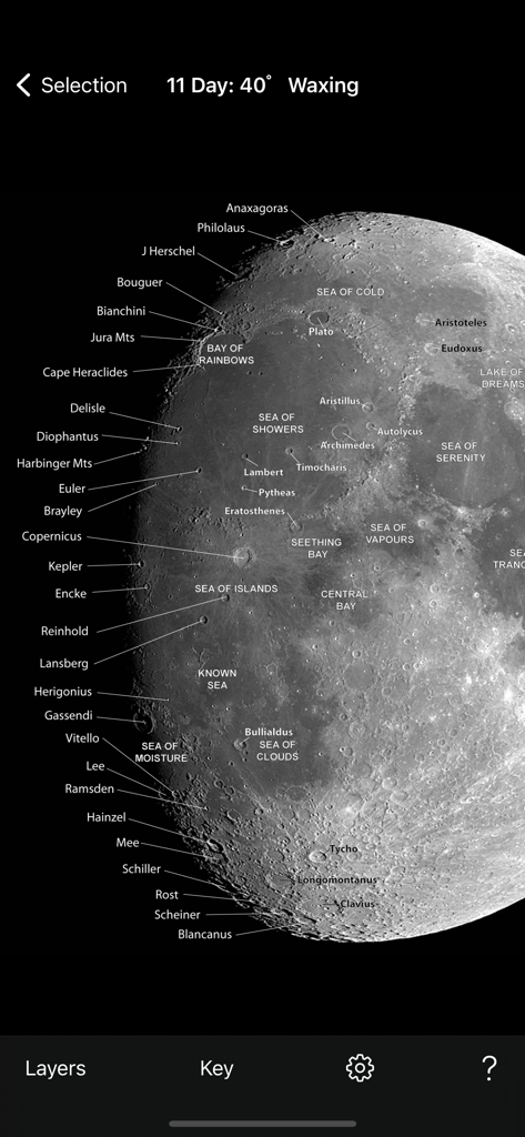
ラベル付きのクレーターと月の海がある、月齢が進む月の詳細な写真マップ
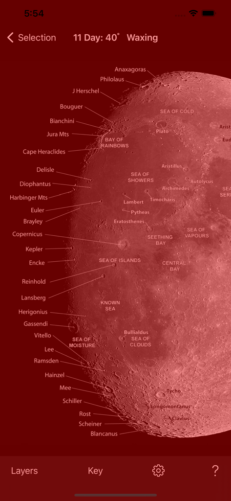
夜間モードでラベル付きのクレーターと地形がある月の写真マップ
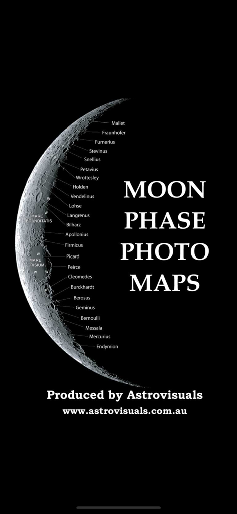
様々な月のクレーターと地形にラベルが付いた三日月写真
説明
Download
類似アプリ
同じカテゴリのトップランクアプリ

Google Translate
Google LLC

火箭沙盒
P2E CO., LTD.

Bible
Life.Church

Youdao Dictionary
Beijing NetEase Youdao Computer System Co.,Ltd

Bible Chat: Daily Devotional
Book Vitals Inc.

Naver Papago - AI Translator
NAVER Corp.

Translate Now - AI Translator
AIR APPS SYSTEMS, UNIPESSOAL, LDA

Lok l0k: Watch Drama TV,Movies
Olivia Harris

Live Translator - AI Translate
DigitalSail (HK) Limited
このページはアプリまたはその開発者の公式ページではなく、情報提供および論評を目的として作成された独立した編集出版物です。明示的に別段の記載がない限り、アプリおよびその開発者は、MWM、Apple、Google Play、アプリのパブリッシャー、またはアプリの開発者と提携、承認、後援、認可、またはその他の公式的な関係はなく、このページのいかなる内容も、アプリがMWMのサービスを使用して開発されたことを意味するものではありません。すべての商標、ロゴ、スクリーンショット、その他のコンテンツはそれぞれの所有者の財産です。