このページはアプリまたはその開発者の公式ページではなく、情報提供および論評を目的として作成された独立した編集出版物です。明示的に別段の記載がない限り、アプリおよびその開発者は、MWM、Apple、Google Play、アプリのパブリッシャー、またはアプリの開発者と提携、承認、後援、認可、またはその他の公式的な関係はなく、このページのいかなる内容も、アプリがMWMのサービスを使用して開発されたことを意味するものではありません。すべての商標、ロゴ、スクリーンショット、その他のコンテンツはそれぞれの所有者の財産です。

My Altimeter GPS Altitude Map
携帯サービスの必要なしに、世界中のどこでも正確な標高、座標、気圧を追跡できます。ピークバガーやアウトドアプロフェッショナル向けに設計されたこのアプリで、リアルタイムデータとGPSスタンプ付き写真で、すべての成果を記録し、大自然をマスターしましょう。
ダウンロード
4K+ユーザー評価
評価数
0開発元
カテゴリ
Navigation対応言語
1最新バージョン
1.0.3サイズ
61.3 MBリリース日
2024年12月22日次の冒険のための精密測定値
インターネット接続なしでもシームレスに機能する、リアルタイムの標高、気圧、位置データであなたの旅を強化しましょう。
信頼性の高いオフライン追跡
携帯サービスが利用できない遠隔地のトレイルに最適な、地球上のどこでも内蔵デバイスセンサーを使用して正確な標高とGPS座標にアクセスできます。
ジオタグ付き頂上証明
ライブ標高、緯度、経度を写真に即座にスタンプします。成果を記録し、高解像度データオーバーレイで正確な位置を共有しましょう。
以下のスクリーンショットと説明は、アプリの公式ストアリスティングから直接取得されたものであり、アプリ開発者の所有物です。
アプリストア
スクリーンショット
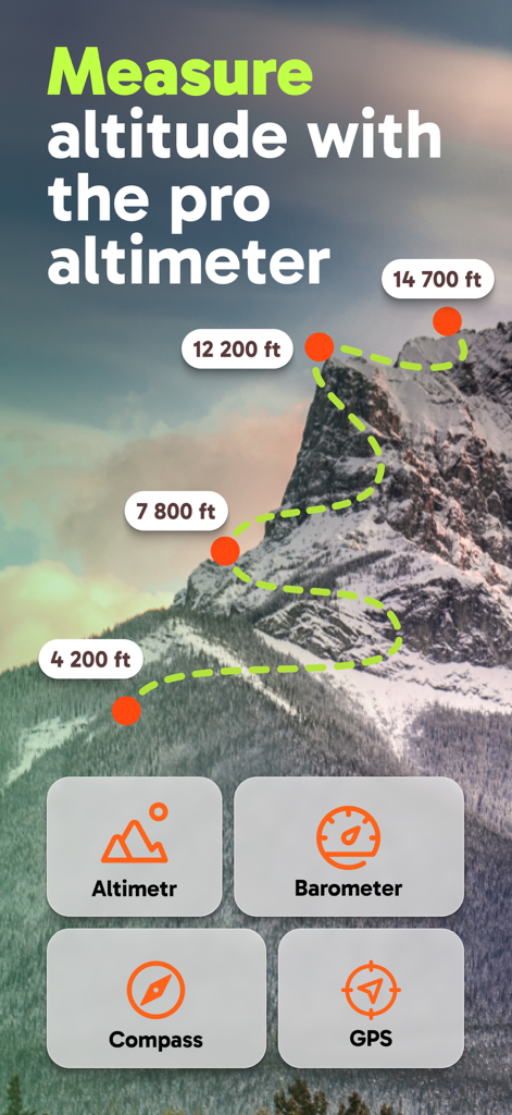
山の標高測定値とナビゲーションツールを表示するMy Altimeterアプリのインターフェース
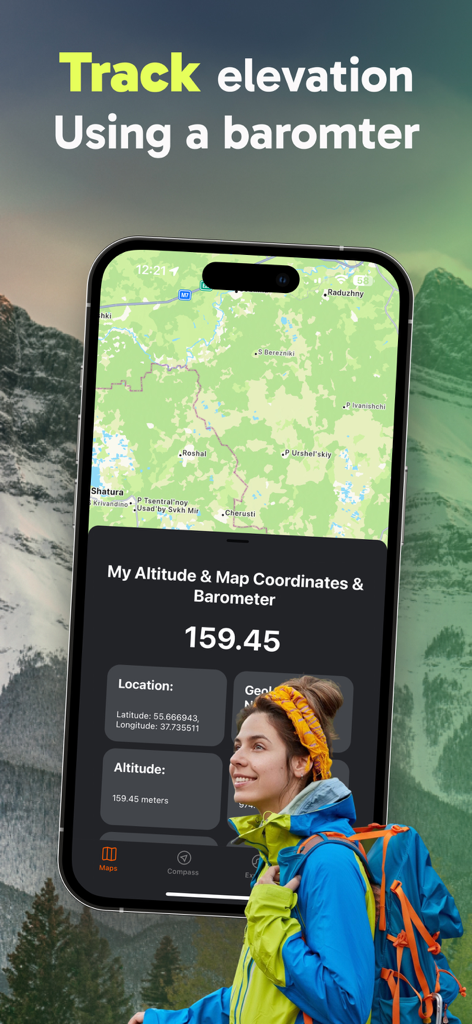
山で標高とGPS座標を追跡するためにMy Altimeterアプリを使用しているハイカー
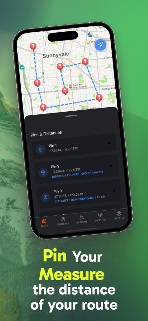
My Altimeterアプリでピンと計算されたルート距離を示すGPSマップインターフェース
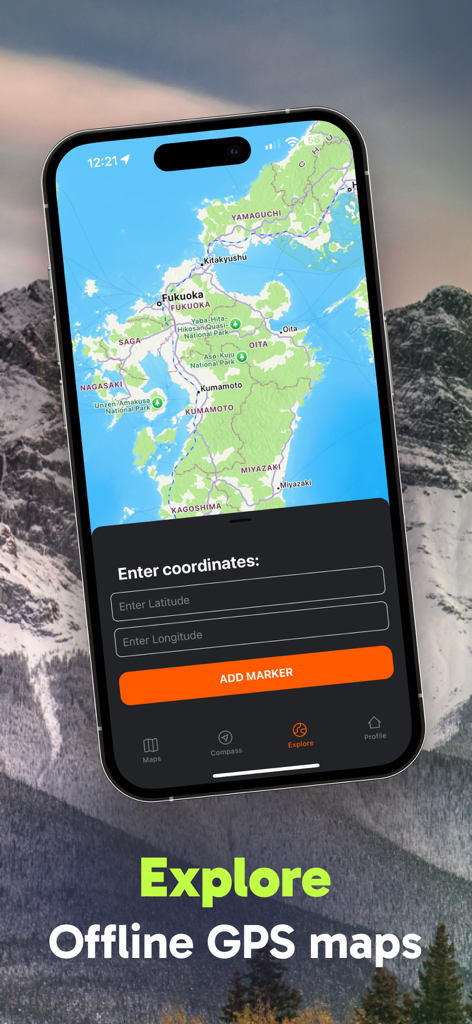
緯度と経度を入力するメニューを備えたオフラインGPSマップを表示するスマートフォン。
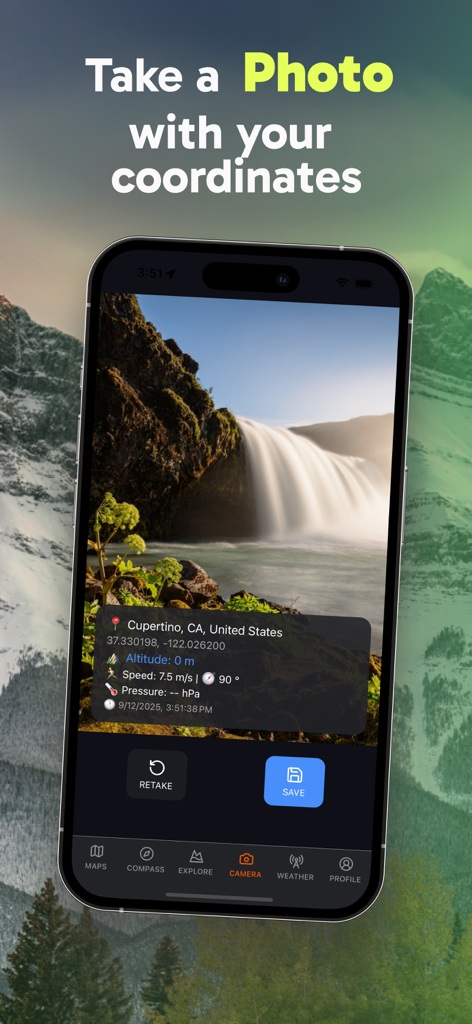
GPS座標、標高、気圧のオーバーレイが付いた滝の写真を表示するiPhone画面
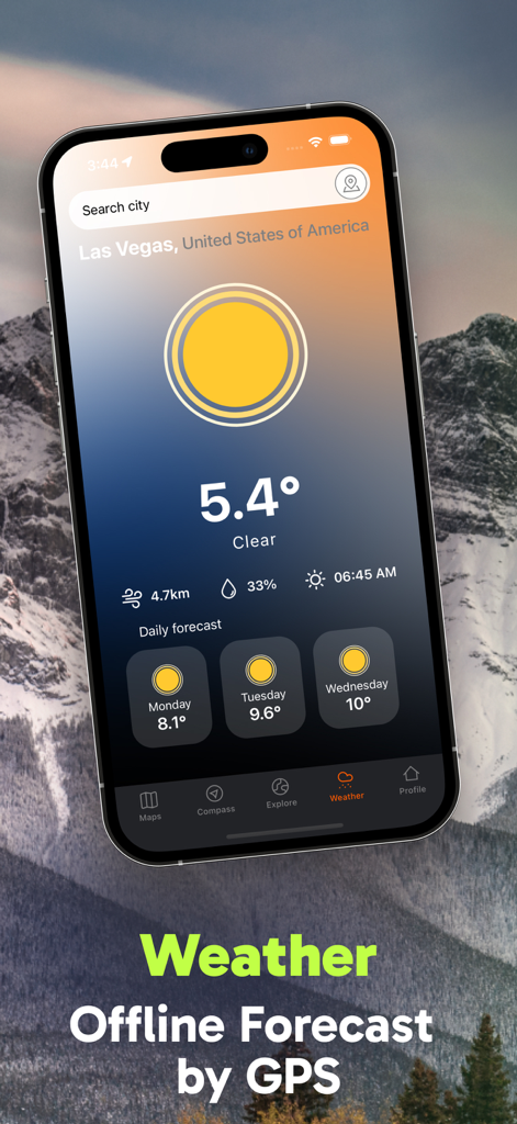
現在の気温と3日間の予報が表示されるMy Altimeterアプリのオフライン天気予報インターフェースを表示するスマートフォンディスプレイ
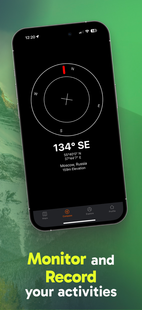
GPS座標と標高データを含むデジタルコンパスを表示するスマートフォン画面
説明
Download
類似アプリ
同じカテゴリのトップランクアプリ

Google Maps
Google LLC

Waze Navigation & Live Traffic
waze

AMap Global
AutoNavi Information Technology Co. Ltd.

百度地图-路线规划,出行必备
Beijing Baidu Netcom Science & Technology Co.,Ltd

Moovit: Bus & Transit Tracker
Moovit App Global LTD

Transit • Subway & Bus Times
9280-0366 Quebec inc.

ParkMobile: Park. Pay. Go.
Parkmobile USA, Inc

腾讯地图-路线规划,导航地铁打车出行
Shenzhen Tencent Computer Systems Company Limited

Île-de-France Mobilités
Ile de France Mobilites
このページはアプリまたはその開発者の公式ページではなく、情報提供および論評を目的として作成された独立した編集出版物です。明示的に別段の記載がない限り、アプリおよびその開発者は、MWM、Apple、Google Play、アプリのパブリッシャー、またはアプリの開発者と提携、承認、後援、認可、またはその他の公式的な関係はなく、このページのいかなる内容も、アプリがMWMのサービスを使用して開発されたことを意味するものではありません。すべての商標、ロゴ、スクリーンショット、その他のコンテンツはそれぞれの所有者の財産です。