このページはアプリまたはその開発者の公式ページではなく、情報提供および論評を目的として作成された独立した編集出版物です。明示的に別段の記載がない限り、アプリおよびその開発者は、MWM、Apple、Google Play、アプリのパブリッシャー、またはアプリの開発者と提携、承認、後援、認可、またはその他の公式的な関係はなく、このページのいかなる内容も、アプリがMWMのサービスを使用して開発されたことを意味するものではありません。すべての商標、ロゴ、スクリーンショット、その他のコンテンツはそれぞれの所有者の財産です。

My Altitude and Elevation GPS
UTM、MGRS、Apple Watch連携機能を使用して、専門家レベルの精度で高度と座標を追跡します。携帯電話のサービスが圏外になる場所でも信頼できるデータが必要なハイカー、専門家、探検家に最適です。
ダウンロード
267K+ユーザー評価
評価数
2K+開発元
カテゴリ
Navigation対応言語
14最新バージョン
6.50サイズ
72.8 MBリリース日
2018年2月15日現代の探検家のための精密ナビゲーション
専門的な土地測量からバックカントリーハイキングまで、高精度の標高データと、険しいアウトドア向けに設計された特殊なGPSツールを使用して、あらゆる地形をマスターしましょう。
超高精度高度追跡
UTMやMGRSなどの専門的な座標フォーマットを使用して、ピークの精度で高度を監視し、あらゆる地形図で常に正確な位置を把握できるようにします。
スマートジオタグ付きドキュメント
GPXおよびKMLデータエクスポートを完全にサポートし、完璧なキャンプ地を偵察したり、専門的な現場サイトを記録したりするために、埋め込み位置データ付きの写真を取得します。
以下のスクリーンショットと説明は、アプリの公式ストアリスティングから直接取得されたものであり、アプリ開発者の所有物です。
アプリストア
スクリーンショット
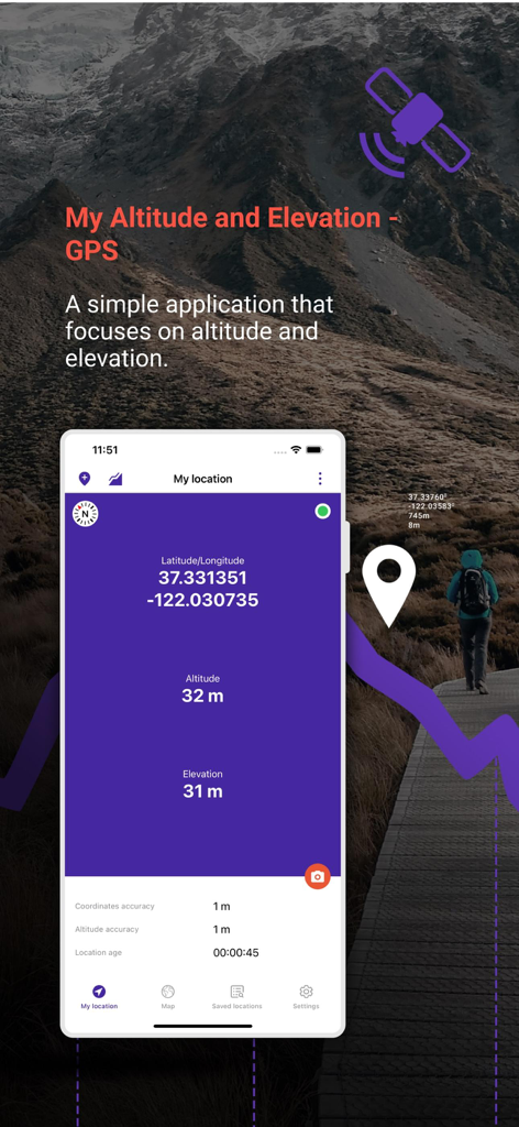
山の風景の上に緯度経度と標高データを示すMy Altitude and Elevation GPSアプリのインターフェース
My Altitude and Elevation GPSアプリのインターフェース、緯度経度と標高座標を表示
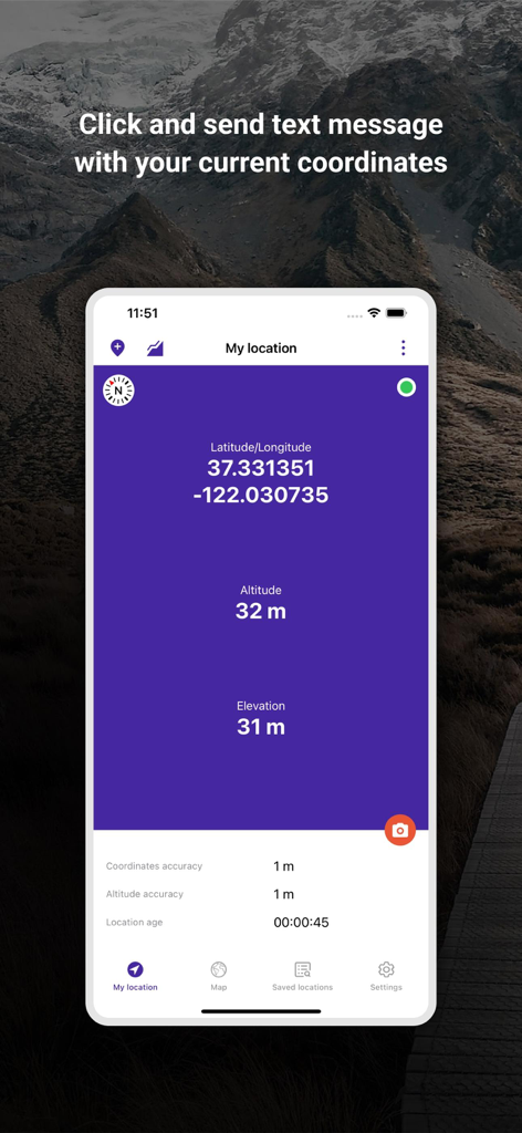
緯度と経度、および位置精度データを示すMy Altitude and Elevation GPSアプリ画面
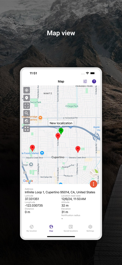
ピンと詳細な位置座標を示すMy Altitude and Elevation GPSアプリのマップビュー
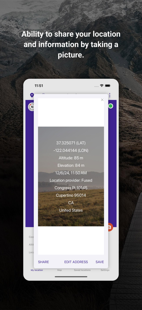
共有用のGPS座標と標高データがオーバーレイされた写真を示すMy Altitudeアプリのスクリーンショット
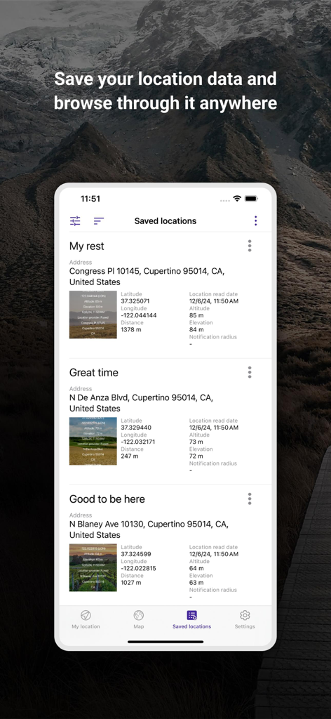
座標と標高データを示すMy Altitude and Elevation GPSアプリの保存済み場所リスト
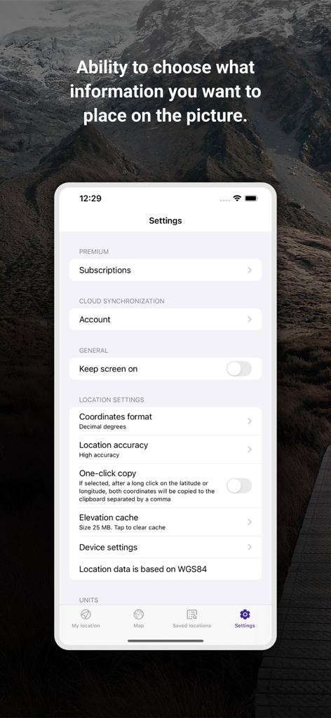
座標フォーマットと位置精度オプションを示すMy Altitude and Elevation GPSアプリの設定画面
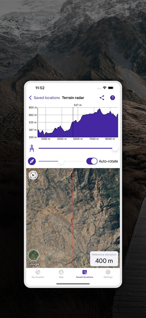
標高プロファイルグラフと衛星マップビューを示す地形レーダー機能
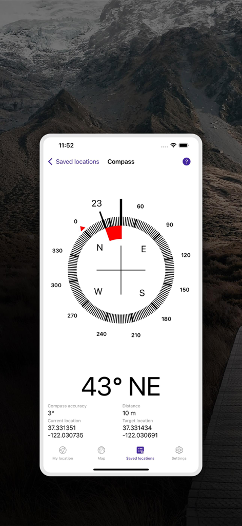
ナビゲーション用の方位とGPS座標を示すデジタルコンパスインターフェース
説明
Download
類似アプリ
同じカテゴリのトップランクアプリ

Google Maps
Google LLC

Waze Navigation & Live Traffic
waze

AMap Global
AutoNavi Information Technology Co. Ltd.

百度地图-路线规划,出行必备
Beijing Baidu Netcom Science & Technology Co.,Ltd

Moovit: Bus & Transit Tracker
Moovit App Global LTD

Transit • Subway & Bus Times
9280-0366 Quebec inc.

ParkMobile: Park. Pay. Go.
Parkmobile USA, Inc

腾讯地图-路线规划,导航地铁打车出行
Shenzhen Tencent Computer Systems Company Limited

Île-de-France Mobilités
Ile de France Mobilites
このページはアプリまたはその開発者の公式ページではなく、情報提供および論評を目的として作成された独立した編集出版物です。明示的に別段の記載がない限り、アプリおよびその開発者は、MWM、Apple、Google Play、アプリのパブリッシャー、またはアプリの開発者と提携、承認、後援、認可、またはその他の公式的な関係はなく、このページのいかなる内容も、アプリがMWMのサービスを使用して開発されたことを意味するものではありません。すべての商標、ロゴ、スクリーンショット、その他のコンテンツはそれぞれの所有者の財産です。