このページはアプリまたはその開発者の公式ページではなく、情報提供および論評を目的として作成された独立した編集出版物です。明示的に別段の記載がない限り、アプリおよびその開発者は、MWM、Apple、Google Play、アプリのパブリッシャー、またはアプリの開発者と提携、承認、後援、認可、またはその他の公式的な関係はなく、このページのいかなる内容も、アプリがMWMのサービスを使用して開発されたことを意味するものではありません。すべての商標、ロゴ、スクリーンショット、その他のコンテンツはそれぞれの所有者の財産です。

National Parks Pocket Maps
電波がなくても公式マップ、11,400以上のトレイル、7,300以上のキャンプ場にアクセス。自信を持って冒険を計画し、ハイキングを追跡し、大自然を探索しましょう。
ダウンロード
72K+ユーザー評価
評価数
2K+開発元
カテゴリ
Travel対応言語
29最新バージョン
7.6サイズ
92.8 MBリリース日
2017年9月25日あらゆる国立公園の冒険をマスターする
500以上の場所の公式NPSマップ、トレイルガイド、キャンプ場データにアクセス。完全にオフラインの状態でも完璧に機能するように設計されています。
信頼できるオフラインナビゲーション
出発前に425以上の公式NPSマップとガイドをダウンロード。電波が届かない奥地でも、電波を失う心配なく探索できます。
11,400以上のトレイルを発見
詳細なトレイルマップで完璧なハイキングを見つけ、7,300以上のキャンプ場のいずれかで休憩しましょう。アメリカ全土の70,000以上の観光地を探索。
以下のスクリーンショットと説明は、アプリの公式ストアリスティングから直接取得されたものであり、アプリ開発者の所有物です。
アプリストア
スクリーンショット
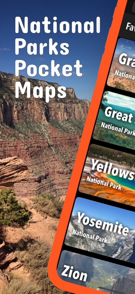
イエローストーン、ヨセミテ、ザイオンなどの国立公園のリストと渓谷の背景を表示する国立公園ポケットマップアプリのスクリーンショット。
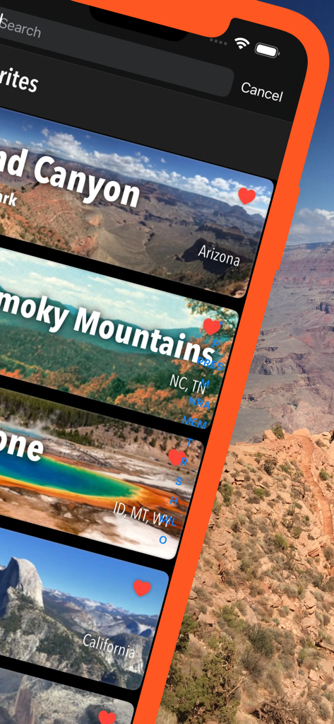
ポケットマップアプリ内でグランドキャニオンとヨセミテを表示しているお気に入りのアメリカ国立公園のリスト
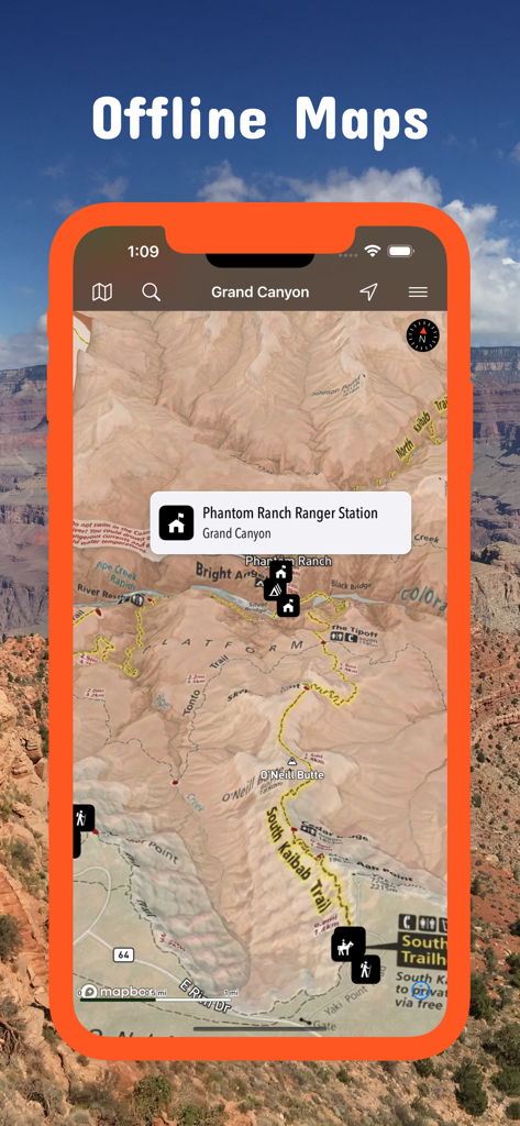
グランドキャニオンの詳細なオフライン地形図を表示する国立公園ポケットマップアプリのスクリーンショット
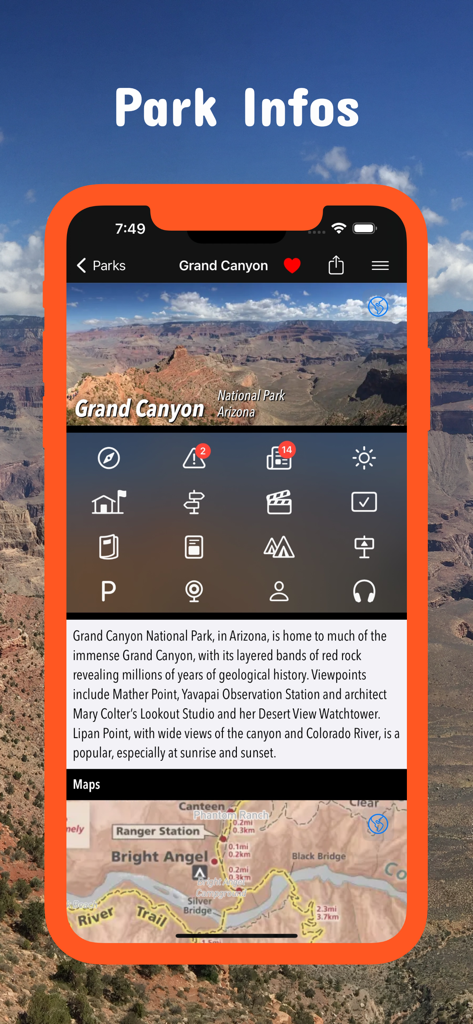
グランドキャニオン国立公園の情報とマップを表示する国立公園ポケットマップアプリ
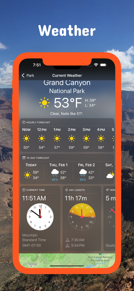
国立公園ポケットマップアプリでグランドキャニオン国立公園の天気予報を表示
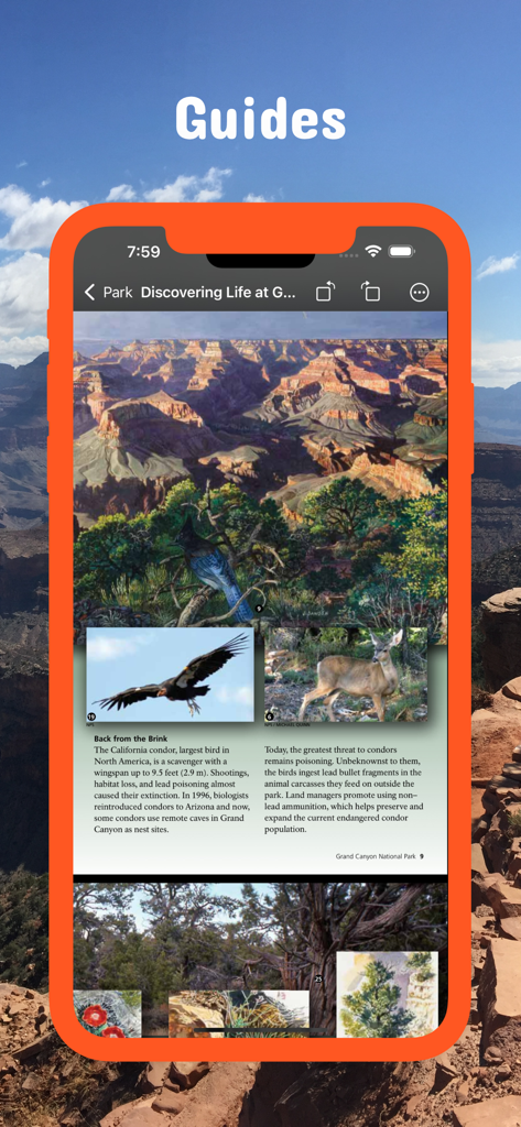
野生生物の写真と教育的なテキストを含むグランドキャニオンの公式国立公園局ガイドを表示するスマートフォン画面
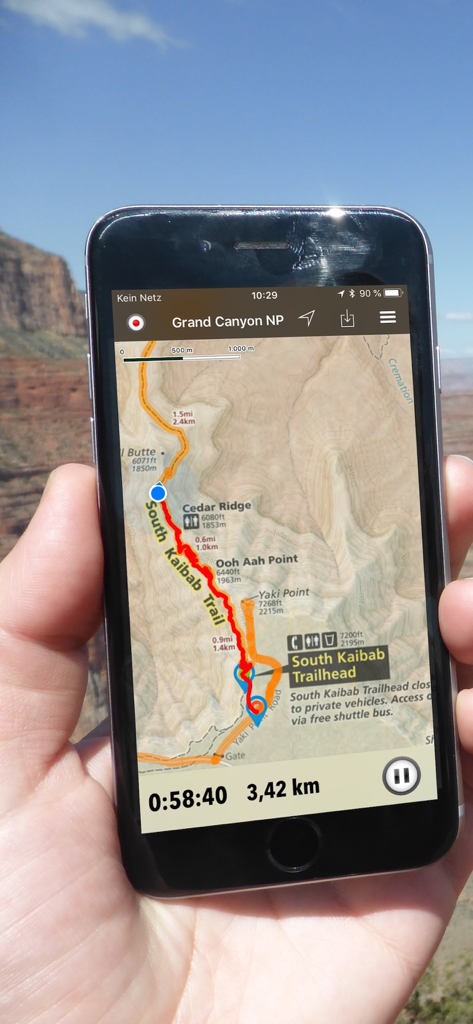
グランドキャニオン国立公園のサウスカイバブトレイルのオフラインマップとGPSトラックを表示するスマートフォン
説明
Download
類似アプリ
同じカテゴリのトップランクアプリ

Uber - Request a ride
Uber Technologies, Inc.

Airbnb
Airbnb, Inc.

铁路12306
ACADEMY OF RAILWAY SCIENCES CO., ltd.

Booking.com: Hotels & Travel
Booking.com B.V.

Grab: Taxi Ride, Food Delivery
GRABTAXI HOLDINGS PTE. LTD.

Trip.com: Book Flights, Hotels
Trip.com Travel Singapore Pte. Ltd.

DiDi China: Ride Hailing
Didi Chuxing (Beijing) Network Platform Technology Co., Ltd

去哪儿旅行-订酒店机票火车票
Beijing Qunar Information Technology Company Limit

Bolt: Request a Ride
BOLT TECHNOLOGY OU
このページはアプリまたはその開発者の公式ページではなく、情報提供および論評を目的として作成された独立した編集出版物です。明示的に別段の記載がない限り、アプリおよびその開発者は、MWM、Apple、Google Play、アプリのパブリッシャー、またはアプリの開発者と提携、承認、後援、認可、またはその他の公式的な関係はなく、このページのいかなる内容も、アプリがMWMのサービスを使用して開発されたことを意味するものではありません。すべての商標、ロゴ、スクリーンショット、その他のコンテンツはそれぞれの所有者の財産です。