このページはアプリまたはその開発者の公式ページではなく、情報提供および論評を目的として作成された独立した編集出版物です。明示的に別段の記載がない限り、アプリおよびその開発者は、MWM、Apple、Google Play、アプリのパブリッシャー、またはアプリの開発者と提携、承認、後援、認可、またはその他の公式的な関係はなく、このページのいかなる内容も、アプリがMWMのサービスを使用して開発されたことを意味するものではありません。すべての商標、ロゴ、スクリーンショット、その他のコンテンツはそれぞれの所有者の財産です。

Northumberland Maps Offline
ハドリアヌスの長城や国立公園のトレッキングに欠かせないコンパニオン。プロ仕様の Ordnance Survey マップで荒野をナビゲート — セルラー信号やローミングデータは不要です。
ダウンロード
8K+ユーザー評価
評価数
0開発元
カテゴリ
Navigation対応言語
1最新バージョン
2.1.1サイズ
612.2 MBリリース日
2015年5月9日プロのようにナビゲート
高い検索意図を持つ探検家のためにカスタマイズされた、プロ仕様の Ordnance Survey マッピング。世界で最も詳細なオフライン地図で、ハドリアヌスの長城とノースアンブリアの荒野を発見しましょう。
信号ゼロ? 問題ありません。
国際ローミング料金をなくし、遠隔地の「デッドゾーン」でも安全を確保しましょう。高解像度マップは完全にデバイスに保存されるため、オフラインでの独立性を完全に確保できます。
Ordnance Survey の精度
英国の地図作成のゴールドスタンダードを体験してください。プロ仕様の 1:25,000 Explorer スケールで、複雑な等高線、特定の小道、歴史的ランドマークを表示します。
以下のスクリーンショットと説明は、アプリの公式ストアリスティングから直接取得されたものであり、アプリ開発者の所有物です。
アプリストア
スクリーンショット
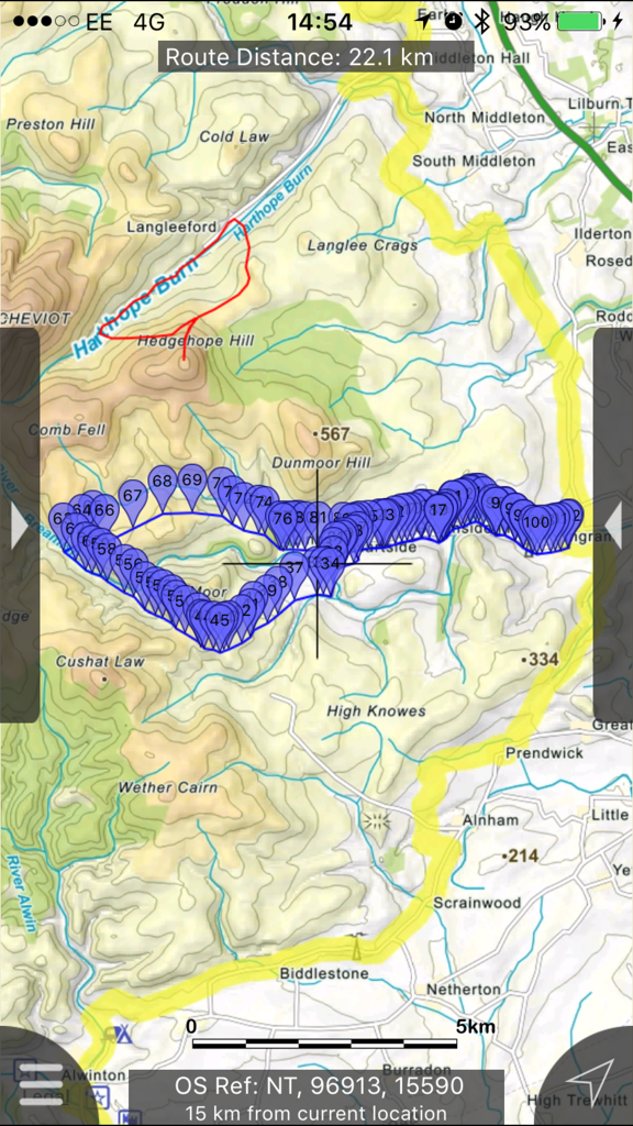
ノースアンバーランドでの詳細な地形ハイクマップ、追跡されたルートとウェイポイント付き
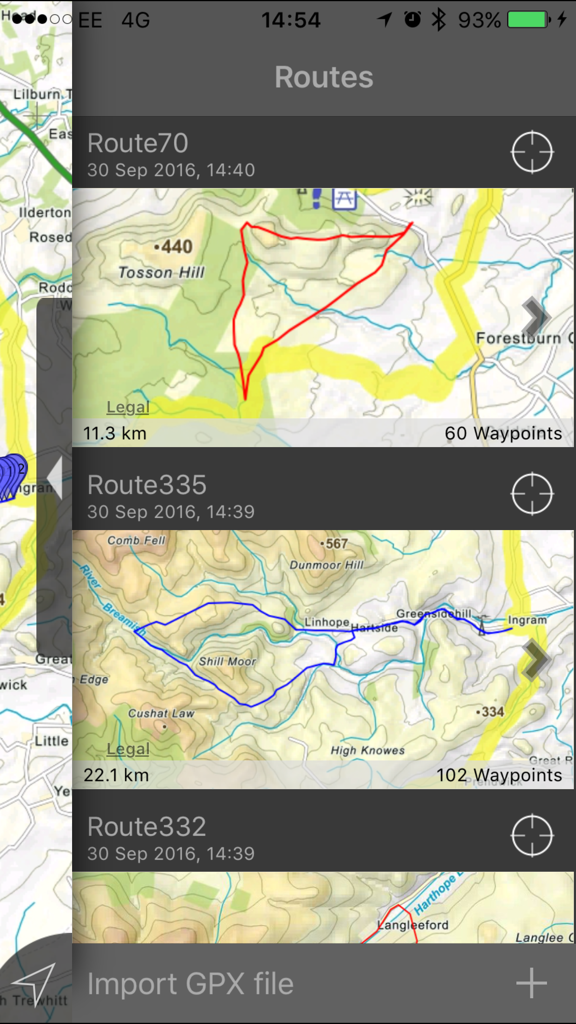
Northumberland Maps Offline アプリに保存されたハイキングルートのリスト、距離と地形図が表示される
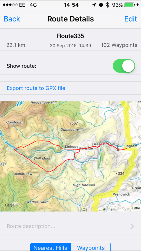
Northumberland Maps アプリ内の地形図の詳細なハイキングルート
ノースアンバーランドの丘のオフライン地形図検索インターフェース
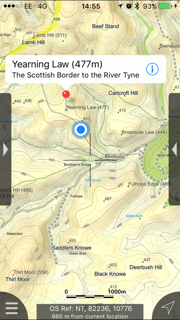
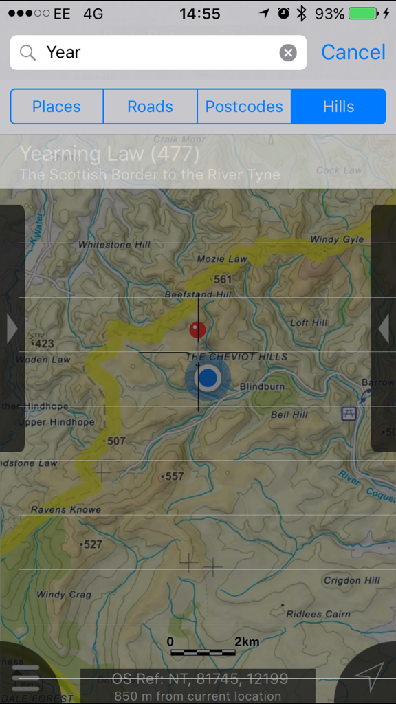
Yearning Law を示すノースアンバーランドの地形図、等高線とハイキングコースが表示される
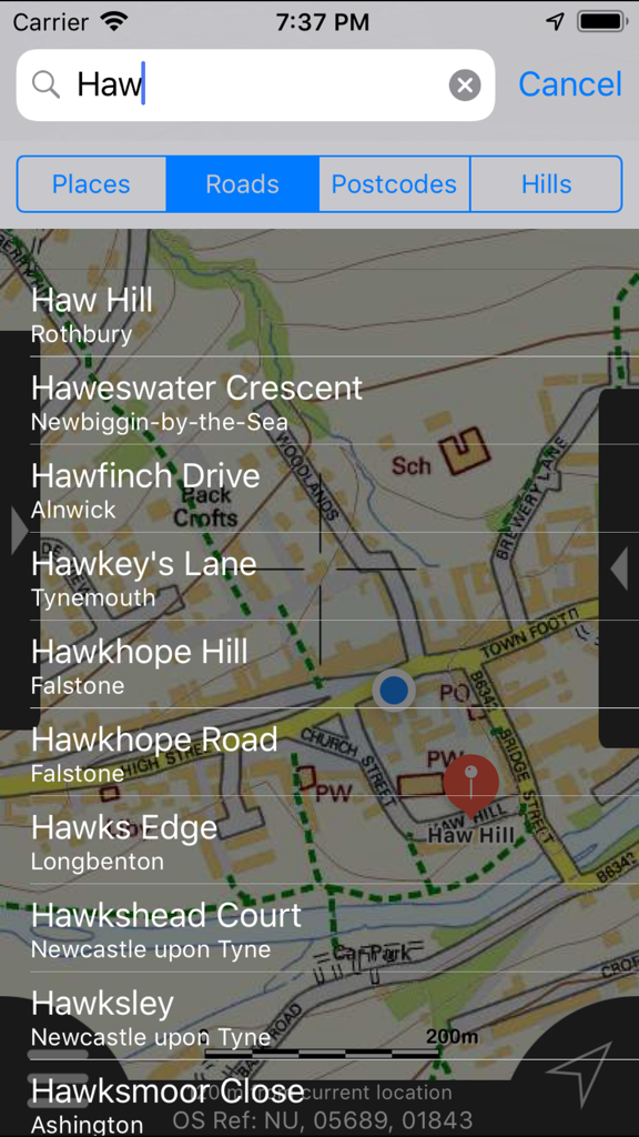
Northumberland Maps アプリの道路と丘のオフライン検索結果
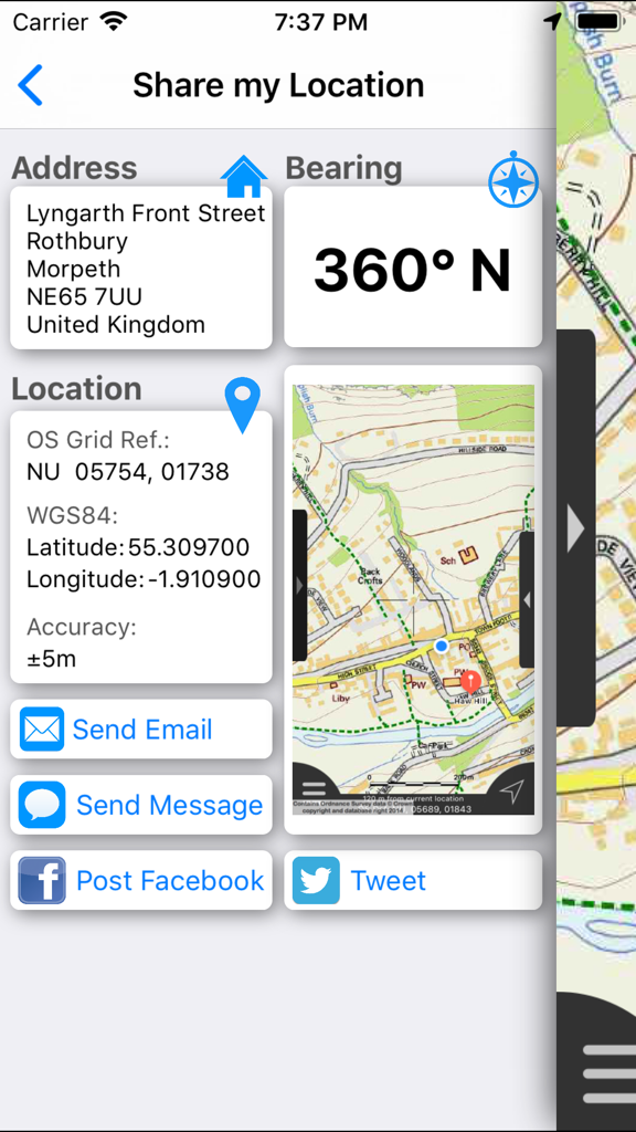
住所、GPS座標、地図ビューが表示される現在地共有インターフェース。
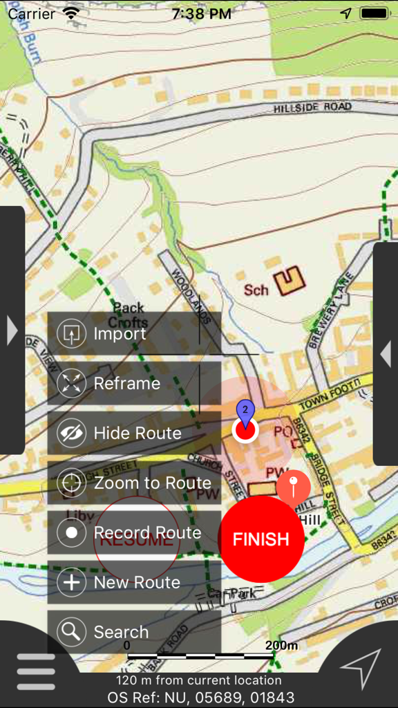
Northumberland Maps Offline アプリのインターフェース、詳細な地図とルート管理メニューが表示される
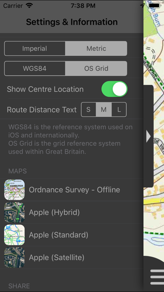
Northumberland Maps Offline アプリの設定と情報画面、単位と座標系のオプションが表示される
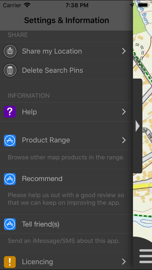
Northumberland Maps Offline アプリの設定と情報メニュー画面、さまざまなナビゲーションと共有オプションが表示される。
説明
Download
類似アプリ
同じカテゴリのトップランクアプリ

Google Maps
Google LLC

Waze Navigation & Live Traffic
waze

AMap Global
AutoNavi Information Technology Co. Ltd.

百度地图-路线规划,出行必备
Beijing Baidu Netcom Science & Technology Co.,Ltd

Moovit: Bus & Transit Tracker
Moovit App Global LTD

Transit • Subway & Bus Times
9280-0366 Quebec inc.

ParkMobile: Park. Pay. Go.
Parkmobile USA, Inc

腾讯地图-路线规划,导航地铁打车出行
Shenzhen Tencent Computer Systems Company Limited

Île-de-France Mobilités
Ile de France Mobilites
このページはアプリまたはその開発者の公式ページではなく、情報提供および論評を目的として作成された独立した編集出版物です。明示的に別段の記載がない限り、アプリおよびその開発者は、MWM、Apple、Google Play、アプリのパブリッシャー、またはアプリの開発者と提携、承認、後援、認可、またはその他の公式的な関係はなく、このページのいかなる内容も、アプリがMWMのサービスを使用して開発されたことを意味するものではありません。すべての商標、ロゴ、スクリーンショット、その他のコンテンツはそれぞれの所有者の財産です。