このページはアプリまたはその開発者の公式ページではなく、情報提供および論評を目的として作成された独立した編集出版物です。明示的に別段の記載がない限り、アプリおよびその開発者は、MWM、Apple、Google Play、アプリのパブリッシャー、またはアプリの開発者と提携、承認、後援、認可、またはその他の公式的な関係はなく、このページのいかなる内容も、アプリがMWMのサービスを使用して開発されたことを意味するものではありません。すべての商標、ロゴ、スクリーンショット、その他のコンテンツはそれぞれの所有者の財産です。

Offline Maps: GPS Tracker GPX
無制限のオフラインマップと正確なGPXトラッキングでバックカントリーをマスターしましょう。技術的な信頼性、広告なし、プライバシーを重視する真剣な探検家のために設計されています。
ダウンロード
64K+ユーザー評価
評価数
200開発元
カテゴリ
Navigation対応言語
16最新バージョン
3.4.0サイズ
24.8 MBリリース日
2021年1月24日オフグリッド探検家のために設計
無制限のオフラインマップ、プログレードのGPXトラッキング、高度な技術データで、野外での真の自律性を体験してください。すべてサブスクリプションや隠れた費用なしで。
無制限のオフライン信頼性
通信サービスやデータが存在しないバックカントリーの「デッドゾーン」でも、自信を持ってナビゲートできます。地域全体を無制限にオフラインで使用できるようにダウンロードしてください。
サブスクリプションフリーの自由
サブスクリプション疲れから解放されましょう。バックグラウンドトラッキング、ウェイポイント、エクスポートへのフルアクセスを、広告、アプリ内購入、月額料金なしで入手できます。
以下のスクリーンショットと説明は、アプリの公式ストアリスティングから直接取得されたものであり、アプリ開発者の所有物です。
アプリストア
スクリーンショット
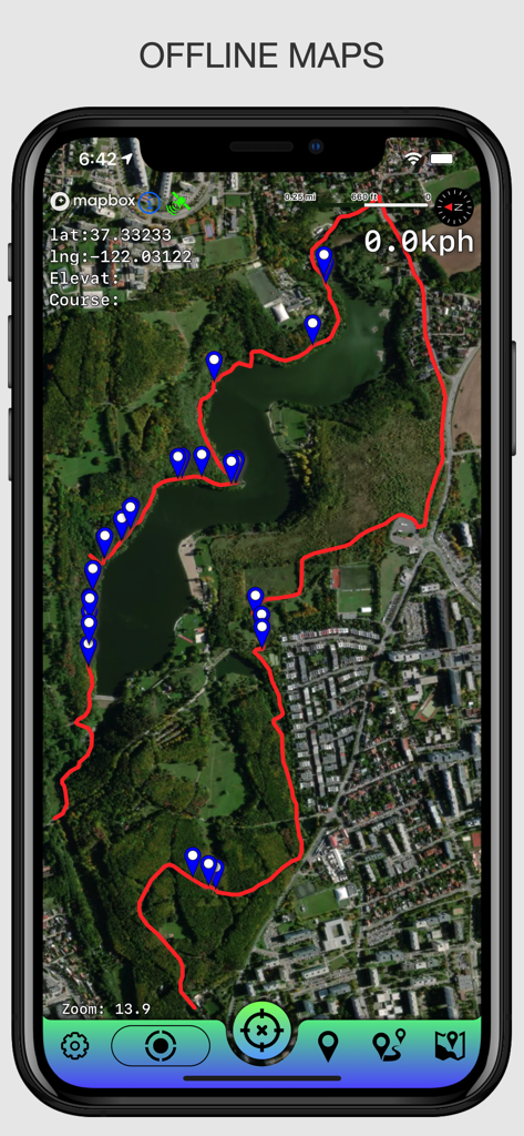
オフラインマップGPSトラッカーアプリで記録されたGPXトラックとウェイポイントを示す衛星マップビュー
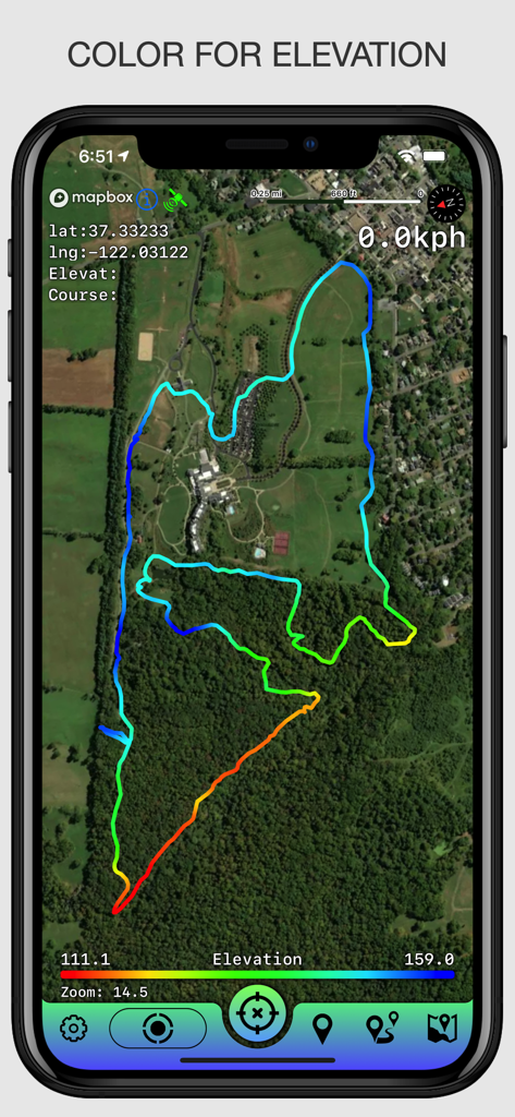
衛星マップ上にカラースケールされたトラックを示すGPXトラッカーアプリ
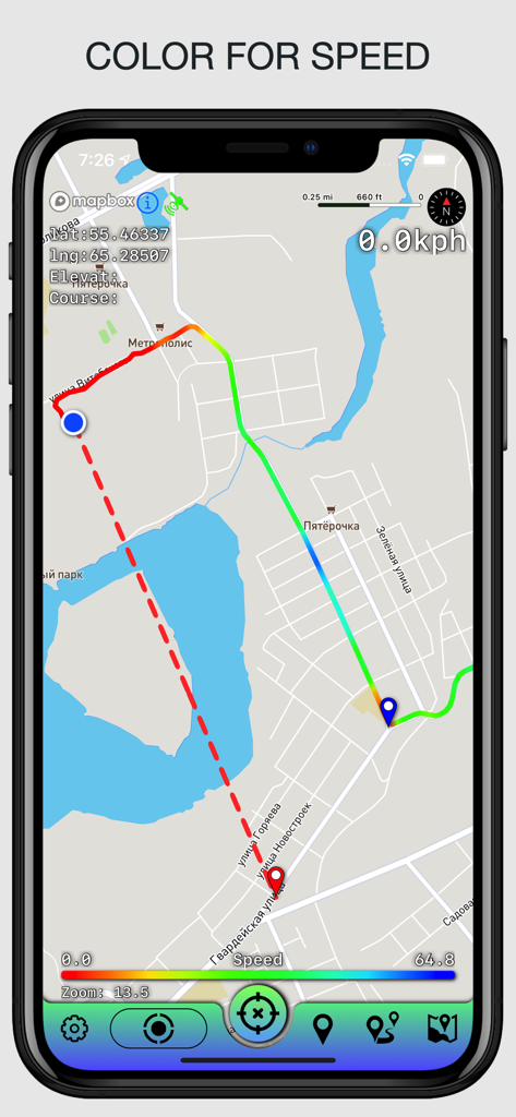
異なる移動速度を表すカラースケールされた勾配を持つマップ上にGPXトラックを表示するモバイルアプリインターフェース
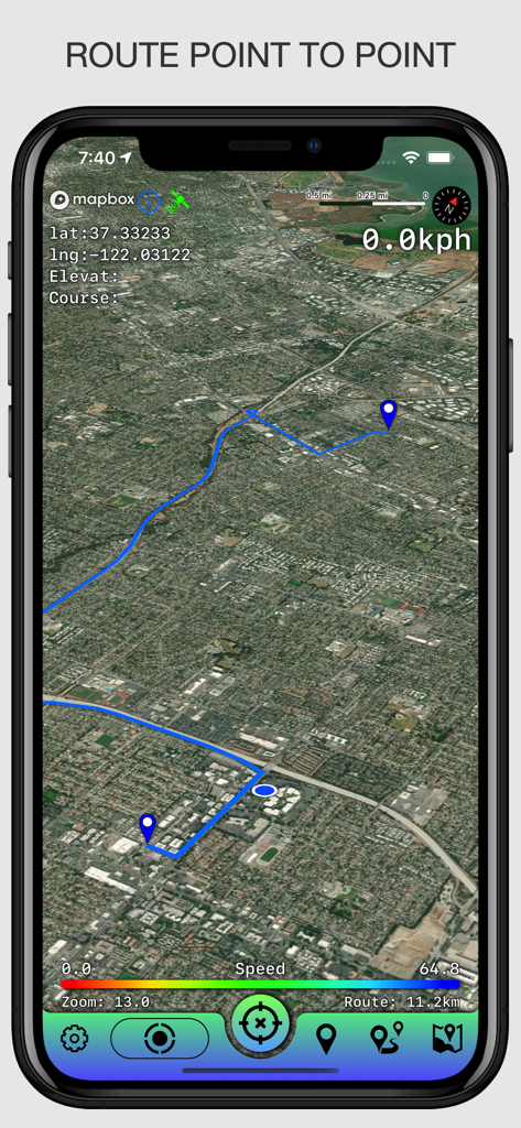
GPS座標と速度データを持つ2点間の青いルート線を示す衛星マップビュー
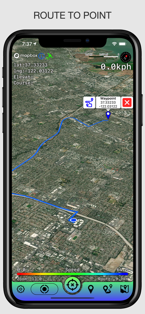
座標を持つ特定のウェイポイントへのナビゲーションルートを示す衛星マップビュー
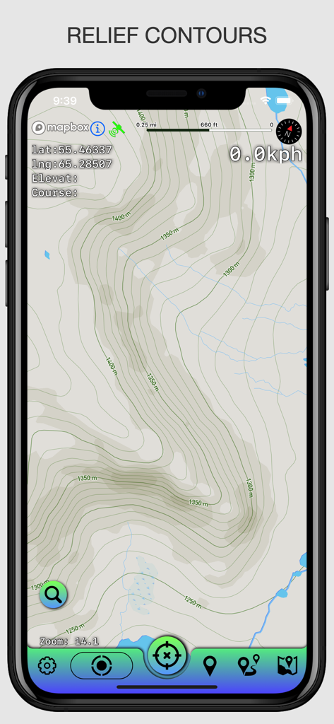
スマートフォン上のGPS座標と地形図表示
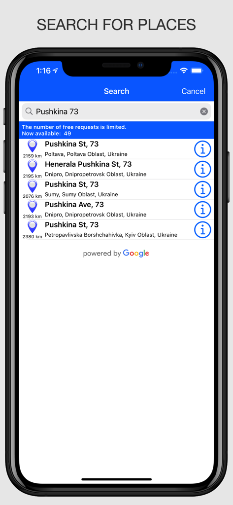
オフラインマップアプリでの場所検索機能を示すモバイルインターフェース
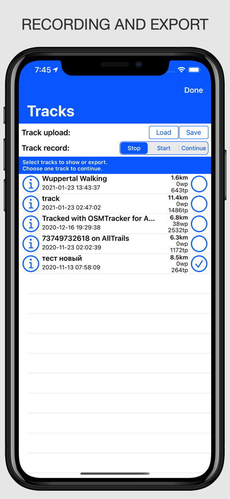
オフラインマップアプリでGPXファイルの開始、停止、エクスポートオプションを含む記録されたGPXトラックのリストを示すインターフェース
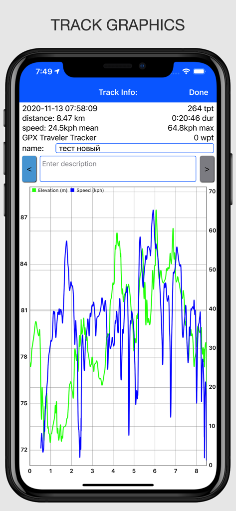
距離に対する速度と高度のトラックグラフィックを示すGPSトラッカーアプリ
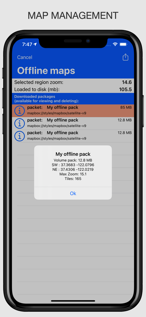
アプリでのダウンロードされたオフラインマップパッケージの管理と技術詳細を示すインターフェース
説明
Download
類似アプリ
同じカテゴリのトップランクアプリ

Google Maps
Google LLC

Waze Navigation & Live Traffic
waze

AMap Global
AutoNavi Information Technology Co. Ltd.

百度地图-路线规划,出行必备
Beijing Baidu Netcom Science & Technology Co.,Ltd

Moovit: Bus & Transit Tracker
Moovit App Global LTD

Transit • Subway & Bus Times
9280-0366 Quebec inc.

ParkMobile: Park. Pay. Go.
Parkmobile USA, Inc

腾讯地图-路线规划,导航地铁打车出行
Shenzhen Tencent Computer Systems Company Limited

Île-de-France Mobilités
Ile de France Mobilites
このページはアプリまたはその開発者の公式ページではなく、情報提供および論評を目的として作成された独立した編集出版物です。明示的に別段の記載がない限り、アプリおよびその開発者は、MWM、Apple、Google Play、アプリのパブリッシャー、またはアプリの開発者と提携、承認、後援、認可、またはその他の公式的な関係はなく、このページのいかなる内容も、アプリがMWMのサービスを使用して開発されたことを意味するものではありません。すべての商標、ロゴ、スクリーンショット、その他のコンテンツはそれぞれの所有者の財産です。