このページはアプリまたはその開発者の公式ページではなく、情報提供および論評を目的として作成された独立した編集出版物です。明示的に別段の記載がない限り、アプリおよびその開発者は、MWM、Apple、Google Play、アプリのパブリッシャー、またはアプリの開発者と提携、承認、後援、認可、またはその他の公式的な関係はなく、このページのいかなる内容も、アプリがMWMのサービスを使用して開発されたことを意味するものではありません。すべての商標、ロゴ、スクリーンショット、その他のコンテンツはそれぞれの所有者の財産です。

OilTrails
エネルギー専門家のための究極のリースロケーター。APIや法的記述による検索、遠隔地のリース道路用のオフラインGPSへのアクセス、泥を避けスケジュールを守るための過去の降水量チェックが可能です。
ダウンロード
41K+ユーザー評価
評価数
300開発元
カテゴリ
Navigation対応言語
1最新バージョン
2.3.027サイズ
118.2 MBリリース日
2016年9月15日油田のプロフェッショナルのための精密ツール
エネルギー部門向けに設計され、現場で実証済みの単一インターフェースから、リース道路の「ラストワンマイル」をナビゲートし、重要な坑井データにアクセスし、現場の状況を監視します。
オフライン対応のサイトナビゲーション
深いデッドゾーンでも機能し続けるターンバイターン方式のGPSを使用して、圏外の遠隔地にあるリース道路をナビゲートします。
APIまたは法的土地表記による検索
場所の推測はやめましょう。13州にわたるAPI番号、オペレーター名、または法的な土地表記を入力して、次の現場を即座に見つけます。
以下のスクリーンショットと説明は、アプリの公式ストアリスティングから直接取得されたものであり、アプリ開発者の所有物です。
アプリストア
スクリーンショット
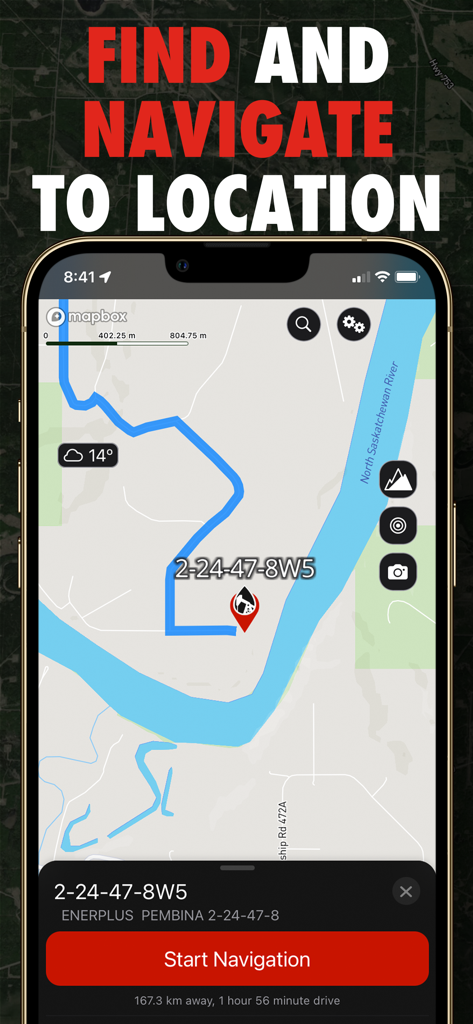
ナビゲーション開始ボタンが表示された、油井サイトへのルートを示すOilTrailsアプリのナビゲーション画面
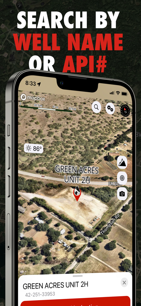
坑井名またはAPI番号による検索機能を備えた、Green Acres Unit 2Hの衛星地図の場所を示すOilTrailsアプリの画面
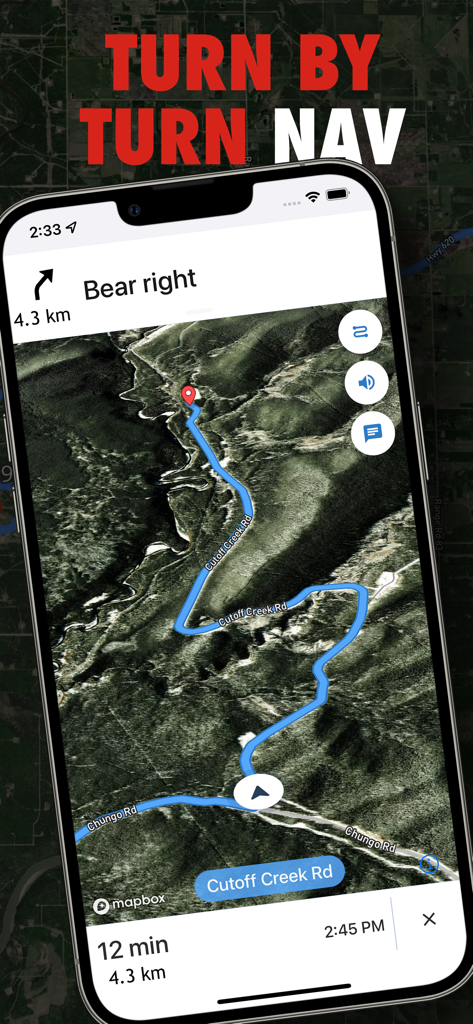
石油・ガス田の場所を示す衛星地図上のターンバイターン方式のナビゲーションを表示するOilTrailsアプリのスクリーンショット。
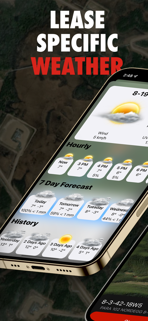
油田操業のためのリース固有の気象予報と降水履歴を表示するOilTrailsモバイルアプリのインターフェース
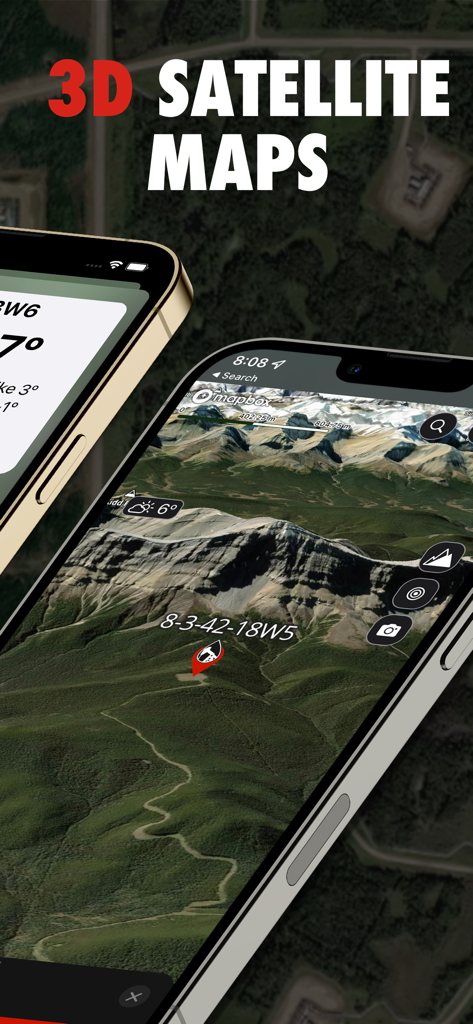
石油坑井の場所の3D衛星地図を表示するOilTrailsアプリのインターフェース
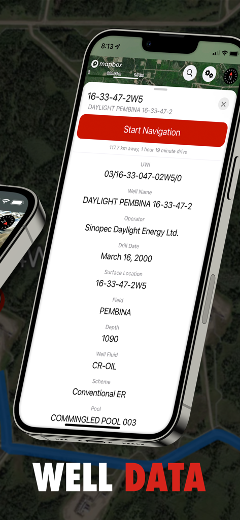
オペレーター、掘削日、現場データなどの詳細な石油坑井情報を表示するOilTrailsアプリの画面
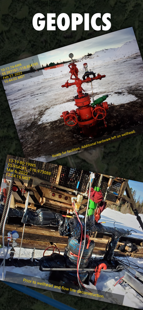
GPS座標とステータスノートが含まれる、位置情報付きの石油坑口写真を表示するOilTrailsアプリのインターフェース
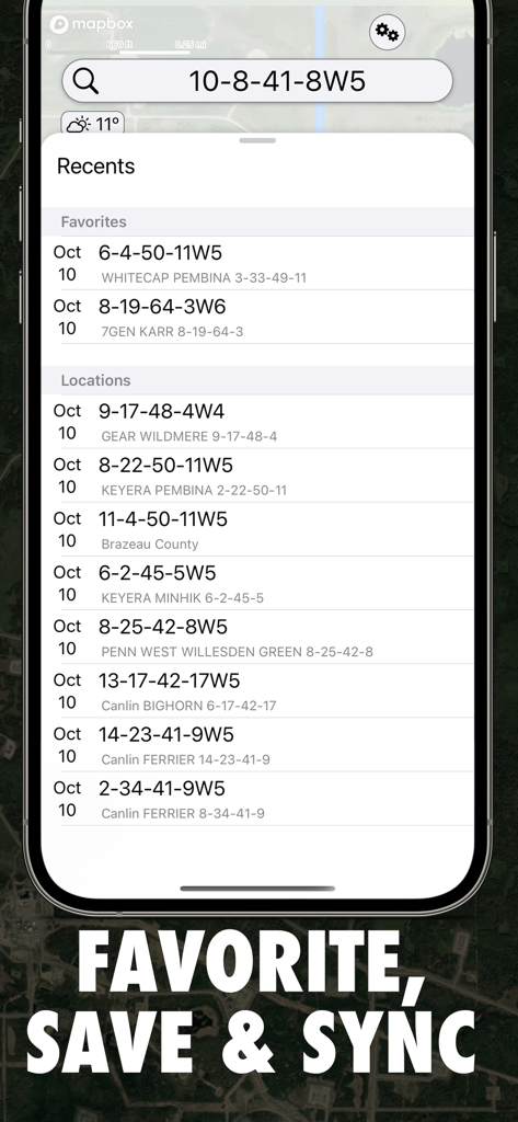
法的な土地表記を含む、お気に入りおよび最近の油田の場所を表示するOilTrailsアプリのインターフェース
説明
Download


このページはアプリまたはその開発者の公式ページではなく、情報提供および論評を目的として作成された独立した編集出版物です。明示的に別段の記載がない限り、アプリおよびその開発者は、MWM、Apple、Google Play、アプリのパブリッシャー、またはアプリの開発者と提携、承認、後援、認可、またはその他の公式的な関係はなく、このページのいかなる内容も、アプリがMWMのサービスを使用して開発されたことを意味するものではありません。すべての商標、ロゴ、スクリーンショット、その他のコンテンツはそれぞれの所有者の財産です。