このページはアプリまたはその開発者の公式ページではなく、情報提供および論評を目的として作成された独立した編集出版物です。明示的に別段の記載がない限り、アプリおよびその開発者は、MWM、Apple、Google Play、アプリのパブリッシャー、またはアプリの開発者と提携、承認、後援、認可、またはその他の公式的な関係はなく、このページのいかなる内容も、アプリがMWMのサービスを使用して開発されたことを意味するものではありません。すべての商標、ロゴ、スクリーンショット、その他のコンテンツはそれぞれの所有者の財産です。

OpenMaps - Topographic maps
正確なOpenStreetMapデータ、ライブタイルマッピング、そしてオフラインでの信頼性を求めるハイカー、マウンテンバイカー、バックカントリー愛好家向けに設計された専門的な地形レイヤーで、あらゆる地形をマスターしましょう。
ダウンロード
227K+ユーザー評価
評価数
0開発元
カテゴリ
Navigation対応言語
1最新バージョン
6.16サイズ
16.2 MBリリース日
2015年9月22日本格的な探検家のための精密マッピング
OpenStreetMapと専門的な地形レイヤーの力を活用して、自信と技術的な正確さを持って最も困難な地形をナビゲートしましょう。
ライブOSMデータ統合
標準的なGPSアプリが見逃しがちな最新のトレイルの変化や隠れたルートを捉える、リアルタイムのコミュニティソースデータで常に先を行きましょう。
テクニカルな地形インサイト
登山家やマウンテンバイカー向けに調整された、詳細な等高線と6つの専門的なマップスタイルで、あらゆる登りと下りをマスターしましょう。
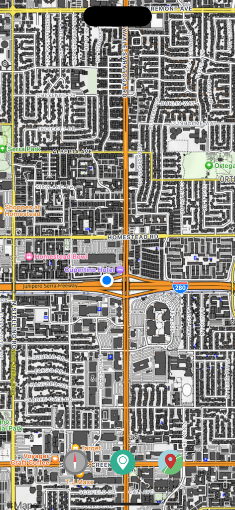
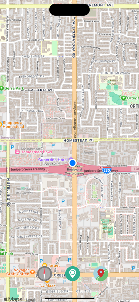
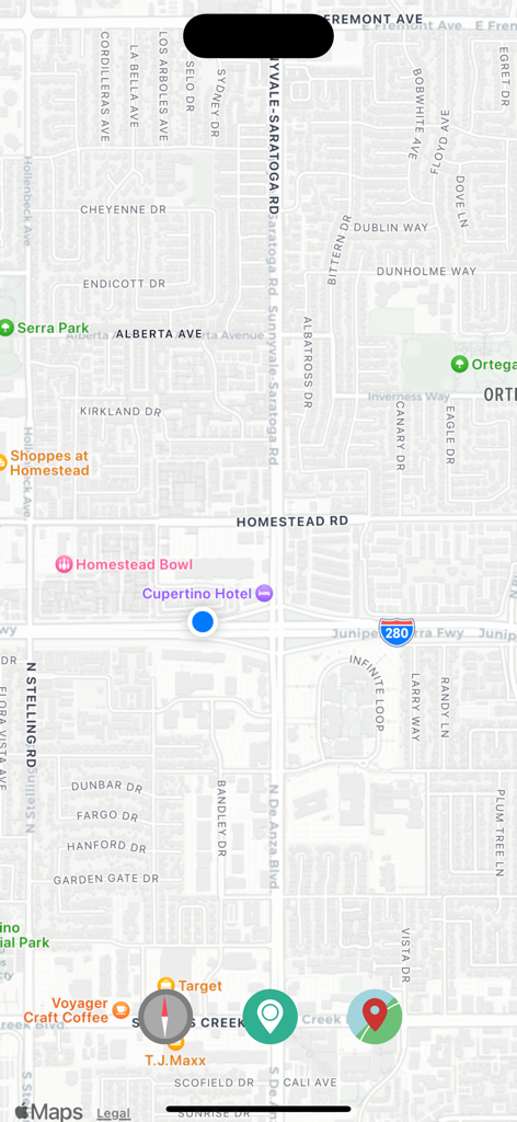
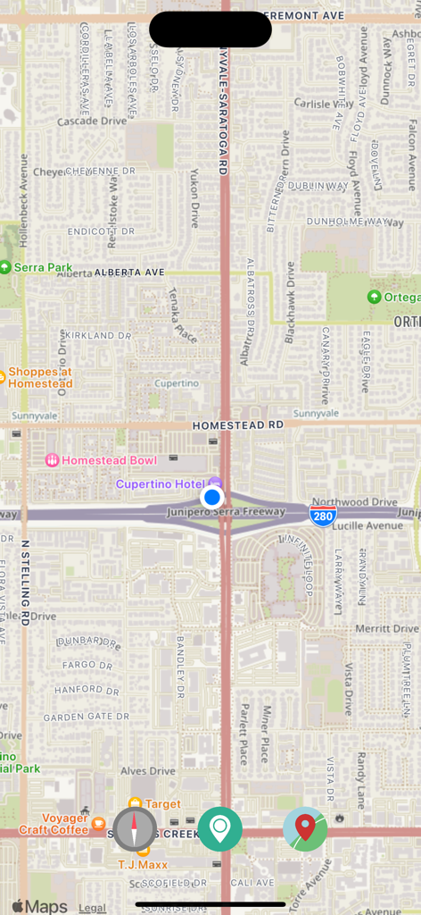
以下のスクリーンショットと説明は、アプリの公式ストアリスティングから直接取得されたものであり、アプリ開発者の所有物です。
アプリストア
スクリーンショット
地元のランドマークや道路を表示する詳細な都市街路地図ビュー
現在地を示す青い点が表示された詳細な都市地図を表示するOpenMapsアプリのスクリーンショット。
通り名や観光スポットが含まれる詳細な都市地図を表示するOpenMapsアプリの画面
ナビゲーションボタンと現在地マーカーが表示された街路地図ビューを表示するOpenMapsアプリのスクリーンショット。
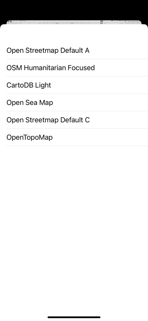
6つのオープンソースの地形図および海図レイヤーの選択肢を表示するOpenMapsアプリのメニュー
説明
Download
類似アプリ
同じカテゴリのトップランクアプリ

Google Maps
Google LLC

Waze Navigation & Live Traffic
waze

AMap Global
AutoNavi Information Technology Co. Ltd.

百度地图-路线规划,出行必备
Beijing Baidu Netcom Science & Technology Co.,Ltd

Moovit: Bus & Transit Tracker
Moovit App Global LTD

Transit • Subway & Bus Times
9280-0366 Quebec inc.

ParkMobile: Park. Pay. Go.
Parkmobile USA, Inc

腾讯地图-路线规划,导航地铁打车出行
Shenzhen Tencent Computer Systems Company Limited

Île-de-France Mobilités
Ile de France Mobilites
このページはアプリまたはその開発者の公式ページではなく、情報提供および論評を目的として作成された独立した編集出版物です。明示的に別段の記載がない限り、アプリおよびその開発者は、MWM、Apple、Google Play、アプリのパブリッシャー、またはアプリの開発者と提携、承認、後援、認可、またはその他の公式的な関係はなく、このページのいかなる内容も、アプリがMWMのサービスを使用して開発されたことを意味するものではありません。すべての商標、ロゴ、スクリーンショット、その他のコンテンツはそれぞれの所有者の財産です。