このページはアプリまたはその開発者の公式ページではなく、情報提供および論評を目的として作成された独立した編集出版物です。明示的に別段の記載がない限り、アプリおよびその開発者は、MWM、Apple、Google Play、アプリのパブリッシャー、またはアプリの開発者と提携、承認、後援、認可、またはその他の公式的な関係はなく、このページのいかなる内容も、アプリがMWMのサービスを使用して開発されたことを意味するものではありません。すべての商標、ロゴ、スクリーンショット、その他のコンテンツはそれぞれの所有者の財産です。

pathRecorder - come back
深い森や広大な海でも、絶対的な自信を持ってナビゲート。インターネット接続なしで正確なルートを記録し、重要なウェイポイントをマークし、帰宅方法を見つけましょう。ハイカー、セーラー、オフローダーのために、堅牢な信頼性を求めるユーザー向けに設計されています。
ダウンロード
21K+ユーザー評価
評価数
0開発元
カテゴリ
Navigation対応言語
1最新バージョン
3.3サイズ
5.8 MBリリース日
2012年4月10日自立した冒険家のための精密ナビゲーション
セルラーデータが利用できなくなる環境向けに設計されたpathRecorderは、オフグリッドを旅する人々に信頼性の高いオフライン追跡、正確なウェイポイント、および生データのエクスポートを提供します。
確実に帰宅
「ComeBack」機能を使用して、開始地点または保存された座標に戻りましょう—インターネット接続は不要です。
技術データポータビリティ
高精度のCSVログで旅を記録します。高度、速度、コースデータをExcelまたはNumbersにエクスポートして、プロフェッショナルな旅行後の分析を行います。
以下のスクリーンショットと説明は、アプリの公式ストアリスティングから直接取得されたものであり、アプリ開発者の所有物です。
アプリストア
スクリーンショット
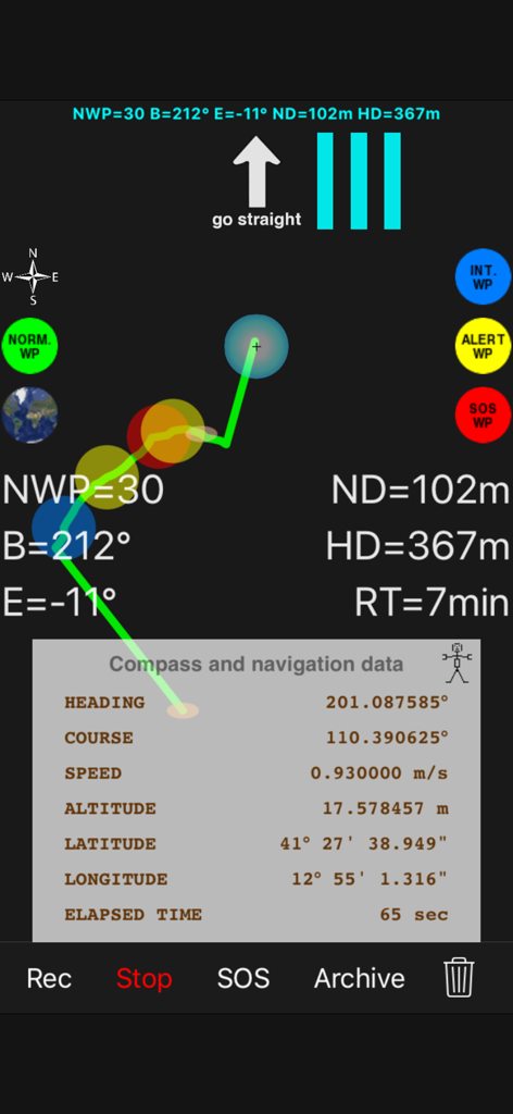
高コントラストの技術ナビゲーションインターフェース。リアルタイムGPSデータとウェイポイント付きの記録されたパンくずリストパスを表示。
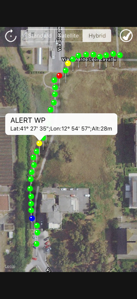
衛星地図ビュー。色付きのウェイポイントのパンくずリストパスと、緯度経度を含む特定の警告座標のポップアップを表示。
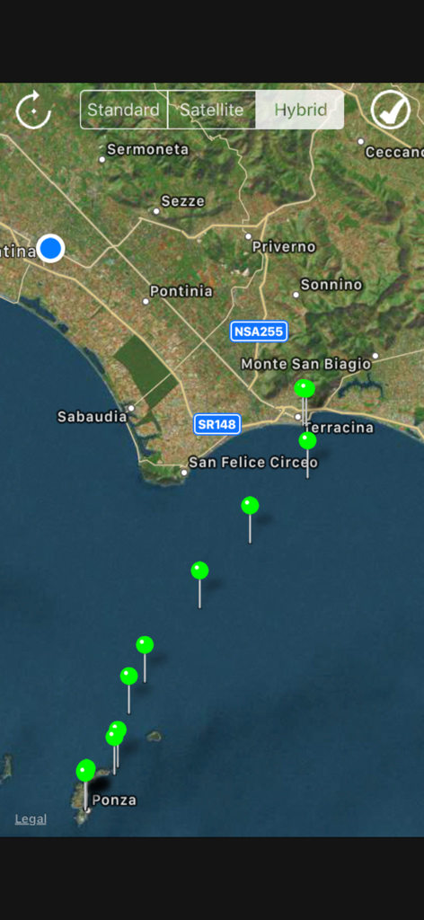
オフショアナビゲーション用の緑色のウェイポイントを持つ記録されたパスを表示するハイブリッドマップ。
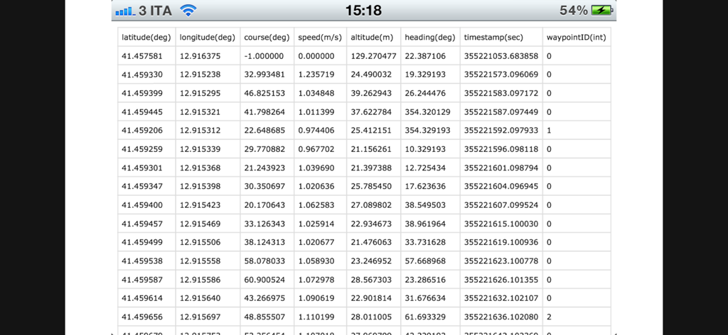
座標と速度を含む記録されたGPSナビゲーションデータのスプレッドシートビュー。
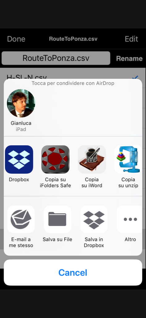
データ分析のためにiOS共有メニュー経由でCSVファイルとして記録されたルートを共有。
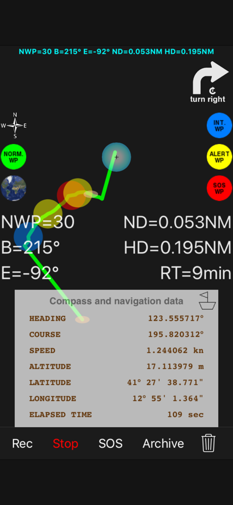
パンくずリストパスと緯度経度を含むGPSデータを持つ高コントラストナビゲーション画面。
説明
Download
類似アプリ
同じカテゴリのトップランクアプリ

Google Maps
Google LLC

Waze Navigation & Live Traffic
waze

AMap Global
AutoNavi Information Technology Co. Ltd.

百度地图-路线规划,出行必备
Beijing Baidu Netcom Science & Technology Co.,Ltd

Moovit: Bus & Transit Tracker
Moovit App Global LTD

Transit • Subway & Bus Times
9280-0366 Quebec inc.

ParkMobile: Park. Pay. Go.
Parkmobile USA, Inc

腾讯地图-路线规划,导航地铁打车出行
Shenzhen Tencent Computer Systems Company Limited

Île-de-France Mobilités
Ile de France Mobilites
このページはアプリまたはその開発者の公式ページではなく、情報提供および論評を目的として作成された独立した編集出版物です。明示的に別段の記載がない限り、アプリおよびその開発者は、MWM、Apple、Google Play、アプリのパブリッシャー、またはアプリの開発者と提携、承認、後援、認可、またはその他の公式的な関係はなく、このページのいかなる内容も、アプリがMWMのサービスを使用して開発されたことを意味するものではありません。すべての商標、ロゴ、スクリーンショット、その他のコンテンツはそれぞれの所有者の財産です。