このページはアプリまたはその開発者の公式ページではなく、情報提供および論評を目的として作成された独立した編集出版物です。明示的に別段の記載がない限り、アプリおよびその開発者は、MWM、Apple、Google Play、アプリのパブリッシャー、またはアプリの開発者と提携、承認、後援、認可、またはその他の公式的な関係はなく、このページのいかなる内容も、アプリがMWMのサービスを使用して開発されたことを意味するものではありません。すべての商標、ロゴ、スクリーンショット、その他のコンテンツはそれぞれの所有者の財産です。

Road Trip Planner™
細部にこだわる旅行者のためのプライバシー重視のツールキット。ルート作成、燃料費の追跡、詳細な旅程管理を一度の購入で実現。サブスクリプション不要、データ追跡なし、オフラインにも完全対応し、これからの旅を強力にサポートします。
ダウンロード
209K+ユーザー評価
評価数
3K+開発元
カテゴリ
Travel対応言語
1最新バージョン
4.8.4サイズ
7.6 MBリリース日
2016年3月31日旅のあらゆる道のりをマスター
精度、プライバシー、そして自由な旅を大切にする旅行者のための、サブスクリプション不要のプロ仕様プランニングツール。
プライベート & サブスクリプション不要
一度の支払いで、完全なデジタル主権を。データの収集や月額料金の請求は一切ありません。
精密なルートロジスティクス
燃料費の自動見積もり、移動時間、各目的地の到着スケジュールにより、推測に頼らない旅を実現します。
以下のスクリーンショットと説明は、アプリの公式ストアリスティングから直接取得されたものであり、アプリ開発者の所有物です。
アプリストア
スクリーンショット
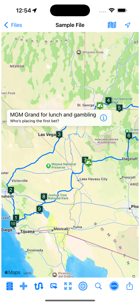
米国南西部の番号付きの立ち寄り先を含む旅行ルートを表示しているRoad Trip Plannerアプリのマップビュー。
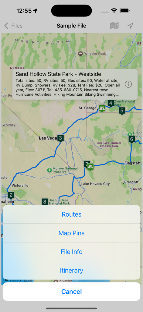
旅行ルートとキャンプ場の情報を表示しているRoad Trip Plannerアプリのマップインターフェース。
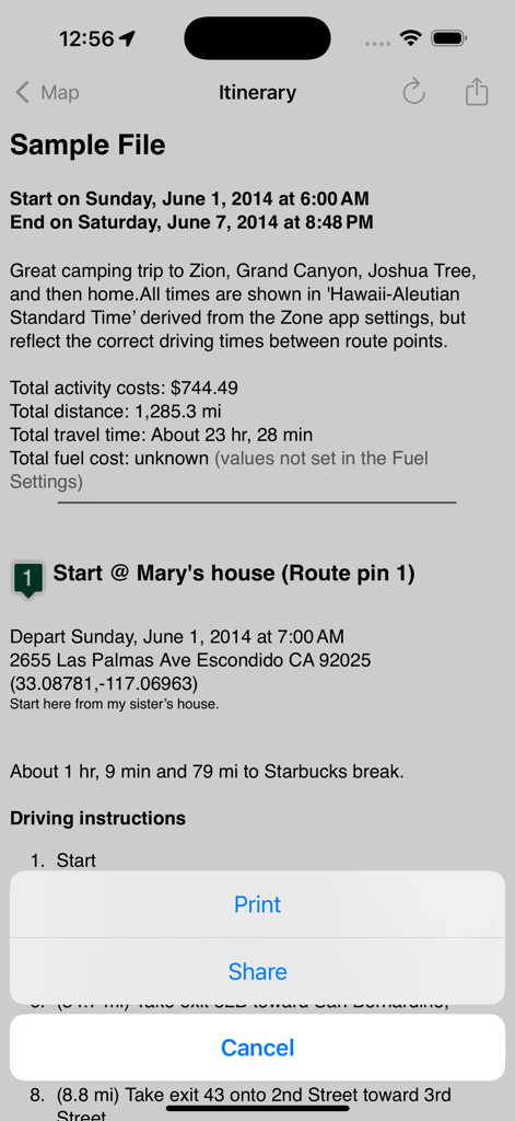
費用と運転ルートを含む詳細な旅程を表示しているRoad Trip Plannerアプリのインターフェース。
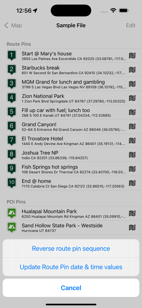
ルートピンと観光スポットを含む順序立てられた旅程を表示しているRoad Trip Plannerアプリ。
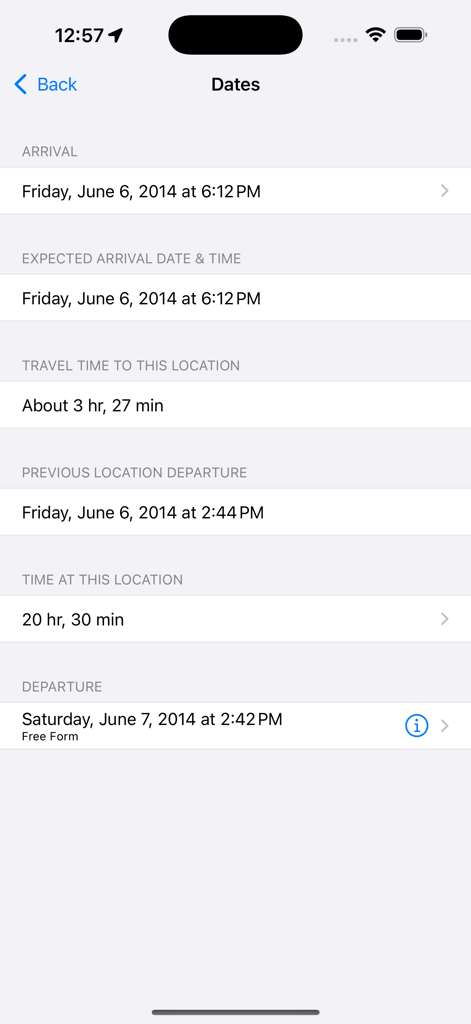
ロードトリップの詳細な旅程の日付と移動時間。
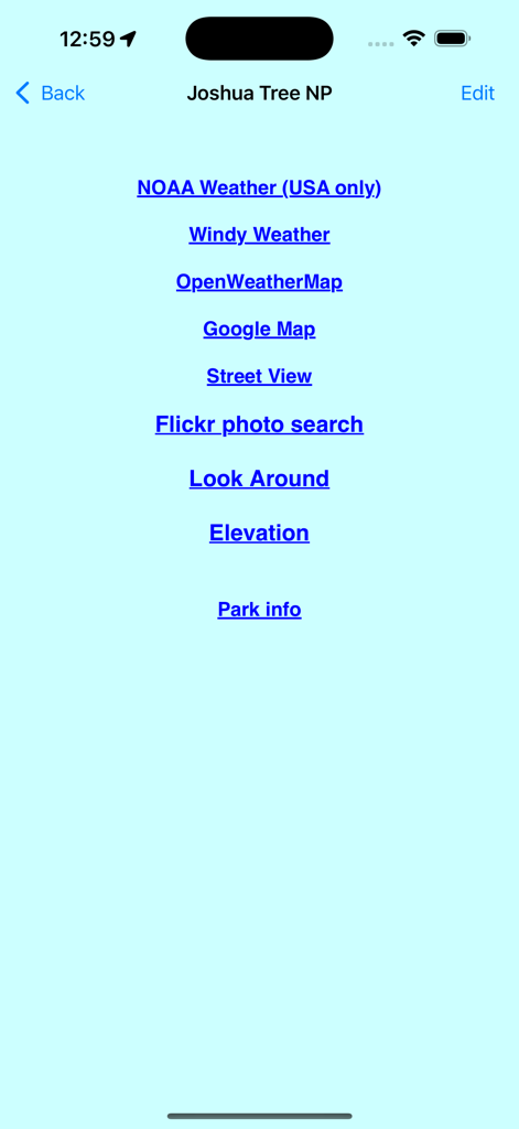
ジョシュア・ツリー国立公園の天気とマップの外部リンク一覧。
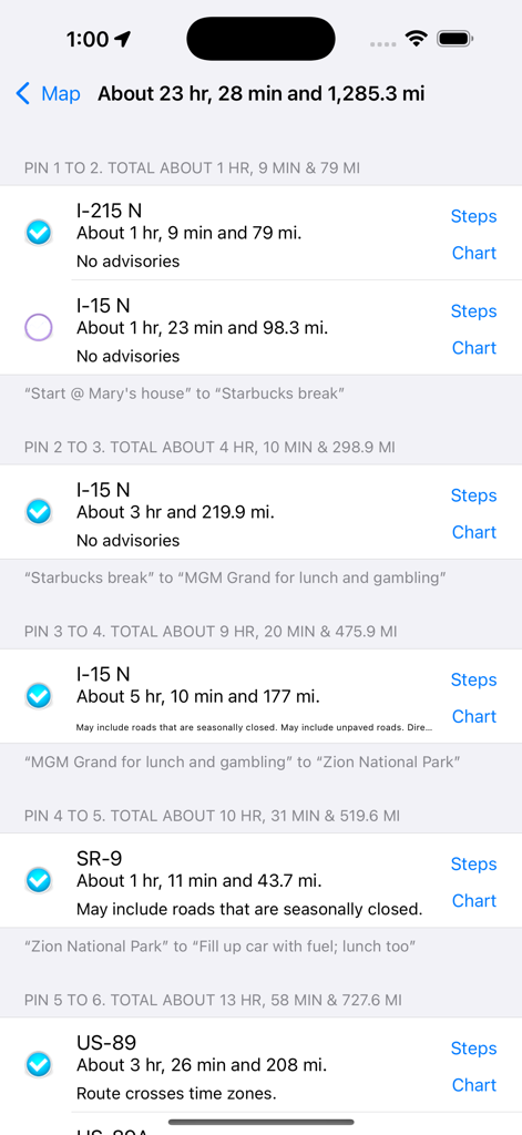
計画された旅の距離と移動時間を示すロードトリップの区間リスト。
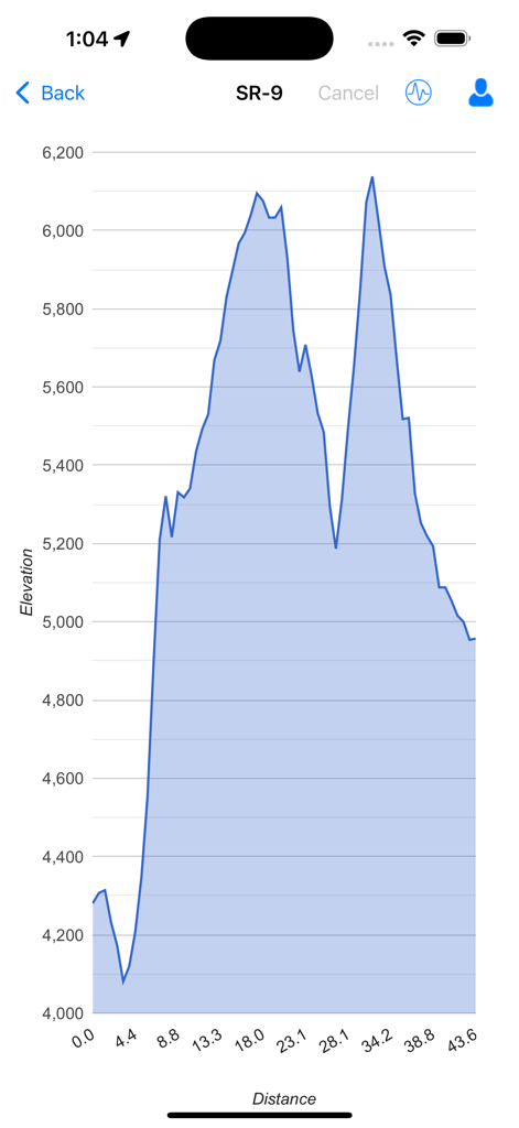
旅行ルートの距離に対する高度の変化を示す標高断面図。
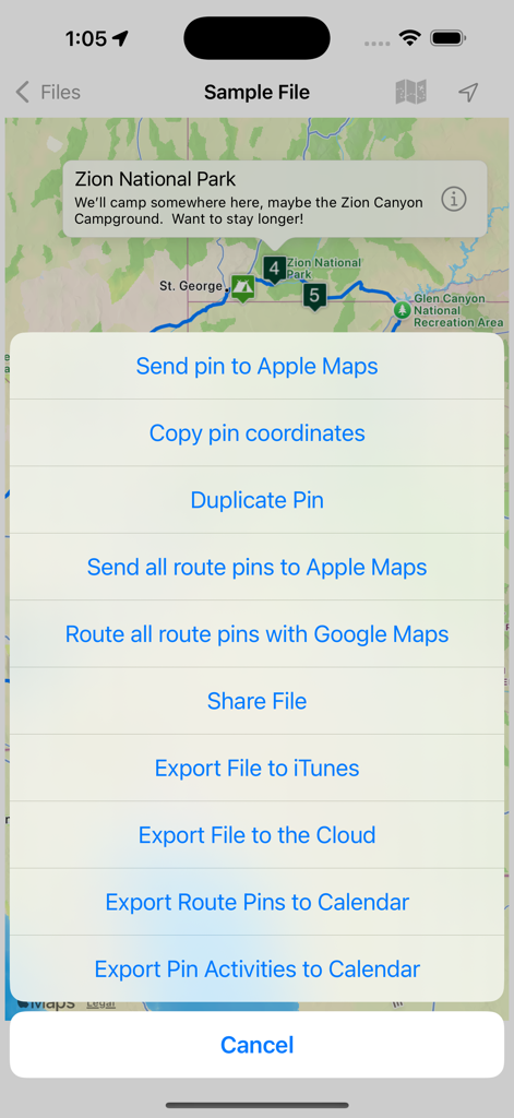
エクスポートメニューとルートピンが表示されたザイオン国立公園のマップを表示しているRoad Trip Plannerアプリ。
説明
Download
類似アプリ
同じカテゴリのトップランクアプリ

Uber - Request a ride
Uber Technologies, Inc.

Airbnb
Airbnb, Inc.

铁路12306
ACADEMY OF RAILWAY SCIENCES CO., ltd.

Booking.com: Hotels & Travel
Booking.com B.V.

Grab: Taxi Ride, Food Delivery
GRABTAXI HOLDINGS PTE. LTD.

Trip.com: Book Flights, Hotels
Trip.com Travel Singapore Pte. Ltd.

DiDi China: Ride Hailing
Didi Chuxing (Beijing) Network Platform Technology Co., Ltd

去哪儿旅行-订酒店机票火车票
Beijing Qunar Information Technology Company Limit

Bolt: Request a Ride
BOLT TECHNOLOGY OU
このページはアプリまたはその開発者の公式ページではなく、情報提供および論評を目的として作成された独立した編集出版物です。明示的に別段の記載がない限り、アプリおよびその開発者は、MWM、Apple、Google Play、アプリのパブリッシャー、またはアプリの開発者と提携、承認、後援、認可、またはその他の公式的な関係はなく、このページのいかなる内容も、アプリがMWMのサービスを使用して開発されたことを意味するものではありません。すべての商標、ロゴ、スクリーンショット、その他のコンテンツはそれぞれの所有者の財産です。